
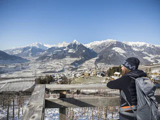
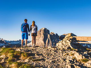
To the Kraxentrager summit
Sasso/Stein, Pfitsch/Val di Vizze, Sterzing/Vipiteno and environs
difficult
Difficulty
1662 m
Elevation gain
7h:00 min
duration
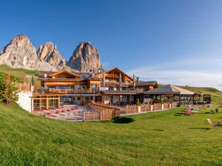
Don't miss the diverse range of experiences of South Tyrol! Enjoy sporting activities, discover the rich culture and visit diverse events in Alpine and Mediterranean locations. Whether young or old, everyone will find something suitable. To help you decide, we present our suggestions for an unforgettable holiday in South Tyrol. Experience the diversity!
Sasso/Stein, Pfitsch/Val di Vizze, Sterzing/Vipiteno and environs
difficult
Difficulty
1662 m
Elevation gain
7h:00 min
duration
Antermoia/Untermoj, San Martin /San Martino, Dolomites Region Kronplatz/Plan de Corones
1/2
Merano/Meran, Meran/Merano, Meran/Merano and environs
Anterselva di Sotto/Antholz-Niedertal, Rasen-Antholz/Rasun Anterselva, Dolomites Region Kronplatz/Plan de Corones
Lasa/Laas, Laas/Lasa, Vinschgau/Val Venosta
Selva/Sëlva/Wolkenstein/Sëlva, Sëlva/Selva di Val Gardena, Dolomites Region Val Gardena
easy
Difficulty
0 m
Elevation gain
0h:01 min
duration
Meltina/Mölten, Mölten/Meltina, Bolzano/Bozen and environs
Vallelunga/Langtaufers, Graun im Vinschgau/Curon Venosta, Vinschgau/Val Venosta
St. Andrä/S. Andrea, Brixen/Bressanone, Brixen/Bressanone and environs
1/8
Sluderno/Schluderns, Schluderns/Sluderno, Vinschgau/Val Venosta
Silandro/Schlanders, Schlanders/Silandro, Vinschgau/Val Venosta
1/7
Anterivo/Altrei, Altrei/Anterivo
Riva di Tures/Rein in Taufers, Sand in Taufers/Campo Tures, Ahrntal/Valle Aurina

1/3
Stava/Staben, Naturns/Naturno, Meran/Merano and environs
Cardano/Kardaun - Cornedo/Karneid, Karneid/Cornedo all'Isarco, Dolomites Region Eggental
Selva/Sëlva/Wolkenstein/Sëlva, Urtijëi/Ortisei, Dolomites Region Val Gardena
easy
Difficulty
61 m
Elevation gain
2h:31 min
duration
1/3
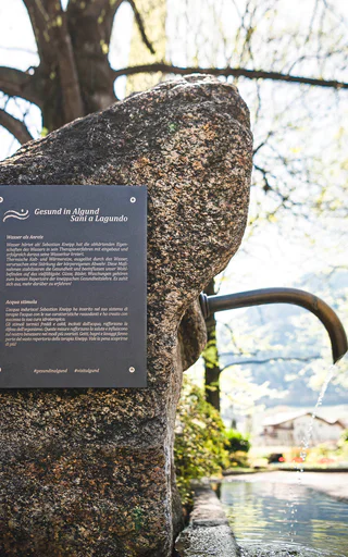
Algund/Lagundo, Meran/Merano and environs
Selva/Sëlva/Wolkenstein/Sëlva, Sëlva/Selva di Val Gardena, Dolomites Region Val Gardena
1/4
Scena/Schenna, Schenna/Scena, Meran/Merano and environs
easy
Difficulty
320 m
Elevation gain
2h:00 min
duration
1/20
Selva/Sëlva/Wolkenstein/Sëlva, Sëlva/Selva di Val Gardena, Dolomites Region Val Gardena
Monteponente/Pfeffersberg, Brixen/Bressanone, Brixen/Bressanone and environs
easy
Difficulty
280 m
Elevation gain
2h:00 min
duration
Corzes/Kortsch, Schlanders/Silandro, Vinschgau/Val Venosta
San Cassiano/San Cassiano, Badia, Dolomites Region Alta Badia
Selva/Sëlva/Wolkenstein/Sëlva, Sëlva/Selva di Val Gardena, Dolomites Region Val Gardena
1/5
Naturno/Naturns, Naturns/Naturno, Meran/Merano and environs
1/5
Niederrasen/Rasun di Sotto, Rasen-Antholz/Rasun Anterselva, Dolomites Region Kronplatz/Plan de Corones
easy
Difficulty
108 m
Elevation gain
0h:25 min
duration
1/13
S.Cristina Gherdëina/S.Cristina Val Gardena/S.Cristina Gherdëina/St.Christina in Gröden, S.Crestina Gherdëina/Santa Cristina Val Gardana, Dolomites Region Val Gardena
difficult
Difficulty
303 m
Elevation gain
2h:00 min
duration
San Martino i.P./St. Martin i.P., St.Martin in Passeier/San Martino in Passiria, Meran/Merano and environs
1/3
Egna/Neumarkt, Neumarkt/Egna, Alto Adige Wine Road
1/2
Novacella/Neustift, Vahrn/Varna, Brixen/Bressanone and environs
easy
Difficulty
215 m
Elevation gain
1h:46 min
duration
Thank you for signing up!
Your subscription is already active
Confirm your registration
To complete your subscription, open the email we just sent you and click on the confirmation link.
Can’t find it? Check your spam folder too.
We noticed that you tried to subscribe to the newsletter, but your email address is already registered. You will continue to receive our offers, tips and inspiration for your holiday.
We noticed that you already tried to subscribe to our Newsletter in the past but didn’t confirmed the subscription. We have resent you an email now, please check your inbox and spam folder to confirm.


