
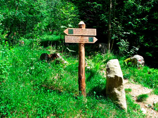
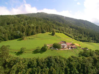
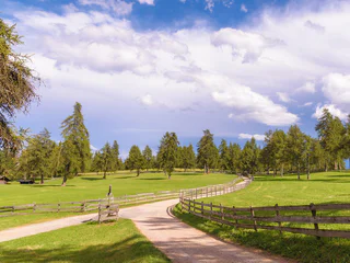
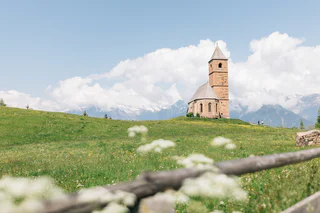
Mountain farmer trail
Transacqua/Ennewasser, Martell/Martello, Vinschgau/Val Venosta
easy
Difficulty
430 m
Elevation gain
3h:00 min
duration
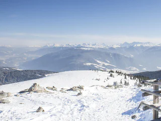
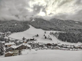
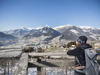
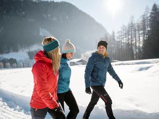
Hiking in winter in South Tyrol is a simple way to enjoy the mountains beyond ski slopes and lifts. Follow winter trails through snow-covered forests, take in wide-open views at the top, or head out for a peaceful walk in the snow. Whether you’re after an easy family-friendly winter hike or a more challenging snowy trek, you’ll find plenty of winter trails here, with all the details you need to plan ahead.
Transacqua/Ennewasser, Martell/Martello, Vinschgau/Val Venosta
easy
Difficulty
430 m
Elevation gain
3h:00 min
duration
Tesido/Taisten, Welsberg-Taisten/Monguelfo-Tesido
medium
Difficulty
300 m
Elevation gain
2h:30 min
duration
Caerna/Garn, Feldthurns/Velturno, Brixen/Bressanone and environs
medium
Difficulty
370 m
Elevation gain
1h:51 min
duration
1/36
Rablà/Rabland, Algund/Lagundo, Meran/Merano and environs
easy
Difficulty
94 m
Elevation gain
1h:10 min
duration
1/3
Valles/Vals, Mühlbach/Rio di Pusteria, Brixen/Bressanone and environs
easy
Difficulty
147 m
Elevation gain
0h:46 min
duration
1/9
Montesole/Sonnenberg - Parcines/Partschins, Partschins/Parcines, Meran/Merano and environs
easy
Difficulty
128 m
Elevation gain
0h:55 min
duration
S.Cristina Gherdëina/S.Cristina Val Gardena/S.Cristina Gherdëina/St.Christina in Gröden, S.Crestina Gherdëina/Santa Cristina Val Gardana
medium
Difficulty
281 m
Elevation gain
2h:07 min
duration
S. Pietro/St. Peter - Valle Aurina/Ahrntal, Sand in Taufers/Campo Tures, Ahrntal/Valle Aurina
easy
Difficulty
154 m
Elevation gain
1h:30 min
duration
1/2
Maranza/Meransen, Mühlbach/Rio di Pusteria, Brixen/Bressanone and environs
medium
Difficulty
218 m
Elevation gain
1h:49 min
duration
1/2
S. Maddalena/St. Magdalena - Funes/Villnöss, Villnöss/Funes, Dolomites Region Lüsen Villnöss
easy
Difficulty
134 m
Elevation gain
0h:58 min
duration
Ausserprags/Braies di Fuori, Prags/Braies, Dolomites Region 3 Zinnen
easy
Difficulty
47 m
Elevation gain
0h:40 min
duration
1/4
Monte S. Vigilio/Vigiljoch, Lana, Meran/Merano and environs
easy
Difficulty
410 m
Elevation gain
3h:00 min
duration
1/2
Gandelle-Franadega-Fienili/Kandellen-Frondeigen-Stadlern, Toblach/Dobbiaco, Dolomites Region 3 Zinnen
easy
Difficulty
61 m
Elevation gain
1h:00 min
duration
1/3
Ortisei/Urtijëi/St. Ulrich/Urtijëi, Urtijëi/Ortisei, Dolomites Region Val Gardena
easy
Difficulty
93 m
Elevation gain
0h:37 min
duration
1/3
Vallesina/Versein, Mölten/Meltina, Bolzano/Bozen and environs
easy
Difficulty
121 m
Elevation gain
1h:37 min
duration
1/3
Lasa/Laas, Laas/Lasa, Vinschgau/Val Venosta
easy
Difficulty
453 m
Elevation gain
2h:10 min
duration
Nova Ponente Centro/Deutschnofen Dorf, Deutschnofen/Nova Ponente, Dolomites Region Eggental
difficult
Difficulty
491 m
Elevation gain
4h:30 min
duration
Monguelfo/Welsberg, Welsberg-Taisten/Monguelfo-Tesido
medium
Difficulty
144 m
Elevation gain
2h:00 min
duration
Mendelpass, Kaltern an der Weinstraße/Caldaro sulla Strada del Vino, Alto Adige Wine Road
easy
Difficulty
241 m
Elevation gain
1h:30 min
duration
1/2
Nobls/Nobls, Jenesien/San Genesio Atesino, Bolzano/Bozen and environs
easy
Difficulty
421 m
Elevation gain
2h:16 min
duration
1/4
Scena/Schenna, Schenna/Scena, Meran/Merano and environs
easy
Difficulty
320 m
Elevation gain
2h:00 min
duration
S. Maddalena/St. Magdalena - Casies/Gsies, Gsies/Valle di Casies
easy
Difficulty
11 m
Elevation gain
0h:12 min
duration
1/5
Hafling Oberdorf/Avelengo di sopra, Hafling/Avelengo, Meran/Merano and environs
easy
Difficulty
85 m
Elevation gain
0h:45 min
duration
1/5
Rio Lagundo/Aschbach, Algund/Lagundo, Meran/Merano and environs
easy
Difficulty
299 m
Elevation gain
3h:10 min
duration

1/3
Terento/Terenten, Terenten/Terento, Brixen/Bressanone and environs
medium
Difficulty
578 m
Elevation gain
2h:45 min
duration
Pietralba/Weissenstein, Aldein/Aldino
easy
Difficulty
630 m
Elevation gain
2h:49 min
duration
Fassing/Fassine, St.Lorenzen/San Lorenzo di Sebato, Dolomites Region Kronplatz/Plan de Corones
easy
Difficulty
176 m
Elevation gain
1h:19 min
duration
1/8
Plaus/Plaus, Algund/Lagundo, Meran/Merano and environs
easy
Difficulty
84 m
Elevation gain
1h:19 min
duration
1/2
Riva di Tures/Rein in Taufers, Ahrntal/Valle Aurina, Ahrntal/Valle Aurina
medium
Difficulty
388 m
Elevation gain
3h:00 min
duration
Moncucco/Giggelberg, Brenner/Brennero, Sterzing/Vipiteno and environs
easy
Difficulty
123 m
Elevation gain
2h:00 min
duration
Thank you for signing up!
You are already subscribed
Confirm your registration
To complete your subscription, open the email we just sent you and click on the confirmation link.
Can’t find it? Check your spam folder too.
We noticed that you are already subscribed to our Newsletter. We will update you on exclusive offers, fun adventures and more so you can make the best out of your vacation.
We noticed that you already tried to subscribe to our Newsletter in the past but didn’t confirmed the subscription. We have resent you an email now, please check your inbox and spam folder to confirm.


