1/2
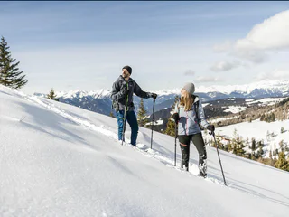
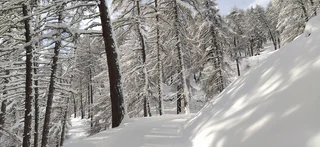
Snowshoe & winterhike Tulper - Pianer Kreuz
Luson/Lüsen, Lüsen/Luson, Dolomites Region Lüsen Villnöss
medium
Difficulty
340 m
Elevation gain
2h:15 min
duration
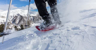
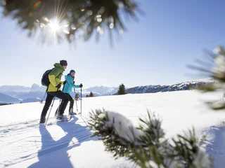
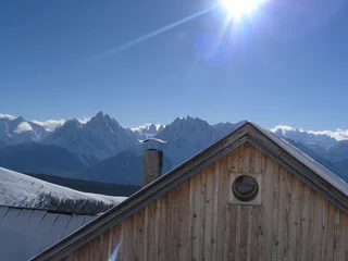
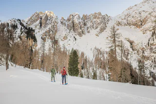
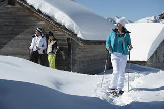
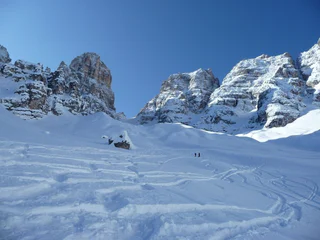
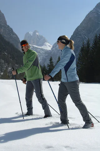
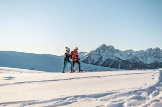
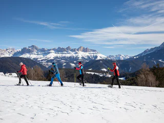
Snowshoe hiking in South Tyrol is a simple way to slow down and enjoy winter at its best. Choose an easy snowshoe tour through peaceful forests, or head higher for wide-open views and trails in the Dolomites. Whether you’re looking for a gentle walk or a more challenging route, you’ll find that South Tyrol offers snowshoe tours for every level here, with all the details you need to plan your snowshoe hiking adventure.
1/2
Luson/Lüsen, Lüsen/Luson, Dolomites Region Lüsen Villnöss
medium
Difficulty
340 m
Elevation gain
2h:15 min
duration

Plose/Plose, Brixen/Bressanone, Brixen/Bressanone and environs
easy
Difficulty
220 m
Elevation gain
1h:46 min
duration
1/3
Planol/Planeil, Mals/Malles, Vinschgau/Val Venosta
difficult
Difficulty
600 m
Elevation gain
4h:30 min
duration
Transacqua/Ennewasser, Martell/Martello, Vinschgau/Val Venosta
medium
Difficulty
404 m
Elevation gain
1h:15 min
duration
Tires/Tiers, Tiers am Rosengarten/Tires al Catinaccio, Dolomites Region Seiser Alm
difficult
Difficulty
0 m
Elevation gain
6h:00 min
duration
S. Candido/Innichen, Innichen/San Candido, Dolomites Region 3 Zinnen
easy
Difficulty
3300 m
Elevation gain
2h:30 min
duration
San Nicolò/St. Nikolaus, Ulten/Ultimo, Meran/Merano and environs
medium
Difficulty
457 m
Elevation gain
2h:36 min
duration
Sesto/Sexten, Sexten/Sesto, Dolomites Region 3 Zinnen
medium
Difficulty
463 m
Elevation gain
1h:25 min
duration
1/3
Vallesina/Versein, Mölten/Meltina, Bolzano/Bozen and environs
easy
Difficulty
121 m
Elevation gain
1h:37 min
duration
Nove Case/Neunhäusern, Gsies/Valle di Casies
medium
Difficulty
908 m
Elevation gain
3h:22 min
duration
1/3
Alpe di Villandro/Villanderer Alm, Villanders/Villandro, Brixen/Bressanone and environs
medium
Difficulty
548 m
Elevation gain
3h:55 min
duration
Sesto/Sexten, Sexten/Sesto, Dolomites Region 3 Zinnen
easy
Difficulty
345 m
Elevation gain
2h:40 min
duration
S.Valentino /St. Valentin, Graun im Vinschgau/Curon Venosta, Vinschgau/Val Venosta
medium
Difficulty
0 m
Elevation gain
5h:00 min
duration
Tarres/Tarsch, Latsch/Laces, Vinschgau/Val Venosta
difficult
Difficulty
1141 m
Elevation gain
4h:52 min
duration
Sesto/Sexten, Sexten/Sesto, Dolomites Region 3 Zinnen
medium
Difficulty
298 m
Elevation gain
1h:07 min
duration

1/3
Unser Frau/Madonna, Schnals/Senales, Vinschgau/Val Venosta
medium
Difficulty
301 m
Elevation gain
1h:16 min
duration
1/2
Gandelle-Franadega-Fienili/Kandellen-Frondeigen-Stadlern, Toblach/Dobbiaco, Dolomites Region 3 Zinnen
medium
Difficulty
711 m
Elevation gain
2h:30 min
duration
1/4
Nova Levante/Welschnofen
easy
Difficulty
183 m
Elevation gain
1h:42 min
duration
Sesto/Sexten, Sexten/Sesto, Dolomites Region 3 Zinnen
medium
Difficulty
551 m
Elevation gain
2h:10 min
duration
1/4
Chienes/Kiens, Kiens/Chienes, Dolomites Region Kronplatz/Plan de Corones
medium
Difficulty
980 m
Elevation gain
5h:30 min
duration
1/2
Sesto/Sexten
medium
Difficulty
493 m
Elevation gain
2h:00 min
duration
1/2
Mazia/Matsch, Mals/Malles, Vinschgau/Val Venosta
medium
Difficulty
365 m
Elevation gain
2h:04 min
duration
1/2
Sesto/Sexten, Toblach/Dobbiaco, Dolomites Region 3 Zinnen
easy
Difficulty
253 m
Elevation gain
1h:30 min
duration
1/6
Chienes/Kiens, St.Lorenzen/San Lorenzo di Sebato, Dolomites Region Kronplatz/Plan de Corones
medium
Difficulty
698 m
Elevation gain
3h:07 min
duration
1/2
S. Maddalena/St. Magdalena - Funes/Villnöss, Villnöss/Funes, Dolomites Region Lüsen Villnöss
easy
Difficulty
247 m
Elevation gain
1h:22 min
duration
1/2
Caerna/Garn, Feldthurns/Velturno, Brixen/Bressanone and environs
medium
Difficulty
0 m
Elevation gain
2h:45 min
duration
1/2
Obereggen/Obereggen, Deutschnofen/Nova Ponente, Dolomites Region Eggental
easy
Difficulty
391 m
Elevation gain
3h:00 min
duration
Stilfs/Stelvio, Vinschgau/Val Venosta
easy
Difficulty
576 m
Elevation gain
2h:08 min
duration
Selva/Sëlva/Wolkenstein/Sëlva, Sëlva/Selva di Val Gardena, Dolomites Region Val Gardena
easy
Difficulty
388 m
Elevation gain
1h:33 min
duration
Nove Case/Neunhäusern, Welsberg-Taisten/Monguelfo-Tesido
medium
Difficulty
702 m
Elevation gain
3h:45 min
duration
Thank you for signing up!
You are already subscribed
Confirm your registration
To complete your subscription, open the email we just sent you and click on the confirmation link.
Can’t find it? Check your spam folder too.
We noticed that you are already subscribed to our Newsletter. We will update you on exclusive offers, fun adventures and more so you can make the best out of your vacation.
We noticed that you already tried to subscribe to our Newsletter in the past but didn’t confirmed the subscription. We have resent you an email now, please check your inbox and spam folder to confirm.


