
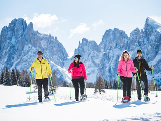
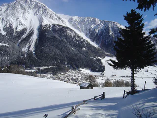
Snowshoe hike - Ponticello/ Brückele - Stolla Alm hut - Plätzwiese high plateau
Braies di Fuori/Ausserprags, Prags/Braies, Dolomites Region 3 Zinnen
medium
Obtížnost
517 m
Převýšení
1h:58 min
doba trvání
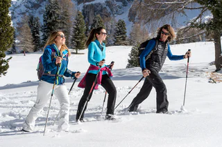
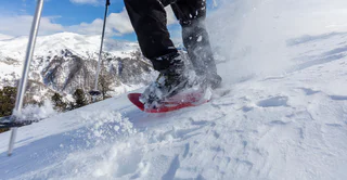
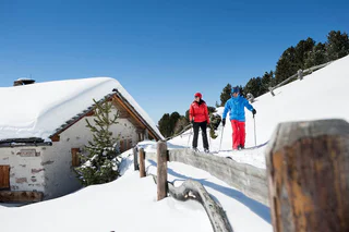
Výlet na sněžnicích v Jižním Tyrolsku je skvělým způsobem, jak poznat nedotčenou přírodu, nádherné výhledy na Dolomity a užít si aktivní pohyb. Na rekreanty čekají rodinné túry na sněžnicích po mírných svazích, ale i strmé výstupy na alpské vrcholy nebo výlety k útulným horským chatám. Tipy na nejlepší túry na sněžnicích v Jižním Tyrolsku najdete zde.
Braies di Fuori/Ausserprags, Prags/Braies, Dolomites Region 3 Zinnen
medium
Obtížnost
517 m
Převýšení
1h:58 min
doba trvání
1/11
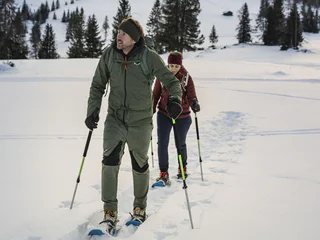
S.Cristina Gherdëina/S.Cristina Val Gardena/S.Cristina Gherdëina/St.Christina in Gröden, S.Crestina Gherdëina/Santa Cristina Val Gardana, Dolomites Region Val Gardena
medium
Obtížnost
647 m
Převýšení
4h:00 min
doba trvání
Altavalle/Hintermartell, Martell/Martello, Vinschgau/Val Venosta
medium
Obtížnost
0 m
Převýšení
2h:30 min
doba trvání
1/2
Obereggen/Obereggen, Deutschnofen/Nova Ponente, Dolomites Region Eggental
easy
Obtížnost
280 m
Převýšení
2h:53 min
doba trvání
1/2
Sesto/Sexten, Toblach/Dobbiaco, Dolomites Region 3 Zinnen
easy
Obtížnost
253 m
Převýšení
1h:30 min
doba trvání
Obereggen/Obereggen, Deutschnofen/Nova Ponente, Dolomites Region Eggental
medium
Obtížnost
0 m
Převýšení
2h:45 min
doba trvání

1/2
Alpe di Rodengo/Rodenecker Alm, Lüsen/Luson, Dolomites Region Lüsen Villnöss
medium
Obtížnost
0 m
Převýšení
5h:00 min
doba trvání
Sesto/Sexten
easy
Obtížnost
345 m
Převýšení
2h:40 min
doba trvání
1/3
Madonna/Unser Frau, Schnals/Senales, Vinschgau/Val Venosta
medium
Obtížnost
489 m
Převýšení
2h:12 min
doba trvání
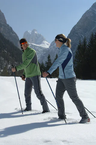
Tires/Tiers, Tiers am Rosengarten/Tires al Catinaccio, Dolomites Region Seiser Alm
medium
Obtížnost
633 m
Převýšení
2h:19 min
doba trvání
Niederdorf/Villabassa, Dolomites Region 3 Zinnen
medium
Obtížnost
416 m
Převýšení
2h:06 min
doba trvání
1/3
Tires/Tiers, Tiers am Rosengarten/Tires al Catinaccio, Dolomites Region Seiser Alm
medium
Obtížnost
0 m
Převýšení
5h:00 min
doba trvání
1/2
Caerna/Garn, Feldthurns/Velturno, Brixen/Bressanone and environs
medium
Obtížnost
0 m
Převýšení
2h:45 min
doba trvání
Dobbiaco Vecchia/Alttoblach, Toblach/Dobbiaco, Dolomites Region 3 Zinnen
medium
Obtížnost
394 m
Převýšení
1h:30 min
doba trvání
Fundres/Pfunders, Mühlwald/Selva dei Molini, Ahrntal/Valle Aurina
easy
Obtížnost
352 m
Převýšení
4h:00 min
doba trvání
1/3
Maso Corto/Kurzras, Schnals/Senales, Vinschgau/Val Venosta
easy
Obtížnost
272 m
Převýšení
3h:15 min
doba trvání
Transacqua/Ennewasser, Martell/Martello, Vinschgau/Val Venosta
medium
Obtížnost
404 m
Převýšení
1h:15 min
doba trvání
San Vigilio, Al Plan/San Vigilio, Dolomites Region Kronplatz/Plan de Corones
medium
Obtížnost
682 m
Převýšení
2h:28 min
doba trvání
Tires/Tiers, Tiers am Rosengarten/Tires al Catinaccio, Dolomites Region Seiser Alm
difficult
Obtížnost
0 m
Převýšení
6h:00 min
doba trvání
Braies di Fuori/Ausserprags, Prags/Braies, Dolomites Region 3 Zinnen
medium
Obtížnost
359 m
Převýšení
1h:28 min
doba trvání
1/2
S.Martino/Reinswald, Klausen/Chiusa, Brixen/Bressanone and environs
medium
Obtížnost
0 m
Převýšení
9h:48 min
doba trvání
Valdurna/Durnholz, Sarntal/Sarentino, Bolzano/Bozen and environs
medium
Obtížnost
0 m
Převýšení
5h:19 min
doba trvání
Valdaora di Mezzo/Mitterolang, Olang/Valdaora, Dolomites Region Kronplatz/Plan de Corones
medium
Obtížnost
472 m
Převýšení
1h:18 min
doba trvání
S. Maddalena/St. Magdalena - Casies/Gsies, Gsies/Valle di Casies
medium
Obtížnost
1100 m
Převýšení
3h:30 min
doba trvání
S. Pietro/St. Peter - Valle Aurina/Ahrntal, Ahrntal/Valle Aurina, Ahrntal/Valle Aurina
medium
Obtížnost
427 m
Převýšení
3h:30 min
doba trvání
Sulden/Solda, Stilfs/Stelvio, Vinschgau/Val Venosta
easy
Obtížnost
492 m
Převýšení
2h:00 min
doba trvání
1/3
Planol/Planeil, Mals/Malles, Vinschgau/Val Venosta
difficult
Obtížnost
600 m
Převýšení
4h:30 min
doba trvání
1/3
Resia/Reschen, Graun im Vinschgau/Curon Venosta, Vinschgau/Val Venosta
easy
Obtížnost
252 m
Převýšení
1h:04 min
doba trvání
1/3
Ortisei/Urtijëi/St. Ulrich/Urtijëi, Urtijëi/Ortisei, Dolomites Region Val Gardena
medium
Obtížnost
46 m
Převýšení
2h:31 min
doba trvání
1/2
Vallesina/Versein, Mölten/Meltina, Bolzano/Bozen and environs
medium
Obtížnost
722 m
Převýšení
4h:54 min
doba trvání


