Skip to content

added to favourites

removed from favourites

Oops! Something went wrong. Try again

Your account is being created

Your account has been successfully created and you are now logged in

You’ve been logged in successfully!

Your account was created successfully, but we couldn't log you in automatically

You are logged out.

Mountaineering

Königsanger

Garn/Caerna, Feldthurns/Velturno, Brixen/Bressanone and environs
from center
Start: Garner Wetterkreuz (1,430 m)
Destination: Königsanger (2,436 m)
Refreshment stop: Radlseehütte (2,284 m)
Trail no. 10 & trail no. 10A
Itinerary

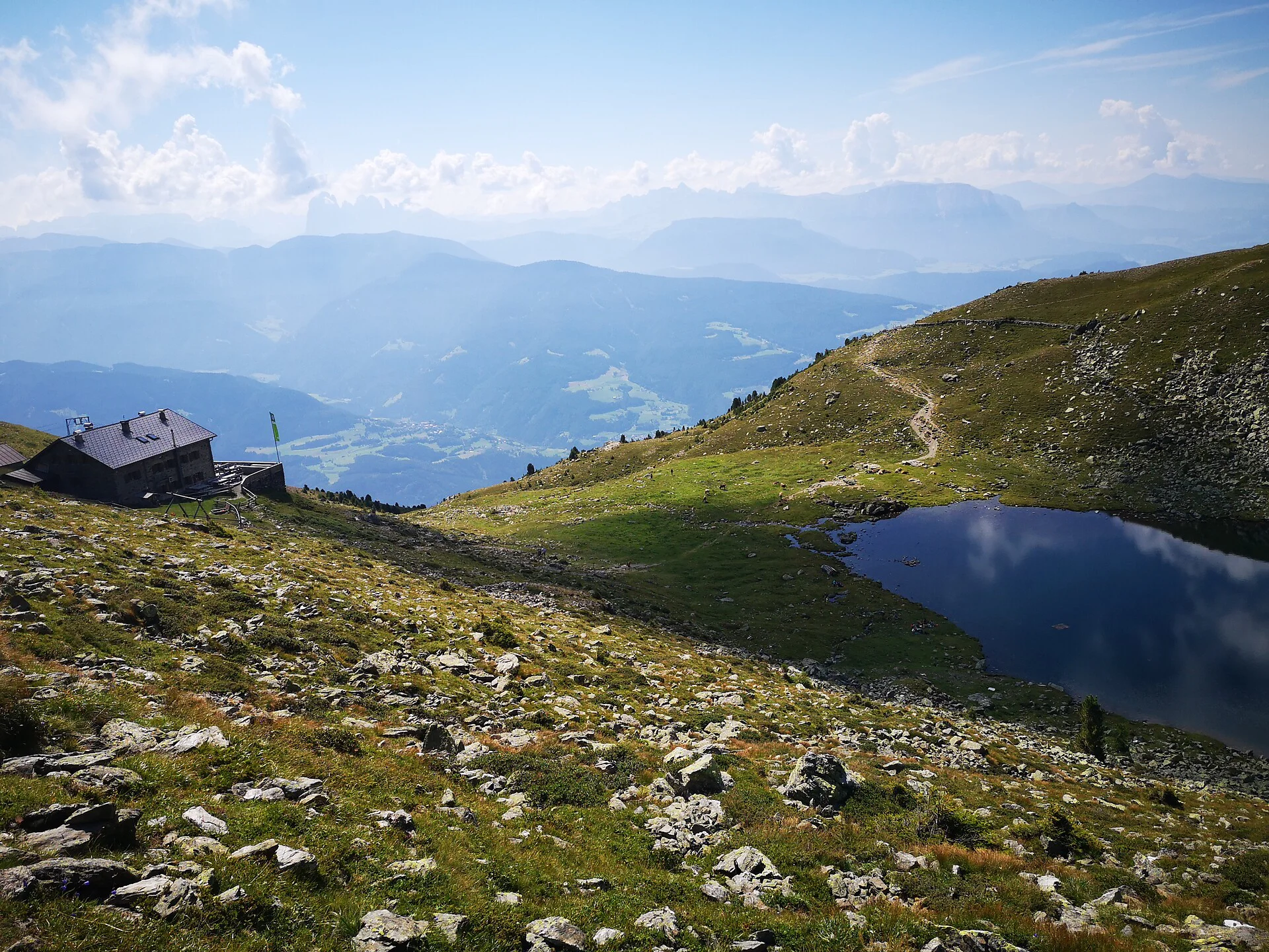
From “Garner Wetterkreuz” follow the gravel path towards Königsanger and then turn onto a narrower forest trail. Leaving behind the forest, the view becomes more and more impressive: the Odle mountains, the Sciliar, the Catinaccio and many more Dolomite peaks. Continue along a narrow mountain path, up the alpine meadows, then path no. 10A leads to the summit - the Königsanger. 

Distance 5 Km
Duration 2h:45 min
Ascent 0 m
Descent 0 m
Highest point 2436 m
Lowest point 1430 m
Details
Timetable of the public transport: www.suedtirolmobil.info
Directions
To get to the parking lot above the Garner Wetterkreuz, first drive to Feldthurns. If you are coming from Klausen, turn left at the crossroads in the village and follow the road to above Verdings. If you are coming from Brixen, pass the village of Feldthurns and stay on the same road until you arrive above Verdings.

There the road to Garn branches off to the right. Follow this road, pass the village of Garn and drive past the Garner weather cross. Shortly afterwards you will reach the large parking lot. The path to the Garner Wetterkreuz begins at the end of the parking lot.
Parking
The parking lot is at the "Garner Wetterkreuz".
Accommodation image
Finish your booking for
Accommodation name
0  room rooms Not selected No board Breakfast Half board Full board All inclusive
Total price: 0 €
(incl. VAT / excl. local tourism tax)