1/2
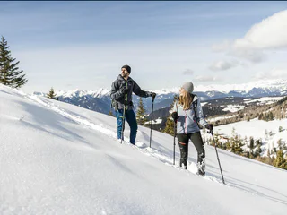
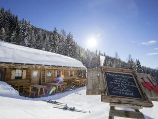
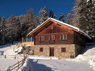
Snowshoe & winterhike Tulper - Pianer Kreuz
Luson/Lüsen, Lüsen/Luson, Dolomites Region Lüsen Villnöss
medium
Poziom trudności
340 m
Wzlot
2h:15 min
czas trwania
Wędruj wyznaczonymi szlakami i odkryj spokojną, łagodną stronę Południowego Tyrolu. Podziwiaj zapierające dech w piersiach widoki na Dolomity, pokryte śniegiem lasy i ciche doliny. Doświadcz absolutnej ciszy, w której odnajdziesz wewnętrzny spokój i nawiążesz głęboką więź z naturą. Dzięki rakietom śnieżnym możesz zejść z utartych szlaków i zanurzyć się w dziewiczych lasach. Zbieraj zimowe wrażenia podczas spacerów i wędrówek na rakietach śnieżnych - krok po kroku, z dala od zgiełku i hałasu.
1/2
Luson/Lüsen, Lüsen/Luson, Dolomites Region Lüsen Villnöss
medium
Poziom trudności
340 m
Wzlot
2h:15 min
czas trwania

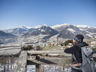
Plose/Plose, Brixen/Bressanone, Brixen/Bressanone and environs
easy
Poziom trudności
220 m
Wzlot
1h:46 min
czas trwania
1/4
Scena/Schenna, Schenna/Scena, Meran/Merano and environs
easy
Poziom trudności
320 m
Wzlot
2h:00 min
czas trwania
1/4
Avelengo Paese/Hafling Dorf, Vöran/Verano, Meran/Merano and environs
easy
Poziom trudności
149 m
Wzlot
1h:43 min
czas trwania

1/2
Nova Ponente Centro/Deutschnofen Dorf, Deutschnofen/Nova Ponente, Dolomites Region Eggental
easy
Poziom trudności
0 m
Wzlot
2h:15 min
czas trwania
Rasun di Sopra/Oberrasen, Rasen-Antholz/Rasun Anterselva, Dolomites Region Kronplatz/Plan de Corones
easy
Poziom trudności
193 m
Wzlot
1h:40 min
czas trwania
Transacqua/Ennewasser, Martell/Martello, Vinschgau/Val Venosta
medium
Poziom trudności
404 m
Wzlot
1h:15 min
czas trwania
1/3
Resia/Reschen, Graun im Vinschgau/Curon Venosta, Vinschgau/Val Venosta
medium
Poziom trudności
326 m
Wzlot
2h:00 min
czas trwania
Obereggen/Obereggen, Deutschnofen/Nova Ponente, Dolomites Region Eggental
medium
Poziom trudności
519 m
Wzlot
3h:00 min
czas trwania
Gandelle-Franadega-Fienili/Kandellen-Frondeigen-Stadlern, Toblach/Dobbiaco, Dolomites Region 3 Zinnen
easy
Poziom trudności
71 m
Wzlot
1h:30 min
czas trwania
Bolzano Centro/Bozen Zentrum, Bolzano/Bozen, Bolzano/Bozen and environs
medium
Poziom trudności
426 m
Wzlot
2h:22 min
czas trwania
1/3
Vallesina/Versein, Mölten/Meltina, Bolzano/Bozen and environs
easy
Poziom trudności
121 m
Wzlot
1h:37 min
czas trwania
Anterselva di Sopra/Antholz-Obertal, Rasen-Antholz/Rasun Anterselva, Dolomites Region Kronplatz/Plan de Corones
easy
Poziom trudności
263 m
Wzlot
1h:19 min
czas trwania
Birchabruck/Ponte Nova, Deutschnofen/Nova Ponente, Dolomites Region Eggental
medium
Poziom trudności
130 m
Wzlot
1h:55 min
czas trwania
1/3
S. Genesio Atesino/Jenesien, Jenesien/San Genesio Atesino, Bolzano/Bozen and environs
easy
Poziom trudności
294 m
Wzlot
2h:07 min
czas trwania
1/2
Maranza/Meransen, Mühlbach/Rio di Pusteria, Brixen/Bressanone and environs
medium
Poziom trudności
218 m
Wzlot
1h:49 min
czas trwania
Sesto/Sexten, Sexten/Sesto, Dolomites Region 3 Zinnen
medium
Poziom trudności
71 m
Wzlot
2h:04 min
czas trwania
1/9
Montesole/Sonnenberg - Parcines/Partschins, Partschins/Parcines, Meran/Merano and environs
easy
Poziom trudności
194 m
Wzlot
1h:34 min
czas trwania
S. Pietro/St. Peter - Valle Aurina/Ahrntal, Sand in Taufers/Campo Tures, Ahrntal/Valle Aurina
easy
Poziom trudności
154 m
Wzlot
1h:30 min
czas trwania
1/2
Longiarù/Campill, Al Plan/San Vigilio, Dolomites Region Kronplatz/Plan de Corones
medium
Poziom trudności
449 m
Wzlot
1h:26 min
czas trwania
1/36
Rablà/Rabland, Algund/Lagundo, Meran/Merano and environs
easy
Poziom trudności
94 m
Wzlot
1h:10 min
czas trwania
Prenn/Prenn, Schenna/Scena, Meran/Merano and environs
easy
Poziom trudności
190 m
Wzlot
2h:00 min
czas trwania
Caerna/Garn, Feldthurns/Velturno, Brixen/Bressanone and environs
medium
Poziom trudności
370 m
Wzlot
1h:51 min
czas trwania
1/4
Prissiano/Prissian, Tisens/Tesimo, Meran/Merano and environs
medium
Poziom trudności
687 m
Wzlot
4h:13 min
czas trwania
San Cassiano/San Cassiano, Badia, Dolomites Region Alta Badia
easy
Poziom trudności
545 m
Wzlot
2h:30 min
czas trwania
Ortisei/Urtijëi/St. Ulrich/Urtijëi, Urtijëi/Ortisei, Dolomites Region Val Gardena
easy
Poziom trudności
110 m
Wzlot
1h:01 min
czas trwania
Valgiovo/Jaufental, St.Leonhard in Passeier/San Leonardo in Passiria, Meran/Merano and environs
easy
Poziom trudności
86 m
Wzlot
0h:30 min
czas trwania
1/2
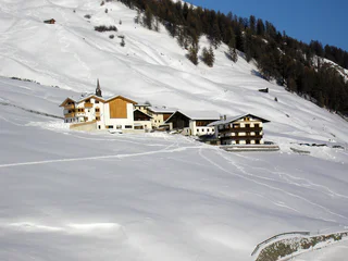
Mazia/Matsch, Mals/Malles, Vinschgau/Val Venosta
medium
Poziom trudności
365 m
Wzlot
2h:04 min
czas trwania
medium
Poziom trudności
436 m
Wzlot
3h:30 min
czas trwania
1/11
Montesole/Sonnenberg - Parcines/Partschins, Partschins/Parcines, Meran/Merano and environs
easy
Poziom trudności
133 m
Wzlot
1h:10 min
czas trwania
Dziękujemy za zapisanie się!
Rejestracja już aktywna
Potwierdź rejestrację
Aby zakończyć rejestrację, otwórz e-mail, który właśnie wysłaliśmy, i kliknij link potwierdzający.
Nie widzisz wiadomości? Sprawdź folder spam.
Otrzymujesz już nasze wyjątkowe oferty, przydatne wskazówki i specjalne propozycje, aby w pełni cieszyć się wakacjami.
Już próbowałeś zapisać się do naszego newslettera, ale nie potwierdziłeś rejestracji. Właśnie wysłaliśmy ci ponownie e‑mail. Sprawdź swoją skrzynkę odbiorczą i folder ze spamem i potwierdź teraz.


