1/2
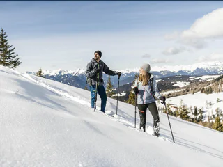
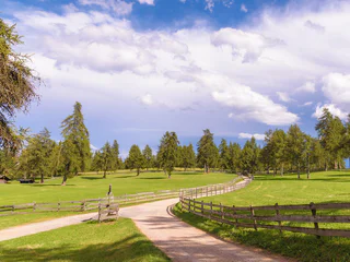
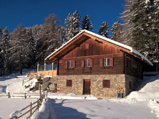
Snowshoe & winterhike Tulper - Pianer Kreuz
Luson/Lüsen, Lüsen/Luson, Dolomites Region Lüsen Villnöss
medium
Moeilijkheidsgraad
340 m
Hoogteverschil
2h:15 min
Duur
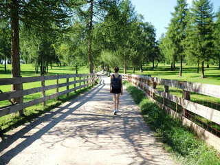
Bij het winterwandelen over de goed verzorgde paden leer je de rustige kant van Zuid-Tirol kennen. Ontdek betoverende uitzichtpunten over de Dolomieten, de besneeuwde bossen in de rustige zijdalen van de Kronplatz/Plan de Corones-regio, en geniet van de absolute stilte van de natuur. Op je sneeuwschoenen blijf je weg van de skipisten en liften. Je duikt de ongerepte bossen in. Dit maakt het sneeuwschoenwandelen en winterwandelen tot een échte belevenis.
1/2
Luson/Lüsen, Lüsen/Luson, Dolomites Region Lüsen Villnöss
medium
Moeilijkheidsgraad
340 m
Hoogteverschil
2h:15 min
Duur

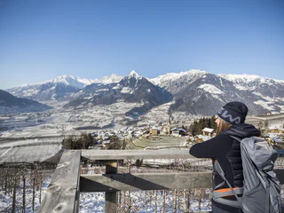
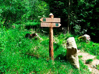
Plose/Plose, Brixen/Bressanone, Brixen/Bressanone and environs
easy
Moeilijkheidsgraad
220 m
Hoogteverschil
1h:46 min
Duur
1/4
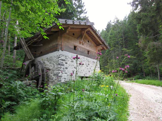
Scena/Schenna, Schenna/Scena, Meran/Merano and environs
easy
Moeilijkheidsgraad
320 m
Hoogteverschil
2h:00 min
Duur
1/4
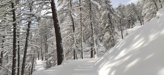
Avelengo Paese/Hafling Dorf, Vöran/Verano, Meran/Merano and environs
easy
Moeilijkheidsgraad
149 m
Hoogteverschil
1h:43 min
Duur

1/2
Nova Ponente Centro/Deutschnofen Dorf, Deutschnofen/Nova Ponente, Dolomites Region Eggental
easy
Moeilijkheidsgraad
0 m
Hoogteverschil
2h:15 min
Duur
Rasun di Sopra/Oberrasen, Rasen-Antholz/Rasun Anterselva, Dolomites Region Kronplatz/Plan de Corones
easy
Moeilijkheidsgraad
193 m
Hoogteverschil
1h:40 min
Duur
Transacqua/Ennewasser, Martell/Martello, Vinschgau/Val Venosta
medium
Moeilijkheidsgraad
404 m
Hoogteverschil
1h:15 min
Duur
1/3
Resia/Reschen, Graun im Vinschgau/Curon Venosta, Vinschgau/Val Venosta
medium
Moeilijkheidsgraad
326 m
Hoogteverschil
2h:00 min
Duur
Obereggen/Obereggen, Deutschnofen/Nova Ponente, Dolomites Region Eggental
medium
Moeilijkheidsgraad
519 m
Hoogteverschil
3h:00 min
Duur
Gandelle-Franadega-Fienili/Kandellen-Frondeigen-Stadlern, Toblach/Dobbiaco, Dolomites Region 3 Zinnen
easy
Moeilijkheidsgraad
71 m
Hoogteverschil
1h:30 min
Duur
Bolzano Centro/Bozen Zentrum, Bolzano/Bozen, Bolzano/Bozen and environs
medium
Moeilijkheidsgraad
426 m
Hoogteverschil
2h:22 min
Duur
1/3
Vallesina/Versein, Mölten/Meltina, Bolzano/Bozen and environs
easy
Moeilijkheidsgraad
121 m
Hoogteverschil
1h:37 min
Duur
Anterselva di Sopra/Antholz-Obertal, Rasen-Antholz/Rasun Anterselva, Dolomites Region Kronplatz/Plan de Corones
easy
Moeilijkheidsgraad
263 m
Hoogteverschil
1h:19 min
Duur
Birchabruck/Ponte Nova, Deutschnofen/Nova Ponente, Dolomites Region Eggental
medium
Moeilijkheidsgraad
130 m
Hoogteverschil
1h:55 min
Duur
1/3
S. Genesio Atesino/Jenesien, Jenesien/San Genesio Atesino, Bolzano/Bozen and environs
easy
Moeilijkheidsgraad
294 m
Hoogteverschil
2h:07 min
Duur
1/2
Maranza/Meransen, Mühlbach/Rio di Pusteria, Brixen/Bressanone and environs
medium
Moeilijkheidsgraad
218 m
Hoogteverschil
1h:49 min
Duur
Sesto/Sexten, Sexten/Sesto, Dolomites Region 3 Zinnen
medium
Moeilijkheidsgraad
71 m
Hoogteverschil
2h:04 min
Duur
1/9
Montesole/Sonnenberg - Parcines/Partschins, Partschins/Parcines, Meran/Merano and environs
easy
Moeilijkheidsgraad
194 m
Hoogteverschil
1h:34 min
Duur
S. Pietro/St. Peter - Valle Aurina/Ahrntal, Sand in Taufers/Campo Tures, Ahrntal/Valle Aurina
easy
Moeilijkheidsgraad
154 m
Hoogteverschil
1h:30 min
Duur
1/2
Longiarù/Campill, Al Plan/San Vigilio, Dolomites Region Kronplatz/Plan de Corones
medium
Moeilijkheidsgraad
449 m
Hoogteverschil
1h:26 min
Duur
1/36
Rablà/Rabland, Algund/Lagundo, Meran/Merano and environs
easy
Moeilijkheidsgraad
94 m
Hoogteverschil
1h:10 min
Duur
Prenn/Prenn, Schenna/Scena, Meran/Merano and environs
easy
Moeilijkheidsgraad
190 m
Hoogteverschil
2h:00 min
Duur
Caerna/Garn, Feldthurns/Velturno, Brixen/Bressanone and environs
medium
Moeilijkheidsgraad
370 m
Hoogteverschil
1h:51 min
Duur
1/4
Prissiano/Prissian, Tisens/Tesimo, Meran/Merano and environs
medium
Moeilijkheidsgraad
687 m
Hoogteverschil
4h:13 min
Duur
San Cassiano/San Cassiano, Badia, Dolomites Region Alta Badia
easy
Moeilijkheidsgraad
545 m
Hoogteverschil
2h:30 min
Duur
Ortisei/Urtijëi/St. Ulrich/Urtijëi, Urtijëi/Ortisei, Dolomites Region Val Gardena
easy
Moeilijkheidsgraad
110 m
Hoogteverschil
1h:01 min
Duur
Valgiovo/Jaufental, St.Leonhard in Passeier/San Leonardo in Passiria, Meran/Merano and environs
easy
Moeilijkheidsgraad
86 m
Hoogteverschil
0h:30 min
Duur
1/2
Mazia/Matsch, Mals/Malles, Vinschgau/Val Venosta
medium
Moeilijkheidsgraad
365 m
Hoogteverschil
2h:04 min
Duur
medium
Moeilijkheidsgraad
436 m
Hoogteverschil
3h:30 min
Duur
1/11
Montesole/Sonnenberg - Parcines/Partschins, Partschins/Parcines, Meran/Merano and environs
easy
Moeilijkheidsgraad
133 m
Hoogteverschil
1h:10 min
Duur
Bedankt voor je inschrijving!
Inschrijving al actief
Bevestig je inschrijving
Om je inschrijving te voltooien, open de e-mail die we je net hebben gestuurd en klik op de bevestigingslink.
Niet gevonden? Kijk ook even in je spammap.
Je ontvangt al onze exclusieve aanbiedingen, handige tips en speciale suggesties om volop van je vakantie te genieten.
Je hebt je al geprobeerd in te schrijven voor onze nieuwsbrief maar deze nog niet bevestigd. We hebben je de e‑mail zojuist opnieuw gestuurd. Controleer je inbox en je spammap en bevestig nu.


