1/2
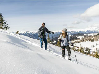
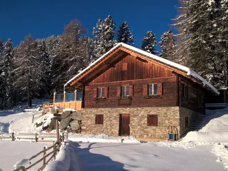
Snowshoe & winterhike Tulper - Pianer Kreuz
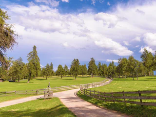
Luson/Lüsen, Lüsen/Luson, Dolomites Region Lüsen Villnöss
medium
Difficulté
340 m
Gain d'altitude
2h:15 min
durée
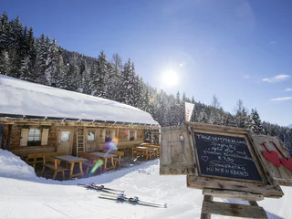
Partir pour une randonnée hivernale, sur des sentiers parfaitement tracés, c'est découvrir le côté paisible du Sud-Tyrol. Points de vue enchanteurs dans les Dolomites, forêts enneigées dans les tranquilles vallées voisines, dans la région du Kronplatz... Les endroits ne manquent pas où vous pouvez profiter de vous-même et de la nature, dans un silence absolu. En raquettes, vous vous éloignerez des pistes de ski et des remontées mécaniques pour découvrir des forêts encore totalement préservées. Mais, que ce soit en raquettes ou à pied, randonner en hiver dans le Sud-Tyrol sera toujours une expérience inoubliable.
1/2
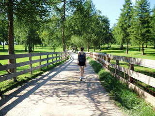
Luson/Lüsen, Lüsen/Luson, Dolomites Region Lüsen Villnöss
medium
Difficulté
340 m
Gain d'altitude
2h:15 min
durée

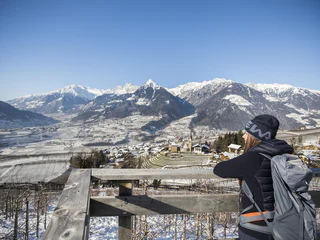
Plose/Plose, Brixen/Bressanone, Brixen/Bressanone and environs
easy
Difficulté
220 m
Gain d'altitude
1h:46 min
durée
1/4
Scena/Schenna, Schenna/Scena, Meran/Merano and environs
easy
Difficulté
320 m
Gain d'altitude
2h:00 min
durée
1/4
Avelengo Paese/Hafling Dorf, Vöran/Verano, Meran/Merano and environs
easy
Difficulté
149 m
Gain d'altitude
1h:43 min
durée

1/2
Nova Ponente Centro/Deutschnofen Dorf, Deutschnofen/Nova Ponente, Dolomites Region Eggental
easy
Difficulté
0 m
Gain d'altitude
2h:15 min
durée
Rasun di Sopra/Oberrasen, Rasen-Antholz/Rasun Anterselva, Dolomites Region Kronplatz/Plan de Corones
easy
Difficulté
193 m
Gain d'altitude
1h:40 min
durée
Transacqua/Ennewasser, Martell/Martello, Vinschgau/Val Venosta
medium
Difficulté
404 m
Gain d'altitude
1h:15 min
durée
1/3
Resia/Reschen, Graun im Vinschgau/Curon Venosta, Vinschgau/Val Venosta
medium
Difficulté
326 m
Gain d'altitude
2h:00 min
durée
Obereggen/Obereggen, Deutschnofen/Nova Ponente, Dolomites Region Eggental
medium
Difficulté
519 m
Gain d'altitude
3h:00 min
durée
Gandelle-Franadega-Fienili/Kandellen-Frondeigen-Stadlern, Toblach/Dobbiaco, Dolomites Region 3 Zinnen
easy
Difficulté
71 m
Gain d'altitude
1h:30 min
durée
Bolzano Centro/Bozen Zentrum, Bolzano/Bozen, Bolzano/Bozen and environs
medium
Difficulté
426 m
Gain d'altitude
2h:22 min
durée
1/3
Vallesina/Versein, Mölten/Meltina, Bolzano/Bozen and environs
easy
Difficulté
121 m
Gain d'altitude
1h:37 min
durée
Anterselva di Sopra/Antholz-Obertal, Rasen-Antholz/Rasun Anterselva, Dolomites Region Kronplatz/Plan de Corones
easy
Difficulté
263 m
Gain d'altitude
1h:19 min
durée
Birchabruck/Ponte Nova, Deutschnofen/Nova Ponente, Dolomites Region Eggental
medium
Difficulté
130 m
Gain d'altitude
1h:55 min
durée
1/3
S. Genesio Atesino/Jenesien, Jenesien/San Genesio Atesino, Bolzano/Bozen and environs
easy
Difficulté
294 m
Gain d'altitude
2h:07 min
durée
1/2
Maranza/Meransen, Mühlbach/Rio di Pusteria, Brixen/Bressanone and environs
medium
Difficulté
218 m
Gain d'altitude
1h:49 min
durée
Sesto/Sexten, Sexten/Sesto, Dolomites Region 3 Zinnen
medium
Difficulté
71 m
Gain d'altitude
2h:04 min
durée
1/9
Montesole/Sonnenberg - Parcines/Partschins, Partschins/Parcines, Meran/Merano and environs
easy
Difficulté
194 m
Gain d'altitude
1h:34 min
durée
S. Pietro/St. Peter - Valle Aurina/Ahrntal, Sand in Taufers/Campo Tures, Ahrntal/Valle Aurina
easy
Difficulté
154 m
Gain d'altitude
1h:30 min
durée
1/2
Longiarù/Campill, Al Plan/San Vigilio, Dolomites Region Kronplatz/Plan de Corones
medium
Difficulté
449 m
Gain d'altitude
1h:26 min
durée
1/36
Rablà/Rabland, Algund/Lagundo, Meran/Merano and environs
easy
Difficulté
94 m
Gain d'altitude
1h:10 min
durée
Prenn/Prenn, Schenna/Scena, Meran/Merano and environs
easy
Difficulté
190 m
Gain d'altitude
2h:00 min
durée
Caerna/Garn, Feldthurns/Velturno, Brixen/Bressanone and environs
medium
Difficulté
370 m
Gain d'altitude
1h:51 min
durée
1/4
Prissiano/Prissian, Tisens/Tesimo, Meran/Merano and environs
medium
Difficulté
687 m
Gain d'altitude
4h:13 min
durée
San Cassiano/San Cassiano, Badia, Dolomites Region Alta Badia
easy
Difficulté
545 m
Gain d'altitude
2h:30 min
durée
Ortisei/Urtijëi/St. Ulrich/Urtijëi, Urtijëi/Ortisei, Dolomites Region Val Gardena
easy
Difficulté
110 m
Gain d'altitude
1h:01 min
durée
Valgiovo/Jaufental, St.Leonhard in Passeier/San Leonardo in Passiria, Meran/Merano and environs
easy
Difficulté
86 m
Gain d'altitude
0h:30 min
durée
1/2
Mazia/Matsch, Mals/Malles, Vinschgau/Val Venosta
medium
Difficulté
365 m
Gain d'altitude
2h:04 min
durée
medium
Difficulté
436 m
Gain d'altitude
3h:30 min
durée
1/11
Montesole/Sonnenberg - Parcines/Partschins, Partschins/Parcines, Meran/Merano and environs
easy
Difficulté
133 m
Gain d'altitude
1h:10 min
durée