1/2
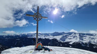
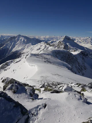
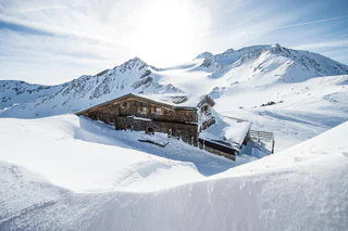
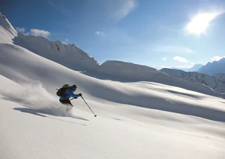
Ski tour from Ridnaun to the Ratschinger Kreuz summit (2359 m)
Ridanna/Ridnaun, Ratschings/Racines, Sterzing/Vipiteno and environs
medium
Moeilijkheidsgraad
1005 m
Hoogteverschil
3h:16 min
Duur
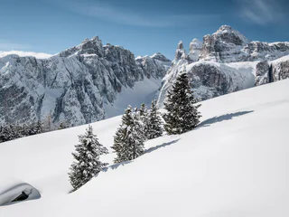
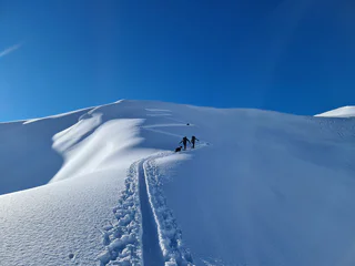
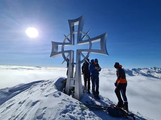
Een ongerept landschap, de rust buiten de skipistes om en besneeuwde hellingen met poedersneeuw en dennenbomen. Of bestorm je liever de Dolomieten? Of ben je meer van de minder steile bergtoppen? Ben je dol op weidse uitzichten? Of neem je alleen genoegen met de hoogste bergtoppen? Waar je ook voor kiest, tijdens het toerskiën in Zuid-Tirol geniet je van unieke natuurbelevingen en sportieve avonturen.
1/2
Ridanna/Ridnaun, Ratschings/Racines, Sterzing/Vipiteno and environs
medium
Moeilijkheidsgraad
1005 m
Hoogteverschil
3h:16 min
Duur
1/3
Colfosco/Colfosco, Corvara, Dolomites Region Alta Badia
difficult
Moeilijkheidsgraad
0 m
Hoogteverschil
1h:45 min
Duur
1/3
Falzeben/Falzeben, Hafling/Avelengo, Meran/Merano and environs
difficult
Moeilijkheidsgraad
752 m
Hoogteverschil
2h:34 min
Duur

Tablà/Tabland - Parcines/Partschins, Moos in Passeier/Moso in Passiria, Meran/Merano and environs
difficult
Moeilijkheidsgraad
1600 m
Hoogteverschil
5h:00 min
Duur

1/3
Corvara/Corvara, Corvara, Dolomites Region Alta Badia
easy
Moeilijkheidsgraad
286 m
Hoogteverschil
1h:26 min
Duur
Stulles/Stuls, Moos in Passeier/Moso in Passiria, Meran/Merano and environs
medium
Moeilijkheidsgraad
1152 m
Hoogteverschil
3h:30 min
Duur
S. Giacomo/St. Jakob - Val di Vizze/Pfitsch, Pfitsch/Val di Vizze, Sterzing/Vipiteno and environs
difficult
Moeilijkheidsgraad
1408 m
Hoogteverschil
4h:46 min
Duur
1/2
Santa Gertrude/St. Gertraud, Ulten/Ultimo, Meran/Merano and environs
medium
Moeilijkheidsgraad
1524 m
Hoogteverschil
5h:49 min
Duur
1/4
S. Giacomo/St. Jakob - Val di Vizze/Pfitsch, Pfitsch/Val di Vizze, Sterzing/Vipiteno and environs
medium
Moeilijkheidsgraad
1266 m
Hoogteverschil
3h:58 min
Duur
Vipiteno/Sterzing, Sterzing/Vipiteno, Sterzing/Vipiteno and environs
difficult
Moeilijkheidsgraad
980 m
Hoogteverschil
3h:30 min
Duur
Resia/Reschen, Graun im Vinschgau/Curon Venosta, Vinschgau/Val Venosta
medium
Moeilijkheidsgraad
964 m
Hoogteverschil
3h:21 min
Duur
1/2
Ridanna/Ridnaun, Ratschings/Racines, Sterzing/Vipiteno and environs
medium
Moeilijkheidsgraad
1019 m
Hoogteverschil
2h:55 min
Duur
Casere/Kasern, Prettau/Predoi, Ahrntal/Valle Aurina
easy
Moeilijkheidsgraad
1183 m
Hoogteverschil
4h:00 min
Duur
1/5
Plata/Platt, Moos in Passeier/Moso in Passiria, Meran/Merano and environs
medium
Moeilijkheidsgraad
1073 m
Hoogteverschil
4h:00 min
Duur
Plan/Pfelders, Riffian/Rifiano, Meran/Merano and environs
difficult
Moeilijkheidsgraad
1661 m
Hoogteverschil
4h:00 min
Duur
1/2
Resia/Reschen, Graun im Vinschgau/Curon Venosta, Vinschgau/Val Venosta
medium
Moeilijkheidsgraad
0 m
Hoogteverschil
4h:00 min
Duur
Ponticolo/Pontigl, Brenner/Brennero, Sterzing/Vipiteno and environs
medium
Moeilijkheidsgraad
1244 m
Hoogteverschil
4h:13 min
Duur
1/2
Maso Corto/Kurzras, Schnals/Senales, Vinschgau/Val Venosta
medium
Moeilijkheidsgraad
634 m
Hoogteverschil
3h:16 min
Duur
San Vigilio, Al Plan/San Vigilio, Dolomites Region Kronplatz/Plan de Corones
medium
Moeilijkheidsgraad
682 m
Hoogteverschil
2h:28 min
Duur
1/4
Valgiovo/Jaufental, Ratschings/Racines, Sterzing/Vipiteno and environs
difficult
Moeilijkheidsgraad
1294 m
Hoogteverschil
3h:57 min
Duur
1/2
S.Martino/Reinswald, Klausen/Chiusa, Brixen/Bressanone and environs
medium
Moeilijkheidsgraad
0 m
Hoogteverschil
9h:48 min
Duur
1/3
Maso Corto/Kurzras, Schnals/Senales, Vinschgau/Val Venosta
difficult
Moeilijkheidsgraad
1517 m
Hoogteverschil
5h:24 min
Duur
Colle/Pichl, Gsies/Valle di Casies
medium
Moeilijkheidsgraad
1400 m
Hoogteverschil
5h:00 min
Duur
1/3
Plan/Pfelders, Moos in Passeier/Moso in Passiria, Meran/Merano and environs
easy
Moeilijkheidsgraad
664 m
Hoogteverschil
2h:30 min
Duur
1/3
San Cassiano/San Cassiano, Badia, Dolomites Region Alta Badia
easy
Moeilijkheidsgraad
78 m
Hoogteverschil
0h:45 min
Duur
1/3
Certosa/Karthaus, Schnals/Senales, Vinschgau/Val Venosta
medium
Moeilijkheidsgraad
1600 m
Hoogteverschil
5h:52 min
Duur
Valdaora di Mezzo/Mitterolang, Al Plan/San Vigilio, Dolomites Region Kronplatz/Plan de Corones
medium
Moeilijkheidsgraad
1217 m
Hoogteverschil
4h:37 min
Duur
Casere/Kasern, Prettau/Predoi, Ahrntal/Valle Aurina
difficult
Moeilijkheidsgraad
1462 m
Hoogteverschil
5h:00 min
Duur
medium
Moeilijkheidsgraad
983 m
Hoogteverschil
3h:30 min
Duur
Stelvio/Stilfs, Stilfs/Stelvio, Vinschgau/Val Venosta
medium
Moeilijkheidsgraad
1119 m
Hoogteverschil
3h:49 min
Duur
Bedankt voor je inschrijving!
Inschrijving al actief
Bevestig je inschrijving
Om je inschrijving te voltooien, open de e-mail die we je net hebben gestuurd en klik op de bevestigingslink.
Niet gevonden? Kijk ook even in je spammap.
We hebben gezien dat je je probeerde aan te melden voor de nieuwsbrief, maar je e-mailadres is al geregistreerd. Je blijft onze aanbiedingen, tips en inspiratie voor je vakantie ontvangen.
Je hebt je al geprobeerd in te schrijven voor onze nieuwsbrief maar deze nog niet bevestigd. We hebben je de e‑mail zojuist opnieuw gestuurd. Controleer je inbox en je spammap en bevestig nu.


