Passer au contenu

ajouté(e) aux favoris

supprimé(e) des favoris

Oups ! Une erreur s’est produite. Réessayer

Ton compte est en cours de création

Ton compte a été créé avec succès et tu es maintenant connecté

Tu es connecté!

Ton compte a été créé avec succès, mais nous n'avons pas pu te connecter automatiquement

Tu es déconnecté

Filtrer
Filtres sélectionnés
    Niveau de difficulté
    Durée
    Distance en km

    Circuits à vélo dans le sud du Sud-Tyrol

    Le sud du Sud-Tyrol est un véritable paradis pour les cyclistes. Découvrez des itinéraires variés traversant des vignobles pittoresques, des villages pleins de charme et des montagnes plus élevées. Que vous préfériez une balade tranquille ou des parcours plus exigeants, vous trouverez ici l’itinéraire parfait pour votre aventure à vélo.

    Résultats
    E-MTB
    E-Bike tour Silvestertal/Valle San Silvestro valley
    Toblach/Dobbiaco, Dolomites Region 3 Zinnen

    The mountainbike roundtour with the Silvesteralm/Malga San Silvestro hut and the Lachwiesenhütte/Rifugio Lachwiesen hut, which invite you to stop for a break, runs mainly on forest paths in the middle of the forest. This tour does not have any difficult parts.

    Charging stations:
    Dobbiaco/Toblach center

    Charging possibility:
    Malga San Silvestro/Silvesteralm hut


    Difficulté : moyenne
    674 m altitude
    21.4 Km distance
    Mountain bike
    MTB tour Silvestertal Valley round (041)
    Toblach/Dobbiaco, Dolomites Region 3 Zinnen

    The mountainbike roundtour with the Silvesteralm/Malga San Silvestro hut and the Lachwiesenhütte/Rifugio Lachwiesen hut, which invite you to stop for a break, runs mainly on forest paths in the middle of the forest. This tour does not have any difficult parts.


    Difficulté : moyenne
    715 m altitude
    25.1 Km distance
    E-Bikes
    E-Bike Tour Albeins-Nafen-St. Peter-Ranui
    Villnöss/Funes, Dolomites Region Villnösstal

    Enjoy mountain bike tours also on steeper trails with the latest e-bike. Even beginners will be impressed by the electric mobility! Explore effortlessly the Geisler mountain landscape with an E-Bike. It’s emission-free, climate-friendly and without being stiff and sore.
    E-Bikes are for everyone due to the very simple operation. Overcome steep inclines with ease and cycle into the wind with a smile on your face, because that makes your bike trip even more fun.

    Difficulté : moyenne
    1082 m altitude
    23.1 Km distance
    Downhills
    CC Top Line
    Al Plan/San Vigilio, Dolomites Region Kronplatz/Plan de Corones

    This line is a more technical and “rocky” version of the Furcia trail featuring sections littered with roots, boulders and carved berms. Suitable for experienced riders who are comfortable handling their bike throughout rough terrain.

    Level: medium to difficult

    Difficulté : moyenne
    0 m altitude
    687.0 m distance
    Cycling
    Roda de Fodom road bike tour
    Badia, Dolomites Region Alta Badia

    The Dolomites Bike Day Route is a panoramic circuit of about 50 km that takes the cyclists on some of the epic stages of the "Giro d'Italia" and the Maratona dles Dolomites roadbike marathon. You will cyclie on legendary mountain passes in the heart of the Dolomites UNESCO World Heritage.

    There are several routes that extend between South Tyrol and Veneto and that every cyclist can choose independently depending on ability and condition.

    Once a year, usually in mid-June, the Campolongo, Falzarego and Valparola passes are closed to motorized traffic from 9 am to 3 pm. On this special day the roads connecting the Ladin valleys Val Badia, Livinallongo and Ampezzo are reserved exclusively for cyclists.

    Difficulté : moyenne
    1399 m altitude
    53.8 Km distance
    Downhills
    Furcia Trail
    Bruneck/Brunico, Dolomites Region Kronplatz/Plan de Corones

    The Herrnsteig trail's little brother too is packed with flow and curves. But while it's nowhere near as wild and bumpy, its 124 bends and turns between the top of Mount Kronplatz and Passo Furcia make it at least equally winding and dizzying. To get back up to the top, simply hop on the Ruis cable car at Passo Furcia. The big challenge on this trail is to master it without pedalling and with as little use of the brakes as possible. It is ideal for medium-advanced and pro bikers who wish to get to most out of an active riding style.

    Difficulté : moyenne
    0 m altitude
    4.9 Km distance
    Downhills
    Crazy Bunny Line
    Bruneck/Brunico, Dolomites Region Kronplatz/Plan de Corones

    With plenty of jumps, bumps and bends in quick succession, this line is an “up-in-the-air” variant along the Furcia trail. If you’re not afraid to let go of the brakes and take off, you’re in for tons of fun on this trail.

    Level: medium

    Difficulté : moyenne
    0 m altitude
    491.0 m distance
    Cycling
    Wine & bike: The Wine Road
    Bolzano/Bozen, Bolzano/Bozen and environs
    The circular bike tour leads through some of the most famous and beautiful historical wine villages along the South Tyrolean Wine Road, Cornaiano/Girlan, Appiano/Eppan, and Caldaro/Kaltern, well-known for their Pinot Blanc wine.

    From Bolzano follow the bike trail that leads to Cornaiano, a historical wine village featuring underground cellars that take up more space than the village itself. The next stage is San Michele/St. Michael, the actual centre of the Appiano castle region. A visit to the wineries in this outstanding wine region is really worthwhile. The wine route now leads back to Caldaro by the lake, famous not only for the wine named after the Kalterer See, but also because it is one of the most well-known wine villages in the province. The route then leads to the village Ora/Auer and from here returns to Bolzano following the Adige/Etsch river.
    Difficulté : moyenne
    436 m altitude
    49.2 Km distance
    Cycling
    Dolomites cycle path: Route Toblach/Dobbiaco - Cortina
    Toblach/Dobbiaco, Dolomites Region 3 Zinnen

    The scenery is dominated by the panorama of the Dolomites UNESCO World Heritage. The route follows the old railway from Toblach/Dobbiaco to Cortina d´Ampezzo, from the Hochpustertal/Alta Pusteria valley across the Höhlensteintal/Val di Landro valley, past lakes and the View of the Three Peaks.  

    WARNING: CLOSURE WITH DEVIATION FROM 01.04.2022
    In the period from 01.04. to 09.07.2022, the rink route from the Nordic Arena - Dobbiaco Lake to the Nasswand will be closed with diversion to an alternative route.
    Planimetry

    Difficulté : moyenne
    563 m altitude
    30.7 Km distance
    E-MTB
    458 Royal Dolomites Tour (2025)
    Kastelruth/Castelrotto, Dolomites Region Seiser Alm

    This mountain-bike or e-bike tour treats bikers to a view of all of the Kings and Queens of the Dolomite mountains, including the Marmolada – Queen of the Dolomites, the majestic Langkofel and Plattkofel, King Laurin and his Rosengarten massif, and the Schlern in all of its legendary might. The route leads from the Eggental Valley to the Fassa Valley and on to the Gröden Valley, followed by a stretch through the Dolomites region Seiser Alm and back to the set-off point. Due to the length of almost 100 km, we recommend riding the tour on an e-bike. If you prefer to ride without an electric motor, you should consider spreading the tour over two days. You can choose to begin the tour from any one of the valleys it covers.
    Information about the timetables and tickets of the summer lifts: www.seiseralm.it/cablecars

    Difficulté : difficile
    4014 m altitude
    97.2 Km distance
    Mountain bike
    MTB tour Ratsberg/Monte Rota (044)
    Toblach/Dobbiaco, Dolomites Region 3 Zinnen

    The moderately difficult bike tour runs mainly on asphalt roads, but also on a forest path. The tour offers a wonderful view of the Höhlensteintal/Val di Landro  valley and the Toblach/Dobbiaco lake.

    Difficulté : moyenne
    435 m altitude
    12.2 Km distance
    Mountain bike
    MTB-tour Marchkinkele/Cornetto di Confine round (042)
    Toblach/Dobbiaco, Dolomites Region 3 Zinnen
    The Marchkinkele/Cornetto di Confine is a summit north of the village Toblach/Dobbiaco, on the border between South Tyrol (Italy) and East Tyrol (Austria).This MTB tour is one of the most demanding in the region.The efforts are quickly forgotten on the summit, as a 360 ° view offers an unforgettable panorama. In the south are the Dolomites with the Three Peaks and in the north the glaciers of Austria. Just below the summit is the Marchhütte hut, which invites you to make a break.
    Difficulté : difficile
    1438 m altitude
    49.3 Km distance
    E-MTB
    eMTB -Tour Marchkinkele/Cornetto di Confine (042)
    Toblach/Dobbiaco, Dolomites Region 3 Zinnen

    The Marchkinkele/Cornetto di Confine is a summit north of the village Toblach/Dobbiaco, on the border between South Tyrol (Italy) and East Tyrol (Austria).This MTB tour is one of the most demanding in the region.The efforts are quickly forgotten on the summit, as a 360 ° view offers an unforgettable panorama. In the south are the Dolomites with the Three Peaks and in the north the glaciers of Austria. Just below the summit is the Marchhütte hut, which invites you to make a break.

    Charging stations:
    Toblach/Dobbiaco center
    Hotel Union
    Dairy Three Peaks

    Charging possibility:
    Silvesteralm/Malga San Silvestro hut

    Difficulté : difficile
    1561 m altitude
    48.0 Km distance
    E-MTB
    428 Royal Dolomites Tour with variant Regensburger mountain hut (2025)
    Kastelruth/Castelrotto, Dolomites Region Seiser Alm

    This mountain-bike or e-bike tour treats bikers to a view of all of the Kings and Queens of the Dolomite mountains, including the Marmolada – Queen of the Dolomites, the majestic Langkofel and Plattkofel, King Laurin and his Rosengarten massif, and the Schlern in all of its legendary might. The route leads from the Eggental Valley to the Fassa Valley and on to the Gröden Valley, followed by a stretch through the Dolomites Region Seiser Alm and back to the set-off point. A little treat in this version of the tour: a great loop via the Langental valley, the Regensburger hut and the legendary St. Jakob church for even more Dolomite flair and enjoyment. Given its length of 105 km, we recommend taking this tour in a few stages. If you opt to use an e-bike, it is possible to cycle the full length in one day, stopping off at one of the countless mountain huts to recharge your bike along the way. You can choose to begin the tour from any one of the valleys it covers.

    Information about the timetables and tickets of the summer lifts: www.seiseralm.it/cablecars

    Difficulté : difficile
    3583 m altitude
    102.4 Km distance
    E-Bikes
    To the Rifugio Forcola/Furkelhütte
    Prad am Stilfser Joch/Prato allo Stelvio, Vinschgau/Val Venosta

    The mountain bike tour to the Rifugio Forcola/Furkelhütte is a wonderful tour to a hut with a breathtaking view and the possibility to stop for refreshments. As the tour runs through a forest path it is very suitable for e-bikers.

    Difficulté : difficile
    1628 m altitude
    40.2 Km distance
    E-Bikes
    To the Malga Vitelli/Kälberalm
    Stilfs/Stelvio, Vinschgau/Val Venosta

    The mountain bike tour to the Malga Vitelli/Kälberalm is an easy tour, which leads through the forest to an alpine pasture. Since the tour follows a forest path, it is suitable for e-bikers.

    Difficulté : facile
    223 m altitude
    1.2 Km distance
    E-Bikes
    To the Malga Stelvio di Sopra/Oberen Stilfser Alm
    Stilfs/Stelvio, Vinschgau/Val Venosta

    The mountain bike tour leads along a forest path to the Malga Stelvio di Sopra/Oberen Stilfser Alm, which makes it ideal for e-bikers. At the end of this relatively easy tour, a managed alpine hut awaits you, with its own alpine dairy and refreshment facilities.

    Difficulté : facile
    504 m altitude
    9.5 Km distance
    Cycling
    Weinstraße - Vino 50
    Margreid an der Weinstraße/Magrè sulla Strada del Vino, Bolzano/Bozen and environs
    The Weinstraße Vino 50 runs through a beautiful wine region with gentle hills and vineyards. Along the way, there are wineries and places to stop for a break. The route is ideal for those who want to combine nature and enjoyment.
    Difficulté : moyenne
    172 m altitude
    41.6 Km distance
    E-Bikes
    Southern Wine Route, Wine & bike: Gewürztraminer and Pinot Noir
    Kurtatsch an der Weinstraße/Cortaccia sulla Strada del Vino, Alto Adige Wine Road

    The southernmost ‘Wine & Bike’ route leads from the wine villages of Cortaccia/Kurtatsch and Magrè/Margreid to Cortina all’Adige/Kurtinig and Salorno/Salurn. Return via Egna/Neumarkt and Ora/Auer, the Lake Kaltern and back to Termeno/Tramin. The stretch from Salorno to Ora can be completed by train.


    Difficulté : moyenne
    451 m altitude
    46.8 Km distance
    E-Bikes
    To Innichen
    Rasen-Antholz/Rasun Anterselva, Dolomites Region Kronplatz/Plan de Corones

    The route initially leads out of the valley, past the football field in Niederrasen and under the Pustertal road. It continues to Oberolang, where you join the Pustertal cycle path. We first cycle past the beautiful Olang reservoir and then pass through the idyllic towns of Welsberg, Niederdorf, and Toblach, until we reach our destination, Innichen, the last major town before the Austrian border. Once there, there are numerous attractions to discover, such as the Acquafun water park, the DoloMythos natural history museum, and the Haunold mountain with its summer toboggan run. Furthermore, the famous Drau cycle path (44 km) leads from Innichen to Lienz in Austria. Innichen also offers a wide selection of bars and restaurants for your culinary needs. For the return journey, you can also take the train from Innichen back to Olang.

    Difficulté : moyenne
    342 m altitude
    25.3 Km distance
    E-Bikes
    Central Wine Route, Wine & bike: Pinot Blanc and Schiava
    Kaltern an der Weinstraße/Caldaro sulla Strada del Vino, Alto Adige Wine Road

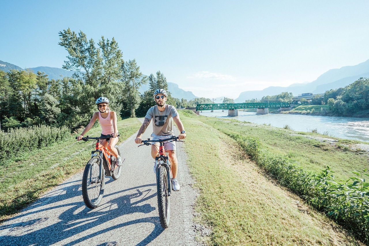
    The 23 km long circular bike tour leads through some of the most famous and most beautiful historical wine villages on the South Tyrolean Wine Road, Cornaiano/Girlan, Appiano/Eppan, and Caldaro/Kaltern, well-known for their Pinot Blanc the autochthonous Kalterer See wine.

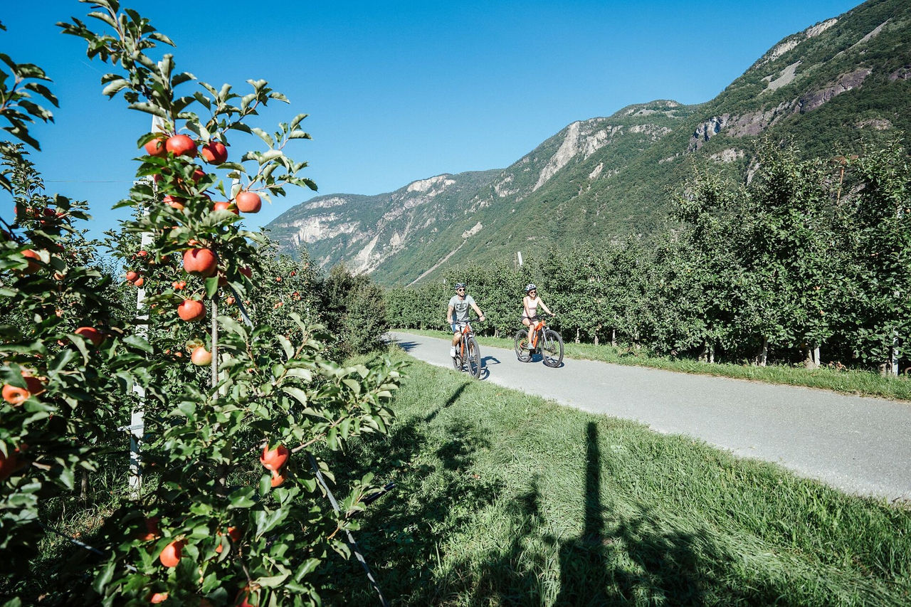
    Route: the shortest of the three wine routes begins in Caldaro in the square in front of the two large wineries, the Kellerei Kaltern and the Erste + Neue Kaltern. The route then leads through a section of forest to the two Montiggler Seen lakes. Continue on to Cornaiano, a historical wine village featuring underground cellars that take up more space than the village itself. The next stages are San Paolo/St. Pauls and San Michele/St. Michael, the actual centre of the Appiano castle region. A visit to the wineries in this outstanding wine region is really worthwhile. The wine route now leads back to Caldaro by the lake, famous not only for the wine named after the Kalterer See, but also because it is one of the most well-known wine villages in the province.

    Difficulté : facile
    0 m altitude
    23.3 Km distance
    Cycling
    Racing bike tour at Passo delle Erbe
    Sëlva/Selva, Dolomites Region Val Gardena

    Starting from Val Gardena, take the state road n. 242 which leads to Chiusa and continues up to Bressanone on the cycle path that runs alongside the SS12. Once in Bressanone take the ascent through S. Andrea up to Passo delle Erbe. At the top you cycle down towards San Martino in Badia to reach Corvara. Turning right you start the ascent to the Gardena Pass passing through Colfosco. After passing the Gardena Pass a pleasant descent leads to Selva.

    Difficulté : difficile
    3536 m altitude
    114.4 Km distance
    E-Bikes
    Southern Wine Route
    Kurtatsch an der Weinstraße/Cortaccia sulla Strada del Vino, Bolzano/Bozen and environs
    The Southern Wine Route is a cycling tour of approximately 40 kilometers through the southernmost wine-growing regions of South Tyrol. It starts in the historic wine village of Kurtatsch/Cortaccia and passes through Margreid/Magrè, Kurtinig/Cortaccia, and Salurn/Salorno, the southernmost municipality of South Tyrol. The route then continues to Neumarkt/Egna and Auer/Ora before returning to Kurtatsch.
    Difficulté : moyenne
    163 m altitude
    41.3 Km distance
    Bikepark
    Brixen Bikepark
    Brixen/Bressanone, Brixen/Bressanone and environs
    Brixen Bikepark on the Plose has four mountain bike trails varying from very easy to challenging. Three of the four descents were only opened in 2018. They were designed by Gravity Logic, which was founded by the legendary trail building team behind Whistler Mountain Bike Park in Canada. All the trails are superbly maintained, boast some fantastic corners and offer plenty of airtime and riding challenges.
    4 lines: 2 difficult, 1 medium, 1 easy
    Accessibility: Plose gondola lift, Palmschoß chairlift
    0 m altitude
    0.0 m distance
    E-MTB
    eMTB-tour Gsiesertal/Val Casies valley (046)
    Toblach/Dobbiaco, Dolomites Region 3 Zinnen

    This some demanding eMTB tour leads to the neighboring Gsiesertal/Val Casies valley, where the demanding part, i.e. the vertical meters, is covered first. The second part of the round tour only has a small altitude difference.

    Charging stations:
    Toblach/Dobbiaco center
    Hotel Gratschwirt
    Hotel Union
    Pircher Oberland
    Cheese Dairy Three Peaks

    Difficulté : moyenne
    613 m altitude
    33.7 Km distance
    E-Bikes
    E-Bike tour Toblach/Dobbiaco - Cortina
    Toblach/Dobbiaco, Dolomites Region 3 Zinnen

    The scenery is dominated by the panorama of the Dolomites UNESCO World Heritage. The route follows the old railway from Toblach/Dobbiaco to Cortina d´Ampezzo, from the Hochpustertal/Alta Pusteria valley across the Höhlensteintal/Val di Landro valley, past lakes and the View of the Three Peaks.  

    From Cortina back to Toblach there are buses with bike trailers operated by the Cortina Express bus company (only in season).

    Charging stations:
    Dobbiaco/Toblach center
    Hotel Tre Cime/Drei Zinnen
    Hotel Union
    Cheese Dairy Three Peaks

    Difficulté : moyenne
    563 m altitude
    30.7 Km distance
    E-Bikes
    Eisacktal Valley Bike Route: Brenner - Bozen
    Mühlbach/Rio di Pusteria, Brixen/Bressanone and environs

    The Brenner Bike Route spans 96 kilometers through the Eisack Valley down to Bolzano. Enjoy gentle hills, charming villages, and cultural treasures along the way. Ideal for those who love to combine nature, culture, and active travel.

    Difficulté : moyenne
    327 m altitude
    103 Km distance
    Mountain bike
    MTB tour Gsiesertal/Val Casies valley Round (046)
    Toblach/Dobbiaco, Dolomites Region 3 Zinnen

    This some demanding MTB tour leads to the neighboring Gsiesertal/Val Casies valley, where the demanding part, i.e. the vertical meters, is covered first. The second part of the round tour only has a small altitude difference.

    Difficulté : moyenne
    592 m altitude
    33.3 Km distance
    Cycling
    Giro Adventure Tour
    Olang/Valdaora, Dolomites Region Kronplatz/Plan de Corones

    The reminiscence of the Giro d'Italia. Walk in the footsteps of the racing bike stars and Giro legends and cover 769 m of altitude. The (sports) history-laden adventure tour does not yet take you to the Stallersattel, but "only" to the Antholz Lake. That should be enough to warm you up. The ride along the valley cycle path through Olang and the Anthiolz Valley offers a great first overview - but the last climb to the biathlon centre gives you a real Giro feeling. Don't forget your pink jersey!

    Difficulté : moyenne
    1234 m altitude
    44.4 Km distance