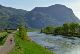
Südtirol Guide App Logo
Passer au contenu

ajouté(e) aux favoris

supprimé(e) des favoris

Oups ! Une erreur s’est produite. Réessayer

Ton compte est en cours de création

Ton compte a été créé avec succès et tu es maintenant connecté

Tu es connecté!

Ton compte a été créé avec succès, mais nous n'avons pas pu te connecter automatiquement

Tu es déconnecté

Filtrer
Filtres sélectionnés
    Niveau de difficulté
    Durée
    Distance en km

    Circuits à vélo dans le sud du Sud-Tyrol

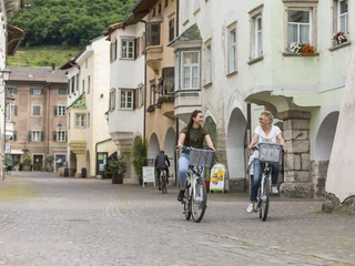
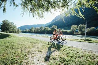
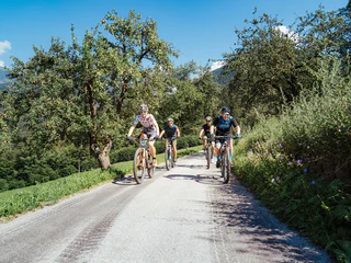
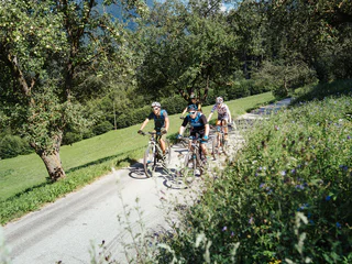
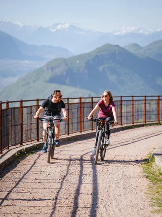
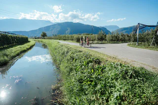
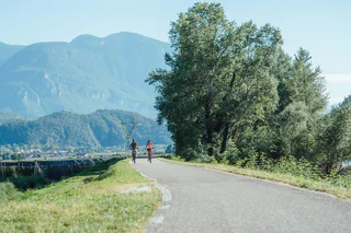
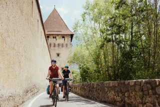
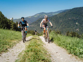
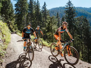
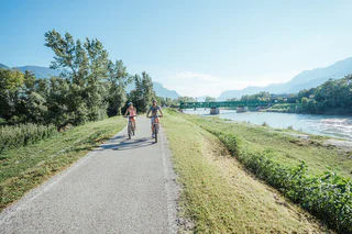
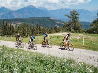
    Le sud du Sud-Tyrol est un véritable paradis pour les cyclistes. Découvrez des itinéraires variés traversant des vignobles pittoresques, des villages pleins de charme et des montagnes plus élevées. Que vous préfériez une balade tranquille ou des parcours plus exigeants, vous trouverez ici l’itinéraire parfait pour votre aventure à vélo.

    Résultats
    E-MTB
    Tour to Alp of Planeil
    Mals/Malles, Vinschgau/Val Venosta

    Wonderful tour with demanding ramps to the winner of the alp cheese olympiad. Enjoy the afternoon snack "Marend" and the view.

    Difficulté : moyenne
    1249 m altitude
    26.4 Km distance
    E-Bikes
    Reach new heights: Bike Tour to Gampielalm and Kröll Hut
    Vintl/Vandoies, Brixen/Bressanone and environs
    Experience the Pfunders mountains on two wheels: this varied tour takes you to the Gampielalm and onwards to the Kröll Hut. Enjoy the tranquility of the alpine pastures and breathtaking views. Perfect for adventurers looking to combine nature and a gentle challenge.
    Difficulté : moyenne
    600 m altitude
    6.4 Km distance
    E-MTB
    Morterer Alm Tour (Malga di Morter)
    Martell/Martello, Vinschgau/Val Venosta

    After this exhausting tour to the Malga di Morter mountain hut you really deserve a good hearty snack. The demanding gradient on asphalt road and then on a partially loose, steeper gravel path demands quite a bit from bikers. If you are an experienced e-mountain biker, you will do easier. Start at the Trattla sports and leisure center and turn right just before Burgaunerhof (1100 m) towards the beautiful Morter mountain hut (1900 m). From the end of the asphalt road, you always go uphill along the rushing Brandnerbach stream through the narrow, incised valley below the peaks Hasenöhrl (3257 m) and Zwölferkreuz (2512 m). You will be surprised at your arrival: You wouldn’t have expected this small, green and peaceful high plateau with the mountain hut situated on the hill and its many homemade specialties. Enjoy a hearty snack and have a nap in the lush grass to prepare yourself for the demanding descent on partially loose gravel that requires concentration. Having arrived at the valley floor, you can look forward to the delicacies of the strawberry valley such as strawberry cake, strawberry jam and a good coffee.

    Tip: If you still have enough energy for a hike, you can climb up on path no. 14 to Cima Zwölferkreuz.

    Difficulté : facile
    850 m altitude
    7.7 Km distance
    Cycling
    Riedl Tour
    Karneid/Cornedo all'Isarco, Dolomites Region Eggental

    This medium difficulty circular bike tour delights everyone, as it runs mostly on paved roads without particularly difficulties passages. The fantastic view of the neighbouring Dolomite mountains is always fascinating.

    Difficulté : moyenne
    599 m altitude
    17.9 Km distance
    E-Bikes
    Cycling and Sightseeing: Leuchtenburg/Castelchiaro Round Tour at Lake Caldaro
    Auer/Ora, Alto Adige Wine Road
    The Leuchtenburg cycling round tour starts at Klughammer on Lake Caldaro and covers a distance of approximately 24.9 km with an elevation difference of about 170 m. The total ascent is around 290 m. This tour is suitable for touring bikes, trekking bikes, city bikes, and mountain bikes and primarily runs on paved, low-traffic roads. The best times for this tour are spring, late summer, autumn, and winter, with the route being particularly beautiful from mid to late April during the blooming season.
    Difficulté : moyenne
    278 m altitude
    24.8 Km distance
    Cycling
    Sellaronda road bike tour
    Corvara, Dolomites Region Alta Badia

    The Sellaronda circuit round the Sella massif has long been a winter favourite.

    However, in recent years the Sellaronda circuit has also become a popular challenge for cyclists.

    The twisty Alpine roads at the foot of the Dolomite peaks are like a dream come true for racing cyclists. The gradients on the circuit are mostly between 8 and 10 %, it is classed as moderately difficult. The asphalt roads are mostly in good condition, although there are small potholes on some sections.

    Difficulté : moyenne
    1674 m altitude
    51.4 Km distance
    Downhills
    Piz de Plaies Trail
    Al Plan/San Vigilio, Dolomites Region Kronplatz/Plan de Corones

    There's nothing wrong with a bit of fun – it was this motivation which in autumn 2014 broke the ground for the Piz de Plaies trail in San Vigilio. The trail is filled to the brim with jumps and banked curves. It's only a short ride up on the Pedagà-Piz de Plaies cable car before the track winds back down into the valley on a mad series of bends. Not a single section of this trail is straight, so prepare for active riding and leave your fear of steep passages at home. It's a guaranteed buzz! Suitable for true pros and medium-advanced riders.

    Difficulté : moyenne
    25 m altitude
    2.8 Km distance
    Mountain bike
    Hasl-Wieben Mountain Bike Tour and the Holy Hansen Trail
    Schlanders/Silandro, Vinschgau/Val Venosta

    The Holy Hansen trail was applied by bikers for bikers. The farm tavern Haslhof (1,550 m), after so many curves to satisfy the hunger of trail, awaits the deserved break with wonderful views.

    From Haslhof westwards pass two fences and get off right after the flowy S1 trail section in sector 1 and 2. In sector 3 and 4 wait a few S2 and S3 somewhat more difficult to thereafter return to the easier element of fun for everyone. The Holy Hansen crosses repeatedly forest and asphalt paths.

    At Wiebenhof follow on asphalt two bends downhill to then turn right into the trail section. Flow pure, spiced with abutting sections, small kickers and faster passages provides this trail section to the crossing of the asphalt road. Take the road uphill for a short stretch and then turn left to continue to enjoy the rest of the trail up to Göflan.

    Time regulation for Shuttle transport at Holy Hansen
    Monday + Wednesday + Friday: Shuttle from 1 pm
    Tuesday + Thursday: Shuttle all day
    Saturday: Shuttle until 11.30  am (start last ride)
    Sunday: no Shuttle

    Official MTB-Shuttles to Trails in Schlanders
    Mobil Car Tel. +39 338 5 07 54 62 - Freeride Vinschgau Tel. +39 348 0 42 72 29
    Stegges Taxi Tel. +39 335 5 44 06 20 - Vinschgau Shuttle Tel. +39 335 6 82 85 14

    Difficulté : difficile
    839 m altitude
    15.5 Km distance
    E-Bikes
    Mölten- Schlaneid- Cable Car to Vilpian- Terlan- Mölten
    Mölten/Meltina, Bolzano/Bozen and environs
    A nice tour with the road bike from Mölten to Schlaneid, with the cable car to Vilpian from there the state road to Terlan and back to Mölten.
    Line 203: Cable car Vilpian- Mölten

    www.suedtirolmobil.info
    Line: 203 - Cable car - Vilpian/Mölten  
    Difficulté : moyenne
    1476 m altitude
    43.5 Km distance
    E-MTB
    Kaltern Bike MTB-Tour: Rosszähne
    Kaltern an der Weinstraße/Caldaro sulla Strada del Vino, Alto Adige Wine Road
    This is a short adventure from Lake Kaltern into the forest between its eastern shore and the Adige Valley. South of the Leuchtenburg castle, enchanted paths lead to the Rosszähnen, a rock formation above the Etsch river.
    Difficulté : moyenne
    588 m altitude
    18.1 Km distance
    Mountain bike
    354 Latemar Ronda
    Welschnofen/Nova Levante, Dolomites Region Eggental

    The classic of the Eggental Valley, the Latemar Ronda, offers breathtaking panoramic views of the Dolomite mountains and is a dream tour for anyone who wants to get up close to the Latemar by mountain bike.

    Clockwise, the Latemar massif can be covered over roughly 36 kilometres with about 400 metres of elevation gain without major climbs, but with two more challenging and steep descents. It can be completed in around 5 hours by experienced hobby mountain bikers or bike-loving families as a full-day tour. The starting point for this uniquely scenic tour can be Welschnofen | Nova Levante, Karersee | Carezza or Obereggen.

    THE LIFTS TO THE LATEMAR RONDA ARE OPEN FROM MID-JUNE UNTIL MID-SEPTEMBER!

    Difficulté : moyenne
    2118 m altitude
    44.6 Km distance
    Mountain bike
    Plankamodui Tour
    Prad am Stilfser Joch/Prato allo Stelvio, Vinschgau/Val Venosta

    Pleasant route across Montechiaro/Lichtenberg and the Platzhof farm into the 12er Trail.

    From Prato/Prad, the gateway to the Stelvio National Park and to Solda/Sulden, you proceed across the Suldenbach streem to Agumes/Agums and from there via a beautiful meadow path with view to the fields, castles and summits of the Upper Venosta Valley in northerly direction to Montechiaro/Lichtenberg. Here starts the ascent on asphalt up to the Lichtenberg Fortress and then on gravel further up to Adelheid Schöpf Lechner from the Platzhof farm (1,354 m). After a nice snack (Brotzeit) with a view towards the direction of Sluderno/Schluderns and on the 3,202 m high Allitzer Spitz peak, you reach the highest point after a few metres further uphill. A flowy descent on narrow and wide trails (S1 and S2), with a few technical tight turns – no risk of boredom. From the Agumsbergerhöfe farms we carry on rolling, soon on tarmac back into the direction of the starting point to the interesting aquaprad National Park visitor center and look forward to a leisurely drink containing electrolytes.

    Tip: The unusual name of the tour relates to a field name at the Agumser Berg mountain at the former climb from the Platzhof farm to Gawierg.

    Difficulté : facile
    506 m altitude
    11.3 Km distance
    E-Bikes
    Pitzoner circular route
    Nals/Nalles, Meran/Merano and environs

    The tour starts from Nalles and leads past the church to the castle Schwanburg (private property). From here, turn right in the direction of Sirmiano. Above the castle Payersberg (private property), a road will lead you to the Bittnerhof and onwards to the Pitzoner-route back to Nalles. This tour can also be done in the opposite direction: Turn left when you see the castle Schwanburg (private property).

    • Total length: 12 km
    • Driving time: 2 hours
    • Difference in altitude: 380 m
    Difficulté : facile
    0 m altitude
    12 Km distance
    Cycling
    Road biking - Passo dello Stelvio Tour
    Naturns/Naturno, Meran/Merano and environs

    Passo dello Stelvio Tour
    Prato allo Stelvio – Stelvio – Gomagoi – Trafoi –
    Passo dello Stelvio – Giogo di Santa Maria – Santa Maria –
    Tubre – Glorenza – Prato allo Stelvio

    Difficulté : difficile
    2316 m altitude
    64.1 Km distance
    Cycling
    Roadbike: Südtiroler - Trientner Weinstraßen
    Kurtatsch an der Weinstraße/Cortaccia sulla Strada del Vino, Alto Adige Wine Road
    From Kurtatsch we cycle along the wine road to the Margreid sports ground, where we turn right to the south. From there we cycle along the rocks via Aichholz (Roveré della Luna) until shortly before Mezzocorona, where the road turns east towards San Michele. We continue southwards, cross the bridge over the Adige at Zambana and continue to Lavis, where we turn off towards Pressano. The route now climbs via Panizza di Sopra and Masen and soon descends again to San Michele all'Adige. There we cycle uphill on the Adige cycle path to Egna. From there, the route continues to Tramin and back to Kurtatsch via the wine route.
    Difficulté : facile
    805 m altitude
    73.9 Km distance
    E-MTB
    Pitzinger Alm mtb round trip
    Pfalzen/Falzes, Dolomites Region Kronplatz/Plan de Corones

    The tour starts at the sports field in Pfalzen and follows MTB Route No. 441 through beautiful forested areas to the Pitzinger Alm, passing the Kofler am Kofel guesthouse and returning to the sports zone in Pfalzen. From the starting point, the route takes you along a paved road toward Platten, through green valleys and gentle hills. Soon, you reach a wooded area where the fresh mountain air makes the ride especially pleasant.

    The trail winds through dense vegetation, offering occasional open views of the surrounding mountains and valley. Some challenging sections include steeper climbs, but the breathtaking views and idyllic nature make every effort worthwhile.

    Once you reach the Pitzinger Alm, surrounded by an impressive mountain backdrop, it’s a perfect spot for a well-deserved break. The return route leads back to the Pfalzen sports zone, passing the Kofler am Kofel guesthouse, where you can savor local cuisine. Here, the views of the Kronplatz and the Dolomites are truly spectacular.

    Difficulté : difficile
    933 m altitude
    21.5 Km distance
    Cycling
    Roadbike: Valle di Cembra
    Margreid an der Weinstraße/Magrè sulla Strada del Vino, Alto Adige Wine Road
    From Margreid, we cycle through the apple orchards via Kurtinig to Salurn, where we turn onto the Adige cycle path heading south. Shortly after Nave San Rocco, we take the road to Lavis and turn left towards the Cembra Valley. We climb up to Cavalese and San Lugano. The route then descends to Ora and back through the orchards to Margreid.
    Difficulté : moyenne
    1326 m altitude
    100.4 Km distance
    Cycling
    Road biking - Passo della Mendola
    Naturns/Naturno, Meran/Merano and environs

    Passo della Mendola – Passo delle Palade Tour
    Naturno – Merano – Lana – San Paolo – Appiano – Passo della
    Mendola – Fondo – Passo delle Palade – Merano – Naturno

    Difficulté : moyenne
    3784 m altitude
    124.8 Km distance
    Downhills
    Montesole Trail (Sunny Benny)
    Latsch/Laces, Vinschgau/Val Venosta

    "One of the most beautiful trails in the Alps" – this is how Bike Magazine described the Montesole /Sunny Benny Trail in Val Venosta.

    This trail is passable nearly all year round and takes you through the austere cultural landscape of Val Venosta’s Sun Mountain. You will not only enjoy the flowing passages, but also the fantastic panoramic views of Monte Tramontana and of the surrounding mountain peaks and glaciers. Start at the mountain station in San Martino in Monte and follow the asphalt road downhill. Turn right after 1.2 km and take hiking path no. 9 for the first broader warm-up trail passage. The main part of the trail with flowing forest floors and more difficult stone passages (partially S2) starts after a short asphalt road crossing at Birchaböden. Look forward to pure trail fun after a short crosswise drive on the Ratschillweg road to the newly built trail section with fantastic steep turns. The successive flatter, flowing “Share the Trail” section starts after a few meters in altitude and takes you along Piani di Annenerg. Continue until the suspension bridge, pass by the cairns and take the partially steep path no. 5 to Tiss. Variant: You can also take path no. 5A to Tiss, just before the suspension bridge. Return on the asphalt road towards Laces or Coldrano. Please note: “Share the Trail” sections for some parts, especially on paths no. 5 and 7. Please show consideration for hikers as they have right of way!


    Difficulté : moyenne
    0 m altitude
    6.0 Km distance
    E-Bikes
    Road biking - Passo di Monte Giovo Tour
    St.Leonhard in Passeier/San Leonardo in Passiria, Meran/Merano and environs

    Passo di Monte Giovo Tour
    San Leonardo, Passiria – Valtina – Passo di Monte Giovo –
    Valtina – San Leonardo, Passiria

    Difficulté : difficile
    1963 m altitude
    38.9 Km distance
    E-MTB
    Kaltern Bike MTB-Tour: Girlan
    Kaltern an der Weinstraße/Caldaro sulla Strada del Vino, Alto Adige Wine Road

    The tour to Girlan / Cornaiano is a relatively short and easy mountainbike tour for novices and bikers with less stamina. Yet it still has a lot to offer. Girlan is a little wine village belonging to the neighboring community of Eppan / Appiano, and is situated on the northern part of the Mitterberg / Monte di Mezzo. There are several lookout spots along this trail where you'll enjoy a beautiful view over the provincial capital of Bozen / Bolzano and the Etsch / Adige Valley. The bike tour to Girlan is characterized by the visual splendor of the "Unterland" district of South Tyrol, with its handsome vineyards and orchards. From Kaltern / Caldaro, you'll first roll along the asphalt bicycle path towards Eppan. This bicycle path takes you along the now-defunct railway line that used to connect Bozen with Kaltern. This fact guarantees you that the grade will remain gentle throughout (because the old locomotives weren't able to overcome grades of more than 6%). Today, the only vestige of that wonderful bygone era is the vintage steam engine standing on the tracks at the exit of Kaltern. Especially on weekends, when the weather is nice, you will encounter lots of foot traffic along the bike trail, including other cyclists, families, children, and dogs – so we recommend that you remain alert at all times. After about five kilometers, you'll reach Eppan. From here, you'll take the narrow asphalt trail at the right, and proceed uphill towards Girlan. Afterwards, you'll continue along technically easy and shady gravel trails and forest paths over the Mitterberg / Monte di Mezzo, past the crossroad at Purzelmoos and the Montiggl Lakes. In summer months, you might want to stop and take a refreshing dip before proceeding downhill via the village of Montiggl and the Montiggl Plateau towards Kaltern.

    Variants: You can follow the bicycle path straight towards Bozen and follow the "Mitterberg" tour in the opposite direction.

    Mustn't be missed: The bicycle path along the former Fleims / Fiemme Valley railroad line from Kaltern to Sigmundskron / Firmiano, the Montiggl Forest, as well as the Montiggl Lakes.


    Difficulté : facile
    264 m altitude
    16.4 Km distance
    E-MTB
    Kaltern Bike MTB-Tour: Kalterer Höhenweg nach Altenburg
    Kaltern an der Weinstraße/Caldaro sulla Strada del Vino, Alto Adige Wine Road

    This is a pleasant roundtrip circuit that will help to acquaint you with the vicinity. It's not quite 20 km long, and will provide you with a good impression of the experience of biking around the Kaltern / Caldaro area. This tour includes beautiful, flowing forest trails interrupted only by charming little lookout points where you can enjoy some wonderful panoramic views of the surrounding vineyards and Lake Caldaro.

    As the name of this route implies, the High-Altitude Trail will first take you uphill from Kaltern. You'll have to manage about 500 meters of altitude differential at the very start. From the town's central market square, you will ascend "through the villages" (the parts of town at higher elevations) – namely: Pfuss and St. Niklaus – up to the so-called "Kalterer Höhe" (high-altitude trail). From this high point, you take the Mendel Pass Road farther up to the Mendel Pass. But this main road is crossed only twice before the High-Altitude Trail really becomes true to its name in the forest and gains elevation until you cross the cableway leading to the Mendel Pass. Now comes the most-enchanting segment of this tour, as you proceed along forest paths and trails downhill until you come to the Ziegelstadel. While passing through the forest, you'll repeatedly come to little clearings where you can stop for a breather and take in the marvelous views. From the Ziegelstadel, you should now take a trail down to Altenburg, the perhaps quietest neighborhood in Kaltern. Altenburg is situated on a sun-drenched plateau above the lake, hidden behind the forest. This is the perfect opportunity for you to pause for refreshments at the Waldschenke Inn or to discover one of the stunning lookout points with a view of Lake Caldaro. The return trip from Altenburg takes you back to Kaltern, past the St. Anton Sports Center with its fun climbing facility. If you feel up to it, you might want to stop by and include a session of wall-climbing in your tour. Or, you can comfortably glide down the path to the central square of Kaltern. Once you've arrived, you might want to relax and enjoy a cup of cappuccino, or a glass of delicious Caldaro wine. What an apt way to conclude a pleasant journey through the many vineyards you've passed through on this tour!

    Variants: This tour can also be combined with the "Panorama" tour – part of which runs along the same High-Altitude Trail. You thus have a number of different options to choose from.


    Difficulté : moyenne
    505 m altitude
    18.7 Km distance
    E-Bikes
    Mountain Bike Adventure on the Caldaro High Path
    Kaltern an der Weinstraße/Caldaro sulla Strada del Vino, Alto Adige Wine Road
    The Caldaro High Path is a moderately difficult mountain bike tour that is ideal for experienced cyclists. This approximately 10 km circular route starts and ends at the sports facilities in the Altenburg Forest in Caldaro. With an elevation difference of about 322 m and an estimated riding time of about 1 ½ hours, the route offers a challenging yet rewarding experience. The trail mainly consists of gravel and leads over wide, traffic-free forest roads, including an initial climb of about 10% over approximately 5 km.
    Difficulté : moyenne
    334 m altitude
    9.8 Km distance
    E-Bikes
    Around the yoke
    Villnöss/Funes, Dolomites Region Villnösstal

    Starting point: St. Peter, kilometres: 10.3 km; altitude difference: 324 m; altitude of starting point: 1145 m; altitude of end: 1145 m; Best season: May to October

    Tour description: The starting point of the tour is the village centre of St. Peter in the Villnöss valley. Here the route first passes by St. Jakob on an asphalted road. This tour leads you along the slopes of the foresty mountain, which parts the Afer and the Villnöss Valleys. After you reach the beautifully situated “Jochhöfe” (farm houses), you make your way across the saddleback on the northern side. You will be rewarded with a panoramic view to Brixen. After about 3 km of forest road, you return to the south side, past the Tschaufisserhöfe farmsteads to Coll. Crossing the road Coll, continue to the Gsoier Bild and via the Sunnseitenweg back to St. Peter.

    Difficulté : moyenne
    410 m altitude
    10.4 Km distance
    Bikepark
    3 - Country Enduro Trails
    Graun im Vinschgau/Curon Venosta, Vinschgau/Val Venosta

    The 3-country Enduro Trails combine a globally unique scenic experience with imposing views, cosy alpine pastures, beautiful lakes, history and culture - interwoven through mountain bike trails. Since mountain biking was discovered and promoted by locals more than 25 years ago, there is a lively mountain bike culture in the villages around the Reschen Pass and you can literally feel you are welcome as a mountain biker.
    Moreover, even in midsummer, temperatures in the Reschen Pass are usually pleasant. In addition to jumping into the Reschen lake, further natural lakes in the forests around the Reschen Pass also provide cooling.


    Trail descents of the finest quality from almost 2,500 metres above sea level make "runs" with more than 1,000 metres in decent at a time is possible! From flowing to technically demanding, but mostly natural, the trails offer everything an enduro heart desires. On a trail day in the border triangle, you will also pass by important landmarks, such as the 3-country border stone, Nauders mountain castle or the Reschen lake with its striking sunken church tower. Due to the vast size of the area, all types of mountain bikers are spread out inconspicuously throughout the terrain. By the end of the trail, all trails are guaranteed to lead you directly back to your starting point.

    0 m altitude
    0.0 m distance
    Cycling
    Kaltern Bike Graveltour: "Fennberg"
    Kaltern an der Weinstraße/Caldaro sulla Strada del Vino, Alto Adige Wine Road

    During this gravel tour you'll be speeding along the western fringes of the Etsch / Adige Valley. You'll be biking along paths and trails offering a variety of cycling experiences, via Altenburg and Graun all the way up to Lake Fennberg, through to Tramin / Termeno and then back to Lake Caldaro.

    In the "South of South Tyrol," the Mendel Ridge rises majestically above the Etsch / Adige Valley. At first glance, it looks as though, between the various wine villages dotted across the valley and the mighty summits, there were only forest. But if you are adventurous at heart, you might want to explore this hidden landscape offering a variety of views and experiences. From the Altenburg Sports Center, forest paths wind their way along the slopes to the Gummererhof Alpine Inn and on into the little hamlet of Graun. From here, you can admire the fabulous view of some of the communities strung along the Wine Route like pearls on a necklace: Tramin / Termeno and Kurtatsch / Cortaccia. You can now remain up high on this balcony and continue rolling to Lake Fennberg. An idyllic scene that – when viewed from below – you wouldn't expect. The lake and the church over its shores is hidden on a small saddle, shielded from the prying eyes of the busy valley, which is why it radiates a special sense of peace and quiet. When taking the return trip, you'll first proceed down the same route, but will the soon leave this balcony and roll down into the Etsch Valley. From Tramin via Lake Caldaro, vineyards will again dominate the landscape. If you have the time, there are numerous eateries and inns along the way where you can stop for refreshments. But there's no reason to not forge on ahead until you get to the market square in Kaltern / Caldaro, where you can toast your success with a glass of delicious Lake Caldaro wine. Or you can interrupt your tour to go for an invigorating dip in the lake.

    Variants: You can simply take this tour back and forth. If you choose this option, when getting to Graun on the return leg, you can also divert and proceed to Altenburg. From here, the road will then take you straight back to Kaltern.

    Difficulté : moyenne
    1675 m altitude
    56.3 Km distance
    Long-distance cycle track
    Road biking - Passo del Rombo
    Naturns/Naturno, Meran/Merano and environs

    Passo del Rombo Tour
    San Leonardo, Passiria – Moso, Passiria – Passo del Rombo –
    Moso, Passiria – San Leonardo, Passiria

    Difficulté : moyenne
    3539 m altitude
    58.6 Km distance