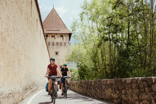
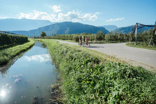
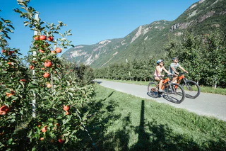
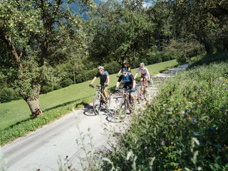
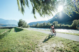
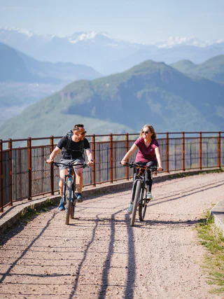
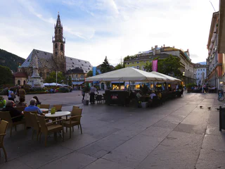
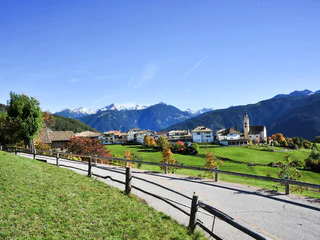
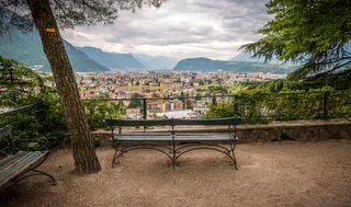
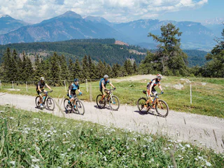
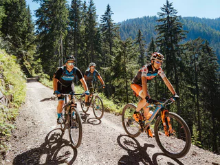
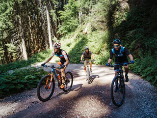
Ga meteen naar de inhoud

toegevoegd aan favorieten

verwijderd uit favorieten

Helaas is er een probleem opgetreden. Probeer het opnieuw.

Uw account wordt aangemaakt

Je account is succesvol aangemaakt en je bent nu ingelogd

U bent succesvol ingelogd!

Uw account is succesvol aangemaakt, maar we konden u niet automatisch aanmelden

U bent uitgelogd

Filteren
Geselecteerde filters
    Moeilijkheidsgraad
    Duur
    Afstand in km

    Fietstochten in het zuiden van Zuid-Tirol

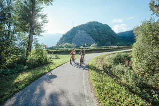
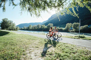
    Het zuiden van Zuid-Tirol is een paradijs voor fietsers. Ontdek de gevarieerde routes die door schilderachtige wijngaarden, charmante dorpjes en de hoger gelegen bergen voeren. Of je nu ontspannen wilt fietsen of uitdagende trajecten wilt trotseren, hier vind je de perfecte route voor jouw fietsavontuur.

    Resultaten
    E-Bikes
    Bike tour to Vernuer/Vernurio
    Riffian/Rifiano, Meran/Merano and environs

    Bike tour Riffian/Rifiano - Vernuer/Vernurio - Riffian/Rifiano       

    Moeilijkheidsgraad: zwaar
    944 m Hoogtemeters
    17.9 Km Route
    E-Bikes
    Road biking - Passo di Monte Giovo Tour
    St.Leonhard in Passeier/San Leonardo in Passiria, Meran/Merano and environs

    Passo di Monte Giovo Tour
    San Leonardo, Passiria – Valtina – Passo di Monte Giovo –
    Valtina – San Leonardo, Passiria

    Moeilijkheidsgraad: zwaar
    1963 m Hoogtemeters
    38.9 Km Route
    E-MTB
    Kaltern Bike MTB-Tour: Steintal large
    Kaltern an der Weinstraße/Caldaro sulla Strada del Vino, Alto Adige Wine Road

    It's hard to believe that the Mitterberg / Monte di Mezzo – this oblong, heavily forested mountain situated between the Etsch / Adige Valley and lake Caldaro – is crisscrossed by more than 600 km of trails, but it's true! The network of bike trails here is so complicated that you'll have to take care to maintain your bearings. The expansive Stein Valley is actually only a shallow depression near the highest point of the Mitterberg – which has an altitude of about 650 meters, and at the summit of which there is a large antenna station. You begin the ascent by first cycling downhill from Kaltern / Caldaro on the bicycle path towards Lake Caldaro, but after a few meters, you'll have to take a sharp left turn into a forest trail which is asphalted at the bottom. At the beginning, there is an only slight uphill grade. But starting at the Montiggl Plateau, it becomes much steeper. When you've gotten a little farther, a gravel trail starts. This gravel trail is only slightly uphill, and will take you to the entrance to the expansive Stein Valley. The route through the Stein Valley is virtually level, so you'll encounter nothing requiring any significant technical skill. The big, moss-covered boulders in the forest will catch your eye; they are found on both sides of the forest trail, and give the valley its name. Once you've gotten to the other side of the Stein Valley, you'll have two options to pedal downhill: The following description applies to the easy asphalt trail (which is nonetheless off limits for motor vehicles). Once you've descended, you can pedal along the level road to the west of the Montiggl Lakes towards Eppan. From there, you should take the bicycle trail along the former railroad line and bike back to Kaltern. In the summertime, the Montiggl Lakes are a popular destination for outdoor swimming, and you can enjoy a slice of delicious, home-made pie and cake in any one of the beach cafes. But please note the large number of pedestrians and hikers you'll encounter along the way to the lakes when the weather is nice. All in all, the Stein Valley is an easy mountainbike tour and, because it will take you mostly through shadowy forest, is to be preferred on hot days.

    Variants: This tour can also be combined with the "Girlan / Cornaiano" tour.

    Mustn't be missed: The Montiggl Lakes.

    Moeilijkheidsgraad: gemiddeld
    389 m Hoogtemeters
    18.0 Km Route
    Mountain bike
    Bike Beats - Mans Trail
    Badia, Dolomites Region Alta Badia

    With the "Mans Trail" the Bike Beats “menu” offers even more adrenalin. After the Heart, the Eye, the Veins and the Breath, it's time for the Hands. The Trail Mans - in Ladin language hands, of moderate difficulty, calls for a sensitive touch and careful attention while riding along a fun route, where the trick lies in finding the optimal equilibrium between manual technique and balance.

    Moeilijkheidsgraad: gemakkelijk
    0 m Hoogtemeters
    1.9 Km Route
    E-Bikes
    Bike tour in Riffian/Rifiano
    Riffian/Rifiano, Meran/Merano and environs

    Bike tour Riffian/Rifiano - Trail along the Passer River Causeway - Riffian/Rifiano       

    Moeilijkheidsgraad: gemakkelijk
    160 m Hoogtemeters
    7.0 Km Route
    Cycling
    Adige cycling path along the Via Claudia Augusta from Naturno to Nalles
    Tisens/Tesimo, Meran/Merano and environs

    The Adige cycling path along the Via Claudia Augusta is a cultural experience through gardens and architecture. The cycling path leads you through the beautiful landscapes of the Etschtal Valley from the Vinschgau Valley to Merano/Meran and to the south to Bolzano/Bozen and Caldaro/Kaltern. Here is the description of the tour from Stava/Staben near Naturno/Naturns to Nalles/Nals, which leads you to Merano and further south. Without any big efforts you can explore the wide valley. The tour is ideal for families and bikers who want to take it slow.

    https://maps.merano-suedtirol.it/en/etschradroute

    Moeilijkheidsgraad: gemakkelijk
    279 m Hoogtemeters
    34 Km Route
    Mountain bike
    Bike Beats - Cör Trail
    Corvara, Dolomites Region Alta Badia
    The red trail “Cör” offers a combination of exciting and fun parts, which will make your heart, cör in Ladin, race during the entire ride. Cör is a medium/difficult trail which winds through the woods offering the opportunity for exciting jumps, waves, berms and wallrides. With 1290 m of length and an altitude difference of 142 m, riding your bike on the Cör trail will absolutely get your adrenaline going.
    Moeilijkheidsgraad: gemiddeld
    0 m Hoogtemeters
    1.4 Km Route
    Cycling
    Kaltern Bike racing bike tour: Above the rooftops of the capital
    Kaltern an der Weinstraße/Caldaro sulla Strada del Vino, Alto Adige Wine Road

    This is a challenging biking tour with plenty of short, steep ramps demanding that you shift to the proper gear. Cyclists who choose this tour will be rewarded with beautiful views from high above the provincial capital of Bozen / Bolzano all the way up to Jenesien / San Genesio. Forget the hustle-and-bustle of the cities amidst verdant alpine pastures on your way to Mölten / Meltina. You will start from the market square in Kaltern / Caldaro, cross the Bahnhofsstrasse and proceed down to the Kellereistrasse (alternative starting-point). The bicycle trail begins at the end of the Kellereistrasse (at the old locomotive) and will take you all the way to the heart of the provincial capital of Bozen / Bolzano. You will proceed along the bicycle trail parallel to the Etsch / Adige River, then along the Talfer Brook – a tributary of the Etsch coming from the Sarn / Sarentino Valley. At the northern outskirts of the town, the road leading into the Sarn Valley and uphill towards Jenesien forks off from the Hauptstrasse. This represents the first highlight of this excursion. The street winds its way upward through two tunnels to the Panorama Balcony with an unobstructed view of the city and the Etsch Valley. You'll soon reach Jenesien, the main settlement of this plateau, and the streets will become gradually narrower as you pedal up to the Schermoos Saddle, the inconspicuous pass between Jenesien and Mölten. You'll be passing by farmers driving their hay wagons – and fewer city folk in their convertibles. The environment is now gradually growing quieter, and the street are adapting more and more to the wild character of the surroundings. Now it will get curvier and completely unrhythmic. You'll be frequently shifting gears – more often than you'll be changing direction. Until you surmount the Schermoos Saddle, you'll have to occasionally switch on your turbo in the appropriate gear. When descending from the saddle to Mölten / Meltina, you'll have to exercise caution, because the street at first remains narrow and treacherous. But in Mölten, you'll turn into the wider, well-established street and continue for a while over the plateau. You are now biking high above the Etsch / Adige Valley between Meran / Merano and Bozen / Bolzano – the perfect opportunity to familiarize yourself with a different aspect of this region. This exciting descent features a couple of curves. A warm wind will again be blowing in your face until you get to Terlan / Terlano and are standing in front of the gates of the provincial capital. You'll now see more vineyards, and viticulture will now characterize the tour. The route does not lead you directly on the main street to Kaltern. Instead, you will be taking little side lanes through wine villages. You'll have to exert yourself until just after the Kaltern Höhe you have achieved the upper part of the Mitterdorf district. Only now can you glide easily into the center of town and maybe treat yourself to an espresso or maybe even a glass of wine – the perfect conclusion to this interesting tour.

    Variant: It is also possible to take this tour in the opposite direction. However, when descending to Bozen / Bolzano, you will have to be especially attentive in the tunnels. And just before the end of the tour, you can visit the charming historical center of Bozen and its medieval promenades.

    Moeilijkheidsgraad: zwaar
    1990 m Hoogtemeters
    74.8 Km Route
    Downhills
    Giro di Naturno
    Naturns/Naturno, Meran/Merano and environs

    Circuito di Naturno (Naturno – Plon – Kreuzbrünnl lungo la Bike Highline Meran/o fino a Ötzi trail – Platzgumm – Ötzi Flow Trai - Naturno)

    Moeilijkheidsgraad: gemakkelijk
    1250 m Hoogtemeters
    23.9 Km Route
    E-Bikes
    Kaltern Bike Tour: Round of Castelfeder
    Kaltern an der Weinstraße/Caldaro sulla Strada del Vino, Alto Adige Wine Road
    This tour is like a journey through the history of the Etsch / Adige Valley. You will pass through historical villages on its sun-drenched eastern flank, though arcades and narrow lanes. And the highlight is a mystical, hilly landscape – an ancient cult site and important biotope that has lost none of its magical appeal. Castelfeder, situated in the "Unterland" district of South Tyrol between the villages of Auer / Ora and Montan / Montagna, is an ancient cult site on prominent display in the landscape. Extravagant geological formations and enormous boulders left behind by receding glaciers can be seen at various elevations. This wild and romantic hilly landscape exerts an unaccountably powerful attraction on every visitor. Castelfeder is the subject of numerous legends and stories. The so-called "Kuchelen" on the highest level are the remains of a ring wall dating back to the Early Middle Ages. The smoothly polished slide at its highest dome is believed to be associated with an ancient fertility cult. It was thought that childless women could get offspring by rubbing the stones dedicated to Mother Earth. The reasons for building the Fleims / Fiemme Valley railroad at the southern edge of the magic hill had less to do with pagan rituals, and more with practical necessity: It leads up from the foot of the Etsch / Adige Valley to the San Lugano Pass and into the "Val di Fiemme." In the 1960s, the railroad was mothballed. Today, cyclists are glad that they can use this old route as a bicycle path. It's a steep ascent over the eastern flank of the Etsch / Adige Valley. The trail takes you first through the magical labyrinth of Castelfeder. This ascent begins at the Etsch Bicycle Trail between Auer and Neumarkt / Egna. To get there, follow the bicycle route from Kaltern / Caldaro and past Lake Caldaro down to Auer and along the Etsch River to the south. After ascending through the mystical biotope, you will continue uphill into the historical center of the village of Montan. After that, you'll enjoy an unobstructed view of the Etsch / Adige Valley as you continue to the small hamlet of Pinzon / Pinzano and down to Neumarkt. In earlier days, Neumarkt was an important commercial center along the Etsch Valley Route; the charming arcades from its heyday are a reminder of its earlier importance. On the route from Montan and then back down into the valley, you'll encounter another visual marvel: The viaduct near the little village of Glen, a looped bridge which the engineers used to elegantly smooth out the necessary hairpin bend of the railroad in the somewhat steeper area of the slope. This roundtrip offers numerous photo-ops, so plan some extra time to stop and take a few snapshots. From Neumarkt, the route then returns you along the bicycle trail via Lake Caldaro up to Kaltern. You can now celebrate the completion of your tour with an espresso or a glass of delicious Caldaro wine.

    Variants: This roundtrip tour can be taken in either direction. If you take it in reverse order, you'll begin in Neumarkt / Egna and visit the Castelfeder last. But because the route crosses the street between Neumarkt and Montan / Montagna, you can also limit yourself to looping backwards via Pinzon / Pinzano and Montan, or you can completely forgo this loop.

    Moeilijkheidsgraad: gemiddeld
    586 m Hoogtemeters
    41.5 Km Route
    Mountain bike
    Morterer Leger Tour
    Latsch/Laces, Vinschgau/Val Venosta

    Challenging, shady tour with rewarding views and connection variant to the Haslhof snack bar and the legendary Holy Hansen trail.

    Start at Hotel Krone in the quiet small village of Morter, that belongs to the municipality of Laces and turn right after the culture center and the fire station following the asphalt road towards Putzenhof. Keep left to pass by its strawberry fields and apple orchards through the National Park gate until the "Wetterkreuz". Follow the forest road with a constant gradient in the shadow of Monte Tramontana until you arrive at Morterer Leger at 1,705 m. The first part of the road is well prepared with white marble gravel, whereas the second half of the road is mainly covered with grass and moss. Having arrived, you will be rewarded with a beautiful picnic area and a nice view of Orecchia di Lepre (3,257 m). Descent on the forest road or on path 7A and the forest road until the Haslhof snack bar and the Holy Hansen trail (S2) or marble quarry.

    Moeilijkheidsgraad: gemiddeld
    985 m Hoogtemeters
    8.5 Km Route
    Cycling
    Bolzano's bike routes
    Bolzano/Bozen, Bolzano/Bozen and environs
    A bike ride past the main sights of the town and its surroundings

    The beginning of our Bolzano bike-tour is the Talvera/Talfer bridge. We follow the cycle-lane along the left-hand bank of the river, going northwards, passing idyllic Castle Mareccio/Maretsch, nestling in the vineyards, up to Sant'Antonio/St. Anton, where the valley begins to narrow, and on to the fairy-tale Castle Roncolo/Runkelstein with its amazing frescoes. After visiting the castle (leave your bike in the bike-park below, before walking up the short but steep path to the castle), you make your way back to the Talfer bridge. At the Piazza Vittoria/Siegesplatz you could visit the new museum-display entitled "BZ 18-45" in the crypt of the Victory Monument. Then we cycle down the Corso Libertá/Freiheitsstrasse to the square of Gries, formerly a village-municipality in its own right and an internationally-renowned spa. The square is dominated by the massive baroque parish church and Benedictine monastery. Nearby is the old parish church of Gries with its romantic cemetery outside and a gem of Gothic wood-carving inside, the beautiful altar by Michael Pacher. From Gries we take the Vittorio Veneto street westwards. For the first 100 metres you will really need to pay attention to the traffic until you hit the cycle lane again. You then pass farms and vineyards before you come to the hospital.  Here the cycle lane forks and you head for the Via Druso/Drususstraße. At the big roundabout follow the signs for Appiano/Eppan as far as the bridge, then take the cycle lane to Castle Firmiano/Sigmundskron and the Messner Mountain Museum. The way back follows the bank of the Isarco/Eisack river, passing below several bridges. After the swimming pool complex we turn left just before the yellow iron bridge, now following the Talvera river until we come opposite the futuristic glass cube of the Museion modern art gallery. We are now back in the town centre, but we have to watch out: the Via Museo/Museumstraße, the Piazza Erbe/Obstplatz and the Piazza Walther Platz are pedestrianized and closed to cyclists, so that means pushing the bike. If you still have got some energy left, you could visit the Ötzi Museum, the Civic museum or the Natural History Museum.

    Moeilijkheidsgraad: gemakkelijk
    153 m Hoogtemeters
    18.8 Km Route
    E-MTB
    Kaltern Bike MTB-Tour: Girlan
    Kaltern an der Weinstraße/Caldaro sulla Strada del Vino, Alto Adige Wine Road

    The tour to Girlan / Cornaiano is a relatively short and easy mountainbike tour for novices and bikers with less stamina. Yet it still has a lot to offer. Girlan is a little wine village belonging to the neighboring community of Eppan / Appiano, and is situated on the northern part of the Mitterberg / Monte di Mezzo. There are several lookout spots along this trail where you'll enjoy a beautiful view over the provincial capital of Bozen / Bolzano and the Etsch / Adige Valley. The bike tour to Girlan is characterized by the visual splendor of the "Unterland" district of South Tyrol, with its handsome vineyards and orchards. From Kaltern / Caldaro, you'll first roll along the asphalt bicycle path towards Eppan. This bicycle path takes you along the now-defunct railway line that used to connect Bozen with Kaltern. This fact guarantees you that the grade will remain gentle throughout (because the old locomotives weren't able to overcome grades of more than 6%). Today, the only vestige of that wonderful bygone era is the vintage steam engine standing on the tracks at the exit of Kaltern. Especially on weekends, when the weather is nice, you will encounter lots of foot traffic along the bike trail, including other cyclists, families, children, and dogs – so we recommend that you remain alert at all times. After about five kilometers, you'll reach Eppan. From here, you'll take the narrow asphalt trail at the right, and proceed uphill towards Girlan. Afterwards, you'll continue along technically easy and shady gravel trails and forest paths over the Mitterberg / Monte di Mezzo, past the crossroad at Purzelmoos and the Montiggl Lakes. In summer months, you might want to stop and take a refreshing dip before proceeding downhill via the village of Montiggl and the Montiggl Plateau towards Kaltern.

    Variants: You can follow the bicycle path straight towards Bozen and follow the "Mitterberg" tour in the opposite direction.

    Mustn't be missed: The bicycle path along the former Fleims / Fiemme Valley railroad line from Kaltern to Sigmundskron / Firmiano, the Montiggl Forest, as well as the Montiggl Lakes.


    Moeilijkheidsgraad: gemakkelijk
    264 m Hoogtemeters
    16.4 Km Route
    E-MTB
    291 Völser Aicha - Tiers link trail
    Völs am Schlern/Fiè allo Sciliar, Dolomites Region Seiser Alm

    This route runs along the main road for the most part and links Völser Aicha with Tiers am Rosengarten, where the Wuhnleger loop-route with its numerous beauty spots begins: The wild, romantic Tschamin Valley and the Wuhnleger Weiher lake are absolute must-sees in the Dolomites region Seiser Alm.

    Moeilijkheidsgraad: gemakkelijk
    301 m Hoogtemeters
    7.9 Km Route
    Biking & Biking Tours
    Pustertal Valley Cycle Trail: Innichen/San Candido - Bruneck/Brunico
    Innichen/San Candido, Dolomites Region 3 Zinnen

    A very varied cycling trip through the wonderful scenery of the Pustertal valley.

    Characteristics: The bike tour takes you sometimes on asphalt tracks and sometimes on well-maintained gravel tracks across meadows and through woods on the left of the main Pustertal valley road to Brunico/Bruneck. You start at 1,175 m in San Candido/Innichen and end up at 800 m in Brunico. The difference in altitude of only 400 m is deceptive; there are some sections that are really tiring. However, most of the route is flat, and from Valdaora/Olang it is almost all downhill. Conveniently, you can put your bike on the train to return. For less experienced cyclists or for families with children, there is the option of travelling back by train from any of the villages on the way.

    Starting points: San Candido/Innichen (35 km), Dobbiaco/Toblach (30 km), Villabassa/Niederdorf (27,5 km)

    This tour is also suitable for e-bikes.

    flyer & train information

    Moeilijkheidsgraad: gemiddeld
    0 m Hoogtemeters
    35 Km Route
    E-MTB
    Kaltern Bike MTB-Tour: Rosszähne
    Kaltern an der Weinstraße/Caldaro sulla Strada del Vino, Alto Adige Wine Road
    This is a short adventure from Lake Kaltern into the forest between its eastern shore and the Adige Valley. South of the Leuchtenburg castle, enchanted paths lead to the Rosszähnen, a rock formation above the Etsch river.
    Moeilijkheidsgraad: gemiddeld
    588 m Hoogtemeters
    18.1 Km Route
    Biking & Biking Tours
    Drava Cycle Path (Drau-Radweg): Innichen/San Candido - Lienz (AUT)
    Innichen/San Candido, Dolomites Region 3 Zinnen

    This cycling tour takes you along a marked cycle trail from San Candido (or from Villabassa/Niederdorf or Dobbiaco/Toblach) via Versciaco/Vierschach and Prato Drava/Winnebach along the Drava (Drau) river to Lienz and is suitable for all types of bikes.

    Characteristics: The route goes from San Candido in Italy to Lienz in East Tirol. This part of the Drava cycle trail was the first to be developed and is currently the best maintained section. You can also start in Villabassa or Dobbiaco, which would make the tour longer accordingly. The section from Dobbiaco to Sillian is downhill. The cycle trail is almost always away from the road on the other side of the river and, because of its width and gradient, is also suitable for families with young children. Along the way there are several bus stops so that sections can be shortened if necessary. The route is well signposted and asphalted throughout. There are many opportunities for rest and refreshment along the way.

    Starting points: Villabassa/Niederdorf (52,5 km), Dobbiaco/Toblach (47,8 km), San Candido/Innichen (44,8 km)

    This tour is also suitable for e-bikes.

    flyer & train information

    Moeilijkheidsgraad: gemakkelijk
    0 m Hoogtemeters
    44.8 Km Route
    E-MTB
    Kaltern Bike MTB-Tour: "Jochgrimm"
    Kaltern an der Weinstraße/Caldaro sulla Strada del Vino, Alto Adige Wine Road

    This tour combines an easy but long ascent along the former railroad line with a stunning view of the Dolomites – including the Latemar and the Rose Garden – and with a wonderful, relatively gentle and fluid downhill trip that speed demons will love. There are practically no difficulties requiring a high level of technical skill, and there are certainly no segments where you'll have to dismount and push your bike. So if you have a high level of physical fitness and if you start out early, you will certainly complete this 90-km marathon – especially since you can breeze along almost 40 km in both directions on dedicated bicycle trails. From the starting-point at the parking lot in the Kellereistrasse, you first proceed along the bicycle trail to Auer / Ora and on to Neumarkt / Egna. After a short and relatively steep ascent through vineyards, you come to the village of Montan / Montagna. The trail then follows the incline along the former Fleims / Fiemme Valley railroad line. You'll climb approx. 800 meters of altitude differential with a grade of no more than 6%. Shortly after you reach Kaltenbrunn / Fontanefredde, you'll turn off to the left via a couple of wooden staircases and then continue along the narrow, low-traffic road to Radein / Redagno and from there along a wide, gently inclined gravel road up to the Jochgrimm. Once you've reached the Jochgrimm Inn (at an elevation of 2,000 meters above sea-level), you'll be rewarded with a fantastic view of the Dolomites: The mighty chain of peaks extending from the Latemar and Rose Garden with the Vajolett Towers is a visual feast – an unforgettable view. There is a beautiful, somewhat wider trail about 10 km in length, always slightly downhill, over alpine meadows and all the way to the Weissenstein Monastery along these imposing mountain cliffs. This ascent is highly enjoyable. You can enjoy this fluid downhill trip, and there are practically no difficulties requiring a high level of technical skill. From the Weissenstein Monastery – a well-known place of pilgrimage – a gravel road first leads you down a steep downhill grade. Just before Deutschnofen / Nova Ponente, you'll have to then accomplish a short opposing climb before descending into the marvelous Branten Valley. You will then proceed at first down a steep gravel trail and in part over streamlets paved with jagged stone (Attention: plenty of flat stones) into a narrow gorge with in part vertical cliff walls. The trail will take you down to Leifers / Laives in the Etsch / Adige Valley. This is a unique experience – not only because of the giant cliff walls, but also because it is pleasantly cool in this valley even on hot summer days. Once you've arrived in Leifers, you have two alternatives to get back to Kaltern: You can either take the bike trail to the south around the Mitterberg / Monte di Mezzo and then past Lake Caldaro, or proceed to the north towards Bozen / Bolzano and then along the bike path towards Meran / Merano and Kaltern. You should base your decision on the wind direction: In the afternoon (especially when the weather is fine), it will be blowing relatively strong from the south. The route towards Bozen is a little bit longer, but quicker when you have a southerly wind to your back. Especially ambitious bikers are free to take the "Coyote Pass," allowing you to accumulate another 150 meters of steep uphill meters of altitude differential.

    Variants: Via Truden / Trodena, you can reach the "Cisloner Alm", "Kanzel," and "Trudner Horn" routes.

    Mustn't be missed: The former Fleims / Fiemme Valley railroad line, the Maria Weissenstein place of pilgrimage, the village of Deutschnofen / Nova Ponente, a beautiful panoramic view of the Weisshorn and Schwarzhorn, the Latemar, the Rose Garden, and the Schlern / Sciliar.

    Moeilijkheidsgraad: zwaar
    3808 m Hoogtemeters
    91.4 Km Route
    E-MTB
    390 Eisacktal Valley-Dolomites region Seiser Alm link trail
    Völs am Schlern/Fiè allo Sciliar, Dolomites Region Seiser Alm

    The „Eisacktal Valley-Dolomites region Seiser Alm link trail“ connects the valley cycle path with the Seiser Alm/Val Gardena biking region and its villages Kastelruth, Seis am Schlern, Völs am Schlern, Tiers am Rosengarten and Seiser Alm.

    Moeilijkheidsgraad: gemiddeld
    689 m Hoogtemeters
    19.9 Km Route
    E-Bikes
    Mölten- Schlaneid- Cable Car to Vilpian- Terlan- Mölten
    Mölten/Meltina, Bolzano/Bozen and environs
    A nice tour with the road bike from Mölten to Schlaneid, with the cable car to Vilpian from there the state road to Terlan and back to Mölten.
    Line 203: Cable car Vilpian- Mölten

    www.suedtirolmobil.info
    Line: 203 - Cable car - Vilpian/Mölten  
    Moeilijkheidsgraad: gemiddeld
    1476 m Hoogtemeters
    43.5 Km Route
    E-MTB
    Kaltern Bike MTB-Tour: Eppaner Höhenweg
    Kaltern an der Weinstraße/Caldaro sulla Strada del Vino, Alto Adige Wine Road

    The Eppan / Appiano High-Altitude Trail starts off with a gentle rise. Later, you can amble down an equally gentle downhill sloping segment over a gravel trail. The trail has an average elevation of 1,000 meters. This tour offers you a fabulous view of the provincial capital of Bozen / Bolzano, the "Unterland" district of South Tyrol, and the majestic Dolomites. After starting in Kaltern / Caldaro, you can roll along the bicycle path towards the town of Eppan / Appiano, then through Eppan towards Matschatsch uphill on a gravel trail that starts out rather steep. You then follow the Mendel Pass Road for a short segment towards the right, later turning off and taking the Michaeler Kehre (Turn No. 6) so as to return onto a forest trail. This forest trail starts off level, but towards the end it gets steeper, leading you into the Furglauer Gorge – a steep groove that runs down between Penegal and Gantkofel / Monte Macaion in the direction of Eppan. There's a short stretch where you'll have to dismount and push your bike. Then you'll reach the gorge, from which you'll have to take another short, but very steep gravel trail out. The Eppan / Appiano High-Altitude Trail starts out with a gentle uphill grade until you reach an elevation of about 1,050 meters above sea-level. A gentle downhill gravel trail follows. You will then reach the visual highlight of this tour: The Buchwald Inn, with its sensational view over Bozen. You then continue over a gravel trail towards Perdonig / Predonico. The return trip is via a path below the High-Altitude Trail – in part over asphalt, and in part over gravel trails through the forest and to the exit of the Furglauer Gorge, past various inns, and through the town of Eppan as you continue on your way by bicycle path towards Kaltern.

    Variants: You can follow the Mendel Pass Road and try the "Penegal" or "Malga Romeno" tours.

    Mustn't be missed: The wonderful panorama of the provincial capital of Bozen / Bolzano and the fabulous Dolomites.

    Moeilijkheidsgraad: gemiddeld
    805 m Hoogtemeters
    28.2 Km Route
    E-MTB
    258 Eisacktal I link trail
    Völs am Schlern/Fiè allo Sciliar, Dolomites Region Seiser Alm

    This tour, the Valle Isarco route I, links the biking region of the Seiser Alm/Val Gardena with the bottom of the Eisacktal Valley, where a number of tours lead in the direction of Brixen and Bozen. These well-maintained bike paths guarantee great routes for mountain bikers and road cyclists alike.

    Moeilijkheidsgraad: gemakkelijk
    467 m Hoogtemeters
    4.9 Km Route
    E-MTB
    Kaltern Bike MTB-Tour: "Kanzel"
    Kaltern an der Weinstraße/Caldaro sulla Strada del Vino, Alto Adige Wine Road

    The name "Kanzel" tells the whole story: This lookout point looms high above the valley and offers breathtaking vistas. The tour to the lookout platform – at an elevation of 970 meters above sea-level – leads from Kaltern / Caldaro along the bicycle trail at first downhill to Lake Caldaro and then to the completely level Etsch / Adige Bicycle Trail to Neumarkt / Egna. Then comes the exciting ascent along the former Fleims / Fiemme Valley railroad line. You'll overcome about 800 meters of altitude differential with a grade of no more than six percent. This railroad line from Auer / Ora to Predazzo was built during World War I by Russian prisoners of war to transport men and matériel from the Etsch / Adige Valley to the Fleims / Fiemme Valley towards the front. After the conclusion of the war, this small railroad transported chiefly wood and passengers until it was finally shut down in the 1960s due to shrinking profitability. The only thing that remained was the perfectly established route which, today, serves as a gravel road called the "former Fleims / Fiemme Valley railroad" or "ex ferrovia". Because the locomotives back then were unable to manage a grade of more than five or six percent, this route is perfect for cyclists – you will be able to gently ascend the meters of altitude differential. As you approach Kaltenbrunn / Fontanefredde, you'll leave the railway route and proceed a short distance uphill along the road to Truden. This is the perfect opportunity to pause for a breather and enjoy a soft drink – but it's actually more sensible to roll through the narrow side valley through which the Truden Brook flows down towards the Etsch / Adige River and down to Mühlen / Molini. Once there, you should take a sharp left turn to Gschnon / Casignano. This little village affords a fabulous view. Right after Gschnon, the asphalt ends and you will proceed along a gravel trail all the way to Kanzel, where you can take a break and fully enjoy the view under the large wooden cross. You will find the following segment quite challenging – both for your arm muscles and your brake linings: The steep gravel forest trail will require constant braking. This can result in cramped finger muscles and smoking-hot brake linings. We therefore recommend that you try "alternating braking" – shifting from your front brakes and your rear brakes so that they don't overheat. When you stop for a moment down at the confluence between Laag / Laghetti and Mazon / Mazzon, you're likely to smell the odor of your overheated brakes. Take care to not touch the hot brakes with your calves – you can really hurt yourself! Finally, you'll follow a short downhill stretch through the lovely vineyards below Mazon before you come to the historical heart of Neumarkt / Egna and begin your return trip to Kaltern / Caldaro. All in all, this outing to the Kanzel is physically challenging, but does not require a high level of technical skill. Thus, even cyclists with modest technical skills can appreciate the fabulous panoramas and make frequent stops along the way at the numerous refreshment opportunities. This route is a "must-have" for any cyclist vacationing in the Kaltern region.

    Variants: You can combine this tour with the route to the Trudner Horn to the "Jochgrimm."

    Mustn't be missed: The Kanzel Cross, the alpine village of Truden, the fabulous panorama of the "Unterland" district of South Tyrol, Kaltern, Bozen / Bolzano, the majestic Monte Roen, the impressive Mendel, and the mighty Penegal.


    Moeilijkheidsgraad: gemiddeld
    1371 m Hoogtemeters
    62.8 Km Route
    E-MTB
    Kaltern Bike MTB-Tour: "Malga Romeno"
    Kaltern an der Weinstraße/Caldaro sulla Strada del Vino, Alto Adige Wine Road

    The Malga Romeno is a beautiful alpine meadow situated just over the steep, western cliffs directly above Lake Caldaro. There, you can enjoy not only delicious Trentino specialties, but also a wonderful view of the Dolomites and the mountains of the Non Valley. The ascent is either view the Mendel Pass Road to the pass. Or: You can take the Mendel gondola-type cableway. When taking this aerial tram, you can spare yourself about 600 meters of altitude! On the other side of the pass, you will proceed down a short forest passage, along a trail across the slope which is secured on one side and which is easy and fluid to take along its entire length. The trail will lead you down into the small village of Cavareno and then a little bit farther downhill until you have to overcome 800 meters of altitude differential to ascend to the Malga Romeno. The lower part of this ascent is over a narrow, low-traffic asphalt road which then transitions later into a gravel trail. This route has a pleasant uphill grade along its entire length and thus represents an easy tour. You will finally reach the Malga Romeno, at an altitude of 1,768 meters above sea-level. After the turning point, you can take a not-too-difficult trail past the Halbweg Hut and down to the Mendel Pass. From there, you will have to proceed down the road. The intoxicating descent via the Mendel Pass Road features a nice little reward at the end: The only recently constructed New Mendel Ascent (Mendelsteig). This trail is a relatively wide, gravel forest path and easy to negotiate. It winds its way down to the Boos Forest Road, whereupon you can take the Hohl Trail (which has now been widened somewhat) which will lead you downhill to the edge of Kaltern / Caldaro – another highlight for bikers wishing to test their technical mettle. At this point, you can decide if you want to take the very beautiful trails and gravel paths of the detour via the Kaltern sports grounds – a very rewarding option! But if, after accomplishing this physically challenging tour, you would rather not deal with any more meters of altitude differential, you can instead take the simple straight route to St. Nikolaus and along the Europe Road back down to Kaltern. All in all, the tour to the Malga Romeno represents a highlight for cyclists with the necessary good physical condition. Because of the beautiful flow trails, this route doesn't require all too much biking technique.

    Variants: This tour can be combined with the "Penegal" tour.

    Mustn't be missed: The village of Cavareno, beautiful lookout points providing

    stunning views of the Dolomites and the mountains of the Non Valley.


    Moeilijkheidsgraad: zwaar
    2051 m Hoogtemeters
    59.3 Km Route
    E-MTB
    Kaltern Bike MTB-Tour: "Monte" Roen
    Kaltern an der Weinstraße/Caldaro sulla Strada del Vino, Alto Adige Wine Road

    This is a tour of superlatives, with awesome panoramic views, taking you to the best lookout summit in the breathtaking "South of South Tyrol."

    In order to climb the Monte Roen, you'll have to overcome about 1,800 meters of altitude differential in a single go. The first intermediate goal is the Mendel Pass. From Kaltern / Caldaro, the Pass Road goes first through the forest, and later over a narrow ribbon of road carved heroically into the side of the mountain, all the way to the pass (at an elevation of 1,363 meters above sea-level). When taking this route, you can enjoy the first sublime views over Kaltern, the Etsch / Adige Valley, and Lake Caldaro.

    If you'd rather forgo the Pass Road, you can instead take the Mendel funicular up to the pass. This saves you 850 meters of altitude differential. (You can find out everything you need about prices and schedules at: kaltern.com/de/die-mendelbahn-in-kaltern.html)

    At the Mendel Pass, you'll leave the road. Now it's time to brace yourself as you enter a world of stunning panoramic views and high adventure! A gravel road will first take you up to the Halbweg Hut. From here on out, the trail becomes a bit wilder. The path up to the Malga Romeno is crisscrossed with tree roots, and the grade will be a challenge to your calves. If it's your intention to continue on to the summit, you'll need either a powerful electro-motor and perfect technical skills. Or you'll have to dismount and push your bike up the trail – maybe after stopping for a breather and taking refreshments at the alpine rest-stop. In any event, you shouldn't "stress out" over this segment. Instead, you simply relax and enjoy the natural grandeur.

    The closer you come to the summit, the more often you will be treated to terrific 360-degree panoramas. When you reach the cross at the summit, you'll be blown back by the fantastic view: The whole chain of the Dolomites, including the Schlern / Sciliar, the incomparable Rose Garden, and Latemar to the east and the Brenta and the glacier region of the Ortler in the west. And a beautiful vista of the provincial capital of Bozen / Bolzano like you were sitting in an airplane. And to wind things up, you can enjoy a superlative descent at the border ridge between the Etsch / Adige Valley and the Non Valley. This starts off on open alpine meadows at the summit and later takes you along an easy trail to the Grauner Joch.

    Now it's time to depart the Non Valley to the right and take the forest trail down to the road to Altenburg. Once you arrive there, you really ought to pay a visit to the chapel there and enjoy the splendid view of Lake Caldaro from the lookout balcony. The trail will now lead through the forest to the St. Anton Sports Center. The cherry on top of this gigantic tour is the fun trail in the forest until you start to pass by the first houses. And now you will finally enter the heart of Kaltern / Caldaro, where you can stop and treat yourself to a glass of delicious wine at the central market square. After this epic adventure, you've earned it!

    Variants: The Mendel / Mendola funicular will save you 850 meters of altitude differential with your bike. If you use the funicular to get to the pass, you can consider combinations with the "Penegal" or "Malga Romeno" tour.

    Moeilijkheidsgraad: zwaar
    1964 m Hoogtemeters
    51.2 Km Route
    Cycling
    Cycle route | Lana to the Mendel Pass
    Lana, Meran/Merano and environs

    Begin in Andreas Hofer Strasse near Lana Tourist Information Office and ride to Tribusplatz square. Here turn right into Treibgasse and then left at the crossroads into Zollstrasse. Follow the signs for Bolzano (left). Cross the MEBO highway and the river Etsch and ride along the Bolzano-Merano cycle path towards Bolzano.

    In Ponte d’Adige follow the signs for Appiano. After passing Sigmundskron Castle, turn right onto the Bolzano-Appiano cycle path. At the end of the path continue towards Caldaro. As you reach the Sanvit cycling shop, leave the cycle path and follow the road to the junction for the Mendel Pass. After a 13 km climb you will reach the mountain pass (1,363 m).

    Continue to ride to Malosco and turn off to Brez. There turn right following the signs for Proves. The Brezjoch mountain pass (1,397 m) takes you to Lauregno where you can ride along the SP 86 road as far as Proves in the direction of the Ultental Valley. Cross below the Hofmahdjoch and into the Ultental Valley. At the end of this road turn right to Lana and, after passing St. Pankraz reservoir, return to your starting point.

    Note: You will be riding through tunnels - make sure that you have lighting on your bicycle.

    Moeilijkheidsgraad: zwaar
    0 m Hoogtemeters
    105.6 Km Route
    E-Bikes
    Bicycle Tour of museums
    Mals/Malles, Vinschgau/Val Venosta

    Discover numerous sights and museums of Upper Vinschgau by bike.

    Moeilijkheidsgraad: gemiddeld
    439 m Hoogtemeters
    31.0 Km Route
    Cycling
    Cycle path Niederdorf/Villabassa - Cortina d´Ampezzo
    Badia, Dolomites Region 3 Zinnen
    From Niederdorf/Villabassa take the bike path in the direction of Lienz along the railroad to Toblach/Dobbiaco. To the right in the direction of Cortina (signposted), the cycling route from Toblach/Dobbiaco leads along the disused railroad line. The route leads in a southerly direction always slightly uphill past Toblach/Dobbiaco Lake, the war cemetery, 3 Zinnen Blick and Dürrensee lake, with Monte Cristallo to the highest point, the Gemärk Pass. This is at 1,530 m above sea level, from which begins the descent to Cortina, with a view of the famous Tofane. Descending, the bike path goes through a tunnel and the subsequent high bridge with a view of Cortina. From Cortina back to Toblach/Dobbiaco, in the summer season, buses with bike trailers run the Cortina Express bus company (advance reservation required).
    Moeilijkheidsgraad: gemiddeld
    500 m Hoogtemeters
    36.1 Km Route
    1 2 3 4 5 6 7 8 9 10 11 12 13 14 15 16 17 18 19 20 21