Südtirol Guide App Logo
Przejdź do treści

dodano do ulubionych

usunięto z ulubionych

Coś poszło nie tak! Wystąpił problem. Spróbuj ponownie

Twoje konto jest właśnie tworzone

Twoje konto zostało pomyślnie utworzone i jesteś teraz zalogowany

Zalogowałeś się pomyślnie!

Twoje konto zostało pomyślnie utworzone, ale nie mogliśmy zalogować Cię automatycznie

Jesteś wylogowany

Filtr
Wybrane filtry
    Poziom trudności
    Czas trwania
    Odległość w km

    Wszystkie wycieczki rowerowe na południu Południowego Tyrolu

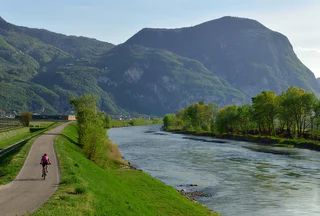
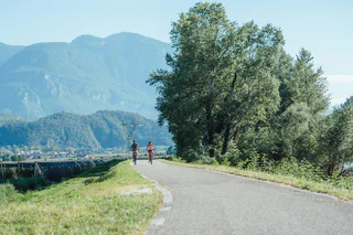
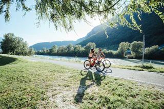
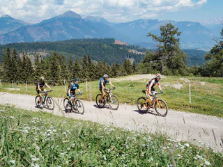
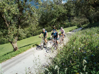
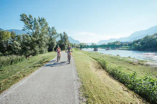
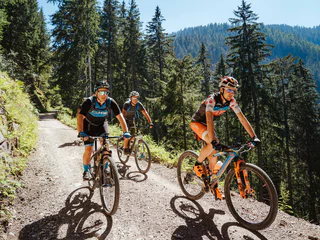
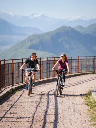
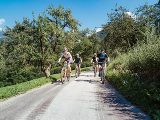
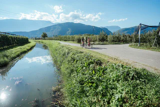
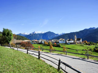
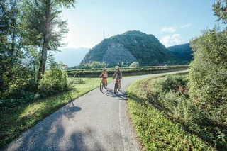
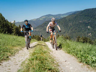
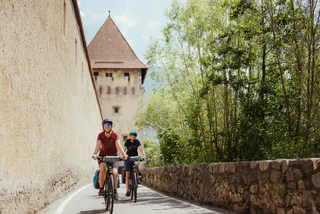
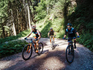
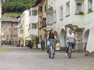
    Południowy Tyrol to raj dla rowerzystów. Odkryj różnorodne trasy prowadzące przez malownicze winnice, urokliwe miejscowości i górskie tereny na większych wysokościach. Niezależnie od tego, czy wolisz spokojne przejażdżki, czy wymagające trasy, tutaj znajdziesz idealną drogę na swoją rowerową przygodę.

    Wyniki
    Cycling
    Bike route Val Casies/Gsiesertal Valley
    Gsies/Valle di Casies
    The bike route begins in the center of the village of Monguelfo, along the banks of the Casies stream in the valley. You ride along the old Casies valley road to the hamlet of Planca di Sopra, where you cross the main road. From here you continue along the Talblickweg path and the hamlet of Steinegge to St. Martin, crossing the main road again before the sports field; from here you ascend to the Talschlusshütte hut in St. Magdalena. Return along the same route.
    Poziom trudności: średni
    425 m wysokość w górę
    18.3 Km odległość
    E-MTB
    Uphill Trumser Alb'l
    Kastelbell-Tschars/Castelbello-Ciardes, Vinschgau/Val Venosta
    Uphill Trumser Alb'l from Kastelbell - marvellous panoramic views guaranteed.
    Poziom trudności: średni
    1567 m wysokość w górę
    15.1 Km odległość
    Cycling
    Weinstraße - Vino 50
    Margreid an der Weinstraße/Magrè sulla Strada del Vino, Bolzano/Bozen and environs
    The Weinstraße Vino 50 runs through a beautiful wine region with gentle hills and vineyards. Along the way, there are wineries and places to stop for a break. The route is ideal for those who want to combine nature and enjoyment.
    Poziom trudności: średni
    172 m wysokość w górę
    41.6 Km odległość
    Bikeparks & Pumptracks
    MTB Skill Area
    Olang/Valdaora, Dolomites Region Kronplatz/Plan de Corones

    Since summer 2022 you can visit the new MTB Skill Area in Oberolang! 

    There you will find an approx. 500 m long natural trail with many different practice elements for beginners & kids.

    In addition, the MTB Skill Area is located directly next to the Kids World and leads past the panoramic route of the Pustertal Valley Cycle Route.

    A small uphill trail rounds it all off.

    The company Mountain Bike Movements from Innsbruck has realized many new skills:


    SKILLS

    • 2 x bumps
    • 2 x jumps
    • 2 x Up&Down
    • 2 x Up&Steps


    COURSE DETAILS

    • 40 m high level
    • Uphill section
    • 5 switchbacks
    • 2 x small berm
    • Nature trail section
    • Easy Downhill section
    • Difficult Downhill section
    • Rockgarden


    We would like to thank the administration B.N.R. Oberolang for providing the space and the two shapers Ale and Davide who helped us start the process.

    0 m wysokość w górę
    0.0 m odległość
    E-MTB
    Leitenalm -Tour
    Schenna/Scena, Meran/Merano and environs

    The roadway to the Taser has always been a classic for mountain bikers. After the construction of the forest road, which begins at the Taser, it is now possible to reach the extremely scenic mountain basin directly below the steeply rising peaks of the Ifinger and the Scheiber, by mountain bike.

    Poziom trudności: trudny
    1337 m wysokość w górę
    13.5 Km odległość
    Downhills
    Crazy Bunny Line
    Al Plan/San Vigilio, Dolomites Region Kronplatz/Plan de Corones

    With plenty of jumps, bumps and bends in quick succession, this line is an “up-in-the-air” variant along the Furcia trail. If you’re not afraid to let go of the brakes and take off, you’re in for tons of fun on this trail.

    Level: medium

    Poziom trudności: średni
    0 m wysokość w górę
    491.0 m odległość
    E-MTB
    Uphill Freiberger Alm/Mahd
    Kastelbell-Tschars/Castelbello-Ciardes, Vinschgau/Val Venosta
    By bike to the Freiberger Alm/Mahd on the Kastelbell Nörderberg
    Poziom trudności: średni
    1111 m wysokość w górę
    10.5 Km odległość
    Cycling
    Sellaronda (clockwise direction)
    Badia, Dolomites Region Alta Badia

    A very panoramic tour with impressiv view on the most beautiful peaks of the dolomites: Sella, Sassongher, Pelmo, Civetta, Marmolada, Sassolungo und Schiliar.

    Corvara - Col Alto – Pralongià – Arabba – Porta Vescovo – Passo Pordoi – Canazei – Col Rodella – Selva Gardena – Dancercepies – Corvara

    Asphalt, gravel road, trail

    Condition: **

    Uphill: **

    Downhill: ****

    Poziom trudności: trudny
    0 m wysokość w górę
    59.2 Km odległość
    E-MTB
    Schloss Annenberg Tour (Castello di S. Anna)
    Latsch/Laces, Vinschgau/Val Venosta

    This challenging uphill trip to S. Martino in Monte runs from Laces over some loose cobble and up some steep paths and involve some areas where the bike must be pushed. The maximum gradient is 24% and therefore this trail is only recommended for experienced mountain bikers.

    Poziom trudności: średni
    1167 m wysokość w górę
    13.4 Km odległość
    E-MTB
    458 Royal Dolomites Tour
    Kastelruth/Castelrotto, Dolomites Region Val Gardena

    On this MTB or E-MTB route, all the queens and kings of the Dolomites can be seen. The Marmolada - Queen of the Dolomites, the majestic Sassolungo and Sassopiatto, King Laurin and his Rosengarten/Catinaccio, and the legendary Sciliar. The route starts from Val Gardena, passes through the Seiser Alm, descends into the Val di Fassa, and then returns to Val Gardena over the Sella Pass. Due to the length of almost 100 km, it is recommended to ride the tour with an E-Bike. Those who prefer to ride without an electric motor should consider splitting the tour into two days.

    For information on the operating times and tickets for the lifts, visit www.seiseralm.it/liftesommer

    The tour starts in Ortisei (easily accessible from Selva di Val Gardena and S. Cristina via the Rodaval cycle path): the Ortisei-Seiser Alm cable car takes you to Europe’s largest high-altitude meadow, the Seiser Alm. Over lush alpine meadows, you ride with a view of the Sciliar – the symbol mountain of South Tyrol – across the Seiser Alm. Numerous mountain huts invite you to stop for a break. The route continues to Compatsch, where the descent into the valley towards Siusi allo Sciliar begins.

    From Siusi allo Sciliar, the bike path continues to St. Konstantin. Shortly after the Gasthof zum Schlern, the ascent to the natural swimming lake Völser Weiher begins, where you can cool off if needed. The tour continues towards Ums (a district of Völs) up to the Schnaggenkreuz and finally onto the main road heading towards Tires at Rosengarten and St. Zyprian. It is worth taking Italy’s first Cabrio cable car to Frommeralm (those entering the tour from Welschnofen, below the Rosengarten Massif, take the Laurin 1 cable car to Frommeralm). The MTB path continues towards Karer Pass, where the descent into the Val di Fassa begins. The level bike path leads through meadows and forests along the Avisio River to Pozza di Fassa, and continues to Campitello di Fassa and Canazei. The bike path offers stunning views of the Dolomites and passes through lively villages. From here, you get breathtaking views of the surrounding Dolomites. The Queen of the Dolomites – the Marmolada, with its 3,343 m – can also be admired from here, along with the Sassolungo, Sassopiatto and the Sella massif. In Canazei, for the summer of 2025, the tour will include the use of the Canazei-Pecol and Toè lifts. Two great trails, the “DoubleU” and a section of the “Infinity”, lead from the top station of the Toè cable car to Pian Frataces (Lupo Bianco). With the Pradel-Salei cable car, we overcome the last altitude meters before heading back to Selva di Val Gardena via the Sella Pass, the Stone City, and the fantastic flow trails at Plan de Gralba. From here, Ortisei can be reached again via the “Rodaval” cycle path.

    Poziom trudności: trudny
    3913 m wysokość w górę
    96.4 Km odległość
    E-Bikes
    S. Pietro in Valle - Pontives
    Lajen/Laion
    Start in St. Peter im Tal at the Maringerhof. The trail leads through the forest in the direction of Pontives. Along the way are the ice springs, where the beer from the former brewery of St. Peter im Tal used to be stored. After a short climb we reach the Unterspisserhof farm and soon the Pontives craft zone. From there we can also go to St. Peter and in the future also to Ortisei.
    Poziom trudności: łatwy
    168 m wysokość w górę
    2.2 Km odległość
    Bikepark
    Jump Area Gassl
    Olang/Valdaora, Dolomites Region Kronplatz/Plan de Corones

    Right next to the valley station of the Olang 1+2 gondola lift in Gassl – where the Gassl Trail ends – a special highlight awaits all biking enthusiasts: the Jump Area Gassl.

    This area impresses with a variety of exciting features: three drops, one kicker, a dirt jump kicker, and a kicker with airbag landing offer adrenaline and action for all skill levels.

    An 80-metre-long conveyor belt takes riders and bikes effortlessly back to the starting point – for endless biking fun without the uphill effort.

    And the best part: the Gassl Bar at the valley station is just around the corner and offers a spacious sun terrace for relaxing and watching the action.

    Poziom trudności: null
    0 m wysokość w górę
    0.0 m odległość
    Cycling
    Sellaronda (counterclockwise direction)
    Badia, Dolomites Region Alta Badia

    A very panoramic tour with impressiv view on the most beautiful peaks of the Dolomites: Sella, Sassongher, Pelmo, Civetta, Marmolada, Sassolungo and Schiliar.


    Poziom trudności: trudny
    3497 m wysokość w górę
    61.2 Km odległość
    Mountain bike
    361 Tschein link
    Welschnofen/Nova Levante, Dolomites Region Eggental

    The tour runs easily from Karer See/Lago di Carezza partly through the forest and along the street Schönblickweg/Via Bellavista to the Tschein Panoramic Chairlift.

    Poziom trudności: łatwy
    483 m wysokość w górę
    11.0 Km odległość
    Bikepark
    Gardenaccia Freeride Biking Route
    Badia, Dolomites Region Alta Badia
    Freeriding is one of the most adrenaline-pumping ways to ride a bike. Mountain bikes are used to descend mountain paths with bumps, jumps and various natural obstacles such as roots, stones and bushes.
    In the Gardenaccia Freeride Bike Park, starting from the mountain station of the Gardenaccia chairlift at an altitude of 1,750 m, two routes have been created:
    - the first, more difficult route, is for bikers who already have good riding skills and looking for a real adrenaline rush.
    - the second is easier and suitable for less experienced bikers.
    The start of the bike park can be reached by taking the Gardenaccia chairlift from La Villa.
    At the Gardenaccia chairlift there is the possibility to rent freeride bikes.
    0 m wysokość w górę
    0.0 m odległość
    Mountain bike
    Brixen Bikepark: Jerry Line
    Brixen/Bressanone, Brixen/Bressanone and environs

    The Jerry Line is really easy. Jerry, the creator of the line who also gave it its name, has never designed it too steep, never too rough and never to tight: It is simply ideal for beginners and kids. There are only 300 metres of difference in elevation from the trailhead to the trail end, but in between are 4.2 km trail fun for the whole family.


    Level of difficulty: Green – very easy
    Novice-friendly line with soft bends and flowing route. There are no artificial obstacles or jumps, the line is also suitable for children. Basic knowledge of mountain bikes required.

    Poziom trudności: łatwy
    5 m wysokość w górę
    4.2 Km odległość
    E-MTB
    293 Wuhnleger Lake tour
    Tiers am Rosengarten/Tires al Catinaccio, Dolomites Region Seiser Alm

    Witnesses to the event recall the air-raid of 1943 which created the small lake at the Wuhnleger. It is now home to toads, salamanders and dragonflies, and showcases an immense biodiversity. The view of the Catinaccio and the Torri del Vajolet together with their mirror-image in the lake is an unmissable natural spectacle.

    Poziom trudności: łatwy
    405 m wysokość w górę
    11.0 Km odległość
    Bikepark
    Brixen Bikepark
    Brixen/Bressanone, Brixen/Bressanone and environs
    Brixen Bikepark on the Plose has four mountain bike trails varying from very easy to challenging. Three of the four descents were only opened in 2018. They were designed by Gravity Logic, which was founded by the legendary trail building team behind Whistler Mountain Bike Park in Canada. All the trails are superbly maintained, boast some fantastic corners and offer plenty of airtime and riding challenges.
    4 lines: 2 difficult, 1 medium, 1 easy
    Accessibility: Plose gondola lift, Palmschoß chairlift
    0 m wysokość w górę
    0.0 m odległość
    E-Bikes
    MTB tour to the Spitzen Alpine hut
    Ulten/Ultimo, Meran/Merano and environs
    The route starts at the Zoggler reservoir in St. Walburg (dam wall) and leads along a forest road to the Spitzen alpine hut (1.856 m), which is open from mid-June to early September.
    Poziom trudności: średni
    714 m wysokość w górę
    7.4 Km odległość
    E-MTB
    Stuanbruch-Trail
    Partschins/Parcines, Meran/Merano and environs
    Route length in km: 10,9
    Vertical climb: ascent 100m – descent 1.260m
    Surface: forest path, root passages, stones, loose stones, steep to very steep, cart path, loose stones, no banister or railings, fencing
    Required technical skills: S1/S2 – moderately difficult with some difficult sections
    Poziom trudności: średni
    36 m wysokość w górę
    10.1 Km odległość
    Bikeparks & Pumptracks
    Pumptrack
    Burgstall/Postal, Meran/Merano and environs

    A pumptrack is a closed-loop circuit with wave-shaped elements and curves, where speed is generated not by pedalling, but through controlled up-and-down body movements – known as “pumping.”

    The pumptrack facility, newly built in September 2025 in Burgstall, offers riding fun and training opportunities for beginners, enthusiasts and professionals alike. The track allows for playful improvement of riding technique and encourages active outdoor recreation.

    A wide range of sports equipment can be used on the track, including mountain bikes, BMX bikes, scooters, balance bikes and roller skates.

    In addition to promoting balance, coordination and motor skills, the pumptrack also serves as a popular meeting place for people of all ages who enjoy physical activity.

    Appropriate protective gear should be worn at all times, and mutual respect among users is essential.

    Poziom trudności: null
    0 m wysokość w górę
    0.0 m odległość
    Mountain bike
    Mountainbiketour to the Schönbergalm hut
    Ahrntal/Valle Aurina, Ahrntal/Valle Aurina

    Very nice mountain bike tour to the Schönbergalm hut in Weißenbach/Rio Bianco, where special culinary highlights and a stunning view of the mountainous landscape are waiting!


    Poziom trudności: średni
    458 m wysokość w górę
    4.4 Km odległość
    E-MTB
    MTB tour to the Kirchberg Valley
    Ulten/Ultimo, Meran/Merano and environs
    The route starts in St. Gertraud (bus stop) and leads along a forest road to the Kirchberg Alm (1,887 m), which is managed from mid-June to early September and continues to Bärhapp (2,296 m). There the forest road ends and the route continues via hiking trail no. 108 to Rabbijoch.
    Poziom trudności: średni
    1071 m wysokość w górę
    8.5 Km odległość
    E-MTB
    Sellaronda MTB tour - anti-clockwise
    Corvara, Dolomites Region Alta Badia

    Spectacular Dolomite peaks and legendary mountain passes: The Sellaronda is one of the most beautiful and popular circular routes in the Alps and offers all kinds of exciting options in winter or in summer. One of these is the Sellaronda mountain biking tour. The tour requires a good level of physical fitness and mountain biking experience, because there are some tricky climbs and a few difficult descents to manage. However, for the last few years there has been the option of avoiding some of the particularly steep climbs by using lifts, making it possible to complete the tour in a day.

    Following the Sellaronda MTB Tour Anti-Clockwise there is a total height difference of about 1.020 m to be cycled uphill and several descents through single trails or forest roads. Therefore it is more suited to those who enjoy cycling uphill on your MTB or e-bike. The time needed to complete the tour varies according the ability of the biker: from a minimum 6 to a maximum of 9 hours, with a lunch break included.

    www.sellaronda-mtb.com

    Poziom trudności: trudny
    3370 m wysokość w górę
    55 Km odległość
    E-Bikes
    Cicling route Monguelfo - Brunico
    Bruneck/Brunico, Dolomites Region Kronplatz/Plan de Corones
    On two wheels through the Pustertal Valley! Explore part of the Pustertal Valley cycle route in a relaxed manner. From Monguelfo to Brunico by bike.
    Start: Monguelfo-Tesido – Monguelfo, village
    Destination: Brunico
    Distance: 17,9 km
    Difference in altitude: 73 m
    Poziom trudności: łatwy
    144 m wysokość w górę
    17.9 Km odległość
    E-Bikes
    Large Überetsch Unterland (lowlands) tour
    Eppan an der Weinstaße/Appiano sulla Strada del Vino, Alto Adige Wine Road

    The bike trail goes trough the wine villages Eppan, Kaltern, Tramin and Kurtatsch up to the country frontier at Salurn on traffic-calmed streets. The tour is appropriate for all kinds of bycicles, but is the most fun to ride on e-bikes or racing bikes.

    The route starts at Eppan and leads on the cycle path and the lake loop road to the Kalterer lake and onwards to Tramin. Towards the village you’ll find a rise. Take it and follow the Weinstraße until you reach Margreid and Kurtinig. In all of those villages you’ll find plenty of possibilities to stop for a bite to eat.

    Arriving at Salurn, change the downhill side and follow the hillslope until you come to Laag. From there you can take the cycle path along the Etsch in a northward direction up until the spot where the rivers Etsch and Eisack are meeting. There you turn left and follow the old railway track of the Überetscher railway until the initial point in Eppan.

    Poziom trudności: średni
    676 m wysokość w górę
    70.9 Km odległość