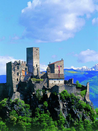
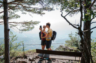
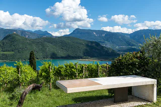
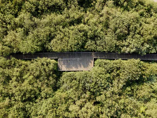
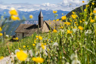
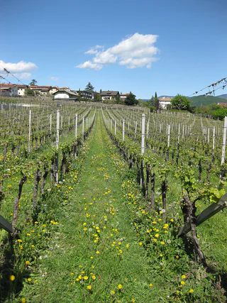
Passer au contenu

ajouté(e) aux favoris

supprimé(e) des favoris

Oups ! Une erreur s’est produite. Réessayer

Ton compte est en cours de création

Ton compte a été créé avec succès et tu es maintenant connecté

Tu es connecté!

Ton compte a été créé avec succès, mais nous n'avons pas pu te connecter automatiquement

Tu es déconnecté

Filtrer
Filtres sélectionnés
    Niveau de difficulté
    Durée
    Distance en km

    Randonnées sur la route des vins du Sud-Tyrol

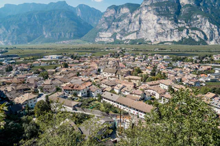
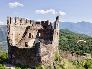
    Lace vos chaussures de randonnée et explore le paysage de la Route des vins du Sud-Tyrol. Ces conseils de randonnée vous emmènent sur des sentiers sinueux, à travers des vignobles pittoresques et de charmants villages, jusqu'à des endroits panoramiques et aériens. Qu'il s'agisse de promenades tranquilles ou de randonnées plus exigeantes, il y en a littéralement pour tous les goûts. La combinaison parfaite du plaisir de la nature et de l'expérience culturelle, tout en savourant les vins typiques du pays et l'hospitalité chaleureuse, caractérise la Route des vins du Sud-Tyrol comme région de randonnée pour les épicuriens.


    Résultats
    Summer
    Hiking tour trought the gorge Rastenbach
    Kaltern an der Weinstraße/Caldaro sulla Strada del Vino, Alto Adige Wine Road

    Hiking tour through Rastenbach gorge with some stairs and bridges. Not difficult hiking tour, but with some upgrades. Duration of walking: about 1 ½ hour. Difference of altitude: about 160 meters.  

    Difficulté : moyenne
    248 m altitude
    1h:37 min durée
    Summer
    Tramin to the Rastenbach gorge
    Tramin an der Weinstraße/Termeno sulla Strada del Vino, Alto Adige Wine Road

    From the town hall square to the fairground, Söllerstraße, after the Hotel Winzerhof turn right into a vineyard path and follow the nature trail (11+11 A) to Lake Kaltern. Turn left at the Hotel Seeleitenhof and follow the signs for "Rastenbachklamm". This is followed by a varied hike over paths, steps, platforms, bridges and past waterfalls and a stream, through the wild and romantic gorge up to Altenburg. Also worth seeing along the way are the ruins of St. Peter, just before Altenburg. Return via Altenburg, Panoramaweg and Römerweg (11) to the Söll fire station and at Hotel Plattenhof back down the nature trail to Tramin.

    Duration: 4.5 - 5 h

    Difference in altitude: 350 m (circular route)

    Difficulté : moyenne
    776 m altitude
    4h:40 min durée
    Summer
    The Titschen Brook Promenade a Salorno/Salurn
    Salorno/Salurn, Alto Adige Wine Road

    According to a legend recorded by Ignaz Vinzenz Zingerle, two children once found a sword made of pure gold here. This sword was stuck in the earth, and couldn’t be completely pulled out. When they returned the next day, a man dressed in old-fashioned attire led them to the grotto behind the waterfall where there were magnificent chambers. That’s where the man revealed to them that he was waiting to be released from a curse: Only he who was able to completely draw the sword from the ground would be able to save him. The sword and the man in the old-fashioned clothing were never seen again.

    Difficulté : facile
    21 m altitude
    0h:10 min durée
    Summer
    Nature Experience Trail Tramin
    Tramin an der Weinstraße/Termeno sulla Strada del Vino, Alto Adige Wine Road
    Family hike featuring beautiful views of the Lake Kaltern.
    The many display boards inform interested hikers about the diverse flora and fauna and the geological discoveries of the region, making the Nature Experience Trail in Tramin a special experience for young and old.

    From the Rathausplatz (town hall square), head along Hans-Feur-Staße street, the town’s main road, till you come to the fairground where you turn left into the Mühlgasse alley. Follow thus until turning right at a junction. After crossing over a bridge, you will see the Hotel Winzerhof.
    On the curve after the Hotel Winzerhof just follow the path 11 and walk straight ahead. The trail first leads through vineyards, then heads gently upwards through mediterranean mixed forest to the restaurant Plattenhof (closed on Monday) in Sella/Söll. On the way there are some small views on the Caldaro lake. At the Hotel Plattenhof, direction Caldaro lake, turn to the left and follow path 11A for approx 20 minutes and then leave the trail and turn to the right. After 50 minutes you will be back at Tramin.
    Difficulté : facile
    294 m altitude
    1h:55 min durée
    Summer
    Hiking tour Mendelpass - Roen
    Kaltern an der Weinstraße/Caldaro sulla Strada del Vino, Alto Adige Wine Road

    Beautiful, not difficult mountain hiking tour with some grades. Starting point: mountain station of the Mendel Cable Car. Final Point: pic Roen, 2116 meters. Duration of walking: about 3.5 hours. Different of altitude: about 750 meters. 

    Difficulté : moyenne
    837 m altitude
    3h:00 min durée
    Summer
    Terlan – Bergjosl Tavern – Legar – Terlan
    Terlan/Terlano, Alto Adige Wine Road

    The tavern Bergjosl is located 600 meters above Terlan, but already belongs to the municipality of Mölten. The turnoff to the mountain restaurant is located halfway between Terlan and Mölten. The Mair family, owners of this Buschenschank, is supervising as well the only forest cemetery for animals in South Tyrol.

    For used hikers this tour can start at the center of Terlan by walking along the Kirchgasse until reaching its end. Here you can find the last farm „Klaus in der Mühle" with its old mill. On the right starts the path to the weather cross (no. 3 A). You will reach the street to Mölten in front of the subway; take the way on the left and turn emediately right, in order to not pass the subway. From here take the left path after the second bend.

    An other version of this way would be along the Weiler „Montigl" – „Grunerhof" and then through the scottish pine wood along rock faces to a panoramic view point. From here you can already see the "Buschenschank Bergjosl" and you reach it on a firstly slight descending path then go right.

    Difficulté : moyenne
    951 m altitude
    4h:50 min durée
    Summer
    Hiking to the "Leiterburg"
    Auer/Ora, Alto Adige Wine Road
    Starting from theHauptplatz/Piazza Principale in Auer, through the beautiful, historic labyrinth of alleys in the direction of the waterfall. Via the "Katzenleiter" hiking path steeply uphill to the beautiful "Leiterburg".
    Once there, a fabulous view over the entire valley awaits the hikers. On this historical site you will find old wall remains and traces of the former castle.
    The way back is via the "Lahnweg".
    Difficulté : moyenne
    451 m altitude
    1h:49 min durée
    Summer
    From St.Anton through Rastenbach Gorge and the Peace Path
    Kaltern an der Weinstraße/Caldaro sulla Strada del Vino, Alto Adige Wine Road
    Starting from the St. Anton sports zone, the route follows a pleasant forest path to Altenburg. Once in Altenburg, the viewing platform offers a panoramic view of Lake Kaltern and the Dolomites behind it. Return through the Rastenbachklamm gorge to the Bärental junction and the newly designed Bärental path. From here you reach the Peace Trail and return to the starting point.
    Difficulté : moyenne
    337 m altitude
    2h:45 min durée
    Summer
    Hike Gaid Festenstein Castle Gaid
    Andrian/Andriano, Alto Adige Wine Road

    Short hike to the Festenstein castle ruins. Check the opening days. Experience a moment of freedom in the historic buildings of Festenstein walls and enjoy a spectacular panoramic view of the Adige Valley there.

    Difficulté : moyenne
    205 m altitude
    0h:45 min durée
    Summer
    Circular hike: Andrian - Festenstein Castle - Gaid - variant Burgstalleck
    Pfitsch/Val di Vizze, Alto Adige Wine Road

    From Andrian walk through the gorge of river Gaido to the ruins of Festenstein - the trail is very steep and requires attention - continue to the hamlet of Gaido (Moarhof). a short distance along trail no. 8, continue along trail no. 6 to the viewpoint Burgstalleck and descend via the Sattelweg trail to the Bittnerhof farm and back to Andrian.


    The hike offers some beautiful viewpoints: take some time to rest and enjoy the view: at the ruins of Castelforte (Festenstein), at Payer's Peak (Burgstalleck) and above Andriano at Schlosspichl.

    Difficulté : moyenne
    726 m altitude
    3h:22 min durée
    Summer
    From Passo Mendola to Mezzavia Hut
    Kaltern an der Weinstraße/Caldaro sulla Strada del Vino, Alto Adige Wine Road
    Start: Begin your hike at the Mendel Pass, following the wide trail toward the Enzian Hut. The path is well-marked and easy to walk. After passing the Enzian Hut, the trail continues into the forest, where you’ll encounter a gentle uphill climb.
    The wide trail remains pleasant, offering beautiful views of the surroundings. After passing the chairlift, you’ll reach the Halbweghütte, your destination. The route is 3.5 km long, takes about 1 hour and 20 minutes, and includes an elevation gain of 240 meters. This hike is perfect for families
    Difficulté : facile
    241 m altitude
    1h:30 min durée
    Summer
    Pinot Noir Walkway - alternative route: Montan/Montagna - Glen/Gleno - Montan/Montagna
    Montan/Montagna, Alto Adige Wine Road

    The Pinot Noir walkway leads through the Pinot Nor growing area along the Trudner Horn/Monte Corno Nature Park and the characteristic villages of Auer/Ora, Montan/Montagna and Neumarkt/Egna. The Pinot Noir growing area in Montan and Mazon/Mazzon is one of the most famous in Italy. Furthermore you walk through several monuments and historical places. The walkway is family-friendly and not dangerous.

    Difficulté : facile
    140 m altitude
    1h:10 min durée
    Summer
    Circular hiking trail from Neumarkt/Egna via Laag/Laghetti to Buchholz/Pochi
    Neumarkt/Egna, Alto Adige Wine Road

    In 1494, the famous German artist Albrecht Dürer travelled for the first time to Italy. His final destination was Venice. Because of the flooded Adige valley, he had to bypass from the cloister St. Florian in Egna/Neumarkt to Buchholz/Pochi. During his stay in the Segonzano Castle, he created a few of his most important watercolors.

    A Part of the path is accessible today.
    Starting from the pilgrims hospice “Klösterle” in St. Florian, the hiking path number 8 leads to Laag/Laghetti. From here to Buchholz/ Pochi we pass the famous “roman” bridge. To Garbe and Laag and back to Klösterle, you have to leave the Dürerweg just before the village of Buchholz and follow trail no. 3.


    Difficulté : moyenne
    661 m altitude
    4h:40 min durée
    Summer
    From St. Michael to the Montiggl lakes
    Eppan an der Weinstaße/Appiano sulla Strada del Vino, Alto Adige Wine Road

    Hiking tour from the center of St. Michael | Eppan to the Montiggl lakes.

    TIP: Go for a swim in one of the lakes and return to the starting point with the lake & hiking bus which runs from mid-June to early September.

    Difficulté : moyenne
    312 m altitude
    3h:53 min durée
    Summer
    Calvary church and Ice holes
    Eppan an der Weinstaße/Appiano sulla Strada del Vino, Alto Adige Wine Road

    A little above the main village of St. Michael | Eppan, the little Gleif Church, which perches atop Kalvarienberg, immediately catches the eye. The view is surprisingly expansive and the church stands on one of the most beautiful glacially polished rocks in the Bozen area.

    Difficulté : moyenne
    200 m altitude
    3h:00 min durée
    Summer
    Branzoll - Rotwand - Burgstallegg
    Auer/Ora, Alto Adige Wine Road
    Long spring and autumn hike to the viewpoints above the Adigevalley between Branzoll and Auer. The trail passes the natural beauty of Bigleider Moos and Göllersee.
    Difficulté : moyenne
    1067 m altitude
    5h:27 min durée
    Summer
    From Terlan to the Ruins of Neuhaus Castle (Maultasch Castle)
    Terlan/Terlano, Alto Adige Wine Road

    Neuhaus Castle Ruins (Maultasch) Neuhaus Castle was probably built in the early 13th century as a double castle: today only the walls remain. These were carefully restored, so that visitors can imagine what life was like there, in early times.

    Difficulté : facile
    178 m altitude
    1h:22 min durée
    Summer
    Terlano's Wine Path (Terlaner Weinweg)
    Terlan/Terlano, Alto Adige Wine Road

    In Terlan you will find a "wine path" running through the upper Terlan area.
    Already existing roads and hiking paths are combined into a theme walk through the vineyards of Terlan.
    From numerous signs you can learn interesting facts about Terlan’s winemaking history and culture. Following the information boards along the path, you will enter vineyards at various altitudes and with different climatic conditions, see the varieties grown in the area and the vine training systems, and be introduced to soil and quality management.
    The accompanying brochure is available at the tourist office or at Terlan's winery.

    Difficulté : facile
    144 m altitude
    1h:51 min durée
    Summer
    From Girlan to MMM Firmian
    Eppan an der Weinstaße/Appiano sulla Strada del Vino, Alto Adige Wine Road

    Easy to moderately difficult hike along pleasant hiking trails, through brushwood and past vineyards to the Messner Mountain Museum Firmian.

    Difficulté : moyenne
    366 m altitude
    2h:22 min durée
    Summer
    From “Garbe” to Buchholz/Pochi di Salorno
    Kurtinig an der Weinstraße/Cortina sulla Strada del Vino, Alto Adige Wine Road

    With this excursion you reach the Pochi di Salorno sculpture garden. This “garden of desires” brings together the works of sculptor Tatz-Borgogno in a small deciduous wood. "Freedom and harmony amongst art and nature" is the motto that the artist has used to accompany the creation and installation of more than 200 sculptures in bronze and marble in the garden.

    Difficulté : moyenne
    382 m altitude
    2h:43 min durée
    Summer
    Hike tour Neuhaus Castle-Montigl-Helfenberg
    Eppan an der Weinstaße/Appiano sulla Strada del Vino, Alto Adige Wine Road

    The hike leads from Terlan via Neuhaus Castle up to the hamlet of Montigl. From the “Moarhof” farm a very steep path leads up to the Helfenberg ruins. From here you go back to Terlan via the same route. Or as an alternative for sure-footed and experienced hikes: path 9 A and path 11 A down to Siebeneich. From there you can take the bus back to Terlan.

    Difficulté : moyenne
    697 m altitude
    2h:34 min durée
    Summer
    “Castle triangle” walk Appiano/Eppan
    Eppan an der Weinstaße/Appiano sulla Strada del Vino, Alto Adige Wine Road

    At the bottom of the Gantkofel the Eppaner Castle triangle is located. On the art-historic walking tour you get an impression of the mediaeval South Tyrol. The walking tour to the castles takes you to the Castle Triangle. First you reach the Castle Hocheppan, which is one of the most important fortifications of SouthTyrol. After a visit as well as refreshment at the Castle tavern the hike continues to the ruin Boymont. A little bit underneath Castle Korb is located, which derived from the Roman époque and is now a hotel.

    Difficulté : moyenne
    373 m altitude
    1h:45 min durée
    Summer
    Through vineyards from Kurtatsch to Tramin
    Kurtatsch an der Weinstraße/Cortaccia sulla Strada del Vino, Alto Adige Wine Road

    This leisurely stroll follows a country road through the vineyards to Tramin. At the halfway mark, in the tiny hamlet of Rungg, there is a farmer's inn offering drinks and snacks where you can rest (closed Wednsedays). After a visit to Tramin, we follow the same road back to Kurtatsch.

    Difficulté : facile
    86 m altitude
    1h:18 min durée
    Summer
    Überetscher walking path to Caldaro
    Eppan an der Weinstaße/Appiano sulla Strada del Vino, Alto Adige Wine Road

    The promenade route was built along the tracks of the former Überetsch railway and is therefore also known as the old railway embankment path. In several places there are benches and playgrounds, which invite you to linger for a while and let off steam.

    Difficulté : facile
    9 m altitude
    2h:22 min durée
    Summer
    Traminer altitude trail
    Tramin an der Weinstraße/Termeno sulla Strada del Vino, Alto Adige Wine Road

    Beautiful hike with a lot of views. The first and the last part of this hike is dominated by beech and mixed forest. Douring the middle part you will find various ditches.

    Difficulté : difficile
    786 m altitude
    4h:30 min durée
    1 2 3 4