
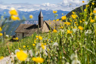
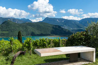
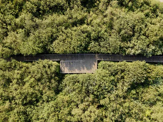
Lake Kaltern Path
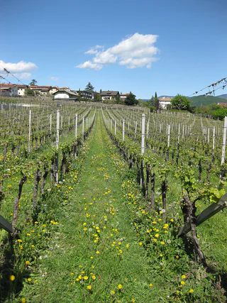
Sella/Söll, Tramin an der Weinstraße/Termeno sulla Strada del Vino, Alto Adige Wine Road
easy
Poziom trudności
430 m
Wzlot
4h:25 min
czas trwania
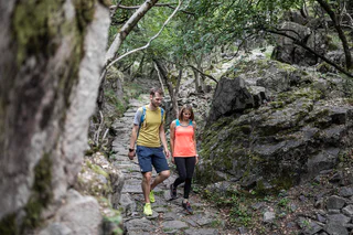
Załóż buty turystyczne i odkrywaj krajobrazy wzdłuż Południowotyrolskiej Drogi Winnej. Te wskazówki dotyczące wędrówek poprowadzą Cię krętymi ścieżkami, przez malownicze winnice i urocze wioski, aż do wietrznych panoramicznych miejsc. Od spokojnych spacerów po wymagające wycieczki - dosłownie każdy znajdzie tu coś dla siebie. Idealne połączenie obcowania z naturą i kulturą przy jednoczesnym delektowaniu się lokalnymi winami i ciepłą gościnnością charakteryzuje Południowotyrolski Szlak Winny jako region wędrówek dla koneserów.
Sella/Söll, Tramin an der Weinstraße/Termeno sulla Strada del Vino, Alto Adige Wine Road
easy
Poziom trudności
430 m
Wzlot
4h:25 min
czas trwania
1/12
Egna/Neumarkt, Neumarkt/Egna, Alto Adige Wine Road
easy
Poziom trudności
332 m
Wzlot
1h:40 min
czas trwania
Salorno/Salurn, Alto Adige Wine Road
easy
Poziom trudności
21 m
Wzlot
0h:10 min
czas trwania
1/7
Laghetti/Laag, Neumarkt/Egna, Alto Adige Wine Road
medium
Poziom trudności
896 m
Wzlot
5h:34 min
czas trwania
Laghetti/Laag, Neumarkt/Egna, Alto Adige Wine Road
easy
Poziom trudności
528 m
Wzlot
2h:38 min
czas trwania
1/5
Tramin an der Weinstraße/Termeno sulla Strada del Vino, Alto Adige Wine Road
easy
Poziom trudności
105 m
Wzlot
1h:07 min
czas trwania
1/6
Caldaro Paese/Kaltern Dorf, Kaltern an der Weinstraße/Caldaro sulla Strada del Vino, Alto Adige Wine Road
medium
Poziom trudności
0 m
Wzlot
3h:00 min
czas trwania
1/3
Andriano/Andrian, Andrian/Andriano, Alto Adige Wine Road
medium
Poziom trudności
321 m
Wzlot
1h:08 min
czas trwania
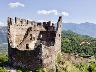
Ronchi/Rungg - Termeno/Tramin, Tramin an der Weinstraße/Termeno sulla Strada del Vino, Alto Adige Wine Road
difficult
Poziom trudności
786 m
Wzlot
4h:30 min
czas trwania

1/3
Salorno/Salurn, Alto Adige Wine Road
easy
Poziom trudności
194 m
Wzlot
1h:00 min
czas trwania
1/2
Salorno/Salurn, Alto Adige Wine Road
easy
Poziom trudności
115 m
Wzlot
0h:30 min
czas trwania
Ora/Auer, Auer/Ora, Alto Adige Wine Road
easy
Poziom trudności
0 m
Wzlot
1h:30 min
czas trwania
Laghetti/Laag, Neumarkt/Egna, Alto Adige Wine Road
medium
Poziom trudności
159 m
Wzlot
1h:45 min
czas trwania
1/5
Terlano/Terlan, Terlan/Terlano, Alto Adige Wine Road
easy
Poziom trudności
144 m
Wzlot
1h:51 min
czas trwania
Caldaro Campi al lago/Kalterer Klughammer, Kaltern an der Weinstraße/Caldaro sulla Strada del Vino, Alto Adige Wine Road
easy
Poziom trudności
307 m
Wzlot
2h:38 min
czas trwania
1/7
Ora/Auer, Auer/Ora, Alto Adige Wine Road
easy
Poziom trudności
151 m
Wzlot
1h:42 min
czas trwania
1/5
Ora/Auer, Auer/Ora, Alto Adige Wine Road
medium
Poziom trudności
1067 m
Wzlot
5h:27 min
czas trwania
1/6
Missiano/Missian, Eppan an der Weinstaße/Appiano sulla Strada del Vino, Alto Adige Wine Road
medium
Poziom trudności
373 m
Wzlot
1h:45 min
czas trwania
Laag/Laghetti, Neumarkt/Egna, Alto Adige Wine Road
easy
Poziom trudności
19 m
Wzlot
0h:43 min
czas trwania
Cortina s.s.d.V./Kurtinig, Kurtinig an der Weinstraße/Cortina sulla Strada del Vino, Alto Adige Wine Road
medium
Poziom trudności
382 m
Wzlot
2h:43 min
czas trwania
1/8
Pinzano/Pinzon, Montan/Montagna, Alto Adige Wine Road
medium
Poziom trudności
750 m
Wzlot
5h:00 min
czas trwania
1/4
Ora/Auer, Auer/Ora, Alto Adige Wine Road
easy
Poziom trudności
264 m
Wzlot
1h:57 min
czas trwania
1/2
Sella/Söll, Tramin an der Weinstraße/Termeno sulla Strada del Vino, Alto Adige Wine Road
easy
Poziom trudności
69 m
Wzlot
1h:00 min
czas trwania
1/3
Caldaro Paese/Kaltern Dorf, Kaltern an der Weinstraße/Caldaro sulla Strada del Vino, Alto Adige Wine Road
medium
Poziom trudności
0 m
Wzlot
4h:30 min
czas trwania
1/4
Caldaro Campi al lago/Kalterer Klughammer, Kaltern an der Weinstraße/Caldaro sulla Strada del Vino, Alto Adige Wine Road
medium
Poziom trudności
434 m
Wzlot
2h:28 min
czas trwania
Magrè s.S.d.V./Margreid a.d.W., Margreid an der Weinstraße/Magrè sulla Strada del Vino, Alto Adige Wine Road
medium
Poziom trudności
1058 m
Wzlot
3h:38 min
czas trwania
1/10
Salorno/Salurn, Alto Adige Wine Road
medium
Poziom trudności
126 m
Wzlot
0h:16 min
czas trwania
1/6
S. Giuseppe al Lago/St. Josef am See, Kaltern an der Weinstraße/Caldaro sulla Strada del Vino, Alto Adige Wine Road
easy
Poziom trudności
0 m
Wzlot
2h:00 min
czas trwania
1/3
Tramin an der Weinstraße/Termeno sulla Strada del Vino, Alto Adige Wine Road
easy
Poziom trudności
294 m
Wzlot
1h:55 min
czas trwania
Laghetti/Laag, Neumarkt/Egna, Alto Adige Wine Road
difficult
Poziom trudności
1492 m
Wzlot
7h:49 min
czas trwania
Dziękujemy za zapisanie się!
Rejestracja już aktywna
Potwierdź rejestrację
Aby zakończyć rejestrację, otwórz e-mail, który właśnie wysłaliśmy, i kliknij link potwierdzający.
Nie widzisz wiadomości? Sprawdź folder spam.
Otrzymujesz już nasze wyjątkowe oferty, przydatne wskazówki i specjalne propozycje, aby w pełni cieszyć się wakacjami.
Już próbowałeś zapisać się do naszego newslettera, ale nie potwierdziłeś rejestracji. Właśnie wysłaliśmy ci ponownie e‑mail. Sprawdź swoją skrzynkę odbiorczą i folder ze spamem i potwierdź teraz.


