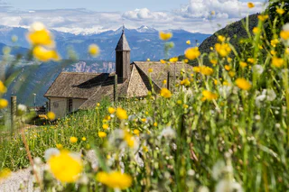
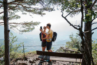
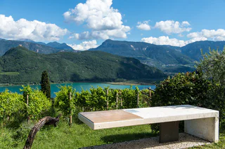
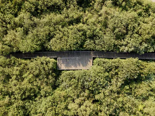
The Spring Promenadeis a beautiful circular walk in Salurn. Several information boards raise awareness of the gold of the 21st century. The waterfall is the highlight of this walk.
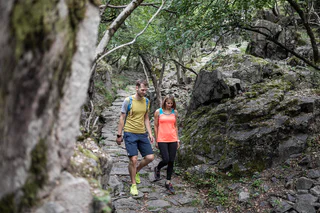
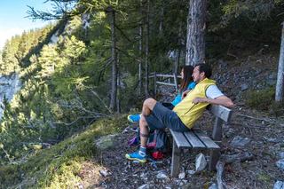
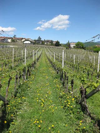
Trek je wandelschoenen aan en verken het landschap langs de Zuid-Tiroolse wijnroute. Deze wandeltips leiden je over kronkelende paden, door schilderachtige wijngaarden en charmante dorpjes tot aan winderige panoramische plekjes. Van ontspannende wandelingen tot uitdagende tochten - hier is letterlijk voor elk wat wils. De perfecte combinatie van genieten van natuur en cultuur en van de lokale wijnen en warme gastvrijheid kenmerken de Zuid-Tiroolse wijnroute als wandelgebied voor fijnproevers.
The Spring Promenadeis a beautiful circular walk in Salurn. Several information boards raise awareness of the gold of the 21st century. The waterfall is the highlight of this walk.
In 1494, the famous German artist Albrecht Dürer travelled for the first time to Italy. His final destination was Venice. Because of the flooded Adige valley, he had to bypass from the cloister St. Florian in Egna/Neumarkt to Buchholz/Pochi. He came across the gill of the river Lakus and passed the Roman's bridge ("Römerbrücke"). After Buchholz/Pochi, he arrived at the Sauch pass. This road brought him to the Lago Santo Lake, where he descended to Cembra, Faver and the Segonzano Castle. During his stay in this castle, he created a few of his most important watercolors.
A Part of the path is accessible today.
This walk in the Monte Corno Natural Park provides you with the opportunity to admire unique landscapes and impressive mountain scenery. On a clear sunny day, you can make out the Palla Bianca, the Pennes Pass, the Mendola range of mountains and the Brenta Group.
This segment will take you from Truden all the way to the idyllic village of Oberradein. The trail starts out downhill as you proceed towards Kaltenbrunn (lodging options and access to public transportation). You then pass by the famed "Ice Holes" of Kaltenbrunn and steadily uphill by way of Unterradein until you come to Oberradein. This village nestled in an unspoilt alpine landscape features stunning natural beauty, with numerous hiking options.
From Jochgrimm first up to the Schwarzhorn (2,439 m above sea-level), where you are immediately rewarded with a great panoramic view. From here it goes back again to Jochgrimm and then up to the magnificent Weisshorn (2,317 meters above sea-level), once again you can enjoy a splendid panoramic view. You will then proceed through increasingly dense vegetation downhill and along the Zirmersteig staircase until you reach Oberradein, an idyllic village surrounded by verdant meadows and lush forests.
This hike goes through both the Monte Corno Natural Park, a scenic jewel rich in flora and fauna, and across the slopes of South Tyrol´s Bassa Atesina. This is where the idyllic villages of Gleno and Casignano can be found. You can enjoy a wonderful view of Castelfeder, the Adige Valley, the Mendola range of mountains and Lake Caldaro to as far away as the mountains above Merano.
Beautiful, not difficult mountain hiking tour with some grades. Starting point: mountain station of the Mendel Cable Car. Final Point: pic Roen, 2116 meters. Duration of walking: about 3.5 hours. Different of altitude: about 750 meters.
On this segment, you will proceed first from Gfrill to the bogland lakes of the "Weiss" and the "Schwarz." From there, the route continues to the Horn-Alm, the highest point of the segment. Hikers can stop here for refreshments and then continue downhill via the Ziss Saddle – not far from there, you can admire the stunning "huckete Stoan," a free-standing erratic boulder made of porphyry the size of a house – until you come to Altrei.
The Pinot Noir walkway leads through the Pinot Nor growing area along the Trudner Horn/Monte Corno Nature Park and the characteristic villages of Auer/Ora, Montan/Montagna and Neumarkt/Egna. The Pinot Noir growing area in Montan and Mazon/Mazzon is one of the most famous in Italy. Furthermore you walk through several monuments and historical places. The walkway is family-friendly and not dangerous.
This pleasant segment leads from idyllic village of Oberradein all the way to Truden – from 1,500 meters to 1,100 meters above sea-level. At the start, you proceed downhill by way of Unterradein until you come to the famed "Ice Holes" of Kaltenbrunn; because of the cool air that streams out of the openings in the ground, it's pleasant here even in the summer. Kaltenbrunn offers refreshment options and connection to public transportation. From here, the route goes slightly uphill and then levels off as you continue to Truden.
Hiking trough the Monte Corno nature parkt to the Königswiese/Prato del Rè.
Salurn / Salorno (221 m) - Salomonhof / Maso Solomon (672 m) - Raststätte / Rifugio Sauch (913 m) - Salurn / Salorno (221 m)
This hike is particularly pleasant in late spring, when the beech trees are full of fresh leaves and the lilies of the valley are flowering.
You can proceed along this very easy segment from Altrei uphill via the Ziss Saddle – not far from there, you can admire the stunning "huckete Stoan," a free-standing erratic boulder made of porphyry the size of a house – until you come to the Horn-Alm (which is managed). From here, you will proceed slightly downhill until you come to the bogland "Schwarz" and "Weiss" lakes. It's now only a short stretch to Gfrill, the goal of this segment.
When you take this extra segment, you will begin from Gfrill, which is located at approx. 1,300 meters above sea-level, and continue to Buchholz at 560 meters above sea-level. At first, you'll have a pleasant, relaxing stroll downhill until you come to Unterstein. You can then continue along the old aerial lift trail until you reach the vestiges of an old cableway. The trail then goes downhill until you come to the brook where the Truden Faultline is especially noticeable. This boundary is distinctly visible not only on the basis of the different geological strata (dolomites and porphyry), but also due to the abrupt change in vegetation. You can then continue to the small village of Buchholz.
This segment begins in Oberradein. Follow the Zirmersteig staircase uphill through the increasingly sparce high-alpine vegetation until you come to the Weisshorn (2,317 meters above sea-level). Here you can enjoy the fabulous panoramic view before embarking on the return trip down to the Jochgrimm. There are various refreshment options as well as plenty of opportunity to admire the very diverse flora of the alpine meadows. After a short breather, the segment goes up to the Schwarzhorn (2,439 m above sea-level).
The Castelfeder hill is an ancient cultural landscape with settlement remains dating back to the Stone Age and Bronze Age. The remains of the castle complex, the legendary “slide of fertility” and the Santa Barbara chapel walls are testament to its mystical past. The area is of particular importance not only from an archaeological and historical perspective but also from an ecological point of view as for years it has enjoyed the status of being a protected natural habitat (biotope).
From the main square the roout starts on a paed road, then to the right on a path leading to „Wies“. At the fence, the path turns to the right - first route H, then route 2 - and proceeds steeply upward on a forest path to the Hirschbettweiher (840 m). On the same path marked 2 we descend to a fork in the path where we go straight ahead. When the path meets the paved Kauderleweg we go to the right, where, after about a 20 inute walk, we reach the Gasthaus An der Himmelspfort inn and continue to the right back to the main square.
This leisurely stroll follows a country road through the vineyards to Tramin. At the halfway mark, in the tiny hamlet of Rungg, there is a farmer's inn offering drinks and snacks where you can rest (closed Wednsedays). After a visit to Tramin, we follow the same road back to Kurtatsch.
7, 14, or 31: When the first Ways of the Cross were built, there was a varying number of stations. In some places there were seven; in other places, 31 stations. Later, there was an agreement to always have 14.
This route will lead you through the Truden Horn Nature Park from the multi-faceted alpine village of Truden all the way to the charming little village of Altrei. The trail is first uphill to the Krabes-Alm, at an elevation of 1,540 meters above sea-level; this is a good place to stop for a short rest. You will then proceed along a forest trail until you come to the high-altitude bog of "Langes Moos." Then you can return to Altrei via an old cobblestone path.
Greifenstein castle is enthroned high above the village of Settequerce / Siebeneich. It was first mentioned in 1159. During the war between the Counts of Tyrol and the Bishop of Trient, in 1275 / 1276, the castle was destroyed. Only in 1334, the small aristocrats, the Lords of Greifenstein decided to re-built it again. On a few years later, in 1348, it was burnt down. In later years (once more re-built in 1363), Greifenstein went into the hands of the Lords of Starkenberg. In 1420, when a part of the Tyrolean aristocracy went into war against the sovereign Duke Frederick of Austria, the sovereign had the castle besieged and starved out. Amongst the duke's enemies was also the minnesinger Oswald von Wolkenstein. He wrote a poetic song about the duke's besieger and made fun of them. The duke's army could not take Castle Greifenstein, but the fight of the aristocracy and the castle's owner, Wilhelm von Starkenberg, became meaningless and, therefore, the Lord of Starkenberg escaped probably through a crevice at the south-western part of the castle. His 18 servants gave up their resistance once they were promised free withdrawal. Today, Castle Greifenstein is merely a ruin. In common language, it is also called the Sauschloss. This name derived from a legend, which speaks about the time of the siege. During this time, the people inside the castle had to face fact that they were left with no food. There was only one well fattened big in the castle's cellar. Suddenly, one of the servants had an idea: instead of slaughtering the animal, they threw it with much laughter over the castle walls and down the rock just in front of the besiegers. When those realized what just had happened, they lost all courage as they believed that the castle's inhabitants still had lots of food available. Therefore, they withdrew ..... and Greifenstein was saved.
Route: from the car park at Kalterer See lake, continue north to the Geier restaurant. Behind the restaurant, a narrow trail leads to the north into the orchards. Walk along these and turn off to the right in an easterly direction following the markers. At the slope on the eastern side of the valley, turn right, passing by the hotel on the left to the Klughammer road. First follow this road, then continue on a trail above the road.
This trail ends at the southern end of the lake. Cross the road to join the Nature Discovery Trail (Naturerlebnisweg). At the end of this nature trail, turn right onto the so-called Kuchlweg trail, hiking to the vineyards on the western side of the valley. Just before the wine road, turn right into the trail through the field, following it until you reach the point where the wine road curves to the right. Cross over and now follow a trail through the field once more. Then follow the footpath next to the wine road to the church of San Giuseppe al Lago/St. Josef am See (Kirche St. Josef). Take the farm track to the right back to the starting point of the hike.
This challenging hike from Truden via the Schwarzhorn and all the way to the Jochgrimm is a unique adventure. From Truden, you'll first proceed uphill to Kaltenbrunn (refreshment stop and access to public transportation). From here, you can then proceed to the famous "Ice Holes" – an unusual phenomenon where cold air streams out of holes in the ground even on the hottest days of summer. You will then proceed steadily uphill via the challenging "Leitensteig" staircase until you come to the Kugeljoch; from this pass, you have a magnificent panoramic view of the Fleims Valley. From the Kugeljoch, you will continue to the Schwarzhorn (2,439 meters above sea-level). Finally, you follow the descending path to the Jochgrimm, the goal of this tour. This hike offers a wealth of unique natural beauty and is – in spite of the level of difficulty – an absolute "must" for ambitious hikers.
This hiking path goes through fabulous beech groves and pictorial forests.