
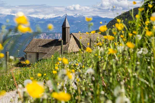
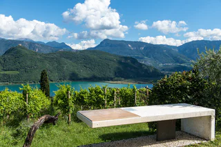
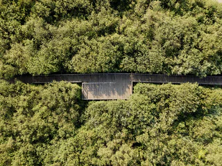
Lake Kaltern Path
Sella/Söll, Tramin an der Weinstraße/Termeno sulla Strada del Vino, Alto Adige Wine Road
easy
Difficulty
430 m
Elevation gain
4h:25 min
duration
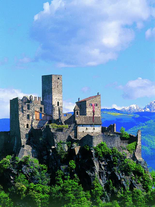
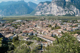
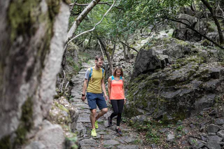
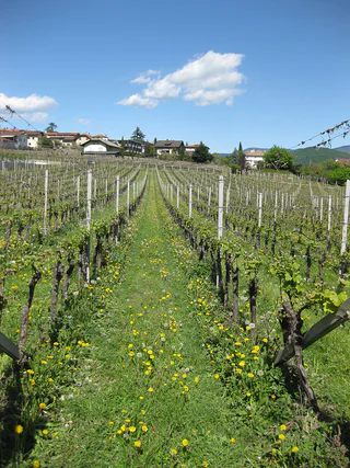
Lace your hiking boots and start exploring the landscape along the Alto Adige Wine Road. By hitting one of these trails, you'll walk on winding paths, through picturesque vineyards and from quaint villages up to sweeping views. Whether you're looking for a leisurely or challenging trail, there are all difficulty levels. On the Alto Adige Wine Road you can experience the perfect blend between nature and culture, taste local wines at modern wineries, and enjoy the flair of an Alpine-Mediterranean atmosphere.
Sella/Söll, Tramin an der Weinstraße/Termeno sulla Strada del Vino, Alto Adige Wine Road
easy
Difficulty
430 m
Elevation gain
4h:25 min
duration
1/12
Egna/Neumarkt, Neumarkt/Egna, Alto Adige Wine Road
easy
Difficulty
332 m
Elevation gain
1h:40 min
duration
Salorno/Salurn, Alto Adige Wine Road
easy
Difficulty
21 m
Elevation gain
0h:10 min
duration
1/7
Laghetti/Laag, Neumarkt/Egna, Alto Adige Wine Road
medium
Difficulty
896 m
Elevation gain
5h:34 min
duration
Laghetti/Laag, Neumarkt/Egna, Alto Adige Wine Road
easy
Difficulty
528 m
Elevation gain
2h:38 min
duration
1/5
Tramin an der Weinstraße/Termeno sulla Strada del Vino, Alto Adige Wine Road
easy
Difficulty
105 m
Elevation gain
1h:07 min
duration
1/6
Caldaro Paese/Kaltern Dorf, Kaltern an der Weinstraße/Caldaro sulla Strada del Vino, Alto Adige Wine Road
medium
Difficulty
0 m
Elevation gain
3h:00 min
duration
1/3
Andriano/Andrian, Andrian/Andriano, Alto Adige Wine Road
medium
Difficulty
321 m
Elevation gain
1h:08 min
duration
Ronchi/Rungg - Termeno/Tramin, Tramin an der Weinstraße/Termeno sulla Strada del Vino, Alto Adige Wine Road
difficult
Difficulty
786 m
Elevation gain
4h:30 min
duration

1/3
Salorno/Salurn, Alto Adige Wine Road
easy
Difficulty
194 m
Elevation gain
1h:00 min
duration
1/2
Salorno/Salurn, Alto Adige Wine Road
easy
Difficulty
115 m
Elevation gain
0h:30 min
duration
Ora/Auer, Auer/Ora, Alto Adige Wine Road
easy
Difficulty
0 m
Elevation gain
1h:30 min
duration
Laghetti/Laag, Neumarkt/Egna, Alto Adige Wine Road
medium
Difficulty
159 m
Elevation gain
1h:45 min
duration
1/5
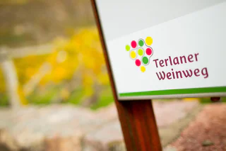
Terlano/Terlan, Terlan/Terlano, Alto Adige Wine Road
easy
Difficulty
144 m
Elevation gain
1h:51 min
duration
Caldaro Campi al lago/Kalterer Klughammer, Kaltern an der Weinstraße/Caldaro sulla Strada del Vino, Alto Adige Wine Road
easy
Difficulty
307 m
Elevation gain
2h:38 min
duration
1/7
Ora/Auer, Auer/Ora, Alto Adige Wine Road
easy
Difficulty
151 m
Elevation gain
1h:42 min
duration
1/5
Ora/Auer, Auer/Ora, Alto Adige Wine Road
medium
Difficulty
1067 m
Elevation gain
5h:27 min
duration
1/6
Missiano/Missian, Eppan an der Weinstaße/Appiano sulla Strada del Vino, Alto Adige Wine Road
medium
Difficulty
373 m
Elevation gain
1h:45 min
duration
Laag/Laghetti, Neumarkt/Egna, Alto Adige Wine Road
easy
Difficulty
19 m
Elevation gain
0h:43 min
duration
Cortina s.s.d.V./Kurtinig, Kurtinig an der Weinstraße/Cortina sulla Strada del Vino, Alto Adige Wine Road
medium
Difficulty
382 m
Elevation gain
2h:43 min
duration
1/8
Pinzano/Pinzon, Montan/Montagna, Alto Adige Wine Road
medium
Difficulty
750 m
Elevation gain
5h:00 min
duration
1/4
Ora/Auer, Auer/Ora, Alto Adige Wine Road
easy
Difficulty
264 m
Elevation gain
1h:57 min
duration
1/2
Sella/Söll, Tramin an der Weinstraße/Termeno sulla Strada del Vino, Alto Adige Wine Road
easy
Difficulty
69 m
Elevation gain
1h:00 min
duration
1/3
Caldaro Paese/Kaltern Dorf, Kaltern an der Weinstraße/Caldaro sulla Strada del Vino, Alto Adige Wine Road
medium
Difficulty
0 m
Elevation gain
4h:30 min
duration
1/4
Caldaro Campi al lago/Kalterer Klughammer, Kaltern an der Weinstraße/Caldaro sulla Strada del Vino, Alto Adige Wine Road
medium
Difficulty
434 m
Elevation gain
2h:28 min
duration
Magrè s.S.d.V./Margreid a.d.W., Margreid an der Weinstraße/Magrè sulla Strada del Vino, Alto Adige Wine Road
medium
Difficulty
1058 m
Elevation gain
3h:38 min
duration
1/10
Salorno/Salurn, Alto Adige Wine Road
medium
Difficulty
126 m
Elevation gain
0h:16 min
duration
1/6
S. Giuseppe al Lago/St. Josef am See, Kaltern an der Weinstraße/Caldaro sulla Strada del Vino, Alto Adige Wine Road
easy
Difficulty
0 m
Elevation gain
2h:00 min
duration
1/3
Tramin an der Weinstraße/Termeno sulla Strada del Vino, Alto Adige Wine Road
easy
Difficulty
294 m
Elevation gain
1h:55 min
duration
Laghetti/Laag, Neumarkt/Egna, Alto Adige Wine Road
difficult
Difficulty
1492 m
Elevation gain
7h:49 min
duration
Thank you for signing up!
You are already subscribed
Confirm your registration
To complete your subscription, open the email we just sent you and click on the confirmation link.
Can’t find it? Check your spam folder too.
We noticed that you are already subscribed to our Newsletter. We will update you on exclusive offers, fun adventures and more so you can make the best out of your vacation.
We noticed that you already tried to subscribe to our Newsletter in the past but didn’t confirmed the subscription. We have resent you an email now, please check your inbox and spam folder to confirm.


