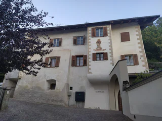
Skip to content

added to favourites

removed from favourites

Oops! Something went wrong. Try again

Your account is being created

Your account has been successfully created and you are now logged in

You’ve been logged in successfully!

You are logged in successfully!

You are logged out.

Filter
Selected filters
    Level of difficulty
    Duration
    Distance in KM

    Holidays along the Alto Adige Wine Road

    Results
    Cycling
    Bike round tour of Vilpiano
    Tisens/Tesimo, The South Tyrolean Wine Road

    This route crosses four villages of the Val d'Adige by orchards, vineyards, along the forest and also provides some viewpoints. The route is easy to ride, since no large height differences have to be overcome.

    There are several places of interest which invite you to linger. The route leads not only past designated bike paths, but also to non-busy routes. Very easy to ride with the racing bike too.

    Difficulty: easy
    47 altitude up
    10.9 Km distance
    Cycling
    Kaltern Bike racing bike: Kohlern
    Kaltern an der Weinstraße/Caldaro sulla Strada del Vino, The South Tyrolean Wine Road
    Kaltern - Bolzano - Colle - La Costa - Pineta - Bolzano - Kaltern
    Level of difficulty medium
    Difficulty: easy
    1460 altitude up
    58.7 Km distance
    Cycling
    Kaltern Bike MTB-Tour: "Kanzel"
    Kaltern an der Weinstraße/Caldaro sulla Strada del Vino, The South Tyrolean Wine Road

    The name "Kanzel" tells the whole story: This lookout point looms high above the valley and offers breathtaking vistas. The tour to the lookout platform – at an elevation of 970 meters above sea-level – leads from Kaltern / Caldaro along the bicycle trail at first downhill to Lake Caldaro and then to the completely level Etsch / Adige Bicycle Trail to Neumarkt / Egna. Then comes the exciting ascent along the former Fleims / Fiemme Valley railroad line. You'll overcome about 800 meters of altitude differential with a grade of no more than six percent. This railroad line from Auer / Ora to Predazzo was built during World War I by Russian prisoners of war to transport men and matériel from the Etsch / Adige Valley to the Fleims / Fiemme Valley towards the front. After the conclusion of the war, this small railroad transported chiefly wood and passengers until it was finally shut down in the 1960s due to shrinking profitability. The only thing that remained was the perfectly established route which, today, serves as a gravel road called the "former Fleims / Fiemme Valley railroad" or "ex ferrovia". Because the locomotives back then were unable to manage a grade of more than five or six percent, this route is perfect for cyclists – you will be able to gently ascend the meters of altitude differential. As you approach Kaltenbrunn / Fontanefredde, you'll leave the railway route and proceed a short distance uphill along the road to Truden. This is the perfect opportunity to pause for a breather and enjoy a soft drink – but it's actually more sensible to roll through the narrow side valley through which the Truden Brook flows down towards the Etsch / Adige River and down to Mühlen / Molini. Once there, you should take a sharp left turn to Gschnon / Casignano. This little village affords a fabulous view. Right after Gschnon, the asphalt ends and you will proceed along a gravel trail all the way to Kanzel, where you can take a break and fully enjoy the view under the large wooden cross. You will find the following segment quite challenging – both for your arm muscles and your brake linings: The steep gravel forest trail will require constant braking. This can result in cramped finger muscles and smoking-hot brake linings. We therefore recommend that you try "alternating braking" – shifting from your front brakes and your rear brakes so that they don't overheat. When you stop for a moment down at the confluence between Laag / Laghetti and Mazon / Mazzon, you're likely to smell the odor of your overheated brakes. Take care to not touch the hot brakes with your calves – you can really hurt yourself! Finally, you'll follow a short downhill stretch through the lovely vineyards below Mazon before you come to the historical heart of Neumarkt / Egna and begin your return trip to Kaltern / Caldaro. All in all, this outing to the Kanzel is physically challenging, but does not require a high level of technical skill. Thus, even cyclists with modest technical skills can appreciate the fabulous panoramas and make frequent stops along the way at the numerous refreshment opportunities. This route is a "must-have" for any cyclist vacationing in the Kaltern region.

    Variants: You can combine this tour with the route to the Trudner Horn to the "Jochgrimm."

    Mustn't be missed: The Kanzel Cross, the alpine village of Truden, the fabulous panorama of the "Unterland" district of South Tyrol, Kaltern, Bozen / Bolzano, the majestic Monte Roen, the impressive Mendel, and the mighty Penegal.


    Difficulty: medium
    1371 altitude up
    62.8 Km distance
    Cycling
    Kaltern Bike Graveltour: To the Heilig lake
    Kaltern an der Weinstraße/Caldaro sulla Strada del Vino, The South Tyrolean Wine Road

    This is a wild and demanding gravel tour which will take you across the "Green Line" of the South Tyrolean forests and down to Lago Santo ("Lake Heilig") in Trentino. You'll proceed along winding forest trails and curving paths – requiring a good command of your gravel bike on earthy terrain.

    You'd better have an adventurous spirit if you want to undertake this tour. In the border area between South Tyrol and the province of Trentino, you'll be passing through seemingly endless forests radiating an enchanting quality. There are many reasons to undertake this tour: You'll love the unparalleled peace and quiet – in part on earthy trails where you can have some fun. And idyllic "Lago Santo" is certainly a worthwhile destination. You'll first proceed at a quick pace via Lake Caldaro and down into the Etsch / Adige Valley. You'll start your ascent on the valley's left flank near Auer / Ora. The trail along the former Fleims / Fiemme Valley railroad will afford you splendid views of the "South of South Tyrol." Once you've passed the last few hamlets, you'll be leaving civilization and ascending on forest roads to the Gfrill Saddle. After a short ascent, you'll arrive in the hamlet of Gfrill / Cauria, 1,000 meters above the Etsch Valley, the last small outpost of South Tyrol before you pass over the provincial border to Trentino. You'll enter into this wild forest and proceed along earthy trails on your way to Lake Heilig. But the adventure isn't over yet! First, there's an exciting descent where you'll come out in Salorno / Salurn, on the shores of the Etsch River. The Etsch Bicycle Trail is the quickest connection back to Lake Caldaro where you can perhaps take a refreshing dip and maybe enjoy a snack near Klughammer. The real end of this tour is only after you have accomplished the final 200 meters of altitude differential on your way to Kaltern / Caldaro. But you'll already have rest-stop options along the way – e.g., at the Albergo Lago Santo or in Salurn. Neumarkt / Egna is likewise worth a side-trip. The bicycle trail will lead you right to it.

    Variants: This tour can also be taken in the reverse order. However, when cycling from Salorno / Salurn up to Lake Heilig, you'll have to overcome slight ramps.

    Difficulty: easy
    1871 altitude up
    83.2 Km distance
    Cycling
    Kaltern Bike racing bike tour: "Nonstal-Schleife"
    Kaltern an der Weinstraße/Caldaro sulla Strada del Vino, The South Tyrolean Wine Road

    The Mendel Pass is the backyard mountain for bike racers from Kaltern / Caldaro, and many just ride up and down it for training purposes. But when you descend on the far side, you'll enter into the Non Valley – also known as the "Apple Basket" of the province of Trentino. It's sun-drenched slopes are crisscrossed by numerous paths and trails through pleasant little villages on your way to Cles, the valley's economic center. It is the ideal node of a loop for different expeditions offering plenty of variety. This is a tour from the vineyards to the apple orchards, from the South Tyrolean Etsch / Adige Valley into the Non Valley of Trentino. The Mendel Pass demarcates the boundary between the two provinces, and in the course of this tour, you will climb it twice – the long, sunny ascent from Kaltern / Caldaro in the fresh early morning, the short ascent from the Non Valley in the afternoon when the forest provides refreshing shade. Even the midday summer heat won't scorch you here because you can speed downhill to Kaltern with the wind to your back while enjoying the fabulous panorama. After the Mendel Pass, your exploration of the Non Valley will take you at first quickly along the shortest path to Cles. The villages of Brèz, Clòz, Romallo, and Revò are strung like pearls on a necklace stretching along the edge of the valley until you finally reach the shores of the reservoir, the Lago di Santa Giustina, the valley's main town, with its many cafes and restaurants where you can pause for a rest and refreshment. Once in Cles, you'll probably want to "fuel up" with a hearty meal. That's because you'll be returning to the Mendel Pass along a higher level. The road will take you up into higher elevations dominated by apple orchards to the town of Rumo. Afterwards, you will exit the apple-growing area and enter a world of wonderous alpine beauty. You will now continue climbing and pass into the Ulten Valley – one of South Tyrol's most pristine and authentic valleys. But you will be passing along only its outermost stretches. That's because you'll soon be taking a hard right turn into Laurein. You will now ascend to the Brezer Joch, an inconspicuous pass at 1,398 meters above sea-level which also marks the highest point of this tour. The route will now curve through partially denser pine forests – with occasional clearings – providing pleasant shade you'll appreciate after the sun-drenched segment through the Non Valley. After a short but exciting descent requiring a degree of concentration, the Non Valley Loop is now nearing its close. You will now proceed over a moderately steep end-spurt with about 500 meters of altitude differential to the Mendel Pass. You might want to leave the main road and cross the village of Ruffrè on the parallel provincial road. You can now breeze along the downhill road and enjoy the ride. Or stop and take a breather to admire the extraordinary view over Kaltern, the lake, the Etsch / Adige Valley, and the Dolomites.

    Variants: The loop through the Non Valley can be taken in either direction. If you still have enough stamina, you can take the Gampen / Palade Pass from Fondo. By the end, you'll have clocked about 130 km and approx. 3,400 meters of altitude differential. And you'll feel that in your leg muscles!

    Difficulty: easy
    2627 altitude up
    101.7 Km distance
    Cycling
    Castelfeder – Trient – Garda
    Auer/Ora, The South Tyrolean Wine Road

    Die Radtour führt entlang der Etsch, vorbei an üppigen Obstplantagen und fruchtbaren Weingärten bis nach Trient und zum Gardasee. Bekannt für das milde Klima und die mediterrane Vegetation, zählt der Gardasee zu den schönsten und beeindruckendsten Naturregionen Italiens.

    Difficulty: medium
    1033 altitude up
    92 Km distance
    Cycling
    Bicycle ride through asparagus fields and blossoming apple orchards
    Terlan/Terlano, The South Tyrolean Wine Road

    The movement in the outdoors is not only healthy, it also causes mental miracles: On foot or by bike - fresh air promotes circulation, relax and brings good mood. The view of the Asparagus fields in Terlan and the blossoming orchards promotes this feeling of happiness.

    Difficulty: easy
    95 altitude up
    29.2 Km distance
    Cycling
    Bassa Atesina/Unterland Tour
    Auer/Ora, The South Tyrolean Wine Road

    Visit the Bassa Atesina and go in for a beautiful bike tour alomg the Südtiroler Weinstraße/Strada del Vino. The pictorial arbours of Egna, the contemplative Village Cortaccia and the romantic historical center of Termeno are waiting for you!

    Difficulty: easy
    273 altitude up
    25.3 Km distance
    Cycling
    Bike tour in Terlan
    Terlan/Terlano, The South Tyrolean Wine Road

    This route crosses four villages of the Val d'Adige by orchards, vineyards, along the forest and also provides some viewpoints. The route is easy to ride, since no large height differences have to be overcome. There are several places of interest which invite you to linger. The route leads not only past designated bike paths, but also to non-busy routes. Very easy to ride with the bike.

    Difficulty: easy
    121 altitude up
    12.3 Km distance
    Cycling
    Kaltern Bike Tour: Mitterberg Round
    Kaltern an der Weinstraße/Caldaro sulla Strada del Vino, The South Tyrolean Wine Road

    If you've ever been to Kaltern / Caldaro or at least passed by it, then you'll already be familiar with the Mitterberg, this long, heavily forested hump of reddish rock in the middle of the Etsch / Adige Valley between the Etsch / Adige River and Lake Caldaro. But not everyone knows that there are more than 600 km of trails and paths in the vicinity of the Mitterberg – an ideal playground for bikers of every stripe. The Mitterberg circuit tour leads entirely along bike trails. It is not restricted solely to the Mitterberg. Rather, it will take you around it – a tour that is extremely suitable for beginners and families – but also a great trail to get a little practice. From Kaltern, you'll first glide along the bike trail on your way down to Auer / Ora. You then continue along Lake Caldaro and finally round the southern tip of the Mitterberg until you come to the Etsch Bridge. Here – just before the village of Auer – you'll now enter the Etsch Valley Bicycle Trail which continues to the south towards Trento and to the north towards Bozen / Bolzano. The tour sticks to the Etsch River – usually far enough away from the autobahn so that you won't be bothered by traffic noise. The Mitterberg circuit tour can be taken in either direction since it consists wholly of asphalt bicycle paths. But the direction indicated here is recommended especially for afternoons when the south wind – the "Ora" – will provide a pleasant tailwind as you speed along the level Etsch Bicycle Trail towards Bozen. Just behind Bozen, the bike trail winds along the old railroad line slightly uphill towards Kaltern.

    Variants: To the south of Lake Caldaro, you can continue straight on the bike trail to Auer / Ora and combine this route with, e.g., the "Neumarkt / Egna" tour.

    Mustn't be missed: Lake Caldaro, the provincial capital of Bozen, Sigmundskron Castle with the Messner Mountain Museum.

    Difficulty: easy
    246 altitude up
    36.2 Km distance
    Cycling
    Cycling tour to the Lake Kaltern
    Terlan/Terlano, The South Tyrolean Wine Road
    We ride on the Etsch cycle path from Terlan in the direction of Bozen to the Sigmundskron train station. Here we take the main road, cross the Etsch bridge on the right and then drive towards Girlan. After a short ascent, we come back to the bike path, which leads in a moderate incline and with a wonderful view of the Adige Valley to the village of St. Michael / Eppan. Here we always stay on the bike path and continue to the village of Kaltern, where we come to the “New Cellar”. There we have to cycle back a short distance and then come right downhill through the orchards into the Lavason valley. We ride downwards and enjoy the wonderful view of Lake Kaltern. At the crossroad to Kaltern we stay left towards Klughammer. Here the lake is on our right. We continue to Gmund and keep left, past some houses, pass under the motorway, onto a bridge and immediately turn left onto the cycle path towards Bozen. Along the Etsch river it goes to Bozen Süd, where you turn left towards Sigmundskron and Terlan.
    Difficulty: easy
    355 altitude up
    52.6 Km distance
    Cycling
    Bike route from Terlan to Lana
    Terlan/Terlano, The South Tyrolean Wine Road

    The route is easy to ride, there are no special height differences to be overcome. Three bike service areas invite you to have a rest: one stop at Vilpian shortly after the Etsch Bridge, a short drive further in Gargazon and one stop at Burgstall/Lana (via the "Old Railway Bridge").

    Attractions in Lana:

    • The Schnatterpeckaltar in the parish church of Niederlana
    • Museum of Fruit-Growing at Brandiser Waalweg No. 4 (near the golf course).
    Difficulty: easy
    93 altitude up
    30.9 Km distance
    Cycling
    Kaltern Bike MTB-Tour: Rosszähne
    Kaltern an der Weinstraße/Caldaro sulla Strada del Vino, The South Tyrolean Wine Road
    This is a short adventure from Lake Kaltern into the forest between its eastern shore and the Adige Valley. South of the Leuchtenburg castle, enchanted paths lead to the Rosszähnen, a rock formation above the Etsch river.
    Difficulty: easy
    588 altitude up
    18.1 Km distance
    Cycling
    Kaltern Bike Tour: Wine route South from Caldaro
    Kaltern an der Weinstraße/Caldaro sulla Strada del Vino, The South Tyrolean Wine Road

    The South Wine Route then runs about 40 km in a long circuit to Salorno / Salurn, the southernmost community of South Tyrol. Along the way, you'll pass through the charming wine villages of Tramin / Termeno, Kurtatsch / Cortaccia, Margreid / Magrè, and Kurtinig / Cortina all’Adige as you glide along the Wine Route.

    The South of South Tyrol: Bicycle tour

    This tour begins at the square in front of the large winery cooperatives (Kellerei Kaltern and Erste + Neue). From here, the bike trail will lead you through the vineyards and down to Lake Caldaro and past its eastern shore (by Klughammer) towards Auer / Ora. You'll pass the reeds and the biotope on the southern banks of the lake before the route enters the Auer-Tramin Bicycle Trail. There, it also bends into the South Wine Route. You can ride on it in either direction. In other words: There are two paths to the southernmost point in Salurn.

    If you now take the right turn, you'll first proceed on the South Tyrolean Wine Route and enter into the historic wine village Tramin / Termeno. The Gewürztraminer variety of grape – which is indigenous to this locality and is used to make some of the finest wines available – is named after this village. The route continues to the south through the historical wine village of Kurtatsch / Cortaccia and past the famous "original grapevine" grafted here in the year in Margreid / Magrè. From here, you will proceed to Kurtinig – often referred to as "Little Venice" by the locals because it is flooded so often. It's only now that the route crosses the Etsch River. Salurn is located on its eastern side. You can take the short side-trip to the Haderburg – which was established here on a rocky prominence in the 11th century as a fortress.

    On the return trip back to Kaltern, you will encounter the villages of Neumarkt / Egna and Auer / Ora on this side of the valley. In Neumarkt, you ought to visit the centuries-old and impressive leafy arcades in the center (which is closed to motor traffic). It's a wonderful opportunity to exit the hustle-and-bustle of modern times and immerse yourself in the Middle Ages. You can admire the handsome old manors, enjoy the coolness of the arcades, and explore the village's shopping options.

    Farther to the north, the bicycle trail will take you past the Castelfeder biotope – an ancient cult site located on a wild, romantic hilly landscape abounding with fascinating geological formations and enormous boulders left behind by receding glaciers, and that has lost none of its magical appeal. If you wish, you can now pay a visit to Auer before continuing across the Etsch River to Lake Caldaro and up to Kaltern.

    A fitting conclusion would be, e.g., a visit to the wine house at the starting-point / finish line of this tour. Or at the market square. The "Punkt" wine house there carries a wide assortment of wines from the Lake Caldaro area.

    Variants: At Margreid / Magrè and Neumarkt / Egna, there are two additional bridges over the Etsch River which you can use as short-cuts. There is also rail service between Salorno / Salurn, Kurtinig / Cortina, Margreid, Neumarkt, and Auer – a great way to save yourself a few kilometers (www.suedtirolmobil.info).

    General information about these three wine village tours:

    Biking along the South Tyrolean Wine Route is always a very special experience. Mild temperatures and about 300 days of sunshine per year make the oldest Wine Route of Italy an ideal place for active vacationers and pleasure-seekers wishing to explore the vicinity by bike. The three pleasure cycling routes of the low-traffic South Tyrolean Wine Route offer a wealth of options to experience the vineyards, visit the wine cellars, and explore the castles. The three wine routes (North, Middle, and South) display almost no significant grades – and they can be cycled throughout the year, both individually and in combination.

    Difficulty: easy
    645 altitude up
    54.0 Km distance
    Cycling
    Bike route from Vilpian to Lana
    Terlan/Terlano, The South Tyrolean Wine Road

    The route is easy to ride, because there are no special height differences to be overcome. Attractions in Lana: the Schnatterpeckaltar in the parish church of Niederlana and the South Tyrol Museum of Fruit-Growing at Brandiser Waalweg No. 4 (near the golf course).

    Difficulty: easy
    47 altitude up
    20.7 Km distance
    Cycling
    Kaltern Bike Graveltour: Regglberg "Almrunde"
    Kaltern an der Weinstraße/Caldaro sulla Strada del Vino, The South Tyrolean Wine Road

    The Regglberg is a high-altitude plateau rising above the eastern shores of the Etsch / Adige River. If you choose to ascend from Leifers / Laives to Deutschnofen / Nova Ponente, you'll land in a landscape of alpine meadows. Here you'll find plenty of rest-stop options – too many, in fact, since you couldn't possibly stop for a break in every inn and cafe situated along this challenging and long tour.

    This tour is challenging, but allows you to explore the east of the Etsch / Adige Valley, on the fringe of the foot of the Dolomites. The meadow landscape at the Regglberg between Deutschnofen and Aldein / Aldino resembles a verdant carpet stretching out in front of the impressive Latemar – from the perspective of Kaltern, the nearest outpost of the Dolomites, this most-prominent peak looms 2,842 meters above sea-level. But to approach it, you'll have to constantly pedal. The first milestone of your journey is the Mitterberg / Monte di Mezzo, accessible via the little Pass Road and the Kreither Saddle and then into the Etsch / Adige Valley. After a couple of relatively level kilometers, you'll reach Leifers / Laives, where the Branten Valley indicate the continued upward direction. At the upper end of the Branten Valley, you'll find the town of Deutschnofen / Nova Ponente perched on a high-altitude plateau. There is a path in the valley basin for your ascent, but the winding trails on the north flank of the valley offer more scenic beauty and are just as quick – besides giving you more panoramic views towards Deutschnofen. You will now proceed upwards into the rolling meadow landscape. You've mastered the steep uphill grade; now, it's a constant up and down. This route offers beauty and variety, and every couple of kilometers, you can take a rest-stop at one of the many charming inns and cafes along the way: the Laabalm, the Neuhütt-Alm, the Schmiederalm, or the Schönrast-Alm. In view of this wealth of options, you might be tempted to spend too much time here – but don't forget: The return leg is still ahead of you! The trail will first take you down into the Etsch Valley. But because the direct way from the Regglberg into the valley is possible only via very steep trails that are best traversed on foot, you'll have to instead take a slight diversion and follow the trail along the former Fleims / Fiemme Valley railroad, which displays a pleasant downhill grade at Montan / Montagna. And you'll be treated to spectacular scenery along the way: First, there's the unobstructed view of the valley, then the rolling terrain of the Castelfeder biotope with its mystical medieval cult site. Once you've arrived in Auer / Ora, you can traverse the Etsch River and quickly reach Lake Caldaro. On warm summer days, you could now take a pleasant dip at Klughammer. After a refreshing dip, you'll be ready to attack the final 200 meters of altitude differential from the lake up to Kaltern / Caldaro.

    Difficulty: easy
    1936 altitude up
    76.2 Km distance
    Cycling
    From Salorno to Bolzano
    Auer/Ora, The South Tyrolean Wine Road

    From the MediterraneanfFlair of Salorno to the pictorial arbours of Egna and the bucolic alleys of Ora and the historical center of Bolzano.

    Difficulty: easy
    0 altitude up
    0.0 m distance
    Cycling
    Castelfeder – Bolzano – Valle Isarco
    Salorno/Salurn, The South Tyrolean Wine Road

    Der Radweg führt über das schöne Etschtal zwischen der Landeshauptstadt Bozen, dem mittelalterliche Städtchen Klausen und der Bischofsstadt Brixen entlang.

    Difficulty: easy
    1288 altitude up
    76.1 Km distance
    Cycling
    Castelfeder – Merano - Val Venosta
    Salorno/Salurn, The South Tyrolean Wine Road

    Dieser Strecke ist ein Teilstück des bekannten Etschradweges und des Radweges Via Claudia Augusta. Hier erleben Sie die beeindruckende Landschaften und die zauberhafte Natur Südtirols. Empfehlens-wert ist ein Abstecher in die Kurstadt Meran, bekannt für zahlreiche Museen und Sehenswürdigkeiten, und den botanische Gärten von „Schloss Trautmannsdorf“.

    Difficulty: medium
    1741 altitude up
    121.4 Km distance
    Cycling
    Kaltern Bike Graveltour: "Fennberg"
    Kaltern an der Weinstraße/Caldaro sulla Strada del Vino, The South Tyrolean Wine Road

    During this gravel tour you'll be speeding along the western fringes of the Etsch / Adige Valley. You'll be biking along paths and trails offering a variety of cycling experiences, via Altenburg and Graun all the way up to Lake Fennberg, through to Tramin / Termeno and then back to Lake Caldaro.

    In the "South of South Tyrol," the Mendel Ridge rises majestically above the Etsch / Adige Valley. At first glance, it looks as though, between the various wine villages dotted across the valley and the mighty summits, there were only forest. But if you are adventurous at heart, you might want to explore this hidden landscape offering a variety of views and experiences. From the Altenburg Sports Center, forest paths wind their way along the slopes to the Gummererhof Alpine Inn and on into the little hamlet of Graun. From here, you can admire the fabulous view of some of the communities strung along the Wine Route like pearls on a necklace: Tramin / Termeno and Kurtatsch / Cortaccia. You can now remain up high on this balcony and continue rolling to Lake Fennberg. An idyllic scene that – when viewed from below – you wouldn't expect. The lake and the church over its shores is hidden on a small saddle, shielded from the prying eyes of the busy valley, which is why it radiates a special sense of peace and quiet. When taking the return trip, you'll first proceed down the same route, but will the soon leave this balcony and roll down into the Etsch Valley. From Tramin via Lake Caldaro, vineyards will again dominate the landscape. If you have the time, there are numerous eateries and inns along the way where you can stop for refreshments. But there's no reason to not forge on ahead until you get to the market square in Kaltern / Caldaro, where you can toast your success with a glass of delicious Lake Caldaro wine. Or you can interrupt your tour to go for an invigorating dip in the lake.

    Variants: You can simply take this tour back and forth. If you choose this option, when getting to Graun on the return leg, you can also divert and proceed to Altenburg. From here, the road will then take you straight back to Kaltern.

    Difficulty: easy
    1675 altitude up
    56.3 Km distance
    Cycling
    Kaltern Bike Graveltour: Tour of Caldaro
    Kaltern an der Weinstraße/Caldaro sulla Strada del Vino, The South Tyrolean Wine Road
    If you start cycling in Kaltern, you will first find yourself surrounded by vines. Soon, however, the paths disappear into forests where you can lose yourself. This tour can only explore a few kilometres of the huge network of paths, but as a selection of the best paths it does justice to the claim of getting to know the area.

    It first leads into the forest on the western flank of the Adige Valley between the sports centre and the small hamlet of Altenburg with one of the most beautiful viewpoints over Lake Kaltern. On the other side, between Kaltern and Etsch, rises the Mitterberg. From the Adige valley, rugged walls rise 400 metres steeply. On the Kalterer side, the wooded terrain slopes gently. Over there is the next destination of the tour, the large stone valley. On the slopes of the Mitterberg you now stay in the forest and pass the Montiggler Lakes. Here you can dangle your feet in the water or go swimming. The Montiggl forest offers an endless network of paths that lead via the village of Montiggl to the cosy wine village of Girlan. Now the vines line the path again when it goes from Girlan back to Kaltern.

    Variants: You can also skip the detour to Altenburg and just do the short loop via the Große Steintal and Montiggl to Girlan. If you feel like it, you can also include a detour to Lake Kaltern in the loop.
    Difficulty: easy
    840 altitude up
    35.0 Km distance
    Cycling
    Kaltern Bike MTB-Tour: Trodena
    Kaltern an der Weinstraße/Caldaro sulla Strada del Vino, The South Tyrolean Wine Road

    Another absolutely superlative tour in the vicinity of Kaltern / Caldaro: Almost 80 km in length and requiring a high level of physical fitness, this route leads – after arriving via the bicycle path from Kaltern to Neumarkt / Egna – along the old railroad tracks to Kaltenbrunn / Fontanefredde and then on to Truden / Trodena. As you proceed along the course of the former Fleims / Fiemme Valley railroad line, you will climb approx. 800 meters of altitude differential with a grade of no more than 6%. This railroad line – stretching from Auer / Ora to Predazzo – was built during World War I by Russian prisoners of war to transport men and matériel from the Etsch / Adige Valley to the Fleims / Fiemme Valley and towards the front. After the conclusion of the war, this small railroad transported chiefly wood and passengers until it was finally shut down in the 1960s due to shrinking profitability. All that remained was the perfectly established route which, today, serves as a gravel road called the "former Fleims / Fiemme Valley railroad line" or "ex ferrovia". Because the locomotives back then were unable to manage a grade of more than five or six percent, this route is perfect for cyclists – you will be able to gently ascend the slope. The old railway tunnels – which seem like gloomy holes when you first approach them – shouldn't startle you: motion detectors will sense your approach and automatically switch on the lights. As you approach Kaltenbrunn / Fontanefredde, you'll turn off of the railway route and proceed a short distance uphill along the road to Truden. This gravel road is not overly steep and so is easily managed, and will take you up to the Ziss Saddle; this represents the transition to Altrei / Anterivo. Continuing to pedal uphill. Shortly before your reach the Horn Alm, you'll be treated to a fantastic long-distance view eastwards. Now you can enjoy the entire Fleims / Fiemme Valley and the majestic craggy towers of the Pale di San Martino looming behind the Rolle Pass. At an elevation of about 1,700 meters above sea-level, the Horn Alm is a very popular destination for cyclists coming from Bozen / Bolzano and its vicinity. From here, you'll take a short ramp uphill before you pass by Lake Schwarz and Lake Weiss on a gravel path downhill towards Gfrill / Cauria. This charming little hamlet is situated high above the Etsch / Adige Valley and affords a breathtaking view of the magnificent Dolomiti di Brenta. You will first proceed along the old and partially paved rural paths through alpine meadows and then downhill via Trail No. 7 – a forest trail requiring a high degree of technical skill and with almost 1,000 meters of altitude differential that will take you to Laag / Laghetti. The return trip to Kaltern in the afternoon is especially pleasurable when the weather is fine because that's when there's a strong southly wind (the so-called "Ora") blowing through the Etsch / Adige Valley that will act as a tailwind, giving you a little extra "push." It's thus no problem to achieve a speed of 40 km/h on average. All in all, the Trudner Horn is a superlative tour featuring great panoramas. However, it requires a medium-good level of technical skill and relatively good physical fitness.

    Variants: In Truden / Trodena, you can decide whether you'd rather opt for the somewhat shorter and easier "Cisloner Alm" or "Kanzel" tours.

    Mustn't be missed: The former Fleims / Fiemme Valley railroad line, Lake Weiss and Lake Schwarz, the villages of Truden / Trodena and Gfrill / Cauria.

    Difficulty: easy
    1904 altitude up
    74.8 Km distance
    Cycling
    Kaltern Bike MTB-Tour: "Jochgrimm"
    Kaltern an der Weinstraße/Caldaro sulla Strada del Vino, The South Tyrolean Wine Road

    This tour combines an easy but long ascent along the former railroad line with a stunning view of the Dolomites – including the Latemar and the Rose Garden – and with a wonderful, relatively gentle and fluid downhill trip that speed demons will love. There are practically no difficulties requiring a high level of technical skill, and there are certainly no segments where you'll have to dismount and push your bike. So if you have a high level of physical fitness and if you start out early, you will certainly complete this 90-km marathon – especially since you can breeze along almost 40 km in both directions on dedicated bicycle trails. From the starting-point at the parking lot in the Kellereistrasse, you first proceed along the bicycle trail to Auer / Ora and on to Neumarkt / Egna. After a short and relatively steep ascent through vineyards, you come to the village of Montan / Montagna. The trail then follows the incline along the former Fleims / Fiemme Valley railroad line. You'll climb approx. 800 meters of altitude differential with a grade of no more than 6%. Shortly after you reach Kaltenbrunn / Fontanefredde, you'll turn off to the left via a couple of wooden staircases and then continue along the narrow, low-traffic road to Radein / Redagno and from there along a wide, gently inclined gravel road up to the Jochgrimm. Once you've reached the Jochgrimm Inn (at an elevation of 2,000 meters above sea-level), you'll be rewarded with a fantastic view of the Dolomites: The mighty chain of peaks extending from the Latemar and Rose Garden with the Vajolett Towers is a visual feast – an unforgettable view. There is a beautiful, somewhat wider trail about 10 km in length, always slightly downhill, over alpine meadows and all the way to the Weissenstein Monastery along these imposing mountain cliffs. This ascent is highly enjoyable. You can enjoy this fluid downhill trip, and there are practically no difficulties requiring a high level of technical skill. From the Weissenstein Monastery – a well-known place of pilgrimage – a gravel road first leads you down a steep downhill grade. Just before Deutschnofen / Nova Ponente, you'll have to then accomplish a short opposing climb before descending into the marvelous Branten Valley. You will then proceed at first down a steep gravel trail and in part over streamlets paved with jagged stone (Attention: plenty of flat stones) into a narrow gorge with in part vertical cliff walls. The trail will take you down to Leifers / Laives in the Etsch / Adige Valley. This is a unique experience – not only because of the giant cliff walls, but also because it is pleasantly cool in this valley even on hot summer days. Once you've arrived in Leifers, you have two alternatives to get back to Kaltern: You can either take the bike trail to the south around the Mitterberg / Monte di Mezzo and then past Lake Caldaro, or proceed to the north towards Bozen / Bolzano and then along the bike path towards Meran / Merano and Kaltern. You should base your decision on the wind direction: In the afternoon (especially when the weather is fine), it will be blowing relatively strong from the south. The route towards Bozen is a little bit longer, but quicker when you have a southerly wind to your back. Especially ambitious bikers are free to take the "Coyote Pass," allowing you to accumulate another 150 meters of steep uphill meters of altitude differential.

    Variants: Via Truden / Trodena, you can reach the "Cisloner Alm", "Kanzel," and "Trudner Horn" routes.

    Mustn't be missed: The former Fleims / Fiemme Valley railroad line, the Maria Weissenstein place of pilgrimage, the village of Deutschnofen / Nova Ponente, a beautiful panoramic view of the Weisshorn and Schwarzhorn, the Latemar, the Rose Garden, and the Schlern / Sciliar.

    Difficulty: medium
    3808 altitude up
    91.4 Km distance
    Cycling
    The mystical Haderburg Castle in Salorno
    Auer/Ora, The South Tyrolean Wine Road

    The mystical Haderburg Castle in Salorno is majestically enthroned on a ledge and offers a breathtaking view over the whole valley.

    Difficulty: easy
    0 altitude up
    0.0 m distance
    Cycling
    Kaltern Bike MTB-Tour: "Malga Romeno"
    Kaltern an der Weinstraße/Caldaro sulla Strada del Vino, The South Tyrolean Wine Road

    The Malga Romeno is a beautiful alpine meadow situated just over the steep, western cliffs directly above Lake Caldaro. There, you can enjoy not only delicious Trentino specialties, but also a wonderful view of the Dolomites and the mountains of the Non Valley. The ascent is either view the Mendel Pass Road to the pass. Or: You can take the Mendel gondola-type cableway. When taking this aerial tram, you can spare yourself about 600 meters of altitude! On the other side of the pass, you will proceed down a short forest passage, along a trail across the slope which is secured on one side and which is easy and fluid to take along its entire length. The trail will lead you down into the small village of Cavareno and then a little bit farther downhill until you have to overcome 800 meters of altitude differential to ascend to the Malga Romeno. The lower part of this ascent is over a narrow, low-traffic asphalt road which then transitions later into a gravel trail. This route has a pleasant uphill grade along its entire length and thus represents an easy tour. You will finally reach the Malga Romeno, at an altitude of 1,768 meters above sea-level. After the turning point, you can take a not-too-difficult trail past the Halbweg Hut and down to the Mendel Pass. From there, you will have to proceed down the road. The intoxicating descent via the Mendel Pass Road features a nice little reward at the end: The only recently constructed New Mendel Ascent (Mendelsteig). This trail is a relatively wide, gravel forest path and easy to negotiate. It winds its way down to the Boos Forest Road, whereupon you can take the Hohl Trail (which has now been widened somewhat) which will lead you downhill to the edge of Kaltern / Caldaro – another highlight for bikers wishing to test their technical mettle. At this point, you can decide if you want to take the very beautiful trails and gravel paths of the detour via the Kaltern sports grounds – a very rewarding option! But if, after accomplishing this physically challenging tour, you would rather not deal with any more meters of altitude differential, you can instead take the simple straight route to St. Nikolaus and along the Europe Road back down to Kaltern. All in all, the tour to the Malga Romeno represents a highlight for cyclists with the necessary good physical condition. Because of the beautiful flow trails, this route doesn't require all too much biking technique.

    Variants: This tour can be combined with the "Penegal" tour.

    Mustn't be missed: The village of Cavareno, beautiful lookout points providing

    stunning views of the Dolomites and the mountains of the Non Valley.


    Difficulty: difficult
    2051 altitude up
    59.3 Km distance
    Cycling
    Kaltern Bike MTB-Tour: Eppaner Höhenweg
    Kaltern an der Weinstraße/Caldaro sulla Strada del Vino, The South Tyrolean Wine Road

    The Eppan / Appiano High-Altitude Trail starts off with a gentle rise. Later, you can amble down an equally gentle downhill sloping segment over a gravel trail. The trail has an average elevation of 1,000 meters. This tour offers you a fabulous view of the provincial capital of Bozen / Bolzano, the "Unterland" district of South Tyrol, and the majestic Dolomites. After starting in Kaltern / Caldaro, you can roll along the bicycle path towards the town of Eppan / Appiano, then through Eppan towards Matschatsch uphill on a gravel trail that starts out rather steep. You then follow the Mendel Pass Road for a short segment towards the right, later turning off and taking the Michaeler Kehre (Turn No. 6) so as to return onto a forest trail. This forest trail starts off level, but towards the end it gets steeper, leading you into the Furglauer Gorge – a steep groove that runs down between Penegal and Gantkofel / Monte Macaion in the direction of Eppan. There's a short stretch where you'll have to dismount and push your bike. Then you'll reach the gorge, from which you'll have to take another short, but very steep gravel trail out. The Eppan / Appiano High-Altitude Trail starts out with a gentle uphill grade until you reach an elevation of about 1,050 meters above sea-level. A gentle downhill gravel trail follows. You will then reach the visual highlight of this tour: The Buchwald Inn, with its sensational view over Bozen. You then continue over a gravel trail towards Perdonig / Predonico. The return trip is via a path below the High-Altitude Trail – in part over asphalt, and in part over gravel trails through the forest and to the exit of the Furglauer Gorge, past various inns, and through the town of Eppan as you continue on your way by bicycle path towards Kaltern.

    Variants: You can follow the Mendel Pass Road and try the "Penegal" or "Malga Romeno" tours.

    Mustn't be missed: The wonderful panorama of the provincial capital of Bozen / Bolzano and the fabulous Dolomites.

    Difficulty: easy
    805 altitude up
    28.2 Km distance
    Cycling
    Kaltern Bike racing bike tour: "Wiesenbalkon" from Merano
    Kaltern an der Weinstraße/Caldaro sulla Strada del Vino, The South Tyrolean Wine Road

    While pedaling in the Etsch / Adige Valley from Bozen / Bolzano to Meran / Merano, to your right you can see only cliffs and steep slopes served by two solitary cableways. But behind those mountain slopes and cliffs, there's an enormous hidden area of verdant alpine meadows dotted by hamlets and countless farmhouses. The road across this landscape is a joy for bicycle racers. This road leads from Kaltern / Caldaro over to the Burggrafenamt / Burgraviato district. This district – which includes the city of Meran – has its name from the previous historical era during which Tyrolean Burgraves reigned here. Today, this region is a center of tourism in South Tyrol: Meran and its neighboring communities are pulsing with life. One the route to this area, the only thing holding you back might be a gentle breeze blowing to the south from the Vinschgau / Venosta Valley along the Etsch / Adige River. This tour starts at the central market square in Kaltern and continues via the Bahnhofsstrasse down to the Kellereistrasse (alternative starting-point) at the end of which (at the old locomotive) the actual bike trail begins that leads down into the Etsch / Adige Valley. You will now proceed along the Etch bicycle path into the valley and later along the little valley roads until you approach the gates of Meran. The traffic will now become somewhat heavier until you have left the branch roads into the center of Meran and the streets up to Schenna / Scena behind you. At the outskirts of Meran, the ascent begins up to Hafling / Avelengo, the first village of the extensive "Wiesenbalkon" ("meadow balcony") above the Etsch Valley. (This village gave its name to the "Haflinger" breed of horse.) On the uphill stretch, the traffic will lighten once you've passed the valley station of the Meran 2000 gondola-type aerial lift (to which many visitors come by car). You can now fully enjoy the fabulous view of the Etsch / Adige Valley until the in part quite steep road disappears behind the cliffs. Not only the view into the valley is now obstructed. Suddenly, Meran has vanished from sight when you immerse yourself in this completely different world of peaceful mountain pastures and rustic farmsteads. From Hafling, the road now winds across the plateau via Vöran and over to Mölten / Meltina. Just before you reach Mölten, in Schlaneid, you can also stay on the main road. But this tour will take you over a narrow side street and past the aerial lift's mountain station that serves the Etsch / Adige Valley. And that again meets the main road in Mölten. This side-trip is an exciting option for cyclists looking for a little adventure. That's because, between Hafling and Mölten, there is one or another side street leading to hamlets and farmsteads that you might like to try out along this route. But in Mölten, you'll again be riding along wider, well-established main street and continue for a while over the plateau. But soon, while descending along this exciting road featuring a couple of curves, a warm wind will again be blowing in your face until you get to Terlan / Terlano and are standing in front of the gates of the provincial capital. You'll now see more vineyards, and viticulture will now characterize the tour. The route does not lead you directly on the main street to Kaltern. Instead, you will be taking little side streets through wine villages. You'll have to exert yourself until just after the Kaltern Höhe you have achieved the upper part of the Mitterdorf district. Only now can you glide easily into the center of town and maybe treat yourself to an espresso or maybe even a glass of wine – the perfect conclusion to this interesting tour.

    Variants: You can take this tour in either direction. However, the descent from Mölten / Meltina to Terlan / Terlano is more charming that the one from Hafling to Meran. Because this route is in the shape of a figure-eight, with nodes between Terlan and Andrian, you are free to try out different variations.
    Difficulty: easy
    2127 altitude up
    100.5 Km distance
    Cycling
    Kalterer See
    Auer/Ora, The South Tyrolean Wine Road

    Der Kalterer See ist der wärmste Bergsee im Alpenraum. Die gemütliche Radtour, geeignet für die ganze Familie, führt entlang des Sees durch bezaubernde Obstwiesen und Weinberge. Erkunden Sie die schönsten Plätze im Süden Südtirols auf Ihrem Fahrrad.

    Difficulty: easy
    202 altitude up
    17.1 Km distance