1/2
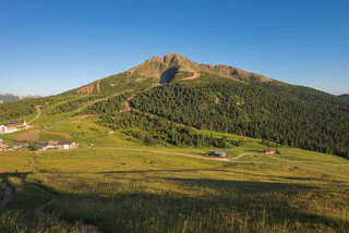
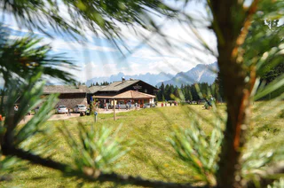
Circular family-hike at Jochgrimm/Oclini
Redagno/Radein, Aldein/Aldino
easy
Difficulté
166 m
Gain d'altitude
1h:30 min
durée
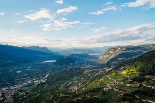
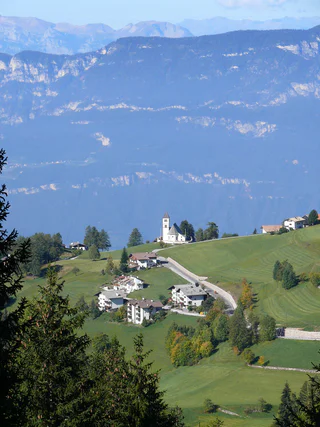
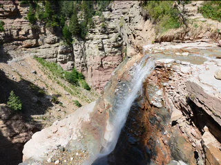
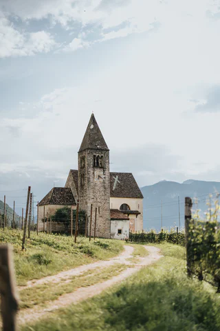
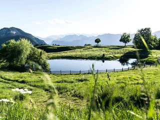
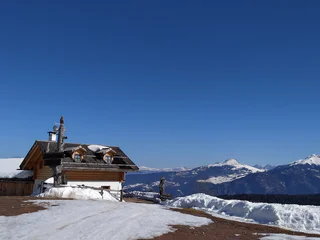
Niché au cœur d’une nature impressionnante, le sud du Sud-Tyrol offre de nombreux sentiers de randonnée traversant des forêts denses, des prairies fleuries et des vignobles pittoresques. Que vous recherchiez une promenade tranquille ou une excursion plus exigeante, vous trouverez ici l’itinéraire idéal pour votre aventure en randonnée.
1/2
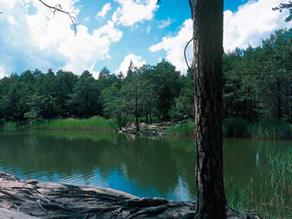
Redagno/Radein, Aldein/Aldino
easy
Difficulté
166 m
Gain d'altitude
1h:30 min
durée
1/2
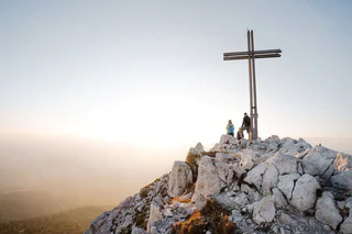
Aldino/Aldein, Aldein/Aldino
easy
Difficulté
225 m
Gain d'altitude
1h:58 min
durée
1/4
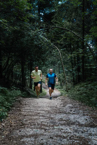
Radein/Redagno, Aldein/Aldino
difficult
Difficulté
3700 m
Gain d'altitude
23h:04 min
durée
1/3
Mazzon/Mazon, Neumarkt/Egna, Alto Adige Wine Road
difficult
Difficulté
1408 m
Gain d'altitude
7h:00 min
durée
1/3
Redagno/Radein, Aldein/Aldino
easy
Difficulté
157 m
Gain d'altitude
1h:30 min
durée
1/7
Redagno/Radein, Aldein/Aldino
medium
Difficulté
364 m
Gain d'altitude
2h:15 min
durée

1/2
Salorno/Salurn, Alto Adige Wine Road
easy
Difficulté
115 m
Gain d'altitude
0h:30 min
durée

Cortina s.s.d.V./Kurtinig, Salorno/Salurn, Alto Adige Wine Road
medium
Difficulté
382 m
Gain d'altitude
2h:43 min
durée
1/2
Radein/Redagno, Aldein/Aldino
difficult
Difficulté
3699 m
Gain d'altitude
23h:04 min
durée
1/5
Aldino/Aldein, Aldein/Aldino
medium
Difficulté
18 m
Gain d'altitude
1h:46 min
durée
1/4
Mazon/Mazzon, Neumarkt/Egna, Alto Adige Wine Road
medium
Difficulté
763 m
Gain d'altitude
3h:42 min
durée
1/7
Laghetti/Laag, Neumarkt/Egna, Alto Adige Wine Road
medium
Difficulté
661 m
Gain d'altitude
4h:40 min
durée
1/3
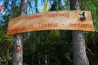
Trodena/Truden, Truden/Trodena
easy
Difficulté
0 m
Gain d'altitude
1h:00 min
durée
1/5
Pietralba/Weissenstein, Aldein/Aldino
easy
Difficulté
630 m
Gain d'altitude
2h:49 min
durée
1/4
Redagno/Radein, Aldein/Aldino
medium
Difficulté
355 m
Gain d'altitude
1h:38 min
durée
Laghetti/Laag, Montan/Montagna, Alto Adige Wine Road
medium
Difficulté
376 m
Gain d'altitude
3h:28 min
durée
1/5
Redagno/Radein, Aldein/Aldino
medium
Difficulté
404 m
Gain d'altitude
3h:34 min
durée
1/6
Rungg/Ronchi - Tramin/Termeno, Kurtatsch an der Weinstraße/Cortaccia sulla Strada del Vino, Alto Adige Wine Road
easy
Difficulté
21 m
Gain d'altitude
1h:00 min
durée
Altrei/Anterivo
medium
Difficulté
429 m
Gain d'altitude
2h:55 min
durée
1/11
Anterivo/Altrei, Altrei/Anterivo
medium
Difficulté
367 m
Gain d'altitude
3h:25 min
durée
1/3
Redagno/Radein, Aldein/Aldino
difficult
Difficulté
590 m
Gain d'altitude
4h:00 min
durée
1/6
Mazzon/Mazon, Neumarkt/Egna, Alto Adige Wine Road
easy
Difficulté
228 m
Gain d'altitude
1h:33 min
durée
1/5
San Lugano/San Lugano, Truden/Trodena
medium
Difficulté
360 m
Gain d'altitude
2h:23 min
durée
Aldino/Aldein, Aldein/Aldino
easy
Difficulté
391 m
Gain d'altitude
3h:23 min
durée

1/4
Ora/Auer, Auer/Ora, Alto Adige Wine Road
medium
Difficulté
607 m
Gain d'altitude
4h:49 min
durée
1/3
Anterivo/Altrei, Altrei/Anterivo
medium
Difficulté
501 m
Gain d'altitude
3h:19 min
durée
Fontanefredde/Kaltenbrunn, Altrei/Anterivo
medium
Difficulté
372 m
Gain d'altitude
2h:51 min
durée
Pinzano/Pinzon, Aldein/Aldino
medium
Difficulté
980 m
Gain d'altitude
3h:51 min
durée
Magrè s.S.d.V./Margreid a.d.W., Kurtatsch an der Weinstraße/Cortaccia sulla Strada del Vino, Alto Adige Wine Road
medium
Difficulté
1058 m
Gain d'altitude
3h:38 min
durée
Pochi/Buchholz, Salorno/Salurn, Alto Adige Wine Road
medium
Difficulté
933 m
Gain d'altitude
3h:04 min
durée


