"Of water and of light" - untouched nature in the Zieltal valley in the Texel Group Nature Park!
At the back of Partschins/Parcines lies the spectacular water-rich Zieltal valley in the middle of the Texel Group Nature Park.
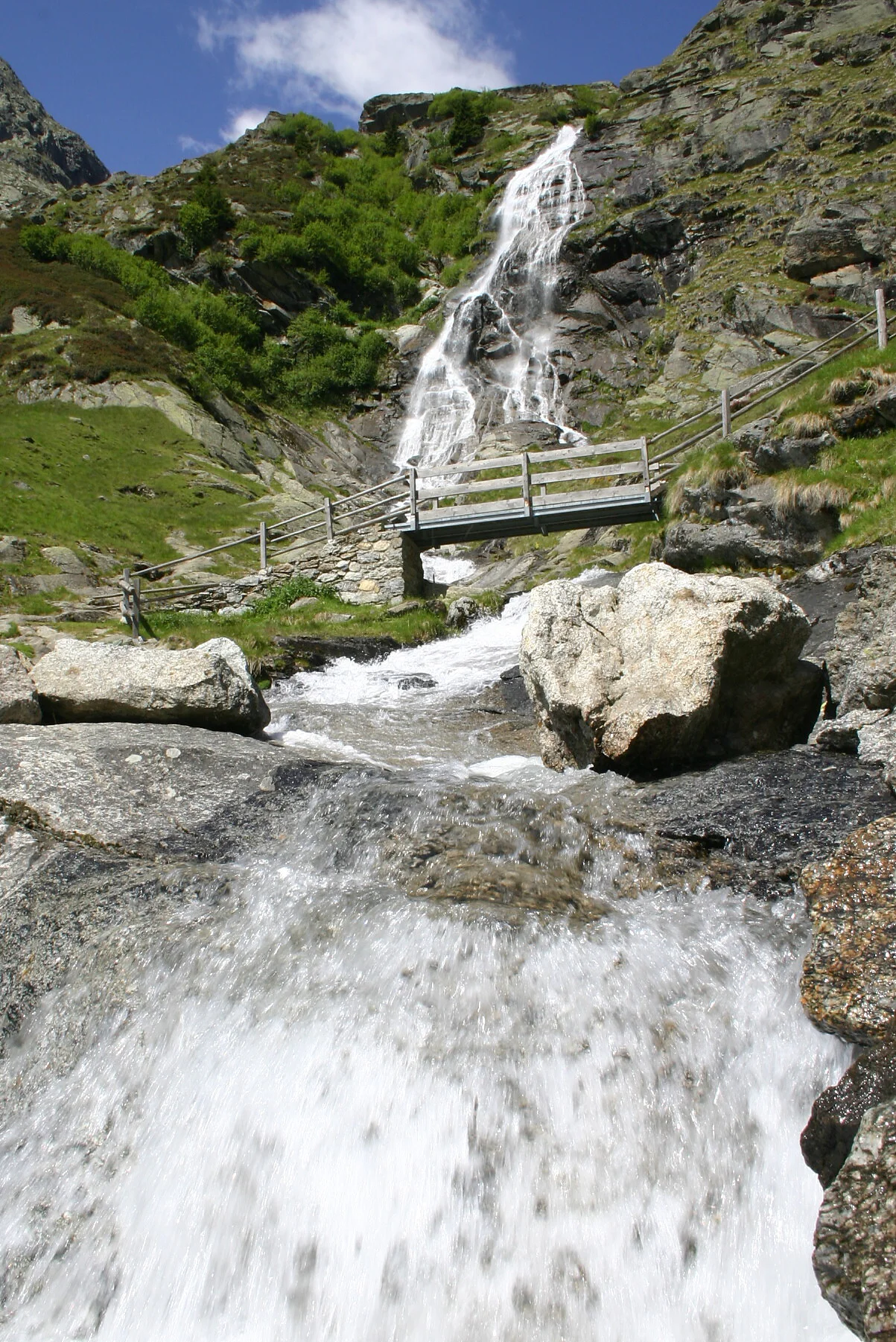
Water is an essential basic element of the nature park. It appears in the Zieltal as a waterfall, spring or rushing stream and here it also impressively demonstrates its shaping and landscape-forming power. Here the Zielbach river plunges into the depths as an almost 100 m high Partschins/Parcines waterfall.
This hike through the Ziel Valley, in the heart of the Texel Group Nature Park, will give you a unique experience of nature!
This hike is only recommended for hikers in good physical condition!
Tour Start
Texelbahn cable car mountain station
Tour End
Texelbahn cable car mountain station
From the mountain station of the Texelbahn cable car in 5 minutes to the "Giggelberg" inn - from there we hike on the well-known "Meraner Höhenweg" no. 24 to the Nasereit refuge (1,523 m, approx. 1 hour). Here path no. 8 branches off, which leads us through the wildly romantic Zieltal valley, past the Kaserstein-, Ginggl- and Zielalm pasture (2,198 m - closed) to the Lodnerhütte mountain pasture (2,295 m). The mountain hut is located directly at the spectacular confluence of the Zielbach stream and Lafaisbach stream and is the starting point for mountain tours to the most beautiful 3,000m peaks such as the Lodner (3,228 m - approx. 3.5 hours), Roteck (3,337 m - approx. 3.5 hours), Hohe Weisse (3,281 m - approx. 4 hours), Tschigat (2,998 m - approx. 3 hours), Zielspitze (3,001 m - approx. 3.30 hours). The descent is via the ascent route.
Timetable search: https://www.suedtirolmobil.info/en/

To complete your subscription, open the email we just sent you and click on the confirmation link.
Can’t find it? Check your spam folder too.