Passer au contenu
ajouté(e) aux favoris
supprimé(e) des favoris
Oups ! Une erreur s’est produite. Réessayer
Ton compte est en cours de création
Ton compte a été créé avec succès et tu es maintenant connecté
Tu es déconnecté
Filtrer
Filtres sélectionnés
    Niveau de difficulté
    Durée
    Distance en km

    Sentiers thématiques dans le Sud-Tyrol

    Randonnée et savoir s'allient sur les plus de 150 sentiers thématiques du Sud-Tyrol. Voyage à travers l'histoire contemporaine ou notre système planétaire, plonge dans le monde des légendes ou consacre-toi entièrement au bon goût. Sur les chemins du vin, les chemins des châtaigniers et les chemins des vallées, tu profiteras d'une expérience de randonnée détendue.

    Résultats
    Hiking
    Latschander irrigation channel path
    Latsch/Laces, Vinschgau/Val Venosta

    The zigzag shaped Latschander irrigation channel path in between Laces and Castelbello was created in 1872/1873 and provides an ideal walk for the whole family. Those who wish to stroll along the entire irrigation channel trail should allow approximately 2.5 hours to do so.

    Difficulté : facile
    50 altitude
    2h:00 min durée
    Hiking
    Hike: Meditation and Fairytale Path
    Sexten/Sesto, Dolomites Region 3 Zinnen

    Legends and stories about the Sextner Tal valley and the Alta Pusteria/Hochpustertal valley have been told and passed on here for years. Now these many fairytales and stories have been used to create a Fable Trail (Fabelweg) in Sesto. Figures depicting characters from all kinds of legends have been set up along the route, giving visitors an insight into a different world.

    Difficulté : moyenne
    700 altitude
    3h:00 min durée
    Hiking
    Goldsee Lake Trail/Goldseeweg
    Stilfs/Stelvio, Vinschgau/Val Venosta

    High above Trafoi is the Goldsee Lake Trail (path nr. 20) which winds through a rock desert. The hiking trail doesn't only offer a magnificent view on the Ortler mounatin, the trail gives you also information about the region. Along the way, theme boards explain the history of the mountain front during the First World War and give an insight into the vegetation and geology.

    Difficulté : moyenne
    105 altitude
    3h:19 min durée
    Hiking
    South Tyrol Strawberry Trail
    Martell/Martello, Vinschgau/Val Venosta

    The South Tyrol Strawberry Trail leads through the picturesque natural and cultural landscape of Val Martello and is walkable all year.

    Difficulté : facile
    370 altitude
    2h:58 min durée
    Hiking
    Sun Path Ahrntal valley - Sunnsat
    Prettau/Predoi, Ahrntal/Valle Aurina

    The sun trail "Sunnsat" is a net of ways and invites to walk and to peregrinate. These ways in the times gone by, were used by smugglers and for other things. Now doing this ways you can pass the blooming fields, the mixed forest, the traditional farms und the huts.

    DOWNLOAD AHRNTAL SUN TRAIL - MAP

    Difficulté : moyenne
    1156 altitude
    6h:22 min durée
    Hiking
    Vineyards Route near Bressanone/Brixen
    Brixen/Bressanone, Brixen/Bressanone and environs

    The starting point for the vineyard trail is in the center of Bressanone/Brixen (refreshments available) at the Adlerbrücke. Follow trail no. 1 through the Stufels district, first via Kranebitt (refreshments available) up to Elvas (refreshments available). Here continue through the Mooswald forest to the Raiermoos biotope and on trail no. 6 via Hochrain to the Strasserhof farm (refreshments available in autumn). Continue on trail no. 4 between vineyards and the typical dry stone walls down to the well-known Neustift monastery (refreshments available). From here head south on trail no. 16 back to Bressanone/Brixen. There is no shortage of places to stop along the way, especially in the fall it is charming to visit one of the rustic Buschenschänke.

    The vineyard path is easy to walk and also brisk, much worth seeing transforms this hike, but without further ado into a day trip. Already at the starting point, the narrow medieval streets of Stufels are fascinating. Once you have conquered the first meters of altitude, you can enjoy a magnificent view over the Bressanone basin from the Wetterkreuz near Elvas. Nature lovers will be delighted by the diversity of the Raiermoos biotope, as well as the centuries-old vineyards on the slopes above Neustift. Wines from these same vineyards can also be tasted directly at the Neustift monastery before heading back towards Brixen.

    Difficulté : facile
    0 altitude
    3h:30 min durée
    Hiking
    The mushroom path in the Laranz forest
    Kastelruth/Castelrotto, Dolomites Region Seiser Alm

    The leisurely hike through the Laranz forest makes every hiker’s wishes come true: fresh forest air, a panoramic platform, mushrooms carved from tree trunks and a view fit for a king.

    This hiking tour can be found in the family hiking booklet “Out and About with Nix the Witch”.

    Difficulté : facile
    152 altitude
    1h:19 min durée
    Hiking
    Theme path: The Milk Mile at Sexten/Sesto
    Sexten/Sesto, Dolomites Region 3 Zinnen

    How is tasty mountain cheese made?
    The ‘Drei Zinnen’ display dairy at Dobbiaco/Toblach and the ‘Milk Mile’ at Sesto/Sexten provide answers to questions like this. The local Alpine dairy farming world is explained along an interactive woodland trail. Interested visitors can try their hand at milking using a wooden cow and read how the various cheese types are made.

    Difficulté : facile
    30 altitude
    0h:19 min durée
    Hiking
    Schneeberg Mountain Hike
    Moos in Passeier/Moso in Passiria, Meran/Merano and environs

    At an altitude of 2,355 m, the mining village on Schneeberg/Monte Neve is easily accessible – but only on foot. With its 800-year history, a unique landscape and gastronomic delights, the Schneeberg remains a highly-frequented tourist destination. In fact, the "Schneeberg" doesn't refer to a "mountain" as such – but rather to the whole mining complex. To the locals in the Passeiertal Valley, "Schneeberg" mainly refers to St. Martin/S. Martino's mining village that includes a mountain refuge with a restaurant and the Adventure mine; now a tourist attraction.

    Difficulté : moyenne
    1215 altitude
    6h:39 min durée
    Hiking
    “Castle triangle” walk Appiano/Eppan
    Eppan an der Weinstaße/Appiano sulla Strada del Vino, The South Tyrolean Wine Road

    At the bottom of the Gantkofel the Eppaner Castle triangle is located. On the art-historic walking tour you get an impression of the mediaeval South Tyrol. The walking tour to the castles takes you to the Castle Triangle. First you reach the Castle Hocheppan, which is one of the most important fortifications of SouthTyrol. After a visit as well as refreshment at the Castle tavern the hike continues to the ruin Boymont. A little bit underneath Castle Korb is located, which derived from the Roman époque and is now a hotel.

    Difficulté : moyenne
    373 altitude
    1h:45 min durée
    Hiking
    Irrigation chanenel path Tschars and Staben
    Kastelbell-Tschars/Castelbello-Ciardes, Vinschgau/Val Venosta

    Hiking along the old water courses is one of the favorite Sunday activities of the South Tyroleans - hardly surpising, since the leisurely walks can be undertaken with the whole family. One of the most beautiful is the "Schnalswaalweg"

    Difficulté : moyenne
    420 altitude
    2h:00 min durée
    Hiking
    Hiking in the Gilfenklamm Gorge
    Ratschings/Racines, Sterzing/Vipiteno and environs

    Cutting through pure white marble, which used to be coveted by stonemasons from all over the world and which shimmers here in every conceivable shade of green, the otherwise peaceful Ratschinger Bach stream becomes a raging torrent. By going down steep steps and over narrow bridges, you can get right down to the heart of the gorge, where a breathtaking natural scene awaits. The lower entrance to the Gilfenklamm gorge is in Stange/Stanghe, from where you walk along a level hiking trail to the entrance to the gorge, where the trail begins to climb gradually over bridges and along well-secured trails. Storming and raging, the wild waters of the Ratschinger stream tumble over numerous waterfalls, forcing themselves through narrow chasms between the steep cliff walls, which ensure that at the lowest, most impressive point - the so-called "church" - even the most dazzling sunshine is dimmed. Going from one bridge to another and up and down steps, you finally reach the end of the gorge. If you take your time, have good shoes and a camera, this hike is a memorable experience for all the family.

    Difficulté : facile
    0 altitude
    1h:30 min durée
    Hiking
    Algund Waalweg canal trail
    Algund/Lagundo, Meran/Merano and environs

    Waalwege are paths along the ancient irrigation channels. The Algunder Waalweg Trail is split into two parts with a lenght of 5 to 6 km. The hike leads along an historical irrigation canal. The canal trail is almost flat. It is therefore ideal for older people or families with children. Hikers, young and old, will be rewarded with fantastic views of Lagundo/Algund as well as the entirety of Merano/Meran and the surrounding area.

    Difficulté : facile
    29 altitude
    1h:08 min durée
    Hiking
    Trail of the plum of Barbian/Barbiano
    Barbian/Barbiano, Brixen/Bressanone and environs

    We start in the village square in Barbiano/Barbian and walk along the Plum Trail towards the lower part of the village, past the Feltuner farm to the cross. There the trail becomes very steep up past the Frühaufhof farm, crossing the road and then, at the Haus Urban guesthouse, proceeds uphill to a fork in the road. From there we continue right and through the upper part of the village back to the centre. On the way there are lots of information panels giving interesting information about the Barbiano plums. Especially good for families.

    Difficulté : facile
    111 altitude
    0h:43 min durée
    Hiking
    7 lakes hiking trail
    Völs am Schlern/Fiè allo Sciliar, Dolomites Region Seiser Alm
    At the foot of the Schlern, between Völser Aicha and St. Konstantin, the path connects seven lakes. It leads through varied and impressive nature and past ancient and unique cultural landscapes. The path runs through the natural park Schlern-Rosengarten, which is part of the Dolomites UNESCO World Heritage, and can also be walked in sections or in the opposite direction.
     
    Difficulté : moyenne
    394 altitude
    3h:46 min durée
    Hiking
    Hiking path: Walk around Sexten/Sesto
    Sexten/Sesto, Dolomites Region 3 Zinnen

    The Sexten circular trail can be started anywhere in Sexten. A short but very beautiful hike that is ideal for exploring the Sexten Valley and for gaining a very good first impression. The entire trail is marked with the number 1. The Sexten circular trail leads past farms 
    farms, across meadows and through dense coniferous forests. Mostly on narrow forest paths, but occasionally also on wide forest roads. Stops along the way invite you to rest and explore

    Difficulté : facile
    227 altitude
    2h:31 min durée
    Hiking
    Family hike: Source of the Drava (Drau) River
    Innichen/San Candido, Dolomites Region 3 Zinnen

    A very easy family hike with no significant inclines. The outward route goes almost entirely through woods, a very peaceful setting. The destination is the source of the Drava river between San Candido/Innichen and Dobbiaco/Toblach. You can drink the water directly from the little fountain: you're unlikely to find fresher, clearer water anywhere.

    Difficulté : facile
    0 altitude
    0h:45 min durée
    Hiking
    Hike on the Adventure Path
    Sand in Taufers/Campo Tures, Ahrntal/Valle Aurina

    Bringing people close to nature...this is the aim of the nature experience path in Sand in Taufers. The circular path is about 3 to 4 miles long and was partially financed by the village of Sand in Taufers and the Department for Natural Parks.Its logo is a squirrel, which accompanies the hiker from one station to the next. Many themes are touched upon: nature, fauna, flora, geology, mythology, legends, myths….. Interesting ideas such as a look-out platform make this round-trip trail even more attractive. The Adventure Path for a Healthy Community will be built or accordingly expanded as part of a theme trails’ project in the autumn of 2015.


    Difficulté : moyenne
    201 altitude
    3h:00 min durée
    Hiking
    Theme path in winter: The meditation path
    Sexten/Sesto, Dolomites Region 3 Zinnen

    Along the way, 14 stations with various texts from the Bible and matching relief carvings invite you to pause for a moment. Both the Lordesstöckl on the way to the forest chapel and the clear fountain at the 9th station of the contemplation trail are always popular with visitors and locals alike.
    The history of the forest chapel is interesting: the church, which is almost entirely made of wood, was built around 1917, as the parish church in Sesto was badly damaged during the First World War. For 14 days, the farmers and the priest at the time worked on the church from early in the morning until nightfall. The wood for this came from a hay barn that had been crushed by the snow. In 1917 and 1918, every church service was celebrated there and, especially during the fascist era, the forest chapel served as a hiding place to hold masses in German. Today, the chapel is also known as the Peace Chapel and was restored in 1974. In 1988, at the suggestion of the then parish priest Markus Küer and in collaboration with the Sesto woodcarver Georg Lanzinger, a path of reflection was laid out to the chapel. Near the chapel there are cup stones, which are among the oldest traces of settlement in Sesto and are also the last of the biblical stations along the path of reflection.

    Difficulté : moyenne
    210 altitude
    1h:30 min durée
    Hiking
    Dialog trail - Col de Flam
    Urtijëi/Ortisei, Dolomites Region Val Gardena

    An authentic adventure in nature that takes you through sunny meadows and forests.
    During the pleasant walk, you will encounter unique inscribed stones. A dialogue trail where all family members can read and exchange thoughts.

    Difficulté : facile
    125 altitude
    1h:00 min durée
    Hiking
    Teufelsteinweg Trail in St. Martin/S. Martino
    St.Martin in Passeier/San Martino in Passiria, Meran/Merano and environs
    From the info office St. Martin in the direction of the village center to the savings bank. Turn left there and walk out of the village to the fire station. Ascend the Feldbauernweg to the right until you reach the last houses. There you will find the entrance to the Teufelsteinweg. From here follow the signs. At the end of the theme trail, descend the asphalt road for a few hundred meters and then hike back to the right along trail no. 4 through the forest to St. Martin. It gets its name from the Devil's Stone, which stands in the middle of the path. A boulder with the hoof print of the devil.

    In winter you may encounter icy or snow-covered spots.

    Trail not suitable for strollers.
    Difficulté : facile
    254 altitude
    2h:00 min durée
    Hiking
    adventure trail Talai
    Graun im Vinschgau/Curon Venosta, Vinschgau/Val Venosta

    In the about 3 kilometers long loop road, twelve stations invite young and old to play and discover. Zipf and Zapf go along with the little natural scientists on their walk and narrate them interesting facts about the forest and its inhabitanst. At the same time the children have to crack several riddles to find the mysterious treasure at the end of the road. The trail is positioned amid of the talai forest in San Valentino. Don't forget to take paper and pencil to note the answers. Preprints also available at the Tourist Information.

    Difficulté : facile
    0 altitude
    2h:30 min durée
    Hiking
    Hike on the Power of Water Trail
    Sand in Taufers/Campo Tures, Ahrntal/Valle Aurina

    The Power of Water is the theme of four trails in Valle di Selva dei Molini that await hikers with a thirst for knowledge about nature. Each one has its very own unique charm.

    Difficulté : moyenne
    893 altitude
    6h:00 min durée
    Hiking
    Circular hike on the eastern side of the Sella massif
    Corvara, Dolomites Region Alta Badia

    This hike on the eastern edge of the Sella massif, with start in Corvara, is a circular hike with little variation in altitude that presents no great technical difficulties for hikers. Nevertheless, you need to be fit before attempting this hike. The hike is particularly interesting from a geological point of view as it crosses some of the characteristic rock formations of the Dolomites and has some especially interesting viewpoints.

    Difficulté : moyenne
    464 altitude
    2h:43 min durée
    Hiking
    Health paths Weißenbach/Rio Bianco
    Ahrntal/Valle Aurina, Ahrntal/Valle Aurina

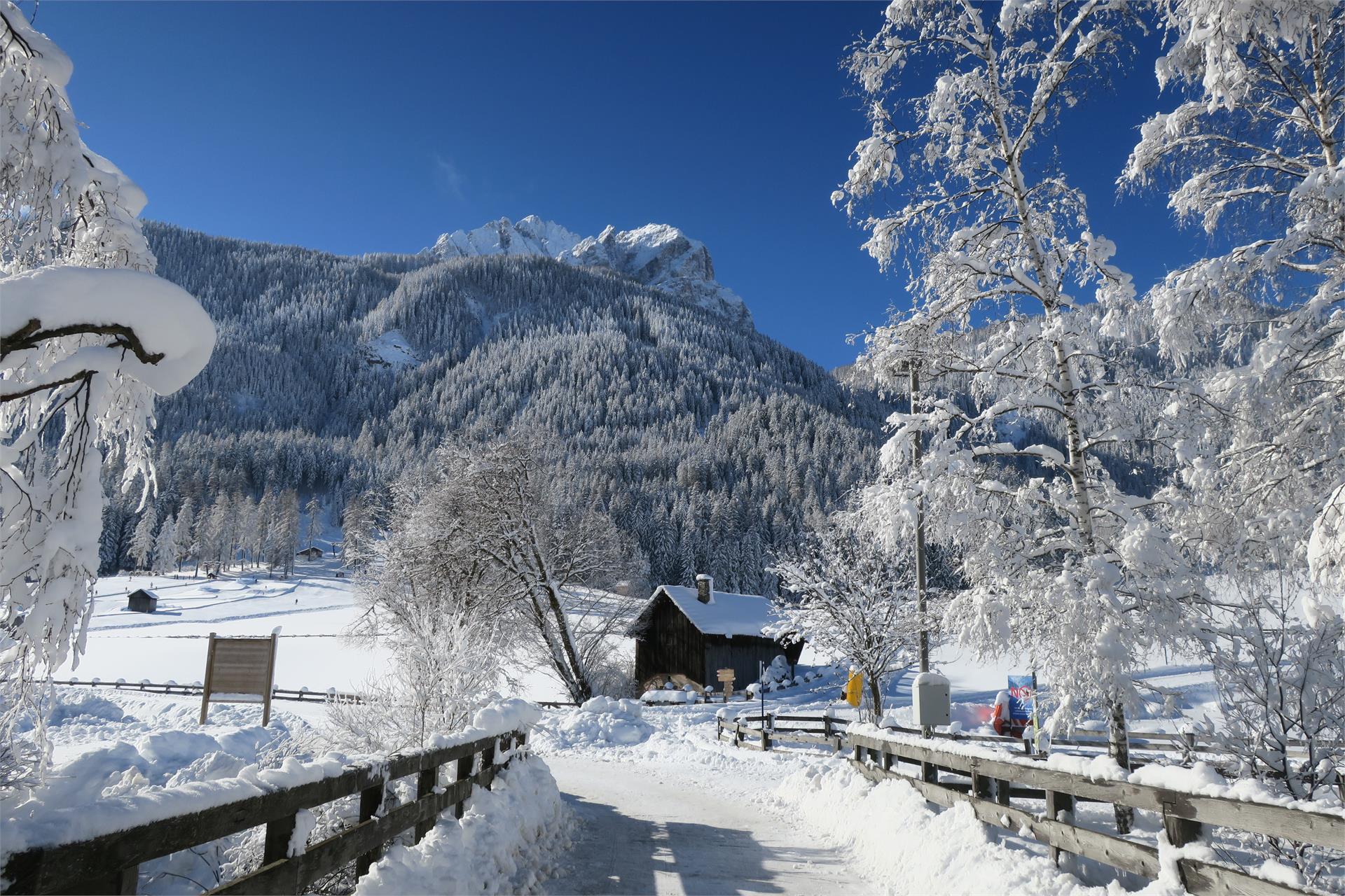
    Special Feature Wellness Trail Weißenbach/Rio Bianco. The mountain village of Weißenbach/Rio Bianco—with its rich diversity of local herbs and the elemental forces of water, air and light—offers the ideal setting for the Weißenbach/Rio Bianco Wellness Trail.

    Regular exercise amid nature works as an active preventative, helping to achieve a balanced harmony between mind, body and soul. The mountain village of Weißenbach/Rio Bianco provides the ideal backdrop. With its unique and beautiful nature, colourful diversity of local herbs, and elementary forces of water, air and light, this outstanding natural landscape cried out for health trails to be created here.

    The three trails represent the three basic pillars of the Kneipp therapy: phytotherapy (the use of natural extracts as medicine) is explained on the Herbal Trail; the cold hydrotherapy can be refreshingly experienced on the Kneipp trail; and the principle of finding a balanced lifestyle through exercise is demonstrated on the Exercise Trail.

    Difficulté : facile
    504 altitude
    3h:30 min durée
    Hiking
    Theme path: Walk around Sexten/Sesto
    Sexten/Sesto, Dolomites Region 3 Zinnen

    The Sexten circular trail can be started anywhere in Sexten. A short but very beautiful hike that is ideal for exploring the Sexten Valley and for gaining a very good first impression. The entire trail is marked with the number 1. The Sexten circular trail leads past farms 
    farms, across meadows and through dense coniferous forests. Mostly on narrow forest paths, but occasionally also on wide forest roads. Stops along the way invite you to rest and explore

    Difficulté : facile
    30 altitude
    2h:10 min durée
    Hiking
    The Archeopfad Archaeological Trail in Brixen
    Brixen/Bressanone, Brixen/Bressanone and environs

    The Archeopfad Trail leads to the old Roman tower in Stufels/Stufles, the historical quarter in Brixen/Bressanone. From up there, a wonderful view opens out on the “Land an der Etsch” (the lands of the River Etsch), as this southern part of Tyrol was once known. The trail, retracing the old Roman paths, leads to historical monuments and ancient places of worship.

    This hike offers both novel as well as tried and tested attractions even for seasoned visitors to South Tyrol.

    Difficulté : facile
    286 altitude
    1h:37 min durée
    1 2 3 4 5 6 7 8 9 10 11 12 13 14 15 16 17