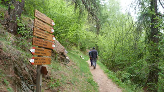
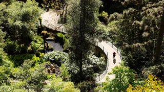
Przejdź do treści

dodano do ulubionych

usunięto z ulubionych

Coś poszło nie tak! Wystąpił problem. Spróbuj ponownie

Twoje konto jest właśnie tworzone

Twoje konto zostało pomyślnie utworzone i jesteś teraz zalogowany

Zalogowałeś się pomyślnie!

Twoje konto zostało pomyślnie utworzone, ale nie mogliśmy zalogować Cię automatycznie

Jesteś wylogowany

Filtr
Wybrane filtry
    Poziom trudności
    Czas trwania
    Odległość w km

    Wędrówki tematyczne po Południowym Tyrolu

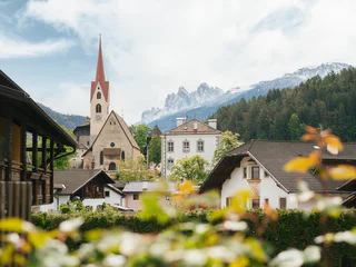
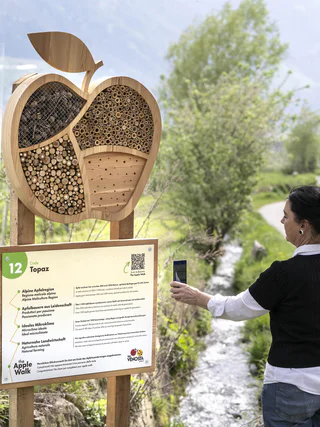
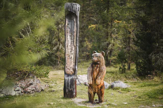
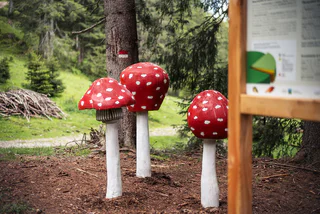
    Zlokalizowane we wszystkich regionach wypoczynkowych Południowego Tyrolu, oznakowane wędrówki tematyczne to wyjątkowe podróże odkrywcze zarówno dla młodszych, jak i starszych. Na przykład w regionie Unterland w Południowym Tyrolu odwiedzający jesienią mogą doświadczyć, jak winogrona przechodzą drogę od winorośli do beczki. W San Valentino w Campo/Gummer można odkrywać wszechświat i nasz układ słoneczny, a w Terlano/Terlan wiosną hodowcy szparagów pokazują, jak te cenne pędy są usuwane z ziemi. W sumie na odwiedzających Południowy Tyrol czeka ponad 150 oznakowanych i pouczających szlaków tematycznych.

    Wyniki
    Hiking
    Dolomites World Heritage Geotrail II: from Armentarola to Pederü
    Al Plan/San Vigilio, Dolomites Region Kronplatz/Plan de Corones

    The seventh stage of the Dolomites World Heritage Geotrail II crosses the Fanes plateau between spectacular and imposing folds, evidence of when the Dolomites, part of the African continental margin, were moved 3000km northwards and collided with the rocks of the European margin.

    The Dolomites UNESCO Geotrail consists of 10 daily stages, focussing particularly on the Dolomites’ geological history.

    Poziom trudności: średni
    707 m wysokość w górę
    5h:01 min czas trwania
    Hiking
    Walk: Roda dles Viles - Walk between the hamlets (B)
    Al Plan/San Vigilio, Dolomites Region Kronplatz/Plan de Corones

    Setting off from Pieve Marebbe, you can enjoy a number of especially beautiful walks to the hamlets of Cianorè, Biëi, Fordora, Frena and La Costa. From each hamlet, the next one is visible and easily reached by connecting tracks and roads, leaving you free to choose the best route to explore the amazing beauty of these landscapes and the architectural singularity of the hamlets.

    Poziom trudności: łatwy
    325 m wysokość w górę
    2h:07 min czas trwania
    Hiking
    Dolomites UNESCO Geotrail - Stage 8: from Pederü to Plätzwiese
    Al Plan/San Vigilio, Dolomites Region Kronplatz/Plan de Corones

    The eighth stage of the Dolomites World Heritage Geotrail II crosses the Senes plateau and reaches Prato Piazza along the northern side of the Croda Rossa d'Ampezzo. This stage invites you to observe the different forms that the relief takes around us: the peaks, the ridges, the valleys, the plateaus, the gorges, are all traces of the balance between erosion and tectonic uplift, which has been shaping the Dolomites for 30 million years.
    Discover more: https://www.dolomitiunesco.info/attivita/dolomites-world-heritage-geotrail/

    The Dolomites UNESCO Geotrail consists of 10 daily stages, focussing particularly on the Dolomites’ geological history.

    Poziom trudności: średni
    1305 m wysokość w górę
    6h:22 min czas trwania
    Hiking
    Historical Tour
    Dolomites Region Seiser Alm

    This walking trail passes through sites of historical interest which narrate the story of Tiers am Rosengarten. In addition to the parish church, notable historic sites en-route include the schoolhouse, the ‘Galgenwiesl’ (Eng: “Gallows Meadows”) field and the St. Sebastian chapel, to name but three of the eleven stations. Each site is indicated by stone tablets and marker stones.

    Poziom trudności: łatwy
    576 m wysokość w górę
    3h:22 min czas trwania
    Hiking
    Excursion Selva - Passo Gardena
    Corvara, Dolomites Region Val Gardena
    From Selva / Plan path no. 654 starts in the direction of Passo Gardena via the beautiful Plans de Frea.
    Poziom trudności: średni
    611 m wysokość w górę
    3h:28 min czas trwania
    Hiking
    Trail f1 | Truden - Oberradein
    The South Tyrolean Wine Road

    This segment will take you from Truden all the way to the idyllic village of Oberradein. The trail starts out downhill as you proceed towards Kaltenbrunn (lodging options and access to public transportation). You then pass by the famed "Ice Holes" of Kaltenbrunn and steadily uphill by way of Unterradein until you come to Oberradein. This village nestled in an unspoilt alpine landscape features stunning natural beauty, with numerous hiking options.

    Poziom trudności: średni
    589 m wysokość w górę
    2h:30 min czas trwania
    Hiking
    Theme walk: "A Soredl"
    Al Plan/San Vigilio, Dolomites Region Kronplatz/Plan de Corones

    Starting from the Miara cable car, the path winds up the sunny slopes of Ras and Costa. Following
    the signs to “A Sorëdl” and walking via Val you reach the hamlet Torpëi. From there continue left on the tarmac road until you reach the village at the level of the Hotel Monte Paraccia

    Poziom trudności: łatwy
    226 m wysokość w górę
    1h:38 min czas trwania
    Hiking
    Alpine Path of the Dolomites no. 1 - stage 2 & 3
    Al Plan/San Vigilio, Dolomites Region Kronplatz/Plan de Corones

    The High Route no. 1 winds along a route of approximately 125 km and 7,300 m of ascent, divided into 12 stages, connecting Lake Braies with Belluno. Here, ere two stages pass through the municipality of Marebbe

    Stage no. 2 goes from the Biella hut to the one in Fanes. Exploring the pastures of Senes, Fodara and Fanes, it is often possible to see animals grazing. The stage can be walked in 3 hours.

    Stage no. 3 goes from Fanes hut to Rifugio Lagazuoi.

    Especially inviting for a break are the various mountain lakes that are encountered along the route. Crossing the plateau of Fanes is a unique experience that, during the hikes, brings to life the legend of the Kingdom of the Fanes. The third stage can be walked in 5 hours.

    Poziom trudności: średni
    2098 m wysokość w górę
    10h:19 min czas trwania
    Hiking
    Tracing the herders
    Ritten/Renon, Bolzano/Bozen and environs

    Dear hiker, can i give you a hiking tip? The "Hirtensteig" themed path offers you an understanding of the herder's life, the livestock and the special features of one of the largest community alpine pasture systems in Europe not just today but also in the distant past at five stations along the trail. 

    Poziom trudności: średni
    204 m wysokość w górę
    0h:49 min czas trwania
    Hiking
    Mulattiera Trodena - Anterivo
    Truden/Trodena, Bolzano/Bozen and environs

    From the hiking starting point in Truden  (visit center Nature parc) you hike up through the village towards the village entrance. From there, follow trail no.5, then Sagenweg (no.8) to the picturesque Rungganöhof, continue there, always following trail 5. You will pass the Pinterschupfe, Peraschupf and Riegenschupfe (all not managed) to the Langes Moos biotope . From here via path No. 9 you arrive to the Krabes Alm (1,540 m, managed during summer). From there follow path no. 6 and then 5 directly to the hiking starting point in Altrei. It's possible return from this point to Truden with the pubblic transport.

    Poziom trudności: średni
    440 m wysokość w górę
    3h:10 min czas trwania
    Hiking
    Trail of the legends
    Jenesien/San Genesio Atesino, Bolzano/Bozen and environs

    Along the way there are 12 stations, which were designed by the pupils of the local primary school. There are lots of small master pieces which were smoothly integrated into the landscape of the Salten high plateau. Each station tells you about a local fairy tale from the area of San Genesio. The stories and fairy tales about witches and similar legendary creatures have always excited the fantasy of children and adults alike. Examples of the many exciting stories are the explanation why the Castle Greifenstein is always called ”Sauerschloss“, the fairy tale of the sunken city, the endless ball of threads, the butter witch of Afing, how the Castle of Greifenstein got its name, the captured mermaid, and many more. Duration: approx. 2 hours Length: 7 km Starting point: Parking space Schermoos Destination: bus stop Straße Jenesien - Mölten

    Poziom trudności: łatwy
    0 m wysokość w górę
    2h:30 min czas trwania
    Hiking
    Dolomite Alpine Ridgeway No.1
    Dolomites Region 3 Zinnen
    This alpine path leads along the north - south route through the eastern Dolomites. During the course of the hike you will get to know interesting areas of the eastern Dolomites. The main route leads along an average height of 2.000m - so you have to expect high - alpine conditions. With the exception of the last sections, which can be bypassed on an easier path, experienced hikers will have no difficulties.

    Stages: 8 -12 days
    Poziom trudności: trudny
    6820 m wysokość w górę
    41h:00 min czas trwania
    Hiking
    Herbal path Flora TraFul
    Stilfs/Stelvio, Vinschgau/Val Venosta
    A world of medicinal and edible herbs grow on our doorstep.

    Along the Flora TraFul wild herb trail you’ll find information about our unique alpine plants and their multiple uses. The purpose of the Flora TraFul nature trail is to vividly illustrate how herbs are used in traditional folk medicine. Along the two-km-long hike, the rudiments of identification are explained, as well as the essentials of plant foraging, insights into herb processing, and the effects produced by some of the herbs.

    Starting point of the hike is the naturatrafoi Visitor Centre of Stelvio National Park, or at the bus stop.
    Poziom trudności: łatwy
    0 m wysokość w górę
    1h:40 min czas trwania
    Hiking
    Peace Trail: Fanes - Monte Vallon Bianco
    Badia, Dolomites Region Kronplatz/Plan de Corones
    Mountain tour that will take you through the realm of Fanes up to Monte Vallon Bianco (2684 m), a desirable peak with artillery base from the First World War. Shoulder your backpack and discover the world of our ancestors along the old military road!
    Poziom trudności: średni
    884 m wysokość w górę
    4h:34 min czas trwania
    Hiking
    Roda dles Viles
    Al Plan/San Vigilio, Dolomites Region Kronplatz/Plan de Corones
    Experience genuine Ladin tradition on a walk through the Ladin viles and admire the ancient architectural style of a bygone era. The viles are groups of wooden or masonry houses and wooden barns that stand close together in the middle of a slope or on the edge of green terraces. They are compact nuclei exposed to the sun, built to protect each other and help with the agricultural products that everyone produces, whether milk, eggs or meat, but also with the various handicraft activities that everyone carries out, while preserving the little arable land available. 
    Get involved in this rural life, but one that is so precious that it can still be told and experienced again here and there.
    Poziom trudności: średni
    478 m wysokość w górę
    2h:47 min czas trwania
    Hiking
    Walk: Roda dles Viles - Walk between the hamlets (A)
    Al Plan/San Vigilio, Dolomites Region Kronplatz/Plan de Corones

    Setting off from Pieve Marebbe, you can enjoy a number of especially beautiful walks to the hamlets of Brach, Ciaseles, Frontü and Biëi. From each hamlet, the next one is visible and easily reached by connecting tracks and roads, leaving you free to choose the best route to explore the amazing beauty of these landscapes and the architectural singularity of the hamlets.

    Poziom trudności: łatwy
    253 m wysokość w górę
    1h:58 min czas trwania
    Hiking
    Alpine Path of the Dolomites no. 2 - stage 2 & 3
    Al Plan/San Vigilio, Dolomites Region Kronplatz/Plan de Corones

    The High Route no. 2 consists of a distance of 180 km, divided into 13 stages, which connects Bressanone to Feltre. The itinerary touches the three provinces of Bolzano, Trento and Belluno.

    Stage 2 goes from the Plose hut to Rifugio Genova, allowing trekkers to discover the wonders of the Puez-Odle Natural Park, often referred to as "Earth’s history book" due to its geological significance. Along the walk, the majestic Sasso Putia remains always in sight and offers many chances for a souvenir photo.

    Stage 3 connects the Rifugio Genova  to the Rifugio Puez. With an additional half an hour walk it is possible to climb to the top of Piz Duleda (2.909m), which offers a stunning view. Due to the multitude of rocks and interesting geological creations, the plateau of Puez is often compared to a moonscape. 

    Poziom trudności: średni
    1316 m wysokość w górę
    8h:19 min czas trwania
    Hiking
    Uina Gorge to Sur-En
    Vinschgau/Val Venosta

    On the Smugglers paths - fascinating hike along the Schlinigtal valley high mountain trail to Uina gorge, a unique trail from 1908 - 1910 hewn in rock about 900 m long.

    Poziom trudności: średni
    339 m wysokość w górę
    6h:30 min czas trwania
    Hiking
    Castle trail "Castelronda" San Genesio variation A
    Jenesien/San Genesio Atesino, Bolzano/Bozen and environs

    The Castle trail „Castelronda“ is about 20 km long and connects the castles and ruins of Bolzano, San Genesio and Terlano: Castle Roncolo/Runkelstein, Castle Rafenstein, Castle Grifo/Greifenstein (vulg. also called Castello del Porco, which means „Pork Castle“), Ruin Helfenberg and Castle Neuhaus (also called Maultasch). The efforts of hikers will be fully satisfied with magnificent views over the most beautiful castles and ruins of the region, in the middle of the nature.

    The trail starts at the Castle Roncolo/Runkelstein in Bolzano/Bozen and leads to the Castle Runkelstein passing the San Genesio cable car valley station. Then you continue to Restaurant Noafer in Cologna/Glaning (a hamlet in the municipality of San Genesio), situated above the Castle ruin Grifo/Greifenstein. Next, you reach the Helfenberg castle ruin and at the same time you can enjoy the marvellous panorama of the surrounding area. The descent towards Terlano/Terlan leads you to the final castle ruin Neuhaus/Maultasch and here ends the trail „Castelronda“. 

    You can choose to start in Bolzano, San Genesio or in Terlano and you can also hike partial sections at your discretion.

    The hikes on the „Castelronda/Burgenweg“ trail are especialliy recommended in spring, autumn and winter.

    Poziom trudności: średni
    67 m wysokość w górę
    1h:33 min czas trwania
    Hiking
    Adventure hiking circuit Lorggen at Mount Plose
    Brixen/Bressanone, Brixen/Bressanone and environs

    Starting at the Plose gondola lift mountain station, follow the Lorggenring trail along the WoodyWalk before it branches off at a wide viewing platform. Stop for a minute and enjoy the view of the Dolomites before continuing into a dense woodland. Along the way, hikers learn about the Lorggen, ancient guardians of the forest and its inhabitants. From the Pfannspitz gondola lift valley station, you can quickly arrive at an elevation of 2,545 m. The view of the spectacular Geißler peaks and the surrounding mountains is absolutely phenomenal! Follow the trail along the ridge to the Plosehütte shelter, from where you can return to Kreuztal at the Plose gondola lift mountain station along trails no. 7 and then no. 3. This part of the circuit offers a magnificent panorama of the Brixen basin. The Lorggenring Hiking Circuit is also accessible to families with children, offering hikers of all ages a unique hiking experience on the slopes of the Plose.

    Poziom trudności: łatwy
    713 m wysokość w górę
    3h:00 min czas trwania
    Hiking
    Discovering the legend of "The farmer of Corvara and the ogre"
    Corvara, Dolomites Region Alta Badia

    This six-hour trail immerses hiking fans in the stories of the farmer of Corvara and the ogre. Along the way, you will discover more about time-honored virtues from long ago, which are still relevant today.

    Disocver the whole legend in the book: "Walking through an enchanted land" available in the tourist offices.


    Poziom trudności: średni
    902 m wysokość w górę
    6h:01 min czas trwania
    Hiking
    Them walk: Tru dal Ega
    La Val, Dolomites Region Kronplatz/Plan de Corones

    From the San Vigilio Nature Park Visitor Centre, walk to the Hotel Aqua Bad Cortina and follow
    the river in the direction of „Tres la Val“. After about 1 hour, you will see a small bridge on the
    left side leading to the 40 springs „Les Fontanes“. Back on the path, after a short asphalt stretch,
    you can take a diversion to the „Ciastlins“ waterfalls. Continuing on the forest path to Pederü, you will see signs for the „Ega de San Vì“ springs. Along the way, several educational stations illustrate the characteristics of water.

    Poziom trudności: łatwy
    225 m wysokość w górę
    1h:52 min czas trwania
    Hiking
    Theme walk: Tru dles Liondes
    Al Plan/San Vigilio, Dolomites Region Kronplatz/Plan de Corones
    We invite everyone to walk the trail of the amazinglegends of the "Fanes Kingdom". The start is at the Hotel Aqua Bad Cortina. Before you start, do not forget to pick up an entertaing quiz, waiting for you at the tourist information and in the Nature Park Visitor Center
    Poziom trudności: łatwy
    60 m wysokość w górę
    0h:46 min czas trwania
    Hiking
    Marble Circuit Trail
    Vinschgau/Val Venosta

    This multi-day hike at high altitude is through the tree linein the Stelvio National Park.Twisting its way around the imposing Laas/Lasa mountains,the breath-takingMarble Circuit Trailhas a total length of 80 km. Part of the formidable Ortler Alps, this spectacular mountain range is internationally renowned for its unusual pure-white Laas/Lasa marble. With stops along the way the circuit trail can be hiked in one go or split into six single-day stages.

    Lining the Marble Circuit Trailare several panels delineating the rich natural diversity found along the trail. Each of these 30 info panels is centred on a specific theme. A further 10 orientation placards offering descriptions of the start and end of the trail are positioned at strategic points along the trail.

    Poziom trudności: trudny
    4164 m wysokość w górę
    36h:00 min czas trwania
    Hiking
    Wine Trail Monteponente
    Brixen/Bressanone and environs
    From Hotel Ziggler follow the steep slope through vineyards (signs). At high altitude a country road leads northward to Scezze. Follow the asphalted road downhill, at the last house you will find the return path (starts with steps). When you reach the Kuenhof farm in the vineyards below, follow the path to the right of the state road to return to Hotel Ziggler, the starting point.
    Poziom trudności: łatwy
    260 m wysokość w górę
    1h:30 min czas trwania
    Hiking
    San Genesio - Salto - Lavena
    Jenesien/San Genesio Atesino, Bolzano/Bozen and environs

    Trail no.1- Suitable for pushchairs. Jenesien, departure from the sportsground on trail no. 33 or trail no.1. Walk along trail no. 1 or the E5 European long-distance walking trail trough the hilly landscape offered by the Salten, to then reach the little church of St. Jacob and Langfenn. Our Hikers' bus can drive xou back to Jenesien. Duration of the excursion: 2 hours and 30 minutes - Drop/rise: 440 m

    Poziom trudności: łatwy
    421 m wysokość w górę
    2h:16 min czas trwania
    Hiking
    Discovering the legend "The Salvan of the Gardena pass"
    Corvara, Dolomites Region Alta Badia

    Embark on a four-hour hike from Colfosco to Passo Gardena, and you will find yourself in the footsteps of the Salvan, the mythical little man of the forest who lived on the border with the Val Gardena.

    Discover the whole legend in the book: "Walking through an enchanted land" available in the tourist offices.


    Poziom trudności: średni
    659 m wysokość w górę
    4h:00 min czas trwania
    Hiking
    Trail f2 | Jochgrimm - Schwarzhorn - Radein
    The South Tyrolean Wine Road

    From Jochgrimm first up to the Schwarzhorn (2,439 m above sea-level), where you are immediately rewarded with a great panoramic view. From here it goes back again to Jochgrimm and then up to the magnificent Weisshorn (2,317 meters above sea-level), once again you can enjoy a splendid panoramic view. You will then proceed through increasingly dense vegetation downhill and along the Zirmersteig staircase until you reach Oberradein, an idyllic village surrounded by verdant meadows and lush forests.

    Poziom trudności: średni
    814 m wysokość w górę
    3h:52 min czas trwania
    Hiking
    Tru di pra certified path
    La Val, Dolomites Region Alta Badia

    This trail has been certified by 'Europäisches Wandergütesiegel' (European Certification for hiking trails).

    Once you have left the village centre, you will understand why La Val is called the village of Alpine meadows: green, well-kept meadows will constantly surround you during this hike. The man-made landscape between 1300 and 2000 metres above sea level developed through the hard work of our farming ancestors, which today is facilitated by the use of agricultural machinery. 

    As the altitude increases, so does the consistency of the meadows: from meagre meadows to the larch meadows of Armentara. Along the route you will find wonderful viewpoints, a sulphurous water spring at Al Bagn and several refreshment points where you can refresh yourself with some of the delicious Ladin specialities that can satisfy every palate: try the typical bales (dumplings) or snack on a well-earned slice of strudel.

    Every year, the non-competitive half-marathon 'Tru di pra' takes place on this route.

    Poziom trudności: średni
    1713 m wysokość w górę
    8h:37 min czas trwania
    1 2 3 4 5 6 7 8 9 10 11 12 13 14 15 16 17 18