1/5
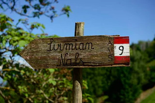
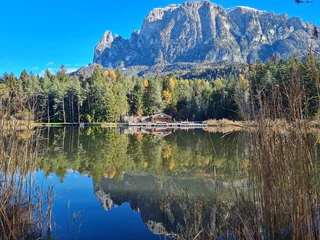
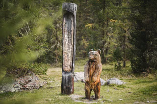
From Nalles to Prissiano via Sirmiano and Grissiano
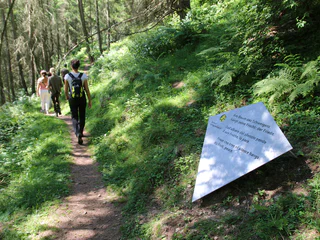
Nalles/Nals, Nals/Nalles, Meran/Merano and environs
medium
Difficulty
675 m
Elevation gain
5h:00 min
duration
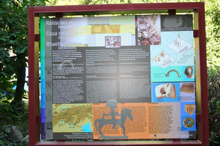
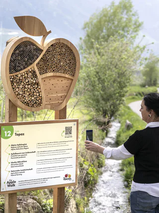
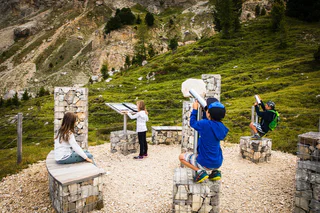
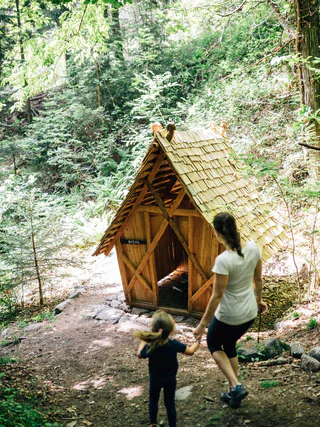
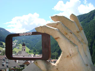
Located throughout South Tyrol’s holiday regions, sign-posted themed hikes are special journeys of discovery for young and old alike. In South Tyrol’s Unterland region, for example, visitors in autumn can experience how grapes go from the vine to the barrel. In San Valentino in Campo/Gummer you can explore the universe and our solar system. and in Terlano/Terlan in spring asparagus farmers demonstrate how the precious shoots are removed from the earth. In total more then 150 sign-posted and informative themed hikes await visitors to South Tyrol.
1/5
Nalles/Nals, Nals/Nalles, Meran/Merano and environs
medium
Difficulty
675 m
Elevation gain
5h:00 min
duration

Fontanefredde/Kaltenbrunn, Truden/Trodena
medium
Difficulty
200 m
Elevation gain
2h:01 min
duration
1/4
San Leonardo i.P./St. Leonhard i.P., Moos in Passeier/Moso in Passiria, Meran/Merano and environs
medium
Difficulty
501 m
Elevation gain
2h:23 min
duration
1/5
Monte di Tramontana/Nördersberg, Schlanders/Silandro, Vinschgau/Val Venosta
easy
Difficulty
160 m
Elevation gain
1h:42 min
duration
1/4
Tirolo/Tirol
easy
Difficulty
201 m
Elevation gain
1h:04 min
duration
1/10
Montesole/Sonnenberg - Parcines/Partschins, Partschins/Parcines, Meran/Merano and environs
easy
Difficulty
171 m
Elevation gain
2h:15 min
duration
1/4
Nova Levante/Welschnofen, Welschnofen/Nova Levante, Dolomites Region Eggental
medium
Difficulty
606 m
Elevation gain
4h:34 min
duration
1/11
Parcines/Partschins, Partschins/Parcines, Meran/Merano and environs
easy
Difficulty
118 m
Elevation gain
0h:58 min
duration
1/7
Ora/Auer, Auer/Ora, Alto Adige Wine Road
easy
Difficulty
151 m
Elevation gain
1h:42 min
duration
Braies di Fuori/Ausserprags, Prags/Braies, Dolomites Region 3 Zinnen
easy
Difficulty
46 m
Elevation gain
0h:31 min
duration
1/11
Vilpiano/Vilpian, Terlan/Terlano, Bolzano/Bozen and environs
difficult
Difficulty
1446 m
Elevation gain
9h:40 min
duration
Aldino/Aldein, Aldein/Aldino
difficult
Difficulty
1601 m
Elevation gain
7h:57 min
duration
1/2
Obereggen/Obereggen, Deutschnofen/Nova Ponente, Dolomites Region Eggental
easy
Difficulty
177 m
Elevation gain
2h:00 min
duration
1/4
Caines/Kuens, Riffian/Rifiano, Meran/Merano and environs
easy
Difficulty
69 m
Elevation gain
0h:22 min
duration
Sciaves/Schabs, Natz-Schabs/Naz-Sciaves, Brixen/Bressanone and environs
easy
Difficulty
86 m
Elevation gain
1h:00 min
duration
1/3
Nova Levante/Welschnofen, Welschnofen/Nova Levante, Dolomites Region Eggental
easy
Difficulty
248 m
Elevation gain
2h:10 min
duration
1/5
Presule/Prösels, Völs am Schlern/Fiè allo Sciliar, Dolomites Region Seiser Alm
medium
Difficulty
378 m
Elevation gain
3h:45 min
duration
1/7
Alpe di Rodengo/Rodenecker Alm, Rodeneck/Rodengo, Brixen/Bressanone and environs
easy
Difficulty
188 m
Elevation gain
1h:30 min
duration
Fontanefredde/Kaltenbrunn, Truden/Trodena
medium
Difficulty
344 m
Elevation gain
2h:28 min
duration
1/3
Obereggen/Obereggen, Deutschnofen/Nova Ponente, Dolomites Region Eggental
easy
Difficulty
305 m
Elevation gain
2h:34 min
duration
Aldino/Aldein, Aldein/Aldino
easy
Difficulty
391 m
Elevation gain
3h:23 min
duration
1/2
Braies di Fuori/Ausserprags, Prags/Braies, Dolomites Region 3 Zinnen
easy
Difficulty
46 m
Elevation gain
0h:31 min
duration
Martello/Martell, Martell/Martello, Vinschgau/Val Venosta
medium
Difficulty
632 m
Elevation gain
3h:00 min
duration
1/6
Solda/Sulden, Stilfs/Stelvio, Vinschgau/Val Venosta
easy
Difficulty
358 m
Elevation gain
2h:13 min
duration
1/3
Bressanone città/Brixen Stadt, Brixen/Bressanone, Brixen/Bressanone and environs
easy
Difficulty
0 m
Elevation gain
2h:15 min
duration
1/2
Auna di Sopra/Oberinn, Ritten/Renon, Bolzano/Bozen and environs
easy
Difficulty
129 m
Elevation gain
0h:49 min
duration
1/3
Saltusio/Saltaus, St.Martin in Passeier/San Martino in Passiria, Meran/Merano and environs
easy
Difficulty
46 m
Elevation gain
2h:30 min
duration
Laghetti/Laag, Neumarkt/Egna, Alto Adige Wine Road
difficult
Difficulty
1492 m
Elevation gain
7h:49 min
duration
1/3
Madonna/Unser Frau, Schnals/Senales, Vinschgau/Val Venosta
medium
Difficulty
803 m
Elevation gain
3h:37 min
duration
San Pancrazio/St. Pankraz, St.Pankraz/San Pancrazio, Meran/Merano and environs
easy
Difficulty
357 m
Elevation gain
2h:01 min
duration
Thank you for signing up!
You are already subscribed
Confirm your registration
To complete your subscription, open the email we just sent you and click on the confirmation link.
Can’t find it? Check your spam folder too.
We noticed that you are already subscribed to our Newsletter. We will update you on exclusive offers, fun adventures and more so you can make the best out of your vacation.
We noticed that you already tried to subscribe to our Newsletter in the past but didn’t confirmed the subscription. We have resent you an email now, please check your inbox and spam folder to confirm.


