1/2
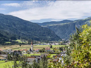
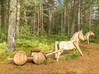
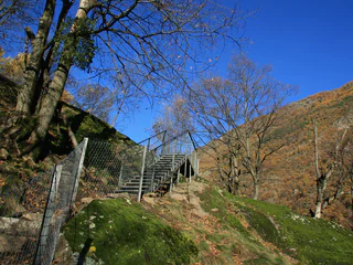
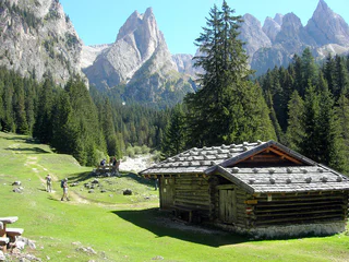
Castel Raubschlössl circular route
Terento/Terenten, Terenten/Terento, Brixen/Bressanone and environs
medium
Difficulty
320 m
Elevation gain
2h:00 min
duration
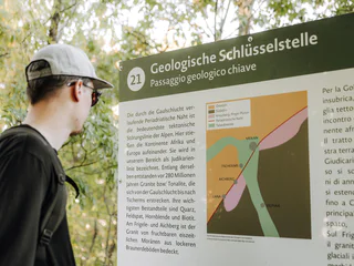
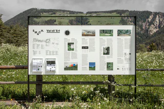
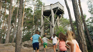
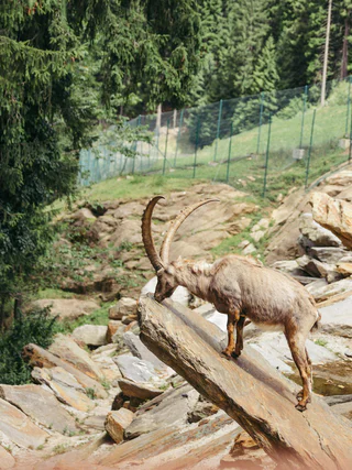
Located throughout South Tyrol’s holiday regions, sign-posted themed hikes are special journeys of discovery for young and old alike. In South Tyrol’s Unterland region, for example, visitors in autumn can experience how grapes go from the vine to the barrel. In San Valentino in Campo/Gummer you can explore the universe and our solar system. and in Terlano/Terlan in spring asparagus farmers demonstrate how the precious shoots are removed from the earth. In total more then 150 sign-posted and informative themed hikes await visitors to South Tyrol.
1/2
Terento/Terenten, Terenten/Terento, Brixen/Bressanone and environs
medium
Difficulty
320 m
Elevation gain
2h:00 min
duration

Tomberg/Montefontana, Kastelbell-Tschars/Castelbello-Ciardes, Vinschgau/Val Venosta
medium
Difficulty
230 m
Elevation gain
2h:45 min
duration
Mazzes/Matzes, Sterzing/Vipiteno, Sterzing/Vipiteno and environs
easy
Difficulty
532 m
Elevation gain
3h:49 min
duration
1/2
Lazfons/Latzfons, Klausen/Chiusa, Brixen/Bressanone and environs
easy
Difficulty
385 m
Elevation gain
2h:34 min
duration
1/5
Cermes/Tscherms, Lana, Meran/Merano and environs
medium
Difficulty
335 m
Elevation gain
1h:26 min
duration
1/8
Longiarù/Campill, San Martin /San Martino, Dolomites Region Kronplatz/Plan de Corones
easy
Difficulty
36 m
Elevation gain
0h:25 min
duration
1/21
Terlano/Terlan, Terlan/Terlano, Bolzano/Bozen and environs
easy
Difficulty
389 m
Elevation gain
2h:25 min
duration
1/3
Castelrotto/Kastelruth, Kastelruth/Castelrotto, Dolomites Region Seiser Alm
easy
Difficulty
44 m
Elevation gain
0h:30 min
duration
1/3
Prissiano/Prissian, Tisens/Tesimo, Meran/Merano and environs
medium
Difficulty
477 m
Elevation gain
3h:01 min
duration
Solda/Sulden, Stilfs/Stelvio, Vinschgau/Val Venosta
easy
Difficulty
424 m
Elevation gain
2h:31 min
duration
1/5
Siusi/Seis, Kastelruth/Castelrotto, Dolomites Region Seiser Alm
easy
Difficulty
152 m
Elevation gain
1h:19 min
duration
Redagno/Radein, Aldein/Aldino
medium
Difficulty
516 m
Elevation gain
2h:32 min
duration
1/3
Juvale/Juval, Kastelbell-Tschars/Castelbello-Ciardes, Vinschgau/Val Venosta
medium
Difficulty
47 m
Elevation gain
1h:30 min
duration
1/4
Nove Case/Neunhäusern, Percha/Perca, Dolomites Region Kronplatz/Plan de Corones
difficult
Difficulty
679 m
Elevation gain
2h:28 min
duration
Radein/Redagno, Aldein/Aldino
difficult
Difficulty
1716 m
Elevation gain
6h:05 min
duration
1/3
Montechiaro/Lichtenberg, Prad am Stilfser Joch/Prato allo Stelvio, Vinschgau/Val Venosta
medium
Difficulty
361 m
Elevation gain
3h:30 min
duration
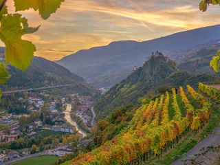
Laghetti/Laag, Neumarkt/Egna, Alto Adige Wine Road
easy
Difficulty
528 m
Elevation gain
2h:38 min
duration
Riscone/Reischach, Bruneck/Brunico, Dolomites Region Kronplatz/Plan de Corones
easy
Difficulty
68 m
Elevation gain
0h:19 min
duration
Alpe di Siusi/Seiseralm, Kastelruth/Castelrotto, Dolomites Region Seiser Alm
medium
Difficulty
301 m
Elevation gain
2h:10 min
duration
1/3
Ponte Gardena/Waidbruck, Waidbruck/Ponte Gardena, Brixen/Bressanone and environs
medium
Difficulty
458 m
Elevation gain
3h:17 min
duration

1/3
San Vigilio, Al Plan/San Vigilio, Dolomites Region Kronplatz/Plan de Corones
easy
Difficulty
325 m
Elevation gain
2h:07 min
duration
Transacqua/Ennewasser, Martell/Martello, Vinschgau/Val Venosta
easy
Difficulty
370 m
Elevation gain
2h:58 min
duration
1/3
Tires/Tiers, Tiers am Rosengarten/Tires al Catinaccio, Dolomites Region Seiser Alm
medium
Difficulty
674 m
Elevation gain
3h:43 min
duration
1/5
Kuens/Caines, Moos in Passeier/Moso in Passiria, Meran/Merano and environs
easy
Difficulty
32 m
Elevation gain
0h:19 min
duration
1/4
Certosa/Karthaus, Schnals/Senales, Vinschgau/Val Venosta
medium
Difficulty
1232 m
Elevation gain
4h:30 min
duration
Montechiaro/Lichtenberg, Prad am Stilfser Joch/Prato allo Stelvio, Vinschgau/Val Venosta
easy
Difficulty
197 m
Elevation gain
0h:52 min
duration
1/5
Vallesina/Versein, Mölten/Meltina, Bolzano/Bozen and environs
easy
Difficulty
390 m
Elevation gain
2h:52 min
duration
1/4
Slingia/Schlinig, Graun im Vinschgau/Curon Venosta, Vinschgau/Val Venosta
easy
Difficulty
380 m
Elevation gain
4h:30 min
duration
1/4
Auna di Sotto/Unterinn, Ritten/Renon, Bolzano/Bozen and environs
medium
Difficulty
152 m
Elevation gain
1h:08 min
duration
1/3
San Cassiano/San Cassiano, Badia, Dolomites Region Alta Badia
medium
Difficulty
544 m
Elevation gain
4h:30 min
duration
Thank you for signing up!
You are already subscribed
Confirm your registration
To complete your subscription, open the email we just sent you and click on the confirmation link.
Can’t find it? Check your spam folder too.
We noticed that you are already subscribed to our Newsletter. We will update you on exclusive offers, fun adventures and more so you can make the best out of your vacation.
We noticed that you already tried to subscribe to our Newsletter in the past but didn’t confirmed the subscription. We have resent you an email now, please check your inbox and spam folder to confirm.


