
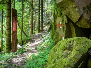
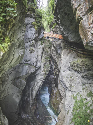
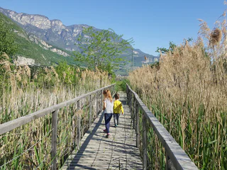
Schnalswaal irrigation channel
Tschars/Ciardes, Kastelbell-Tschars/Castelbello-Ciardes, Vinschgau/Val Venosta
easy
Difficulty
244 m
Elevation gain
3h:00 min
duration
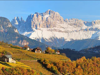
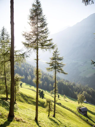
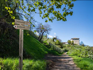
Located throughout South Tyrol’s holiday regions, sign-posted themed hikes are special journeys of discovery for young and old alike. In South Tyrol’s Unterland region, for example, visitors in autumn can experience how grapes go from the vine to the barrel. In San Valentino in Campo/Gummer you can explore the universe and our solar system. and in Terlano/Terlan in spring asparagus farmers demonstrate how the precious shoots are removed from the earth. In total more then 150 sign-posted and informative themed hikes await visitors to South Tyrol.
Tschars/Ciardes, Kastelbell-Tschars/Castelbello-Ciardes, Vinschgau/Val Venosta
easy
Difficulty
244 m
Elevation gain
3h:00 min
duration
S.Valentino /St. Valentin, Graun im Vinschgau/Curon Venosta, Vinschgau/Val Venosta
medium
Difficulty
580 m
Elevation gain
3h:00 min
duration
Freiberg/Montefranco, Kastelbell-Tschars/Castelbello-Ciardes, Vinschgau/Val Venosta
medium
Difficulty
219 m
Elevation gain
2h:00 min
duration
1/3
Nobls/Nobls, Jenesien/San Genesio Atesino, Bolzano/Bozen and environs
medium
Difficulty
396 m
Elevation gain
2h:34 min
duration
1/3
Soprabolzano/Oberbozen, Ritten/Renon, Bolzano/Bozen and environs
medium
Difficulty
707 m
Elevation gain
4h:46 min
duration
1/2
Stanghe/Stange, Ratschings/Racines, Sterzing/Vipiteno and environs
easy
Difficulty
0 m
Elevation gain
1h:30 min
duration
1/13
Collepietra/Steinegg, Karneid/Cornedo all'Isarco, Dolomites Region Eggental
medium
Difficulty
334 m
Elevation gain
3h:27 min
duration
1/2
Issengo/Issing, Kiens/Chienes, Dolomites Region Kronplatz/Plan de Corones
easy
Difficulty
409 m
Elevation gain
3h:01 min
duration

1/3
easy
Difficulty
193 m
Elevation gain
1h:25 min
duration
1/2
Longiarù/Campill, San Martin /San Martino, Dolomites Region Kronplatz/Plan de Corones
easy
Difficulty
64 m
Elevation gain
0h:55 min
duration
1/8
Rio Lagundo/Aschbach, Algund/Lagundo, Meran/Merano and environs
easy
Difficulty
179 m
Elevation gain
1h:19 min
duration
Fontanefredde/Kaltenbrunn, Truden/Trodena
medium
Difficulty
372 m
Elevation gain
2h:51 min
duration
1/2
Gandelle-Franadega-Fienili/Kandellen-Frondeigen-Stadlern, Toblach/Dobbiaco, Dolomites Region 3 Zinnen
easy
Difficulty
61 m
Elevation gain
2h:30 min
duration
Riomolino/Mühlbach - Gais, Gais, Dolomites Region Kronplatz/Plan de Corones
medium
Difficulty
800 m
Elevation gain
5h:30 min
duration
1/5
Magrè s.S.d.V./Margreid a.d.W., Kurtinig an der Weinstraße/Cortina sulla Strada del Vino, Alto Adige Wine Road
easy
Difficulty
0 m
Elevation gain
1h:11 min
duration
Juvale/Juval, Kastelbell-Tschars/Castelbello-Ciardes, Vinschgau/Val Venosta
medium
Difficulty
256 m
Elevation gain
1h:43 min
duration
Stelvio/Stilfs, Stilfs/Stelvio, Vinschgau/Val Venosta
medium
Difficulty
682 m
Elevation gain
4h:15 min
duration
S. Martino/St. Martin - Casies/Gsies, Gsies/Valle di Casies
easy
Difficulty
256 m
Elevation gain
2h:30 min
duration
1/5
Plata/Platt, Moos in Passeier/Moso in Passiria, Meran/Merano and environs
easy
Difficulty
355 m
Elevation gain
1h:42 min
duration
1/2
Prissiano/Prissian, Tisens/Tesimo, Meran/Merano and environs
medium
Difficulty
377 m
Elevation gain
2h:22 min
duration
1/36
Rablà/Rabland, Algund/Lagundo, Meran/Merano and environs
easy
Difficulty
83 m
Elevation gain
1h:07 min
duration
Piavenna/Plawenn, Graun im Vinschgau/Curon Venosta, Vinschgau/Val Venosta
medium
Difficulty
287 m
Elevation gain
3h:04 min
duration
Vallesina/Versein, Mölten/Meltina, Bolzano/Bozen and environs
medium
Difficulty
677 m
Elevation gain
4h:43 min
duration

1/6
Plose/Plose, Brixen/Bressanone, Brixen/Bressanone and environs
easy
Difficulty
674 m
Elevation gain
2h:52 min
duration
1/5
Ortisei/Urtijëi/St. Ulrich/Urtijëi, Kastelruth/Castelrotto, Dolomites Region Seiser Alm
medium
Difficulty
330 m
Elevation gain
1h:30 min
duration
Quadrato/Quadrat, Partschins/Parcines, Meran/Merano and environs
easy
Difficulty
111 m
Elevation gain
2h:25 min
duration
1/3
San Pancrazio/St. Pankraz, St.Pankraz/San Pancrazio, Meran/Merano and environs
easy
Difficulty
265 m
Elevation gain
1h:57 min
duration
Redagno/Radein, Aldein/Aldino
difficult
Difficulty
892 m
Elevation gain
4h:43 min
duration
1/4
Laives/Leifers, Bolzano/Bozen and environs
difficult
Difficulty
1314 m
Elevation gain
4h:25 min
duration
1/6
Prissiano/Prissian, Tisens/Tesimo, Meran/Merano and environs
easy
Difficulty
86 m
Elevation gain
0h:43 min
duration
Thank you for signing up!
You are already subscribed
Confirm your registration
To complete your subscription, open the email we just sent you and click on the confirmation link.
Can’t find it? Check your spam folder too.
We noticed that you are already subscribed to our Newsletter. We will update you on exclusive offers, fun adventures and more so you can make the best out of your vacation.
We noticed that you already tried to subscribe to our Newsletter in the past but didn’t confirmed the subscription. We have resent you an email now, please check your inbox and spam folder to confirm.


