
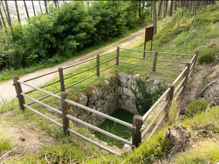
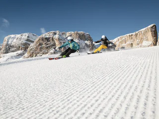
Source of the river Drava
Prato alla Drava/Winnebach, Toblach/Dobbiaco, Dolomites Region 3 Zinnen
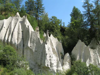
Le Sud-Tyrol est remarquablement riche en contes et légendes qui se rapportent à des lieux mystérieux et à des paysages inhabituels. Des lieux mystiques comme les bancs des sorcières sur l'Alpe de Siusi racontent des histoires de sorcières et de rois, des lieux de force comme les Stoanernen Mandln avec leurs plus de cent formations de pierre ou les anciennes ruines sur la colline de Castelfeder invitent à se ressourcer. Des paysages uniques comme les pyramides de terre sont des buts de randonnées qui valent la peine.
Prato alla Drava/Winnebach, Toblach/Dobbiaco, Dolomites Region 3 Zinnen
Brunico città/Bruneck Stadt, Bruneck/Brunico, Dolomites Region Kronplatz/Plan de Corones
Auna di Sotto/Unterinn, Ritten/Renon, Bolzano/Bozen and environs
1/3
Sciaves/Schabs, Natz-Schabs/Naz-Sciaves, Brixen/Bressanone and environs
1/2
Tiso/Teis, Villnöss/Funes, Dolomites Region Lüsen Villnöss
Alpe di Siusi/Seiseralm, Kastelruth/Castelrotto, Dolomites Region Seiser Alm
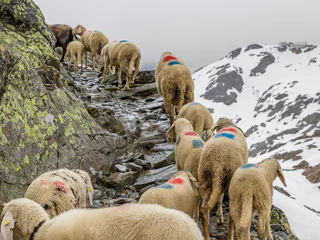
Santa Valburga/St. Walburg, Ulten/Ultimo, Meran/Merano and environs
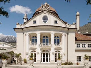
Merano/Meran, Meran/Merano, Meran/Merano and environs
1/2
S. Genesio Atesino/Jenesien, Jenesien/San Genesio Atesino, Bolzano/Bozen and environs
Anterivo/Altrei
Prissian/Prissiano, Tisens/Tesimo, Meran/Merano and environs
S. Pietro/St. Peter - Funes/Villnöss, Villnöss/Funes, Dolomites Region Lüsen Villnöss
1/8
Parcines/Partschins, Partschins/Parcines, Meran/Merano and environs
1/3
Corvara/Corvara, Corvara, Dolomites Region Alta Badia
1/3
Merano/Meran, Meran/Merano, Meran/Merano and environs
1/5
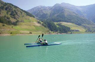
Vernago/Vernagt, Schnals/Senales, Vinschgau/Val Venosta
1/3
Vernago/Vernagt, Schnals/Senales, Vinschgau/Val Venosta
1/2
Verano/Vöran, Vöran/Verano, Meran/Merano and environs
1/3
Merano/Meran, Meran/Merano, Meran/Merano and environs
1/9
S.Cristina Gherdëina/S.Cristina Val Gardena/S.Cristina Gherdëina/St.Christina in Gröden, S.Crestina Gherdëina/Santa Cristina Val Gardana, Dolomites Region Val Gardena
1/10
Selva/Sëlva/Wolkenstein/Sëlva, Sëlva/Selva di Val Gardena, Dolomites Region Val Gardena
1/5
Terento/Terenten, Terenten/Terento, Brixen/Bressanone and environs
1/2
Siusi/Seis, Kastelruth/Castelrotto, Dolomites Region Seiser Alm
1/2
Carezza/Karersee, Welschnofen/Nova Levante, Dolomites Region Eggental
1/4
S.Cristina Gherdëina/S.Cristina Val Gardena/S.Cristina Gherdëina/St.Christina in Gröden, S.Crestina Gherdëina/Santa Cristina Val Gardana, Dolomites Region Val Gardena
La Villa/La Villa, Badia, Dolomites Region Alta Badia
S.Martino/Reinswald, Villanders/Villandro, Brixen/Bressanone and environs
Terento/Terenten, Terenten/Terento, Brixen/Bressanone and environs
1/3
Giovignano/Tschiffnon, Feldthurns/Velturno, Brixen/Bressanone and environs

1/3
Carezza/Karersee, Welschnofen/Nova Levante, Dolomites Region Eggental


