
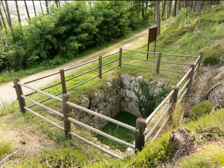
Source of the river Drava
Prato alla Drava/Winnebach, Toblach/Dobbiaco, Dolomites Region 3 Zinnen
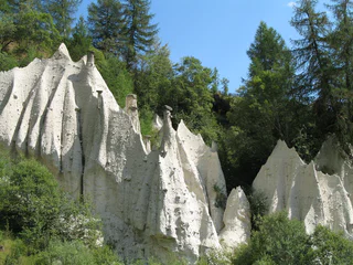
Jižní Tyrolsko je obzvláště bohaté na příběhy, které se vinou kolem tajných míst a neobvyklých přírodních útvarů. Památky, jako jsou čarodějnické lavice na Alpe di Siusi/Seiser Alm, vyprávějí příběhy o čarodějnicích a králích, zatímco místa síly, jako je "Stoanerne Mandln" s více než stovkou cairnů nebo starobylé zříceniny na kopci Castelfeder, vybízejí návštěvníky k odpočinku a hlubokému nádechu. Jedinečné přírodní útvary, jako jsou zemní pyramidy, jsou místa, která stojí za procházku a prozkoumání.
Prato alla Drava/Winnebach, Toblach/Dobbiaco, Dolomites Region 3 Zinnen
Brunico città/Bruneck Stadt, Bruneck/Brunico, Dolomites Region Kronplatz/Plan de Corones
Auna di Sotto/Unterinn, Ritten/Renon, Bolzano/Bozen and environs
1/3
Sciaves/Schabs, Natz-Schabs/Naz-Sciaves, Brixen/Bressanone and environs
1/2
Tiso/Teis, Villnöss/Funes, Dolomites Region Lüsen Villnöss
Alpe di Siusi/Seiseralm, Kastelruth/Castelrotto, Dolomites Region Seiser Alm
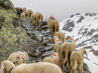
Santa Valburga/St. Walburg, Ulten/Ultimo, Meran/Merano and environs
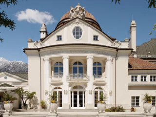
Merano/Meran, Meran/Merano, Meran/Merano and environs
1/2
S. Genesio Atesino/Jenesien, Jenesien/San Genesio Atesino, Bolzano/Bozen and environs
Anterivo/Altrei
Prissian/Prissiano, Tisens/Tesimo, Meran/Merano and environs
S. Pietro/St. Peter - Funes/Villnöss, Villnöss/Funes, Dolomites Region Lüsen Villnöss
1/8
Parcines/Partschins, Partschins/Parcines, Meran/Merano and environs
1/3
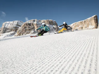
Corvara/Corvara, Corvara, Dolomites Region Alta Badia
1/3
Merano/Meran, Meran/Merano, Meran/Merano and environs
1/5
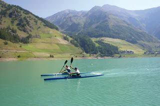
Vernago/Vernagt, Schnals/Senales, Vinschgau/Val Venosta
1/3
Vernago/Vernagt, Schnals/Senales, Vinschgau/Val Venosta
1/2
Verano/Vöran, Vöran/Verano, Meran/Merano and environs
1/3
Merano/Meran, Meran/Merano, Meran/Merano and environs
1/9
S.Cristina Gherdëina/S.Cristina Val Gardena/S.Cristina Gherdëina/St.Christina in Gröden, S.Crestina Gherdëina/Santa Cristina Val Gardana, Dolomites Region Val Gardena
1/10
Selva/Sëlva/Wolkenstein/Sëlva, Sëlva/Selva di Val Gardena, Dolomites Region Val Gardena
1/5
Terento/Terenten, Terenten/Terento, Brixen/Bressanone and environs
1/2
Siusi/Seis, Kastelruth/Castelrotto, Dolomites Region Seiser Alm
1/2
Carezza/Karersee, Welschnofen/Nova Levante, Dolomites Region Eggental
1/4
S.Cristina Gherdëina/S.Cristina Val Gardena/S.Cristina Gherdëina/St.Christina in Gröden, S.Crestina Gherdëina/Santa Cristina Val Gardana, Dolomites Region Val Gardena
La Villa/La Villa, Badia, Dolomites Region Alta Badia
S.Martino/Reinswald, Villanders/Villandro, Brixen/Bressanone and environs
Terento/Terenten, Terenten/Terento, Brixen/Bressanone and environs
1/3
Giovignano/Tschiffnon, Feldthurns/Velturno, Brixen/Bressanone and environs

1/3
Carezza/Karersee, Welschnofen/Nova Levante, Dolomites Region Eggental


