
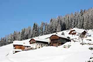
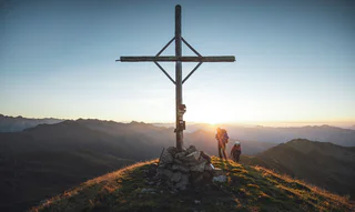
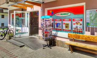
Horse-drawn sleigh rides
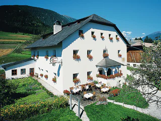
San Vigilio, Al Plan/San Vigilio, Dolomites Region Kronplatz/Plan de Corones
| Kronplatz vous invite à explorer ses trésors naturels et culturels. Que vous soyez amateur de sports d'hiver ou de détente, cette région a tout pour plaire. |
San Vigilio, Al Plan/San Vigilio, Dolomites Region Kronplatz/Plan de Corones
San Vigilio, Al Plan/San Vigilio, Dolomites Region Kronplatz/Plan de Corones
medium
Difficulté
722 m
Gain d'altitude
17.3 Km
distance
Plata/Platten - Falzes/Pfalzen, Pfalzen/Falzes, Dolomites Region Kronplatz/Plan de Corones
medium
Difficulté
360 m
Gain d'altitude
1h:30 min
durée
Issengo/Issing, Pfalzen/Falzes, Dolomites Region Kronplatz/Plan de Corones
1/7
Brunico città/Bruneck Stadt, Bruneck/Brunico, Dolomites Region Kronplatz/Plan de Corones
1/4
Nove Case/Neunhäusern, Percha/Perca, Dolomites Region Kronplatz/Plan de Corones
difficult
Difficulté
319 m
Gain d'altitude
1h:19 min
durée
Gais/Gais, Gais, Dolomites Region Kronplatz/Plan de Corones
Rasun di Sopra/Oberrasen, Rasen-Antholz/Rasun Anterselva, Dolomites Region Kronplatz/Plan de Corones
easy
Difficulté
231 m
Gain d'altitude
2h:27 min
durée
St. Lorenzen/S. Lorenzo di Sebato, St.Lorenzen/San Lorenzo di Sebato, Dolomites Region Kronplatz/Plan de Corones
San Vigilio, Al Plan/San Vigilio, Dolomites Region Kronplatz/Plan de Corones
easy
Difficulté
0 m
Gain d'altitude
0h:03 min
durée
1/3
Sorafurcia/Geiselsberg, Olang/Valdaora, Dolomites Region Kronplatz/Plan de Corones
medium
Difficulté
711 m
Gain d'altitude
6.6 Km
distance
1/2
Pieve di Marebbe/Enneberg Pfarre, Al Plan/San Vigilio, Dolomites Region Kronplatz/Plan de Corones
1/9
Rasun di Sotto/Niederrasen, Rasen-Antholz/Rasun Anterselva, Dolomites Region Kronplatz/Plan de Corones
Sopranessano/Aschbach, Percha/Perca, Dolomites Region Kronplatz/Plan de Corones
easy
Difficulté
243 m
Gain d'altitude
1h:00 min
durée
1/2
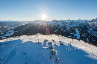
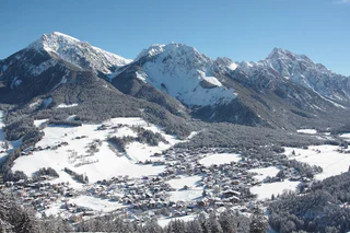
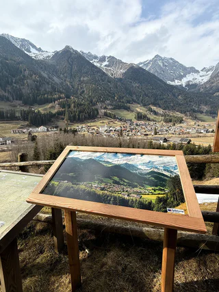
Dolomites Region Kronplatz/Plan de Corones
120 km
pente totale
32
randonnées
2,275 m
Point le plus haut :
1/2
Valdaora di Sopra/Oberolang, Olang/Valdaora, Dolomites Region Kronplatz/Plan de Corones
1/3
San Vigilio, Al Plan/San Vigilio, Dolomites Region Kronplatz/Plan de Corones
easy
Difficulté
253 m
Gain d'altitude
1h:58 min
durée
Riscone/Reischach, Al Plan/San Vigilio, Dolomites Region Kronplatz/Plan de Corones
easy
Difficulté
0 m
Gain d'altitude
0h:03 min
durée
1/2
San Vigilio, Al Plan/San Vigilio, Dolomites Region Kronplatz/Plan de Corones
easy
Difficulté
128 m
Gain d'altitude
0h:55 min
durée
Vila di Sopra/Oberwielenbach, Percha/Perca, Dolomites Region Kronplatz/Plan de Corones
San Vigilio, Al Plan/San Vigilio, Dolomites Region Kronplatz/Plan de Corones
Valdaora di Mezzo/Mitterolang, Olang/Valdaora, Dolomites Region Kronplatz/Plan de Corones
difficult
Difficulté
1034 m
Gain d'altitude
4h:05 min
durée
1/2
Brunico città/Bruneck Stadt, Bruneck/Brunico, Dolomites Region Kronplatz/Plan de Corones
1/5
Nove Case/Neunhäusern, Rasen-Antholz/Rasun Anterselva, Dolomites Region Kronplatz/Plan de Corones
difficult
Difficulté
1583 m
Gain d'altitude
5h:05 min
durée
Antermoia/Untermoj, San Martin /San Martino, Dolomites Region Kronplatz/Plan de Corones
Anterselva di Sotto/Antholz-Niedertal, Rasen-Antholz/Rasun Anterselva, Dolomites Region Kronplatz/Plan de Corones
1/5
Niederrasen/Rasun di Sotto, Rasen-Antholz/Rasun Anterselva, Dolomites Region Kronplatz/Plan de Corones
easy
Difficulté
108 m
Gain d'altitude
0h:25 min
durée
1/7
Anterselva di Mezzo/Antholz-Mittertal, Rasen-Antholz/Rasun Anterselva, Dolomites Region Kronplatz/Plan de Corones
Brunico città/Bruneck Stadt, Bruneck/Brunico, Dolomites Region Kronplatz/Plan de Corones
1/5
San Vigilio, Al Plan/San Vigilio, Dolomites Region Kronplatz/Plan de Corones


