
Fountain at the far end of Lake Antholz
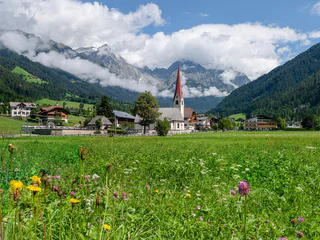
Antholz-Obertal/Anterselva di Sopra, Rasen-Antholz/Rasun Anterselva, Dolomites Region Kronplatz/Plan de Corones
Antholz-Obertal/Anterselva di Sopra, Rasen-Antholz/Rasun Anterselva, Dolomites Region Kronplatz/Plan de Corones
Selva die Molini/Mühlwald, Pfalzen/Falzes, Dolomites Region Kronplatz/Plan de Corones
easy
Difficulty
839 m
Elevation gain
4h:30 min
duration
Pieve di Marebbe/Enneberg Pfarre, Al Plan/San Vigilio, Dolomites Region Kronplatz/Plan de Corones
Anterselva di Mezzo/Antholz-Mittertal, Rasen-Antholz/Rasun Anterselva, Dolomites Region Kronplatz/Plan de Corones
medium
Difficulty
347 m
Elevation gain
1h:40 min
duration
Issengo/Issing, Pfalzen/Falzes, Dolomites Region Kronplatz/Plan de Corones

1/4
St. Lorenzen/S. Lorenzo di Sebato, St.Lorenzen/San Lorenzo di Sebato, Dolomites Region Kronplatz/Plan de Corones
1/9
Nove Case/Neunhäusern, Rasen-Antholz/Rasun Anterselva, Dolomites Region Kronplatz/Plan de Corones
easy
Difficulty
42 m
Elevation gain
2h:19 min
duration
Antholz-Niedertal/Anterselva di Sotto, Rasen-Antholz/Rasun Anterselva, Dolomites Region Kronplatz/Plan de Corones
San Vigilio, Al Plan/San Vigilio, Dolomites Region Kronplatz/Plan de Corones
1/13
Casteldarne/Ehrenburg, Kiens/Chienes, Dolomites Region Kronplatz/Plan de Corones
La Val/La Val, Al Plan/San Vigilio, Dolomites Region Kronplatz/Plan de Corones

1/2
Riscone/Reischach, Bruneck/Brunico, Dolomites Region Kronplatz/Plan de Corones
St. Lorenzen/S. Lorenzo di Sebato, St.Lorenzen/San Lorenzo di Sebato, Dolomites Region Kronplatz/Plan de Corones
Valdaora di Sopra/Oberolang, Olang/Valdaora, Dolomites Region Kronplatz/Plan de Corones
Anterselva di Sopra/Antholz-Obertal, Rasen-Antholz/Rasun Anterselva, Dolomites Region Kronplatz/Plan de Corones
difficult
Difficulty
87 m
Elevation gain
0h:00 min
duration
Luson/Lüsen, Al Plan/San Vigilio, Dolomites Region Kronplatz/Plan de Corones
medium
Difficulty
671 m
Elevation gain
2h:19 min
duration
Riscone/Reischach, Bruneck/Brunico, Dolomites Region Kronplatz/Plan de Corones
easy
Difficulty
9 m
Elevation gain
0h:12 min
duration
Anterselva di Sopra/Antholz-Obertal, Rasen-Antholz/Rasun Anterselva, Dolomites Region Kronplatz/Plan de Corones
difficult
Difficulty
0 m
Elevation gain
0h:00 min
duration
1/5
Valdaora di Sopra/Oberolang, Olang/Valdaora, Dolomites Region Kronplatz/Plan de Corones
1/5
Nove Case/Neunhäusern, Rasen-Antholz/Rasun Anterselva, Dolomites Region Kronplatz/Plan de Corones
medium
Difficulty
343 m
Elevation gain
1h:15 min
duration
Anterselva di Sopra/Antholz-Obertal, Rasen-Antholz/Rasun Anterselva, Dolomites Region Kronplatz/Plan de Corones
Sorafurcia/Geiselsberg, Olang/Valdaora, Dolomites Region Kronplatz/Plan de Corones
medium
Difficulty
512 m
Elevation gain
1h:38 min
duration
1/17
Riscone/Reischach, Bruneck/Brunico, Dolomites Region Kronplatz/Plan de Corones
Valdaora di Sopra/Oberolang, Olang/Valdaora, Dolomites Region Kronplatz/Plan de Corones
1/5
Sorafurcia/Geiselsberg, Olang/Valdaora, Dolomites Region Kronplatz/Plan de Corones
1/4
Valdaora di Sopra/Oberolang, Olang/Valdaora, Dolomites Region Kronplatz/Plan de Corones
1/2
San Vigilio, Al Plan/San Vigilio, Dolomites Region Kronplatz/Plan de Corones
easy
Difficulty
352 m
Elevation gain
6h:30 min
duration
1/3
Anterselva di Sotto/Antholz-Niedertal, Rasen-Antholz/Rasun Anterselva, Dolomites Region Kronplatz/Plan de Corones
Mitterolang/Valdaora di Mezzo, Olang/Valdaora, Dolomites Region Kronplatz/Plan de Corones
easy
Difficulty
45 m
Elevation gain
0h:43 min
duration
1/2
San Vigilio, Al Plan/San Vigilio, Dolomites Region Kronplatz/Plan de Corones
Thank you for signing up!
Your subscription is already active
Confirm your registration
To complete your subscription, open the email we just sent you and click on the confirmation link.
Can’t find it? Check your spam folder too.
We noticed that you tried to subscribe to the newsletter, but your email address is already registered. You will continue to receive our offers, tips and inspiration for your holiday.
We noticed that you already tried to subscribe to our Newsletter in the past but didn’t confirmed the subscription. We have resent you an email now, please check your inbox and spam folder to confirm.


