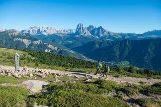
1/4
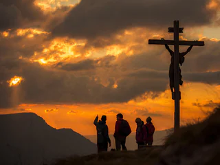
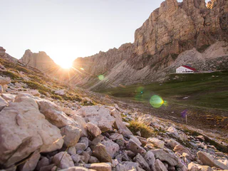
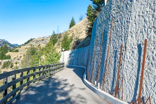
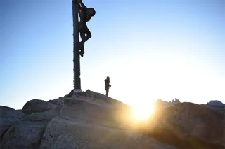
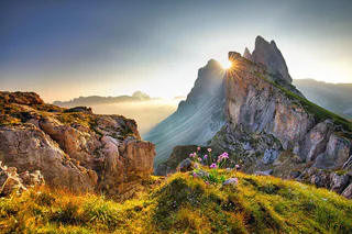
Sunset hike "Burning Dolomites" from the panorama terrace Sëurasas
S. Giacomo/St. Jakob - Ortisei/St.Ulrich, S.Crestina Gherdëina/Santa Cristina Val Gardana, Dolomites Region Val Gardena
medium
Difficulté
394 m
Gain d'altitude
1h:46 min
durée
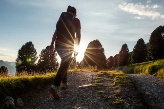
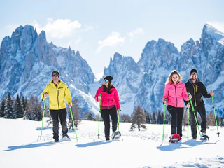
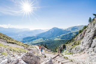
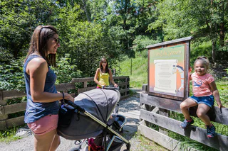
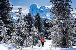
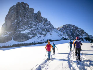
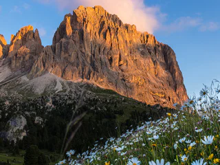
Le paysage est un cadeau dont tu peux profiter au mieux à pied. Au printemps dans le Sud-Tyrol, tu assistes au réveil de la nature dans la vallée et dans les prairies alpines en fleurs, tandis qu'en plein été, tu es attiré par les sommets aériens, les refuges recommandés et les randonnées en altitude. Les randonnées d'automne offrent une vue grandiose et des couleurs magnifiques. En hiver, la nature enneigée t'enveloppe lors de randonnées romantiques en raquettes et en hiver.
1/4
S. Giacomo/St. Jakob - Ortisei/St.Ulrich, S.Crestina Gherdëina/Santa Cristina Val Gardana, Dolomites Region Val Gardena
medium
Difficulté
394 m
Gain d'altitude
1h:46 min
durée

Selva/Sëlva/Wolkenstein/Sëlva, Sëlva/Selva di Val Gardena, Dolomites Region Val Gardena
easy
Difficulté
21 m
Gain d'altitude
0h:31 min
durée
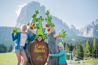
1/4
S. Giacomo/St. Jakob - Ortisei/St.Ulrich, Urtijëi/Ortisei, Dolomites Region Val Gardena
medium
Difficulté
903 m
Gain d'altitude
2h:53 min
durée
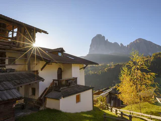
1/4
Ortisei/Urtijëi/St. Ulrich/Urtijëi, Urtijëi/Ortisei, Dolomites Region Val Gardena
medium
Difficulté
0 m
Gain d'altitude
0h:49 min
durée

1/5
Ortisei/Urtijëi/St. Ulrich/Urtijëi, Urtijëi/Ortisei, Dolomites Region Val Gardena
easy
Difficulté
100 m
Gain d'altitude
1h:00 min
durée
Selva/Sëlva/Wolkenstein/Sëlva, Sëlva/Selva di Val Gardena, Dolomites Region Val Gardena
medium
Difficulté
820 m
Gain d'altitude
3h:43 min
durée
1/2
Ortisei/Urtijëi/St. Ulrich/Urtijëi, Urtijëi/Ortisei, Dolomites Region Val Gardena
easy
Difficulté
101 m
Gain d'altitude
0h:39 min
durée
1/11
S.Cristina Gherdëina/S.Cristina Val Gardena/S.Cristina Gherdëina/St.Christina in Gröden, S.Crestina Gherdëina/Santa Cristina Val Gardana, Dolomites Region Val Gardena
medium
Difficulté
647 m
Gain d'altitude
4h:00 min
durée
1/3
St. Ulrich/Urtijëi/Ortisei/Urtijëi, Urtijëi/Ortisei, Dolomites Region Val Gardena
medium
Difficulté
12 m
Gain d'altitude
0h:10 min
durée
1/5
Alpe di Siusi/Seiseralm, Urtijëi/Ortisei, Dolomites Region Val Gardena
medium
Difficulté
426 m
Gain d'altitude
5h:30 min
durée
1/12
Selva/Sëlva/Wolkenstein/Sëlva, Sëlva/Selva di Val Gardena, Dolomites Region Val Gardena
medium
Difficulté
922 m
Gain d'altitude
3h:40 min
durée
1/3
Ortisei/Urtijëi/St. Ulrich/Urtijëi, Urtijëi/Ortisei, Dolomites Region Val Gardena
easy
Difficulté
61 m
Gain d'altitude
2h:31 min
durée
1/11
S.Cristina Gherdëina/S.Cristina Val Gardena/S.Cristina Gherdëina/St.Christina in Gröden, S.Crestina Gherdëina/Santa Cristina Val Gardana, Dolomites Region Val Gardena
easy
Difficulté
359 m
Gain d'altitude
2h:17 min
durée
Selva/Sëlva/Wolkenstein/Sëlva, Sëlva/Selva di Val Gardena, Dolomites Region Val Gardena
easy
Difficulté
0 m
Gain d'altitude
2h:00 min
durée
1/11
St. Jakob/S. Giacomo - St.Ulrich/Ortisei, Urtijëi/Ortisei, Dolomites Region Val Gardena
difficult
Difficulté
1183 m
Gain d'altitude
4h:58 min
durée
1/3
Ortisei/Urtijëi/St. Ulrich/Urtijëi, Urtijëi/Ortisei, Dolomites Region Val Gardena
easy
Difficulté
100 m
Gain d'altitude
0h:25 min
durée
1/24
S.Cristina Gherdëina/S.Cristina Val Gardena/S.Cristina Gherdëina/St.Christina in Gröden, S.Crestina Gherdëina/Santa Cristina Val Gardana, Dolomites Region Val Gardena
easy
Difficulté
64 m
Gain d'altitude
0h:45 min
durée
1/7
Ortisei/Urtijëi/St. Ulrich/Urtijëi, Urtijëi/Ortisei, Dolomites Region Val Gardena
easy
Difficulté
355 m
Gain d'altitude
3h:40 min
durée
1/4
S. Pietro/St. Peter - Laion/Lajen, Urtijëi/Ortisei, Dolomites Region Val Gardena
medium
Difficulté
488 m
Gain d'altitude
1h:49 min
durée
Ortisei/Urtijëi/St. Ulrich/Urtijëi, Urtijëi/Ortisei, Dolomites Region Val Gardena
difficult
Difficulté
2327 m
Gain d'altitude
8h:43 min
durée
Selva/Sëlva/Wolkenstein/Sëlva, Sëlva/Selva di Val Gardena, Dolomites Region Val Gardena
easy
Difficulté
0 m
Gain d'altitude
1h:00 min
durée
1/8
S.Cristina Gherdëina/S.Cristina Val Gardena/S.Cristina Gherdëina/St.Christina in Gröden, S.Crestina Gherdëina/Santa Cristina Val Gardana, Dolomites Region Val Gardena
medium
Difficulté
450 m
Gain d'altitude
2h:25 min
durée
1/2
Ortisei/Urtijëi/St. Ulrich/Urtijëi, Urtijëi/Ortisei, Dolomites Region Val Gardena
medium
Difficulté
543 m
Gain d'altitude
4h:04 min
durée
1/5
St. Ulrich/Urtijëi/Ortisei/Urtijëi, Urtijëi/Ortisei, Dolomites Region Val Gardena
difficult
Difficulté
1396 m
Gain d'altitude
4h:37 min
durée
1/7
Sëlva/Selva di Val Gardena, S.Crestina Gherdëina/Santa Cristina Val Gardana, Dolomites Region Val Gardena
medium
Difficulté
432 m
Gain d'altitude
1h:30 min
durée
1/6
St. Ulrich/Urtijëi/Ortisei/Urtijëi, Urtijëi/Ortisei, Dolomites Region Val Gardena
difficult
Difficulté
320 m
Gain d'altitude
3h:22 min
durée
1/16
S.Cristina Gherdëina/S.Cristina Val Gardena/S.Cristina Gherdëina/St.Christina in Gröden, S.Crestina Gherdëina/Santa Cristina Val Gardana, Dolomites Region Val Gardena
medium
Difficulté
419 m
Gain d'altitude
1h:30 min
durée
1/2
Ortisei/Urtijëi/St. Ulrich/Urtijëi, Urtijëi/Ortisei, Dolomites Region Val Gardena
medium
Difficulté
1113 m
Gain d'altitude
6h:00 min
durée
1/5
Selva/Sëlva/Wolkenstein/Sëlva, Sëlva/Selva di Val Gardena, Dolomites Region Val Gardena
medium
Difficulté
878 m
Gain d'altitude
3h:37 min
durée
Selva/Sëlva/Wolkenstein/Sëlva, Sëlva/Selva di Val Gardena, Dolomites Region Val Gardena
difficult
Difficulté
0 m
Gain d'altitude
5h:00 min
durée


