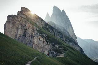
1/5
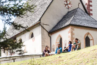
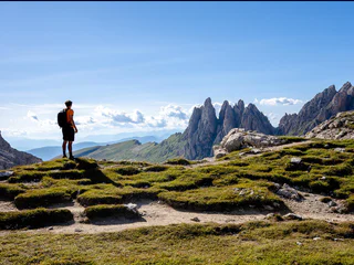
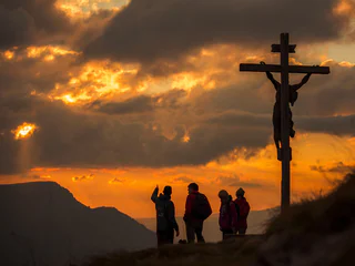
St. Jacobs church hike
Ortisei/Urtijëi/St. Ulrich/Urtijëi, Urtijëi/Ortisei, Dolomites Region Val Gardena
medium
Poziom trudności
330 m
Wzlot
2h:00 min
czas trwania
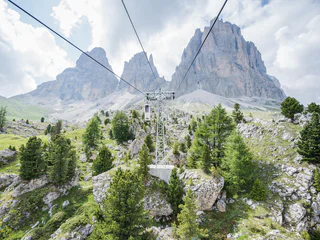
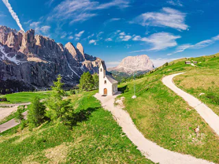
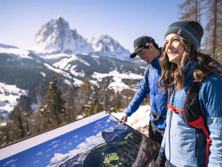
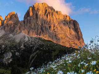
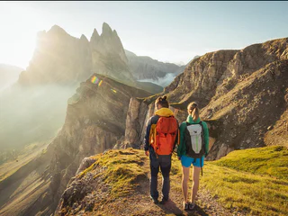
| Przeżyj niezapomniane przygody podczas wędrówek w Dolomitach Gröden. Region ten oferuje liczne szlaki piesze, które zachwycają pięknem przyrody i bogactwem krajobrazów. |
1/5
Ortisei/Urtijëi/St. Ulrich/Urtijëi, Urtijëi/Ortisei, Dolomites Region Val Gardena
medium
Poziom trudności
330 m
Wzlot
2h:00 min
czas trwania
1/5
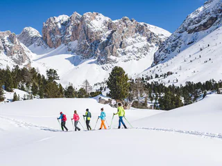
S.Cristina Gherdëina/S.Cristina Val Gardena/S.Cristina Gherdëina/St.Christina in Gröden, S.Crestina Gherdëina/Santa Cristina Val Gardana, Dolomites Region Val Gardena
difficult
Poziom trudności
842 m
Wzlot
5h:25 min
czas trwania
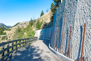
1/3
Pescosta/Pescosta, Sëlva/Selva di Val Gardena, Dolomites Region Val Gardena
medium
Poziom trudności
611 m
Wzlot
3h:28 min
czas trwania

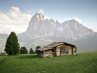
Selva/Sëlva/Wolkenstein/Sëlva, Sëlva/Selva di Val Gardena, Dolomites Region Val Gardena
easy
Poziom trudności
0 m
Wzlot
2h:30 min
czas trwania
1/16
Selva/Sëlva/Wolkenstein/Sëlva, S.Crestina Gherdëina/Santa Cristina Val Gardana, Dolomites Region Val Gardena
medium
Poziom trudności
80 m
Wzlot
1h:10 min
czas trwania
S.Cristina Gherdëina/S.Cristina Val Gardena/S.Cristina Gherdëina/St.Christina in Gröden, Sëlva/Selva di Val Gardena, Dolomites Region Val Gardena
easy
Poziom trudności
0 m
Wzlot
0h:16 min
czas trwania
1/3
St. Ulrich/Urtijëi/Ortisei/Urtijëi, Urtijëi/Ortisei, Dolomites Region Val Gardena
medium
Poziom trudności
147 m
Wzlot
1h:16 min
czas trwania
1/5
S.Cristina Gherdëina/S.Cristina Val Gardena/S.Cristina Gherdëina/St.Christina in Gröden, Urtijëi/Ortisei, Dolomites Region Val Gardena
difficult
Poziom trudności
4889 m
Wzlot
10h:00 min
czas trwania
1/2
Ortisei/Urtijëi/St. Ulrich/Urtijëi, Urtijëi/Ortisei, Dolomites Region Val Gardena
medium
Poziom trudności
543 m
Wzlot
4h:04 min
czas trwania
1/3
Ortisei/Urtijëi/St. Ulrich/Urtijëi, Urtijëi/Ortisei, Dolomites Region Val Gardena
medium
Poziom trudności
46 m
Wzlot
2h:31 min
czas trwania
1/13
S.Cristina Gherdëina/St.Christina in Gröden/S.Cristina Gherdëina/S.Cristina Val Gardena, S.Crestina Gherdëina/Santa Cristina Val Gardana, Dolomites Region Val Gardena
difficult
Poziom trudności
1045 m
Wzlot
5h:10 min
czas trwania
1/4
Selva/Sëlva/Wolkenstein/Sëlva, Urtijëi/Ortisei, Dolomites Region Val Gardena
medium
Poziom trudności
1101 m
Wzlot
4h:28 min
czas trwania

1/12
S.Cristina Gherdëina/S.Cristina Val Gardena/S.Cristina Gherdëina/St.Christina in Gröden, S.Crestina Gherdëina/Santa Cristina Val Gardana, Dolomites Region Val Gardena
easy
Poziom trudności
286 m
Wzlot
1h:37 min
czas trwania
Selva/Sëlva/Wolkenstein/Sëlva, Sëlva/Selva di Val Gardena, Dolomites Region Val Gardena
easy
Poziom trudności
21 m
Wzlot
0h:31 min
czas trwania
Selva/Sëlva/Wolkenstein/Sëlva, Sëlva/Selva di Val Gardena, Dolomites Region Val Gardena
medium
Poziom trudności
231 m
Wzlot
1h:31 min
czas trwania
1/14
S.Cristina Gherdëina/S.Cristina Val Gardena/S.Cristina Gherdëina/St.Christina in Gröden, S.Crestina Gherdëina/Santa Cristina Val Gardana, Dolomites Region Val Gardena
medium
Poziom trudności
207 m
Wzlot
2h:00 min
czas trwania
Selva/Sëlva/Wolkenstein/Sëlva, Urtijëi/Ortisei, Dolomites Region Val Gardena
easy
Poziom trudności
61 m
Wzlot
2h:31 min
czas trwania
1/6
S.Cristina Gherdëina/S.Cristina Val Gardena/S.Cristina Gherdëina/St.Christina in Gröden, S.Crestina Gherdëina/Santa Cristina Val Gardana, Dolomites Region Val Gardena
easy
Poziom trudności
350 m
Wzlot
2h:40 min
czas trwania
1/4
S. Giacomo/St. Jakob - Ortisei/St.Ulrich, S.Crestina Gherdëina/Santa Cristina Val Gardana, Dolomites Region Val Gardena
medium
Poziom trudności
394 m
Wzlot
1h:46 min
czas trwania
1/16
Selva/Sëlva/Wolkenstein/Sëlva, S.Crestina Gherdëina/Santa Cristina Val Gardana, Dolomites Region Val Gardena
medium
Poziom trudności
207 m
Wzlot
2h:00 min
czas trwania
1/3
Ortisei/Urtijëi/St. Ulrich/Urtijëi, Urtijëi/Ortisei, Dolomites Region Val Gardena
easy
Poziom trudności
61 m
Wzlot
2h:31 min
czas trwania
1/6
Sëlva/Selva di Val Gardena, S.Crestina Gherdëina/Santa Cristina Val Gardana, Dolomites Region Val Gardena
medium
Poziom trudności
865 m
Wzlot
2h:57 min
czas trwania
1/8
Selva/Sëlva/Wolkenstein/Sëlva, S.Crestina Gherdëina/Santa Cristina Val Gardana, Dolomites Region Val Gardena
medium
Poziom trudności
400 m
Wzlot
3h:00 min
czas trwania
1/3
S.Cristina Gherdëina/S.Cristina Val Gardena/S.Cristina Gherdëina/St.Christina in Gröden, S.Crestina Gherdëina/Santa Cristina Val Gardana, Dolomites Region Val Gardena
easy
Poziom trudności
58 m
Wzlot
0h:43 min
czas trwania
1/4
S. Giacomo/St. Jakob - Ortisei/St.Ulrich, Urtijëi/Ortisei, Dolomites Region Val Gardena
medium
Poziom trudności
903 m
Wzlot
2h:53 min
czas trwania
Ortisei/Urtijëi/St. Ulrich/Urtijëi, Urtijëi/Ortisei, Dolomites Region Val Gardena
easy
Poziom trudności
110 m
Wzlot
1h:01 min
czas trwania
1/12
Selva/Sëlva/Wolkenstein/Sëlva, Sëlva/Selva di Val Gardena, Dolomites Region Val Gardena
medium
Poziom trudności
922 m
Wzlot
3h:40 min
czas trwania
1/7
S. Giacomo/St. Jakob - Ortisei/St.Ulrich, Urtijëi/Ortisei, Dolomites Region Val Gardena
difficult
Poziom trudności
1264 m
Wzlot
4h:05 min
czas trwania
1/6
Selva/Sëlva/Wolkenstein/Sëlva, S.Crestina Gherdëina/Santa Cristina Val Gardana, Dolomites Region Val Gardena
medium
Poziom trudności
992 m
Wzlot
5h:47 min
czas trwania
1/3
St. Ulrich/Urtijëi/Ortisei/Urtijëi, Urtijëi/Ortisei, Dolomites Region Val Gardena
medium
Poziom trudności
12 m
Wzlot
0h:10 min
czas trwania
Dziękujemy za zapisanie się!
Subskrypcja jest już aktywna
Potwierdź rejestrację
Aby zakończyć rejestrację, otwórz e-mail, który właśnie wysłaliśmy, i kliknij link potwierdzający.
Nie widzisz wiadomości? Sprawdź folder spam.
Zauważyliśmy, że próbowałeś(-aś) zapisać się do newslettera, ale Twój adres e-mail jest już zarejestrowany. Nadal będziesz otrzymywać nasze oferty, wskazówki i inspiracje na Twój urlop.
Już próbowałeś zapisać się do naszego newslettera, ale nie potwierdziłeś rejestracji. Właśnie wysłaliśmy ci ponownie e‑mail. Sprawdź swoją skrzynkę odbiorczą i folder ze spamem i potwierdź teraz.


