1/2
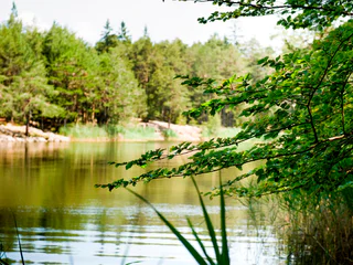
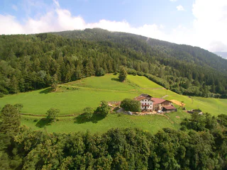
From Aldino to Göller lake
Aldino/Aldein, Aldein/Aldino
easy
Difficulty
379 m
Elevation gain
3h:38 min
duration
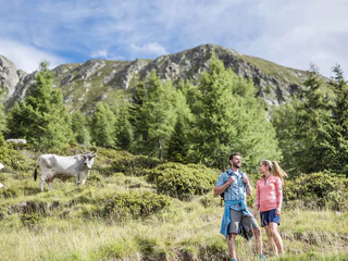
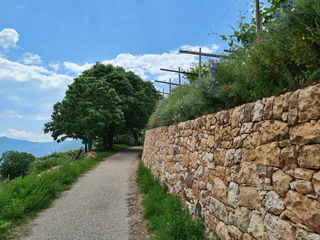
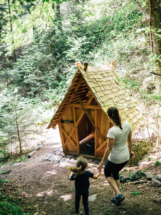
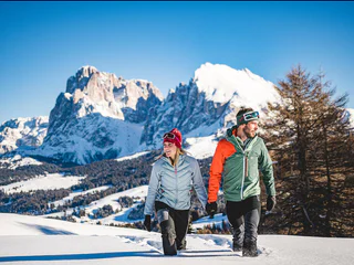
The sun is out, you’re fully packed – now where do you want to go? The peaks, pinnacles and towers of the Dolomites gleam invitingly in the morning light. Are they even more beautiful from the summit? The valleys are criss-crossed with trails through vineyards and apple orchards, past imposing castles, around enchanting lakes and along the Waalweg canal trails. South Tyrol has more than 16,000 km of signposted hiking trails that run through the ever-changing natural landscape, including themed trails, multi-day tours and high-Alpine trails.
1/2
Aldino/Aldein, Aldein/Aldino
easy
Difficulty
379 m
Elevation gain
3h:38 min
duration

Obereggen/Obereggen, Deutschnofen/Nova Ponente, Dolomites Region Eggental
medium
Difficulty
519 m
Elevation gain
3h:00 min
duration
S.Giuseppe/Moos, Sexten/Sesto, Dolomites Region 3 Zinnen
medium
Difficulty
700 m
Elevation gain
3h:00 min
duration
1/4
Monte Scena/Schennaberg, Schenna/Scena, Meran/Merano and environs
medium
Difficulty
1000 m
Elevation gain
4h:49 min
duration
Anterselva di Mezzo/Antholz-Mittertal, Percha/Perca, Dolomites Region Kronplatz/Plan de Corones
medium
Difficulty
578 m
Elevation gain
1h:52 min
duration
1/2
Cortaccia s.S.d.V./Kurtatsch, Kurtatsch an der Weinstraße/Cortaccia sulla Strada del Vino, Alto Adige Wine Road
easy
Difficulty
86 m
Elevation gain
1h:18 min
duration
Fleres/Pflersch, Brenner/Brennero, Sterzing/Vipiteno and environs
medium
Difficulty
898 m
Elevation gain
3h:28 min
duration
1/4
Caines/Kuens, Riffian/Rifiano, Meran/Merano and environs
easy
Difficulty
69 m
Elevation gain
0h:22 min
duration
Ried/Novale - St. Martin i.P./San Martino i.P., St.Martin in Passeier/San Martino in Passiria, Meran/Merano and environs
0 m
Elevation gain
0h:00 min
duration
1/2
Longiarù/Campill, Al Plan/San Vigilio, Dolomites Region Kronplatz/Plan de Corones
medium
Difficulty
449 m
Elevation gain
1h:26 min
duration
1/9
Trodena/Truden, Truden/Trodena
medium
Difficulty
544 m
Elevation gain
3h:49 min
duration
1/4
Monte Scena/Schennaberg, Schenna/Scena, Meran/Merano and environs
medium
Difficulty
125 m
Elevation gain
1h:49 min
duration
1/3
San Pancrazio/St. Pankraz, St.Pankraz/San Pancrazio, Meran/Merano and environs
easy
Difficulty
265 m
Elevation gain
1h:57 min
duration
Acereto/Ahornach, Sand in Taufers/Campo Tures, Ahrntal/Valle Aurina
easy
Difficulty
248 m
Elevation gain
2h:00 min
duration
Prissiano/Prissian, Tisens/Tesimo, Meran/Merano and environs
easy
Difficulty
218 m
Elevation gain
1h:48 min
duration
1/9
Montesole/Sonnenberg - Parcines/Partschins, Partschins/Parcines, Meran/Merano and environs
easy
Difficulty
128 m
Elevation gain
0h:55 min
duration
Ronchi/Rungg - Termeno/Tramin, Tramin an der Weinstraße/Termeno sulla Strada del Vino, Alto Adige Wine Road
difficult
Difficulty
786 m
Elevation gain
4h:30 min
duration
1/6
Presule/Prösels, Völs am Schlern/Fiè allo Sciliar, Dolomites Region Seiser Alm
easy
Difficulty
137 m
Elevation gain
1h:30 min
duration
1/2
Alpe di Siusi/Seiseralm, Kastelruth/Castelrotto, Dolomites Region Seiser Alm
medium
Difficulty
351 m
Elevation gain
3h:37 min
duration
Sill/Sill, Ritten/Renon, Bolzano/Bozen and environs
easy
Difficulty
100 m
Elevation gain
0h:49 min
duration
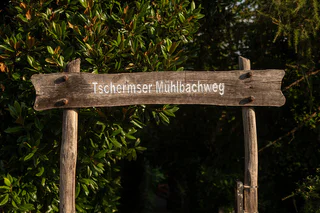
1/3
Tscherms/Cermes, Meran/Merano and environs
easy
Difficulty
1 m
Elevation gain
0h:04 min
duration
Ridanna/Ridnaun, Ratschings/Racines, Sterzing/Vipiteno and environs
easy
Difficulty
360 m
Elevation gain
1h:23 min
duration
1/5
Ega/Eggen, Deutschnofen/Nova Ponente, Dolomites Region Eggental
medium
Difficulty
442 m
Elevation gain
3h:34 min
duration
Braies di Fuori/Ausserprags, Prags/Braies, Dolomites Region 3 Zinnen
easy
Difficulty
40 m
Elevation gain
0h:31 min
duration
1/2
Velloi/Vellau, Algund/Lagundo, Meran/Merano and environs
medium
Difficulty
451 m
Elevation gain
3h:19 min
duration
Sasso/Stein, Pfitsch/Val di Vizze, Sterzing/Vipiteno and environs
medium
Difficulty
455 m
Elevation gain
3h:30 min
duration

1/3
Nova Levante/Welschnofen, Welschnofen/Nova Levante, Dolomites Region Eggental
medium
Difficulty
489 m
Elevation gain
3h:30 min
duration
1/4
Glorenza/Glurns, Glurns/Glorenza, Vinschgau/Val Venosta
easy
Difficulty
134 m
Elevation gain
2h:00 min
duration
Martello/Martell, Martell/Martello, Vinschgau/Val Venosta
medium
Difficulty
404 m
Elevation gain
3h:00 min
duration
1/6
Verano/Vöran, Vöran/Verano, Meran/Merano and environs
medium
Difficulty
445 m
Elevation gain
3h:25 min
duration
Thank you for signing up!
You are already subscribed
Confirm your registration
To complete your subscription, open the email we just sent you and click on the confirmation link.
Can’t find it? Check your spam folder too.
We noticed that you are already subscribed to our Newsletter. We will update you on exclusive offers, fun adventures and more so you can make the best out of your vacation.
We noticed that you already tried to subscribe to our Newsletter in the past but didn’t confirmed the subscription. We have resent you an email now, please check your inbox and spam folder to confirm.


