1/3
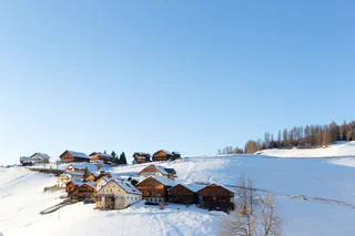
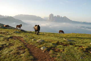
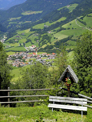
Winter hike von La Val to the Rit meadows
La Val/La Val, La Val, Dolomites Region Alta Badia
medium
Moeilijkheidsgraad
729 m
Hoogteverschil
4h:45 min
Duur
1/3
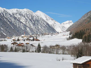
La Val/La Val, La Val, Dolomites Region Alta Badia
medium
Moeilijkheidsgraad
729 m
Hoogteverschil
4h:45 min
Duur
1/3
Vallesina/Versein, Mölten/Meltina, Bolzano/Bozen and environs
medium
Moeilijkheidsgraad
519 m
Hoogteverschil
2h:07 min
Duur
1/2
Colma/Kollmann, Barbian/Barbiano, Brixen/Bressanone and environs
medium
Moeilijkheidsgraad
0 m
Hoogteverschil
2h:00 min
Duur
1/4
Carezza/Karersee, Welschnofen/Nova Levante, Dolomites Region Eggental
easy
Moeilijkheidsgraad
127 m
Hoogteverschil
1h:33 min
Duur

Villa Ottone/Uttenheim, Gais, Dolomites Region Kronplatz/Plan de Corones
easy
Moeilijkheidsgraad
60 m
Hoogteverschil
0h:43 min
Duur
1/2
Fleres/Pflersch, Brenner/Brennero, Sterzing/Vipiteno and environs
medium
Moeilijkheidsgraad
245 m
Hoogteverschil
0h:49 min
Duur
1/2
Gandelle-Franadega-Fienili/Kandellen-Frondeigen-Stadlern, Toblach/Dobbiaco, Dolomites Region 3 Zinnen
medium
Moeilijkheidsgraad
711 m
Hoogteverschil
2h:30 min
Duur
Tirolo/Tirol, Tirol/Tirolo, Meran/Merano and environs
medium
Moeilijkheidsgraad
527 m
Hoogteverschil
5h:00 min
Duur
Alpe di Villandro/Villanderer Alm, Villanders/Villandro, Brixen/Bressanone and environs
easy
Moeilijkheidsgraad
166 m
Hoogteverschil
0h:18 min
Duur
1/3
Tramin an der Weinstraße/Termeno sulla Strada del Vino, Alto Adige Wine Road
easy
Moeilijkheidsgraad
294 m
Hoogteverschil
1h:55 min
Duur
1/2
Alpe di Siusi/Seiseralm, Kastelruth/Castelrotto, Dolomites Region Seiser Alm
medium
Moeilijkheidsgraad
1292 m
Hoogteverschil
7h:04 min
Duur
1/5
S.Cristina Gherdëina/S.Cristina Val Gardena/S.Cristina Gherdëina/St.Christina in Gröden, Urtijëi/Ortisei, Dolomites Region Val Gardena
difficult
Moeilijkheidsgraad
4889 m
Hoogteverschil
10h:00 min
Duur
Selva/Sëlva/Wolkenstein/Sëlva, Sëlva/Selva di Val Gardena, Dolomites Region Val Gardena
easy
Moeilijkheidsgraad
0 m
Hoogteverschil
1h:00 min
Duur
1/2
Valles/Vals, Mühlbach/Rio di Pusteria, Brixen/Bressanone and environs
easy
Moeilijkheidsgraad
340 m
Hoogteverschil
1h:30 min
Duur
1/4
Collepietra/Steinegg, Karneid/Cornedo all'Isarco, Dolomites Region Eggental
medium
Moeilijkheidsgraad
0 m
Hoogteverschil
5h:00 min
Duur
S. Giacomo/St. Jakob - Val di Vizze/Pfitsch, Mühlbach/Rio di Pusteria, Brixen/Bressanone and environs
medium
Moeilijkheidsgraad
580 m
Hoogteverschil
1h:49 min
Duur
S.Valentino/St. Valentin - Funes/Villnöss, Villnöss/Funes, Dolomites Region Lüsen Villnöss
medium
Moeilijkheidsgraad
924 m
Hoogteverschil
4h:31 min
Duur
1/4
Telves/Telfes, Sterzing/Vipiteno, Sterzing/Vipiteno and environs
easy
Moeilijkheidsgraad
186 m
Hoogteverschil
2h:45 min
Duur
Flanes/Flans, Freienfeld/Campo di Trens, Sterzing/Vipiteno and environs
easy
Moeilijkheidsgraad
0 m
Hoogteverschil
1h:00 min
Duur
1/3
Luson/Lüsen, Lüsen/Luson, Dolomites Region Lüsen Villnöss
medium
Moeilijkheidsgraad
403 m
Hoogteverschil
2h:10 min
Duur
S.Valentino /St. Valentin
medium
Moeilijkheidsgraad
580 m
Hoogteverschil
3h:00 min
Duur

1/6
Plose/Plose, Brixen/Bressanone, Brixen/Bressanone and environs
easy
Moeilijkheidsgraad
674 m
Hoogteverschil
2h:52 min
Duur
Sasso/Stein, Pfitsch/Val di Vizze, Sterzing/Vipiteno and environs
medium
Moeilijkheidsgraad
455 m
Hoogteverschil
3h:30 min
Duur
1/6
Siusi/Seis, Kastelruth/Castelrotto, Dolomites Region Seiser Alm
easy
Moeilijkheidsgraad
17 m
Hoogteverschil
0h:30 min
Duur
1/7
Selva/Sëlva/Wolkenstein/Sëlva, S.Crestina Gherdëina/Santa Cristina Val Gardana, Dolomites Region Val Gardena
difficult
Moeilijkheidsgraad
600 m
Hoogteverschil
4h:00 min
Duur
S.Giuseppe/Moos, Sexten/Sesto, Dolomites Region 3 Zinnen
medium
Moeilijkheidsgraad
1092 m
Hoogteverschil
2h:40 min
Duur
1/2
Aica/Aicha, Natz-Schabs/Naz-Sciaves, Brixen/Bressanone and environs
easy
Moeilijkheidsgraad
89 m
Hoogteverschil
0h:45 min
Duur
Valles/Vals, Mühlbach/Rio di Pusteria, Brixen/Bressanone and environs
easy
Moeilijkheidsgraad
39 m
Hoogteverschil
0h:40 min
Duur
1/5
Tablà/Tabland - Parcines/Partschins, Naturns/Naturno, Meran/Merano and environs
medium
Moeilijkheidsgraad
745 m
Hoogteverschil
3h:49 min
Duur
Sasso/Stein, Pfitsch/Val di Vizze, Sterzing/Vipiteno and environs
easy
Moeilijkheidsgraad
601 m
Hoogteverschil
2h:04 min
Duur
Bedankt voor je inschrijving!
Inschrijving al actief
Bevestig je inschrijving
Om je inschrijving te voltooien, open de e-mail die we je net hebben gestuurd en klik op de bevestigingslink.
Niet gevonden? Kijk ook even in je spammap.
Je ontvangt al onze exclusieve aanbiedingen, handige tips en speciale suggesties om volop van je vakantie te genieten.
Je hebt je al geprobeerd in te schrijven voor onze nieuwsbrief maar deze nog niet bevestigd. We hebben je de e‑mail zojuist opnieuw gestuurd. Controleer je inbox en je spammap en bevestig nu.


