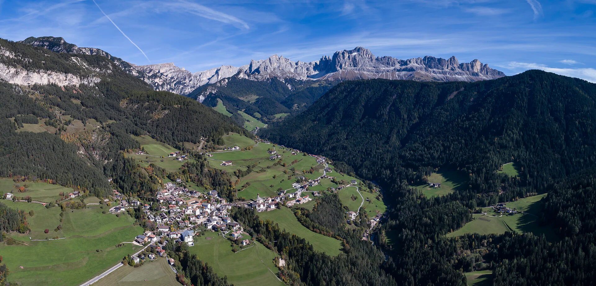
The vast, gently undulating plateau of volcanic origin lying between Welschnofen and Tiers is covered with magnificent fir woods and dotted with large pastures, each one providing grazing in the summer. The rural landscape and its functions are easy to make out and perfectly preserved.The itinerary is long enough to get a good understanding of the structure of the landscape, which follows the morphology of the land. Mount Rosengarten, between the Karerpass, Tireser Alpl and Valley Fassatal, is a rugged, craggy crest with a number of peaks reaching an altitude of 3,000 metres: Kesselkogel, Rosengarten, Cima Scalieret, Vajolet-Türme und Rotwand.
This beautiful itinerary runs along the ridge between Eggental and the Tierser Valley. It follows a forest road which is closed to traffic and begins near the Niger mountain hut (1690 m a.s.l.). The whole route is well sign-posted and very varied, with flat terrain interspersed with up and downhill sections, following the undulating shape of the slope. The path is a dirt road and every 20/30 metres there are narrow drainage channels which do not, however, cause any problems. Almost all the route is in the woods but, after the Vaia storm in October 2018 which brought down a huge number of trees, a lot of new and beautiful views of the imposing Rosengarten cliff and Latemar have since opened up. There are a number of detours along the way, with directions to Jocherhof farm always well-signposted at the forks.
Please check the opening hours of the huts and restaurants: www.seiseralm.it/huts
Wear layers and comfortable boots. It is important to have sunscreen with you at all times, a change of clothes should it rain and a small first aid kit.
The starting point of the tour or the sight is easily and comfortably accessible by public transport:
By bus line 176 from Völs am Schlern stop to bus station St. Zyprian (Tiers) and with bus line 185 further to the bus stop at Niger Pass or by bus line 185 from Bozen bus station to the bus stop at Niger Pass.Private transport: large free car park (with no reserved spaces, untarmacked surface) near the Nigerpass mountain hut. To reach the beginning of the route, you have to cross the provincial road and go along a section where there is no pavement.
Public transport: there is also a bus stop at the car park.

To complete your subscription, open the email we just sent you and click on the confirmation link.
Can’t find it? Check your spam folder too.