
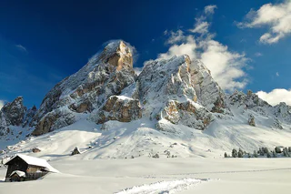
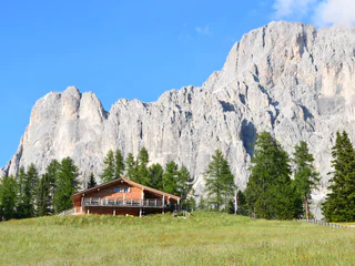
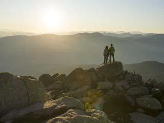
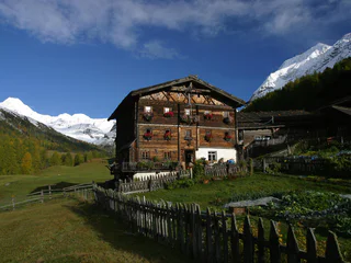
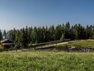
Winter Hike: Sexten - Fischleital Valley - Talschlusshütte
S.Giuseppe/Moos, Sexten/Sesto, Dolomites Region 3 Zinnen
medium
Difficulty
227 m
Elevation gain
1h:45 min
duration
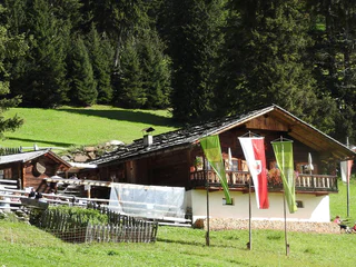
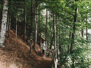
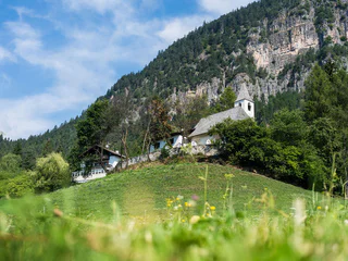
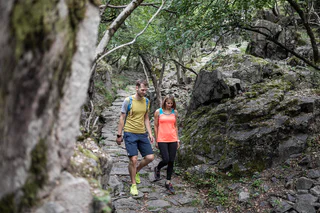
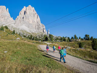
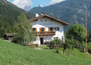
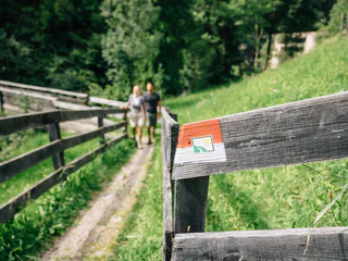
The sun is out, you’re fully packed – now where do you want to go? The peaks, pinnacles and towers of the Dolomites gleam invitingly in the morning light. Are they even more beautiful from the summit? The valleys are criss-crossed with trails through vineyards and apple orchards, past imposing castles, around enchanting lakes and along the Waalweg canal trails. South Tyrol has more than 16,000 km of signposted hiking trails that run through the ever-changing natural landscape, including themed trails, multi-day tours and high-Alpine trails.
S.Giuseppe/Moos, Sexten/Sesto, Dolomites Region 3 Zinnen
medium
Difficulty
227 m
Elevation gain
1h:45 min
duration
1/5
Longiarù/Campill, San Martin /San Martino, Dolomites Region Kronplatz/Plan de Corones
medium
Difficulty
284 m
Elevation gain
1h:40 min
duration
1/3
S. Maddalena/St. Magdalena - Casies/Gsies, Gsies/Valle di Casies
easy
Difficulty
240 m
Elevation gain
1h:10 min
duration
Ronchi/Rungg - Termeno/Tramin, Tramin an der Weinstraße/Termeno sulla Strada del Vino, Alto Adige Wine Road
easy
Difficulty
0 m
Elevation gain
0h:45 min
duration
Magrè s.S.d.V./Margreid a.d.W., Margreid an der Weinstraße/Magrè sulla Strada del Vino, Alto Adige Wine Road
medium
Difficulty
0 m
Elevation gain
3h:19 min
duration
1/3
Foiana/Völlan, Lana, Meran/Merano and environs
medium
Difficulty
432 m
Elevation gain
2h:07 min
duration
Colle Isarco/Gossensaß, Brenner/Brennero, Sterzing/Vipiteno and environs
medium
Difficulty
586 m
Elevation gain
2h:22 min
duration
1/3
Prissiano/Prissian, Tisens/Tesimo, Meran/Merano and environs
medium
Difficulty
477 m
Elevation gain
3h:01 min
duration
1/3
Nova Levante/Welschnofen, Welschnofen/Nova Levante, Dolomites Region Eggental
easy
Difficulty
152 m
Elevation gain
1h:10 min
duration
1/7
Ora/Auer, Auer/Ora, Alto Adige Wine Road
easy
Difficulty
151 m
Elevation gain
1h:42 min
duration
1/5
S. Martino al Monte/St. Martin - Laces/Latsch, Latsch/Laces, Vinschgau/Val Venosta
medium
Difficulty
182 m
Elevation gain
4h:00 min
duration
1/4
Cermes/Tscherms, Marling/Marlengo, Meran/Merano and environs
easy
Difficulty
84 m
Elevation gain
1h:15 min
duration
1/5
Siusi/Seis, Kastelruth/Castelrotto, Dolomites Region Seiser Alm
easy
Difficulty
280 m
Elevation gain
2h:00 min
duration
Trafoi/Trafoi, Stilfs/Stelvio, Vinschgau/Val Venosta
easy
Difficulty
600 m
Elevation gain
3h:58 min
duration
1/3
S.Cristina Gherdëina/S.Cristina Val Gardena/S.Cristina Gherdëina/St.Christina in Gröden, S.Crestina Gherdëina/Santa Cristina Val Gardana, Dolomites Region Val Gardena
medium
Difficulty
841 m
Elevation gain
3h:00 min
duration
1/4
Obereggen/Obereggen, Deutschnofen/Nova Ponente, Dolomites Region Eggental
easy
Difficulty
86 m
Elevation gain
0h:25 min
duration
1/2
La Val/La Val, La Val, Dolomites Region Alta Badia
medium
Difficulty
407 m
Elevation gain
3h:51 min
duration
Alpe di Villandro/Villanderer Alm, Villanders/Villandro, Brixen/Bressanone and environs
easy
Difficulty
166 m
Elevation gain
0h:18 min
duration
1/5
Albion/Albions, Lajen/Laion
medium
Difficulty
175 m
Elevation gain
3h:40 min
duration
1/2
Novale/Ried, Lajen/Laion
medium
Difficulty
648 m
Elevation gain
4h:49 min
duration
1/3
Caerna/Garn, Klausen/Chiusa, Brixen/Bressanone and environs
medium
Difficulty
1029 m
Elevation gain
5h:02 min
duration
1/5
Gand/Ganda - Eppan/Appiano, Eppan an der Weinstaße/Appiano sulla Strada del Vino, Alto Adige Wine Road
easy
Difficulty
444 m
Elevation gain
2h:00 min
duration
1/4
Maso Corto/Kurzras, Schnals/Senales, Vinschgau/Val Venosta
medium
Difficulty
233 m
Elevation gain
2h:19 min
duration
Nove Case/Neunhäusern, Rasen-Antholz/Rasun Anterselva, Dolomites Region Kronplatz/Plan de Corones
easy
Difficulty
16 m
Elevation gain
0h:49 min
duration
1/3
Planol/Planeil, Mals/Malles, Vinschgau/Val Venosta
difficult
Difficulty
600 m
Elevation gain
4h:30 min
duration
1/3
Monte di Tramontana/Nördersberg, Schlanders/Silandro, Vinschgau/Val Venosta
easy
Difficulty
70 m
Elevation gain
0h:31 min
duration
1/5
San Leonardo i.P./St. Leonhard i.P., St.Leonhard in Passeier/San Leonardo in Passiria, Meran/Merano and environs
easy
Difficulty
181 m
Elevation gain
1h:01 min
duration
1/4
Terento/Terenten, Terenten/Terento, Brixen/Bressanone and environs
medium
Difficulty
780 m
Elevation gain
4h:49 min
duration
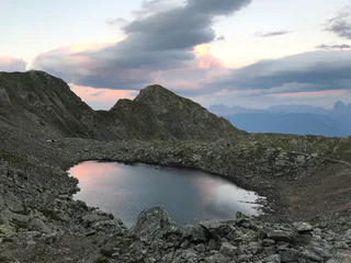
S.Giuseppe/Moos, Sexten/Sesto, Dolomites Region 3 Zinnen
medium
Difficulty
1092 m
Elevation gain
2h:40 min
duration

1/8
Montesole/Sonnenberg - Parcines/Partschins, Partschins/Parcines, Meran/Merano and environs
medium
Difficulty
495 m
Elevation gain
3h:30 min
duration
Thank you for signing up!
You are already subscribed
Confirm your registration
To complete your subscription, open the email we just sent you and click on the confirmation link.
Can’t find it? Check your spam folder too.
We noticed that you are already subscribed to our Newsletter. We will update you on exclusive offers, fun adventures and more so you can make the best out of your vacation.
We noticed that you already tried to subscribe to our Newsletter in the past but didn’t confirmed the subscription. We have resent you an email now, please check your inbox and spam folder to confirm.


