Südtirol Guide App Logo
Skip to content

added to favourites

removed from favourites

Oops! Something went wrong. Try again

Your account is being created

Your account has been successfully created and you are now logged in

You’ve been logged in successfully!

Your account was created successfully, but we couldn't log you in automatically

You are logged out.

Hiking in South Tyrol

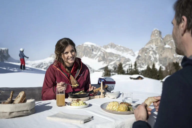
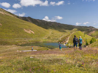
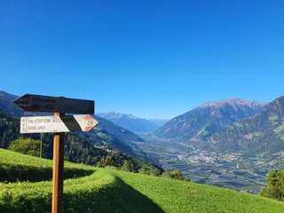
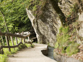
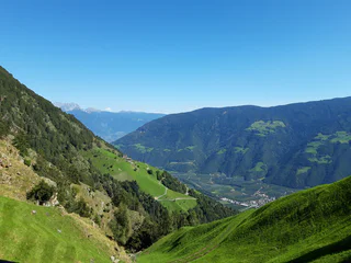
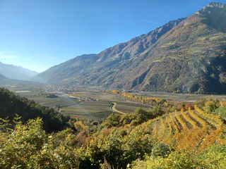
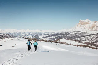
The sun is out, you’re fully packed – now where do you want to go? The peaks, pinnacles and towers of the Dolomites gleam invitingly in the morning light. Are they even more beautiful from the summit? The valleys are criss-crossed with trails through vineyards and apple orchards, past imposing castles, around enchanting lakes and along the Waalweg canal trails. South Tyrol has more than 16,000 km of signposted hiking trails that run through the ever-changing natural landscape, including themed trails, multi-day tours and high-Alpine trails.

  1. Excursion to the hut Kuhalm

    Telves/Telfes, Ratschings/Racines, Sterzing/Vipiteno and environs

    easy

    Difficulty

    668 m

    Elevation gain

    2h:12 min

    duration

  2. Winter walk - Roanerhof

    Caminata di Tures/Kematen, Sand in Taufers/Campo Tures, Ahrntal/Valle Aurina

    easy

    Difficulty

    231 m

    Elevation gain

    2h:00 min

    duration

  3. Summer-walk around the Ratsberg/Monte Rota

    Gandelle-Franadega-Fienili/Kandellen-Frondeigen-Stadlern, Toblach/Dobbiaco, Dolomites Region 3 Zinnen

    medium

    Difficulty

    441 m

    Elevation gain

    4h:00 min

    duration

  4. Natur-Mythenweg path

    Juvale/Juval, Kastelbell-Tschars/Castelbello-Ciardes, Vinschgau/Val Venosta

    medium

    Difficulty

    431 m

    Elevation gain

    2h:30 min

    duration

  5. Trail c1 | Montan - Altrei

    Anterivo/Altrei, Altrei/Anterivo

    difficult

    Difficulty

    1402 m

    Elevation gain

    5h:31 min

    duration

  6. Hike around the Plattkofel and Langkofel

    Alpe di Siusi/Seiseralm, Kastelruth/Castelrotto, Dolomites Region Seiser Alm

    medium

    Difficulty

    1066 m

    Elevation gain

    6h:16 min

    duration

  7. From San Cassiano/Sciaré to the Malga Valparola alp and to the Passo Valparola

    San Cassiano/San Cassiano, Badia, Dolomites Region Alta Badia

    easy

    Difficulty

    516 m

    Elevation gain

    2h:00 min

    duration

  8. To the Alpine pasture in the Lasa Valley

    Oris/Eyrs, Laas/Lasa, Vinschgau/Val Venosta

    medium

    Difficulty

    880 m

    Elevation gain

    4h:01 min

    duration

  9. Snowshoe hike: Seikofel

    Sesto/Sexten, Sexten/Sesto, Dolomites Region 3 Zinnen

    medium

    Difficulty

    298 m

    Elevation gain

    1h:07 min

    duration

  10. Snowshoe hike from Welschnofen | Nova Levante to the "Totmoos"

    Carezza/Karersee, Welschnofen/Nova Levante, Dolomites Region Eggental

    medium

    Difficulty

    602 m

    Elevation gain

    4h:00 min

    duration

  11. Themed & didactic hiking path stone mile

    Valdaora di Mezzo/Mitterolang, Olang/Valdaora, Dolomites Region Kronplatz/Plan de Corones

    easy

    Difficulty

    42 m

    Elevation gain

    0h:12 min

    duration

  12. South Tyrol Strawberry Trail

    Transacqua/Ennewasser, Martell/Martello, Vinschgau/Val Venosta

    easy

    Difficulty

    370 m

    Elevation gain

    2h:58 min

    duration

  13. The Houfa Hitte hut in the Gsiesertal Valley 1883 m

    Colle/Pichl, Gsies/Valle di Casies

    easy

    Difficulty

    395 m

    Elevation gain

    1h:37 min

    duration

  14. Marling Irrigation Channel Path – Scenic Walk from Töll

    Montesole/Sonnenberg - Parcines/Partschins, Marling/Marlengo, Meran/Merano and environs

    easy

    Difficulty

    24 m

    Elevation gain

    3h:15 min

    duration

  15. Hike from Pederü to Capanna Alpina

    San Vigilio, Badia, Dolomites Region Alta Badia

    medium

    Difficulty

    739 m

    Elevation gain

    5h:10 min

    duration

  16. Summer-walk to the Lachwiesen hut

    Gandelle-Franadega-Fienili/Kandellen-Frondeigen-Stadlern, Toblach/Dobbiaco, Dolomites Region 3 Zinnen

    medium

    Difficulty

    458 m

    Elevation gain

    2h:30 min

    duration

  17. Trail f1 | Truden - Oberradein

    Radein/Redagno, Aldein/Aldino

    medium

    Difficulty

    589 m

    Elevation gain

    2h:30 min

    duration

  18. Kalkofenwanderung am Weißhorn

    Redagno/Radein, Aldein/Aldino

    easy

    Difficulty

    109 m

    Elevation gain

    1h:03 min

    duration

  19. Suspension Bridge Solda

    Solda/Sulden, Stilfs/Stelvio, Vinschgau/Val Venosta

    medium

    Difficulty

    185 m

    Elevation gain

    0h:54 min

    duration

  20. Oclini - Passo Cugola

    Redagno/Radein, Aldein/Aldino

    medium

    Difficulty

    294 m

    Elevation gain

    2h:30 min

    duration

  21. Long-distance hiking trail: Bonner Höhenweg and Toblacher Pfannhorn 2663 m

    S. Maddalena/St. Magdalena - Casies/Gsies, Gsies/Valle di Casies

    medium

    Difficulty

    1666 m

    Elevation gain

    8h:07 min

    duration

  22. Health path Prettau/Predoi

    Casere/Kasern, Prettau/Predoi, Ahrntal/Valle Aurina

    easy

    Difficulty

    365 m

    Elevation gain

    1h:45 min

    duration

  23. From Badia to the sanctuary of La Crusc/S.Croce and back through the Armentara meadows

    Badia/Badia, Badia, Dolomites Region Alta Badia

    easy

    Difficulty

    71 m

    Elevation gain

    2h:45 min

    duration

  24. Winter hike: Circular Path Rasen

    Rasun di Sopra/Oberrasen, Rasen-Antholz/Rasun Anterselva, Dolomites Region Kronplatz/Plan de Corones

    easy

    Difficulty

    231 m

    Elevation gain

    2h:27 min

    duration

  25. Geiselsberg - Kronplatz

    Geiselsberg/Sorafurcia, Bruneck/Brunico, Dolomites Region Kronplatz/Plan de Corones

    difficult

    Difficulty

    957 m

    Elevation gain

    3h:00 min

    duration

  26. Circular lake hike to Lake Carezza and Lake Mittersee

    Nova Levante/Welschnofen, Welschnofen/Nova Levante, Dolomites Region Eggental

    easy

    Difficulty

    127 m

    Elevation gain

    1h:34 min

    duration

  27. Family hike from Lake Carezza to the Häusler Sam hut

    Karersee/Carezza, Welschnofen/Nova Levante, Dolomites Region Eggental

    easy

    Difficulty

    214 m

    Elevation gain

    3h:30 min

    duration

  28. Winter hike through the farmland of Alta Badia

    La Villa/La Villa, Badia, Dolomites Region Alta Badia

    easy

    Difficulty

    281 m

    Elevation gain

    3h:00 min

    duration

  29. European hiking trail E5 through the Tschögglberg

    Nobls/Nobls, Jenesien/San Genesio Atesino, Bolzano/Bozen and environs

    easy

    Difficulty

    116 m

    Elevation gain

    3h:34 min

    duration

  30. Kofler am Kofl

    Plata/Platten - Falzes/Pfalzen, Pfalzen/Falzes, Dolomites Region Kronplatz/Plan de Corones

    medium

    Difficulty

    360 m

    Elevation gain

    1h:30 min

    duration