1/2
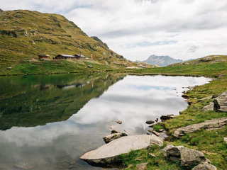
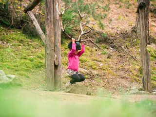
Cortaccia – Lochweg - Graun – Alter Grauner Weg - Cortaccia
Cortaccia s.S.d.V./Kurtatsch, Kurtatsch an der Weinstraße/Cortaccia sulla Strada del Vino, Alto Adige Wine Road
medium
Difficulty
0 m
Elevation gain
2h:55 min
duration
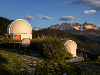
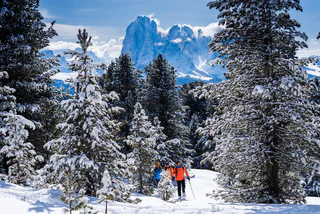
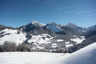
The sun is out, you’re fully packed – now where do you want to go? The peaks, pinnacles and towers of the Dolomites gleam invitingly in the morning light. Are they even more beautiful from the summit? The valleys are criss-crossed with trails through vineyards and apple orchards, past imposing castles, around enchanting lakes and along the Waalweg canal trails. South Tyrol has more than 16,000 km of signposted hiking trails that run through the ever-changing natural landscape, including themed trails, multi-day tours and high-Alpine trails.
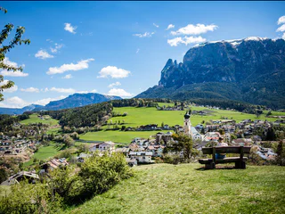
1/2
Cortaccia s.S.d.V./Kurtatsch, Kurtatsch an der Weinstraße/Cortaccia sulla Strada del Vino, Alto Adige Wine Road
medium
Difficulty
0 m
Elevation gain
2h:55 min
duration
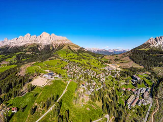
1/4
La Val/La Val, La Val, Dolomites Region Alta Badia
easy
Difficulty
158 m
Elevation gain
0h:30 min
duration

S. Andrea/St. Andrä, Brixen/Bressanone, Brixen/Bressanone and environs
easy
Difficulty
0 m
Elevation gain
1h:40 min
duration
Avenes/Afens, Pfitsch/Val di Vizze, Sterzing/Vipiteno and environs
medium
Difficulty
1221 m
Elevation gain
6h:30 min
duration
1/2
S. Candido/Innichen, Toblach/Dobbiaco, Dolomites Region 3 Zinnen
easy
Difficulty
319 m
Elevation gain
2h:00 min
duration
1/2
Naturno/Naturns, Naturns/Naturno, Meran/Merano and environs
easy
Difficulty
271 m
Elevation gain
1h:55 min
duration
1/4
Magdfeld/Magdfeld, Riffian/Rifiano, Meran/Merano and environs
medium
Difficulty
810 m
Elevation gain
5h:00 min
duration
Sesto/Sexten, Toblach/Dobbiaco, Dolomites Region 3 Zinnen
difficult
Difficulty
1035 m
Elevation gain
3h:30 min
duration
1/4
S.Valentino in Campo/Gummer, Karneid/Cornedo all'Isarco, Dolomites Region Eggental
easy
Difficulty
34 m
Elevation gain
0h:37 min
duration
Selva/Sëlva/Wolkenstein/Sëlva, Sëlva/Selva di Val Gardena, Dolomites Region Val Gardena
easy
Difficulty
21 m
Elevation gain
0h:31 min
duration
Ciardes/Tschars, Kastelbell-Tschars/Castelbello-Ciardes, Vinschgau/Val Venosta
medium
Difficulty
420 m
Elevation gain
2h:00 min
duration
Sesto/Sexten, Sexten/Sesto, Dolomites Region 3 Zinnen
medium
Difficulty
556 m
Elevation gain
3h:40 min
duration
1/8
Vallesina/Versein, Mölten/Meltina, Bolzano/Bozen and environs
easy
Difficulty
345 m
Elevation gain
2h:04 min
duration
Nove Case/Neunhäusern, Rasen-Antholz/Rasun Anterselva, Dolomites Region Kronplatz/Plan de Corones
medium
Difficulty
811 m
Elevation gain
2h:30 min
duration
Proves/Proveis, Proveis/Proves, Meran/Merano and environs
easy
Difficulty
166 m
Elevation gain
1h:46 min
duration
Tesido/Taisten, Welsberg-Taisten/Monguelfo-Tesido
easy
Difficulty
15 m
Elevation gain
0h:45 min
duration
1/2
Sesto/Sexten
medium
Difficulty
400 m
Elevation gain
2h:30 min
duration
1/7
Prato /Prad, Prad am Stilfser Joch/Prato allo Stelvio, Vinschgau/Val Venosta
easy
Difficulty
130 m
Elevation gain
1h:30 min
duration
Lagundo/Algund, Algund/Lagundo, Meran/Merano and environs
medium
Difficulty
0 m
Elevation gain
37h:00 min
duration
1/4
S. Pietro/St. Peter - Laion/Lajen, Urtijëi/Ortisei, Dolomites Region Val Gardena
medium
Difficulty
488 m
Elevation gain
1h:49 min
duration
1/4
Fiè/Völs, Völs am Schlern/Fiè allo Sciliar, Dolomites Region Seiser Alm
easy
Difficulty
130 m
Elevation gain
1h:10 min
duration
1/2
Collepietra/Steinegg, Tiers am Rosengarten/Tires al Catinaccio, Dolomites Region Seiser Alm
medium
Difficulty
1138 m
Elevation gain
5h:31 min
duration
1/17
Plazzoles/Platzers, Tisens/Tesimo, Meran/Merano and environs
easy
Difficulty
28 m
Elevation gain
0h:28 min
duration
San Nicolò/St. Nikolaus, Ulten/Ultimo, Meran/Merano and environs
easy
Difficulty
144 m
Elevation gain
1h:34 min
duration
S. Pietro/St. Peter - Valle Aurina/Ahrntal, Ahrntal/Valle Aurina, Ahrntal/Valle Aurina
medium
Difficulty
400 m
Elevation gain
3h:00 min
duration
S. Maddalena/St. Magdalena - Casies/Gsies, Gsies/Valle di Casies
easy
Difficulty
11 m
Elevation gain
0h:12 min
duration
1/2
San Vigilio, Al Plan/San Vigilio, Dolomites Region Kronplatz/Plan de Corones
easy
Difficulty
210 m
Elevation gain
1h:31 min
duration
Ridanna/Ridnaun, Ratschings/Racines, Sterzing/Vipiteno and environs
easy
Difficulty
330 m
Elevation gain
1h:11 min
duration
Riscone/Reischach, Bruneck/Brunico, Dolomites Region Kronplatz/Plan de Corones
difficult
Difficulty
1324 m
Elevation gain
3h:30 min
duration

1/4
Tires/Tiers, Tiers am Rosengarten/Tires al Catinaccio, Dolomites Region Seiser Alm
medium
Difficulty
530 m
Elevation gain
2h:12 min
duration
Thank you for signing up!
You are already subscribed
Confirm your registration
To complete your subscription, open the email we just sent you and click on the confirmation link.
Can’t find it? Check your spam folder too.
We noticed that you are already subscribed to our Newsletter. We will update you on exclusive offers, fun adventures and more so you can make the best out of your vacation.
We noticed that you already tried to subscribe to our Newsletter in the past but didn’t confirmed the subscription. We have resent you an email now, please check your inbox and spam folder to confirm.


