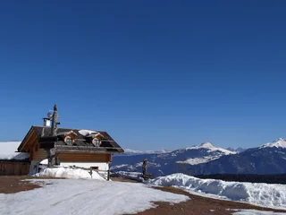
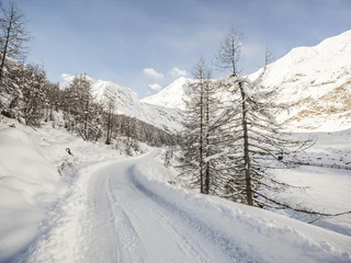
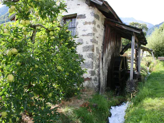
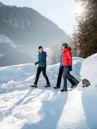
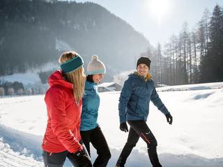
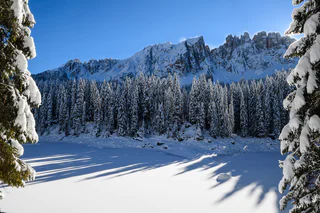
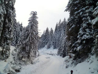
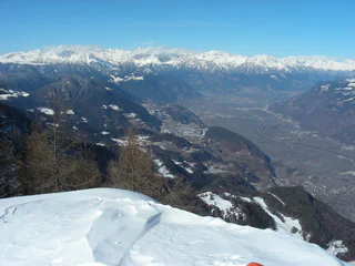
Partir pour une randonnée hivernale, sur des sentiers parfaitement tracés, c'est découvrir le côté paisible du Sud-Tyrol. Points de vue enchanteurs dans les Dolomites, forêts enneigées dans les tranquilles vallées voisines, dans la région du Kronplatz... Les endroits ne manquent pas où vous pouvez profiter de vous-même et de la nature, dans un silence absolu. En raquettes, vous vous éloignerez des pistes de ski et des remontées mécaniques pour découvrir des forêts encore totalement préservées. Mais, que ce soit en raquettes ou à pied, randonner en hiver dans le Sud-Tyrol sera toujours une expérience inoubliable.
A well-known hut with a beautiful view
Starting point: Monguelfo-Tesido – Tesido, parking lot above the mountain farm Mudler (1620 m)
Distance: 4,1 km
Descent: along the ascending route
Walking time: 01:30 h
Difficulty: easy
Difference in altitude: 392m
Tobogganing possibility: yes / difficulty easy
Information: also feasible with snow shoes or touring skis
A hike along Ried, Lettner, Waldbrunn and Gailerhof and back to Welsberg
Starting point: Monguelfo-Tesido – Monguelfo, bus stop in the Via Stazione 1087 m
Distance: round hike of ca. 5 km
Hiking time: 2 hours
Level of difficulty: medium to difficult
Altitude difference: 144 m
Where you get the most beautiful view of the valley
Starting point: Val Casies/Gsiesertal Valley – S. Maddalena, Head of the valley (1465 m)
Distance: 5 km
Descent: along the ascending route
Walking time: 01:30 – 02:00 h
Difficulty: medium
Difference in altitude: 577 m
Tobboganing possibility: yes
Information: also feasible with snowshoes or touring skis
Hike passing by characteristic farms
Starting point: Monguelfo-Tesido – Tesido, tourist office (1206 m)
Distance: 8 km
Descent: circular route
Duration: 02:40 h
Difficulty: medium
Difference in altitude: 300 m
Possibility of sledding: no
Hike amongst characteristic hamlets: Schintlholz/Schintlholz, Hölzl, Prati di Tesido
Starting point: Val Casies/Gsiesertal Valley – Colle, parish church (1260 m)
Distance: 6 km
Descent: along the same route or by public transport
Duration: 02:00 h
Difficulty: medium
Difference in altitude: 300 m
Possibility of sledding: no
Hike from S. Martino to the Karbacher Tal Valley
Starting point: Val Casies/Gsiesertal Valley – S. Martino, tourist information office (1276 m) or Karbacherhof farm (1425 m)
Distance: 5 km
Descent: same way as ascent
Walking time: 01:50 h
Difficulty: medium
Difference in altitude: 391 m S. Martino | 242 m maso Karbacherhof
Tobogganing possibility: no
Information: Depending on weather conditions: with freshly fallen snow in parts only accessible with snow shoes.
Family friendly hike
Starting point: Val Casies/Gsiesertal Valley – S. Maddalena, Head of the valley (1465 m)
Distance: 3 km
Descent: along the ascending route
Walking time: 01:00 h
Difficulty: easy
Difference in altitude: 195 m
Tobogganing possibility: yes / easy difficulty
Information: also feasible with snowshoes or touring skis
Towards the Dolomites
Starting point: Monguelfo-Tesido – Tesido, tourist office (1206 m)
Distance: 3,5 km
Descent: along the ascending route
Duration: 01:00 h
Difficulty: easy
Difference in altitude: 171 m
Possibility of sledding: no
An afternoon hike
Starting point: Val Casies/Gsiesertal Valley – S. Maddalena, Head of the valley (1465 m)
Distance: 2,5 km
Descent: circular hike
WalkingTime: 00:50 h
Difficulty: easy
Difference in altitude: 102 m
Tobboganing possibility: no
Information: Depending on weather conditions: partially only accessible with snow shoes.
This diverse hike starts in the historic center of Niederdorf, right by the Spitalkirche (Church), combining natural beauty with cultural charm. As you ascend the Eggerberg, you will enjoy splendid views of the Puster Valley while the trail winds through peaceful forests and open fields.
A highlight of the route is the viewing platform—a perfect spot to pause, marvel at the scenery, and take a deep breath. From here, breathtaking panoramas unfold over the South Tyrolean mountains, including the majestic Cristallo and the rugged Pragser Dolomites, towering impressively above the valley.
The trail then descends along the so-called “Castle Path” down to the historic Welsperg Castle, whose medieval charm evokes the atmosphere of knights and tales from bygone eras.
Since there are no refreshment stops along the way, it is advisable to bring your own snacks and drinks. This moderately challenging tour is ideal for those seeking tranquility, love expansive views, and want to discover an authentic part of South Tyrol’s cultural landscape.
Hike on old haymaking paths to the Lüsen Alps.
Before motorization an road construction, the hay harvest from the alpine pastures in winter was brought to the valley with sledges. The hike leads from the Lüsnerhof tot he left of the stream on the farm track uphill. At the edge of the forest the road through the forest goes left to the farmhouse of the Gargitthof. Below the farmhouse there is a nice resting place witha wonderful panoramic view. The way back goes from the rest area over the path tot he forest road and back to Lüsen Rungg.
Excursion on the sunny side of the valley
Starting point: Val Casies/Gsiesertal Valley – Colle, parish church (1260 m)
Distance: 5 km
Descent: Circular route
Walking time: 01:30 h
Difficulty: easy
Difference in altitude: 120 m
Tobogganing possibility: no
This hike leads to one of the most beautiful high plateaus in South Tyrol in the heart of the Fanes-Sennes-Braies nature park, which is a UNESCO World Heritage Site. Plätzwiese high plateau fascinates with an overwhelming view of the surrounding mountains of the Dolomites. Dominating everything is the northernmost 3000 metre peak in the Dolomites - the Hohe Gaisl (3146m).
Please note: Due to the temperature fluctuations, there may be icy patches on the trails and we therefore recommend the use of crampons!
Hiking on the sunny side of the valley
Starting point: Val Casies/Gsiesertal Valley – Colle, Hotel Stoll (1225 m)
Distance: 6.5 km
Descent: circular route
Walking time: 02:15 h
Difficulty: easy
Difference in altitude: 120 m
Possibility of sledding: no
Hiking fun for all ages
Starting point: Val Casies/Gsiesertal Valley – S. Maddalena, Head of the valley (1465 m)
Distance: 3,5 km
Descent: along the ascending route
Walking time: 01:10 h
Difficulty: easy
Difference in altitude: 239 m
Tobogganing possibility: yes / easy difficulty
Information: also feasible with snowshoes or touring skis
Panoramic winter hike to the Lüsen Alps, possible stop on the Alpine Hut Kreuzwiesen Alm and slegde descent on the forest road.
The panoramic street of the Val Casies Valley
Starting point: Val Casies/Gsiesertal Valley – S. Maddalena, Head of the valley (1465 m)
Distance: 16,5 km
Descent: using public transport
Walking time: 05:00 h
Difficulty: easy
Difference in altitude: 200 m
Tobboganing possibility: no
Information: Depending on weather conditions: with freshly fallen snow only accessible with snow shoes.
For winterlovers
Starting point: Val Casies/Gsiesertal Valley – S. Maddalena, Head of the valley (1465 m)
Distance: 0,5 km
Descent: along the ascending route
Walking time: 00:10 h
Difficulty: easy
Difference in altitude: 12m
Tobogganing possibility: no
Information: Directly at the cross country track
Through a marvellous winter forest
Starting point: Val Casies/Gsiesertal Valley – S. Maddalena, Head of the valley (1465 m)
Distance: 5 km
Descent: along the ascending route
Walking time: 02:00 h Difficulty: medium
Difference in altitude: 536 m
Tobboganing possibility: yes / medium difficulty
Information: also feasible with snowshoes or touring skis
Those setting out from Villabassa to the Bodenwiese meadow embark on a roughly three-hour hike deep into the pristine natural surroundings of the region.
The starting point is in the picturesque village center of Villabassa. From here, follow the well-marked trail number 27, which first leads you past the historic spa town of Bad Maistatt – a place full of history and natural healing springs, perfect for a restful pause.
Continue towards Altschluderbach, where a short but rewarding climb takes you up to the Bodenwiese meadow. Here, a breathtaking panoramic view unfolds over the surrounding meadows and mountains – an ideal spot to catch your breath and soak it all in.
The return route takes you over the charming Maistatt Bridge before leading back to the village.
This hike offers not only physical activity but also an immersive experience in nature and its peaceful retreats – a true delight for those seeking beauty and tranquility.
Home of mountain farmers: hike from Monte Eggerberg mountain to Villabassa
Starting point: Monguelfo-Tesido – Monguelfo, school center (1112 m)
Distance: 8 km
Descent: with public transportation
Duration: 02:45 h
Difficulty: medium
Difference in altitude: 348 m
Possibility of sledding: no
Short hike at the head of the valley
Starting point: Val Casies/Gsiesertal Valley – S. Maddalena, Head of the valley (1465 m)
Distance: 2 km
Descent: circular hike
Walking time: 00:40 h
Difficulty: easy
Difference in altitude: 80 m
Tobboganing possibility: no
Route: from the car park at Kalterer See lake, continue north to the Geier restaurant. Behind the restaurant, a narrow trail leads to the north into the orchards. Walk along these and turn off to the right in an easterly direction following the markers. At the slope on the eastern side of the valley, turn right, passing by the hotel on the left to the Klughammer road. First follow this road, then continue on a trail above the road.
This trail ends at the southern end of the lake. Cross the road to join the Nature Discovery Trail (Naturerlebnisweg). At the end of this nature trail, turn right onto the so-called Kuchlweg trail, hiking to the vineyards on the western side of the valley. Just before the wine road, turn right into the trail through the field, following it until you reach the point where the wine road curves to the right. Cross over and now follow a trail through the field once more. Then follow the footpath next to the wine road to the church of San Giuseppe al Lago/St. Josef am See (Kirche St. Josef). Take the farm track to the right back to the starting point of the hike.
Along the shores of the Rienza river to the Salla hamlets
Starting point: Monguelfo-Tesido – Monguelfo, tourist information office (1087 m)
Distance: 6 km
Descent: circular hike
Duration: 03:45 h
Difficulty: medium
Difference in altitude: 180 m
Possibility of sledding: no
Hiking and sledding fun at “Hubi”
Starting point: a) Val Casies/Gsiesertal Valley – S. Maddalena, Head of the valley (1465 m) b) Val Casies/Gsiesertal Valley – S. Maddalena, “Huben” cottages
Distance: a) 3,3 km b) 3,8 km
Descent: along the ascending route
Walking time: a) 01:30 - 02:00 h b) 01:15 h – 01:30 h
Difficulty: a) medium b) easy
Difference in altitude: a) 485 m b) 410 m
Tobboganing possibility: yes / medium difficulty
Information: also feasible with snowshoes or touring skis | Tip: Snowshoe hike from Calsale "Huben (limited parking available) along Pfinn stream possible (01:00 h)
This trail is mostly snow-free and offers a magnificent view of the opposite Monte Tramontana mountains with the Stelvio National Park and the snowy Ortler group.
Circular hike to the head of the valley in the Val Casies/Gsiesertal Valley
Starting Point: Val Casies/Gsiesertal Valley – S. Maddalena, Head of the valley, Parish church (1400 m)
Distance: 6 km
Descent: circular hike
Walking time: 01:50 h
Difficulty: medium
Difference in altitude: 175 m
Information: Depending on weather conditions: with freshly fallen snow only accessible with snow shoes.