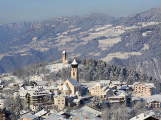
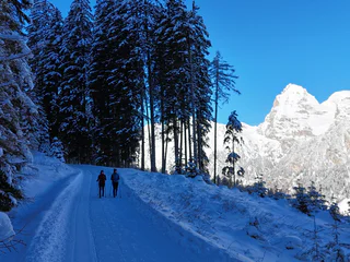
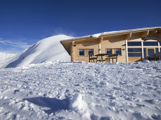
Südtirol Guide App Logo
Passer au contenu

ajouté(e) aux favoris

supprimé(e) des favoris

Oups ! Une erreur s’est produite. Réessayer

Ton compte est en cours de création

Ton compte a été créé avec succès et tu es maintenant connecté

Tu es connecté!

Ton compte a été créé avec succès, mais nous n'avons pas pu te connecter automatiquement

Tu es déconnecté

Filtrer
Filtres sélectionnés
    Niveau de difficulté
    Durée
    Distance en km
    Activités

    Randonnées hivernales dans le Sud-Tyrol

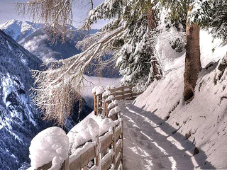
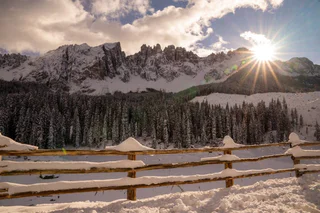
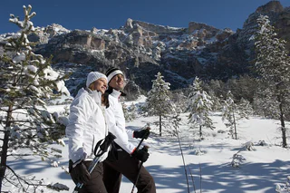
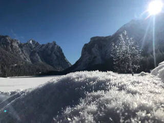
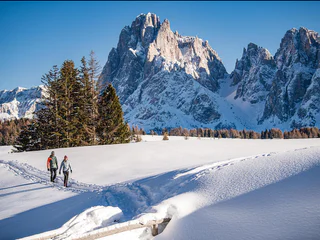
    Partir pour une randonnée hivernale, sur des sentiers parfaitement tracés, c'est découvrir le côté paisible du Sud-Tyrol. Points de vue enchanteurs dans les Dolomites, forêts enneigées dans les tranquilles vallées voisines, dans la région du Kronplatz... Les endroits ne manquent pas où vous pouvez profiter de vous-même et de la nature, dans un silence absolu. En raquettes, vous vous éloignerez des pistes de ski et des remontées mécaniques pour découvrir des forêts encore totalement préservées. Mais, que ce soit en raquettes ou à pied, randonner en hiver dans le Sud-Tyrol sera toujours une expérience inoubliable.
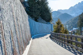
    Résultats
    Snowshoe Hikes
    Snow shoe walk to the Wuhnleger and to the St. Sebastian chapel
    Tiers am Rosengarten/Tires al Catinaccio, Dolomites Region Seiser Alm

    There’s no place other than the Wuhnleger where you can experience such intensely beautiful views over the UNESCO World Heritage site with the Rosengarten and Vajolettürme towers. The box-seat beside the woodland, with its beautiful little lake reflecting the mountains, boasts incredible, endless views in summer and winter alike, and is the perfect place to stop for a break.

    Difficulté : moyenne
    321 m altitude
    2h:04 min durée
    Long-Distance Hiking Paths
    Sentiero della Posta
    Urtijëi/Ortisei, Dolomites Region Val Gardena

    Ask any of the locals, and they might let you in on their favourite insider tip: a lovely, historical trail which crosses forests and meadows. Get ready for a beautiful walk and a somewhat mystical experience. The delightful scent of flowers and mesmerising birdsong will accompany you for 5 km as you explore the lush, untouched nature: the dappled sunlight washes over the moss-covered forest, creating a pleasant ambience and tableau to be admired.

    Difficulté : moyenne
    259 m altitude
    2h:00 min durée
    Hiking
    Winter-walk: Ratsberg/Monte Rota
    Niederdorf/Villabassa, Dolomites Region 3 Zinnen

    This roundtrack offers a beatiful view over Dobbiaco/Toblach and the Valle di Landro/Höhlensteintal.
    (Be careful: Some sections could be icy!)

    Difficulté : moyenne
    477 m altitude
    4h:00 min durée
    Snowshoe Hikes
    Terrain Cure Trail 1 - Circular trail: Aschbach - Vigiljoch - Aschbach
    Algund/Lagundo, Meran/Merano and environs

    The climatic terrain cure is a special form of exercise therapy characterised by activity adapted to one’s fitness level, endurance training, and time spent in the outdoors experiencing the landscape, which is carried out through a personalised walking programme.

    So-called terrain hiking improves endurance and agility, increases speed and flexibility, reinforces the cardiovascular system, stimulates breathing activity and strengthens muscles, ligaments and joints. It has a positive impact on the metabolism, activates the digestive system and noticeably increases the expenditure of calories.
    The climatic terrain cure is recommended for functional cardiovascular disorders, respiratory and metabolic disorders, and above all is a tried and tested method of primary prevention and general health promotion.
    The "Terrainkur" trails in Partschins/Parcines have been certified  by the Ludwig-Maximilians-University of Munich.

    Difficulté : difficile
    435 m altitude
    2h:08 min durée
    Snowshoe Hikes
    Snowshoe walking Gampen Alm
    Villnöss/Funes, Dolomites Region Villnösstal

    Snowshoe tour from Zans, about the Gampenwiesen, to the hutGampen Alm. Return with the toboggan to Zans or to St. Magdalena/Ranui.

    Difficulté : moyenne
    392 m altitude
    1h:19 min durée
    Summer
    Winter hike hut Gampen
    Villnöss/Funes, Dolomites Region Villnösstal
    Beautiful circular hike to the hut Gampenalm with a magnificent view of the Geisler peaks.
    Difficulté : moyenne
    400 m altitude
    2h:13 min durée
    Summer
    Hike along the Schenner Waalweg Trail
    Schenna/Scena, Meran/Merano and environs

    This picturesque hike along the Schenner Waal irrigation channel runs along an unspoilt trail through the chestnut grove and orchards high above the spa town of Merano, and is also thoroughly recommended for hot summer days.

    Difficulté : facile
    320 m altitude
    2h:00 min durée
    Summer
    The Algunder Waalweg irrigation channel pathway from Partschins/Parcines to Meran/o
    Partschins/Parcines, Meran/Merano and environs

    The Algund irrigation channel pathway, or Waalweg, is a 10 km long path running alongside the old irrigation channel. Flat and even almost all the way, the trail boasts incredible views over the Meran/o area and leads you through Plars, Algund/Lagundo village and Gratsch/Quarazze until you get to the Saint Magdalena Chapel and then along the Tappeiner path to Meran/o city.


    Difficulté : moyenne
    141 m altitude
    2h:42 min durée
    Summer
    From Ranui to hut Geisler Alm
    Villnöss/Funes, Dolomites Region Villnösstal

    A hike to a beautiful pasture beneath the Geisler Mountains. You can stop by to eat at the alpine hut Geisler Alm which offers also a playground for children.

    Difficulté : moyenne
    735 m altitude
    4h:27 min durée
    Hiking
    Winter-walk around the Toblach/Dobbiaco lake
    Toblach/Dobbiaco, Dolomites Region 3 Zinnen

    The easy winter walk takes around the idyllic lake of Dobbiaco/Toblach.

    A nature trail around the lake with 11 stations provides valuable information on the vegetation, wildlife and geomorphology of the area. 

    Further information to the water treasures of Dobbiaco: 
    https://www.drei-zinnen.info/en/dobbiaco/dobbiaco/experiencing-dobbiaco/lago-di-dobbiaco-lago-di-landro-and-dobbiaco-water-treasures.html

    Difficulté : facile
    13 m altitude
    0h:45 min durée
    Summer
    Hike to the Lazinser Alm Mountain Hut
    Moos in Passeier/Moso in Passiria, Meran/Merano and environs

    The Lazinser Alm is located at the end of the Pfelderertal valley at the foot of the Hohe Wilde mountain. The Lazinser Alm is a favourite hiking goal for young and old, with a wonderful location that has been left natural but is still easy to reach. The Lazinser Alm is more of a stately house than a mountain hut, where one can enjoy the summer days outdoors on their large veranda. Like at the Timmelsalm mountain hut, numerous cattle graze the pastures of the Lazinser Alm.
    Difficulty: a problem-free hike in every aspect, suitable even for weaker hikers or children. Walking time from Pfelders/Plan, approx. 1 hour and 15 minutes.
    Source: Alpine farm hikes in Passeiertal valley.

    Difficulté : facile
    258 m altitude
    1h:25 min durée
    Hiking
    Circular winter hiking trail of Vals
    Mühlbach/Rio di Pusteria, Brixen/Bressanone and environs

    Experience a scenic loop through Valser Valley– an easy hike to enjoy the wintery valley landscape and surrounding nature. Perfect for a short walk with beautiful views.

    Difficulté : facile
    340 m altitude
    1h:30 min durée
    Summer
    Panoramic Trail Circular Hike at winter
    Tisens/Tesimo, Meran/Merano and environs

    Easy hike above Tisens/Tesimo with beautiful viewpoints of the Tisner Mittelgebirge mountain range.

    Attention: the path is not cleared in winter and can be icy in places. Always wear good shoes!


    Difficulté : facile
    81 m altitude
    0h:43 min durée
    Summer
    Snowshoe hike to the Lyfi peak
    Martell/Martello, Vinschgau/Val Venosta
    This ski-tour starts at the Lake Gioveretto, from there you follow the path no. 10 to the managed Malga Lyfi. There you pass the mountain hut on your right and continue through the forest by following the same signposting until the junction of paths. When you reach the "Lyfiknott", a wonderful snow-covered winter landscape awaits you. From there the way is steep and demanding, but when you reach the Lyfi Peak, you have a wonderful view over the snow-covered Val Venosta.
    Difficulté : difficile
    1424 m altitude
    4h:16 min durée
    Barrier-Free
    Hike to the Eggentaler Almen Alpine Pastures
    Deutschnofen/Nova Ponente, Dolomites Region Eggental

    This relaxing hike is sure to make the heart of every hiker beat a little faster. Fantastic views of the Latemar, Weißhorn and Schwarzhorn mountains and great places to stop for delicious refreshments make this hike an unforgettable experience.

    Difficulté : moyenne
    454 m altitude
    3h:25 min durée
    Hiking
    Winter Panorama Path in Welschnofen | Nova Levante
    Welschnofen/Nova Levante, Dolomites Region Eggental
    The winter panorama path in Welschnofen | Nova Levante is a pleasant circular hike that delights both locals and tourists. With a length of 5.1 kilometers and a duration of about 1 hour and 30 minutes, it’s perfect for a relaxed stroll. The path runs above the village center, offering stunning views of the surrounding Rosengarten | Catinaccio and Latemar and valley. Interesting stops along the way provide information about the village, its history, and traditions.
    Difficulté : facile
    143 m altitude
    1h:25 min durée
    Hiking
    Footpath Cudan-Dumat
    Urtijëi/Ortisei, Dolomites Region Val Gardena
    A journey of discovery of Ladin culture, walking through the village starting at the valley station of the Resciesa funicular and first reaching the 'Solaria' house and then the 'Cudan' house. You will firstly cross a beautiful meadow with a wonderful view of Ortisei, and then plunge into nature through the coniferous forest. You will then reach the characteristic 'Dumat' farmstead. The way back runs along the Via Mureda until, after about 700 m, at the junction, you turn left into Via Meisules, to return to the village centre.
    Difficulté : facile
    110 m altitude
    1h:01 min durée
    Hiking
    Winter Circular Hike to the Flaner Jöchl Ridge on the Rosskopf
    Sterzing/Vipiteno, Sterzing/Vipiteno and environs

    The winter circular hike to the Flaner Jöchl at Rosskopf / Monte Cavallo ridge is an easy panoramic hike for all the family on Sterzing’s / Vipiteno local mountain. The well-prepared trail leads through the snowy mountain and woodland landscape across the valley basin and offers wonderful views of the surrounding mountains. From the nearby Sarntal Alps where the hike begins, to the view of the mountains of the Pfitschtal valley in the foreground and the peaks of the Dolomites on the horizon, through to the view into the Pflerschtal valley: a range of winter worlds present themselves to hikers as they walk along. Snowshoes are not necessary for the circular trail!

    Difficulté : facile
    160 m altitude
    2h:00 min durée
    Hiking
    Winter-walk arount the source of the Drau/Drava river
    Toblach/Dobbiaco, Dolomites Region 3 Zinnen

    The winter hike passes the source of the Drava/Drau River. The Drava/Drau is a river of 749 km which takes origin in the field of Dobbiaco/Toblach and crosses Italy, Austria, Slovenia, Croatia and Hungary.

    Further information to the water treasures of Dobbiaco: www.three-peaks.info/en/dobbiaco/dobbiaco/experiencing-dobbiaco/lago-di-dobbiaco-and-dobbiaco-water-treasures.html?_ga=1.204887893.455846822.1385385320

    Difficulté : facile
    208 m altitude
    2h:42 min durée
    Summer
    Hiking: Curon - Salg - Arlundo
    Graun im Vinschgau/Curon Venosta, Vinschgau/Val Venosta

    From the end of the village near the St. Anna chapel right up to the forest, there turn left to "Salg", continue on the forest road to the hamlet of Klopair with descent to Resia or descent to Arlund and back across the sea to Graun.

    Difficulté : facile
    516 m altitude
    3h:12 min durée
    Snowshoe Hikes
    rumbling tour: Resia - Vallierteck - Froj
    Graun im Vinschgau/Curon Venosta, Vinschgau/Val Venosta
    You walk past the stations of the Way of the Cross (each around 300 metres long) until you reach the end of the hike, a charming little church in the middle of a dense forest.
    Difficulté : facile
    252 m altitude
    1h:04 min durée
    Snowshoe Hikes
    Winter walk to the Messnerjoch mountain hut
    Welschnofen/Nova Levante, Dolomites Region Seiser Alm

    The snowshoe hike starts at the Nigerpass and follows the hiking trail no. 1 to the Messnerjoch mountain hut. This easy snowshoe or winter hike is ideal for families and offers wonderful views of the Rosengarten massif.

    Difficulté : facile
    239 m altitude
    1h:13 min durée
    Snowshoe Hikes
    Hike along the Sun Trail in Stuls/Stulles
    Moos in Passeier/Moso in Passiria, Meran/Merano and environs

    Signposted as „Sonnenrundweg“ trail (Sun Path), this simple 1 hr. 45 min. hiking circuit crossing over sunny slopes and through shady woods leads off the parking lot near the church. In winter the wooded sections are ideal for snowshoe hiking.

    Refreshment stops: Various taverns in Stulles

    The trail is not suitable for pushchairs.

    Difficulté : facile
    272 m altitude
    1h:40 min durée
    Hiking
    Winter-walk: Cultural Round Tour
    Toblach/Dobbiaco, Dolomites Region 3 Zinnen

    The cultural round tour passes at all famous churches and chapels at Dobbiaco/Toblach. The parisch church of St. John the Baptist, the sanctuary of St. Mary, the chapels of Melate/Mellaten, Monte Rota/Ratsberg and Fienili/Stadlern, the church of San Silvestro/Wahlen an the "Leitnstöckl" are visitable.

    Difficulté : moyenne
    500 m altitude
    4h:30 min durée
    1 2 3 4 5 6 7 8 9 10 11 12 13 14 15 16 17