
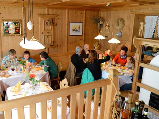
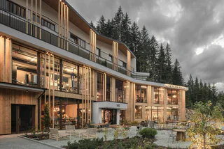
Hotel Almina "Family & Spa"
Valgiovo/Jaufental, Ratschings/Racines, Sterzing/Vipiteno and environs
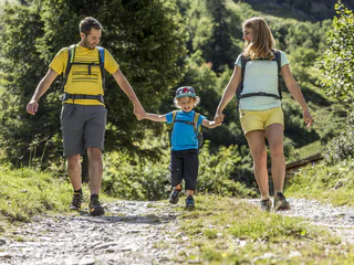
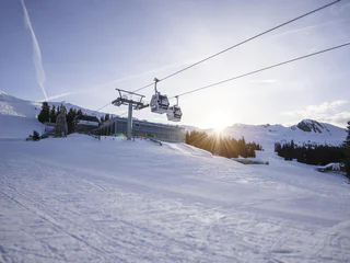
Objevte jedinečný charakter jihotyrolského údolí Wipptal s malebným Sterzingem/Vipitenem, nejsevernějším městem Jižního Tyrolska. Boční údolí Alp nabízejí impozantní horské vrcholy a vášnivou sportovní kulturu. Cestou poznávejte a setkávejte se s krásnými hrady.
Valgiovo/Jaufental, Ratschings/Racines, Sterzing/Vipiteno and environs
1/6
S. Giacomo/St. Jakob - Val di Vizze/Pfitsch, Pfitsch/Val di Vizze, Sterzing/Vipiteno and environs
medium
Obtížnost
1787 m
Převýšení
5h:34 min
doba trvání
1/5
S. Giacomo/St. Jakob - Val di Vizze/Pfitsch, Pfitsch/Val di Vizze, Sterzing/Vipiteno and environs
1/4
S. Giacomo/St. Jakob - Val di Vizze/Pfitsch, Pfitsch/Val di Vizze, Sterzing/Vipiteno and environs
1/3
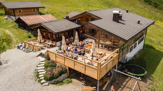
Ridanna/Ridnaun, Ratschings/Racines, Sterzing/Vipiteno and environs
easy
Obtížnost
0 m
Převýšení
0h:03 min
doba trvání
1/3
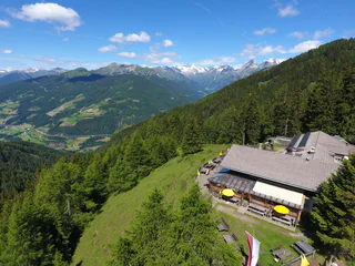
Fleres/Pflersch, Brenner/Brennero, Sterzing/Vipiteno and environs
Fleres/Pflersch, Brenner/Brennero, Sterzing/Vipiteno and environs
medium
Obtížnost
1737 m
Převýšení
7h:43 min
doba trvání
Vipiteno/Sterzing, Sterzing/Vipiteno, Sterzing/Vipiteno and environs

1/2
Vipiteno/Sterzing, Sterzing/Vipiteno, Sterzing/Vipiteno and environs
Mareta/Mareit, Ratschings/Racines, Sterzing/Vipiteno and environs
Sasso/Stein, Pfitsch/Val di Vizze, Sterzing/Vipiteno and environs
difficult
Obtížnost
1662 m
Převýšení
7h:00 min
doba trvání
Valgiovo/Jaufental, Ratschings/Racines, Sterzing/Vipiteno and environs
easy
Obtížnost
0 m
Převýšení
0h:04 min
doba trvání
1/2
Ridanna/Ridnaun, Ratschings/Racines, Sterzing/Vipiteno and environs
medium
Obtížnost
1005 m
Převýšení
3h:16 min
doba trvání
1/2
Mazzes/Matzes, Sterzing/Vipiteno, Sterzing/Vipiteno and environs
Valgiovo/Jaufental, Ratschings/Racines, Sterzing/Vipiteno and environs
medium
Obtížnost
569 m
Převýšení
2h:31 min
doba trvání
1/2
Telves/Telfes, Ratschings/Racines, Sterzing/Vipiteno and environs
Caminata/Kematen, Pfitsch/Val di Vizze, Sterzing/Vipiteno and environs
1/9
Ridanna/Ridnaun, Ratschings/Racines, Sterzing/Vipiteno and environs
Vipiteno/Sterzing, Sterzing/Vipiteno, Sterzing/Vipiteno and environs
1/2
Stanghe/Stange, Ratschings/Racines, Sterzing/Vipiteno and environs
easy
Obtížnost
270 m
Převýšení
1h:43 min
doba trvání
Fleres/Pflersch, Brenner/Brennero, Sterzing/Vipiteno and environs

1/2
Racines di Dentro/Innerratschings, Ratschings/Racines, Sterzing/Vipiteno and environs
Sasso/Stein, Pfitsch/Val di Vizze, Sterzing/Vipiteno and environs
easy
Obtížnost
601 m
Převýšení
2h:04 min
doba trvání
1/2
Fleres/Pflersch, Brenner/Brennero, Sterzing/Vipiteno and environs
medium
Obtížnost
588 m
Převýšení
1h:49 min
doba trvání

1/3
Vipiteno/Sterzing, Sterzing/Vipiteno, Sterzing/Vipiteno and environs
easy
Obtížnost
350 m
Převýšení
2h:00 min
doba trvání
1/6
Novale/Ried - Vipiteno/Sterzing, Sterzing/Vipiteno, Sterzing/Vipiteno and environs
Moncucco/Giggelberg, Brenner/Brennero, Sterzing/Vipiteno and environs
difficult
Obtížnost
778 m
Převýšení
5h:00 min
doba trvání
Telves/Telfes, Sterzing/Vipiteno, Sterzing/Vipiteno and environs
easy
Obtížnost
0 m
Převýšení
0h:00 min
doba trvání
1/2
Valgiovo/Jaufental, Ratschings/Racines, Sterzing/Vipiteno and environs
easy
Obtížnost
0 m
Převýšení
0h:12 min
doba trvání
1/2
Telves/Telfes, Sterzing/Vipiteno, Sterzing/Vipiteno and environs
easy
Obtížnost
271 m
Převýšení
1h:15 min
doba trvání


