
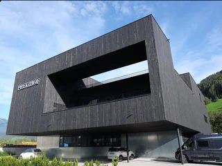
Boutique Enjoy Collection
Vipiteno/Sterzing, Sterzing/Vipiteno, Sterzing/Vipiteno and environs
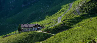
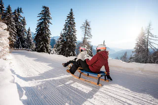
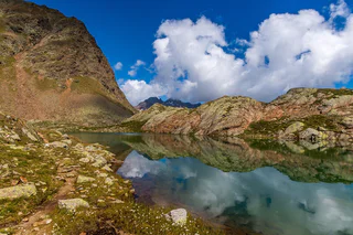
Objevte jedinečný charakter jihotyrolského údolí Wipptal s malebným Sterzingem/Vipitenem, nejsevernějším městem Jižního Tyrolska. Boční údolí Alp nabízejí impozantní horské vrcholy a vášnivou sportovní kulturu. Cestou poznávejte a setkávejte se s krásnými hrady.
Vipiteno/Sterzing, Sterzing/Vipiteno, Sterzing/Vipiteno and environs
1/5
Colle Isarco/Gossensaß, Brenner/Brennero, Sterzing/Vipiteno and environs
1/7
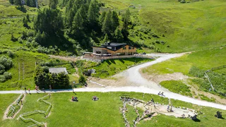
Ridanna/Ridnaun, Ratschings/Racines, Sterzing/Vipiteno and environs
Flanes/Flans, Freienfeld/Campo di Trens, Sterzing/Vipiteno and environs
medium
Obtížnost
1472 m
Převýšení
6h:30 min
doba trvání
Fleres/Pflersch, Brenner/Brennero, Sterzing/Vipiteno and environs
medium
Obtížnost
898 m
Převýšení
3h:28 min
doba trvání
Telves/Telfes, Ratschings/Racines, Sterzing/Vipiteno and environs
medium
Obtížnost
650 m
Převýšení
3h:00 min
doba trvání
1/4
Avenes/Afens, Pfitsch/Val di Vizze, Sterzing/Vipiteno and environs
easy
Obtížnost
519 m
Převýšení
0h:00 min
doba trvání
Stanghe/Stange, Ratschings/Racines, Sterzing/Vipiteno and environs
1/4
Vipiteno/Sterzing, Sterzing/Vipiteno, Sterzing/Vipiteno and environs
Fleres/Pflersch, Brenner/Brennero, Sterzing/Vipiteno and environs
1/4
Flans/Flanes, Freienfeld/Campo di Trens, Sterzing/Vipiteno and environs
Flaines/Flains, Pfitsch/Val di Vizze, Sterzing/Vipiteno and environs
Fleres/Pflersch, Brenner/Brennero, Sterzing/Vipiteno and environs
medium
Obtížnost
1267 m
Převýšení
4h:55 min
doba trvání
1/2
Vipiteno/Sterzing, Sterzing/Vipiteno, Sterzing/Vipiteno and environs
Moncucco/Giggelberg, Brenner/Brennero, Sterzing/Vipiteno and environs
medium
Obtížnost
1379 m
Převýšení
6h:00 min
doba trvání
Sasso/Stein, Pfitsch/Val di Vizze, Sterzing/Vipiteno and environs
easy
Obtížnost
1214 m
Převýšení
4h:42 min
doba trvání
1/7
Valgiovo/Jaufental, Ratschings/Racines, Sterzing/Vipiteno and environs
1/3
Vipiteno/Sterzing, Sterzing/Vipiteno, Sterzing/Vipiteno and environs
Vipiteno/Sterzing, Sterzing/Vipiteno, Sterzing/Vipiteno and environs
Valles/Vals, Mühlbach/Rio di Pusteria, Sterzing/Vipiteno and environs
easy
Obtížnost
689 m
Převýšení
4h:00 min
doba trvání
1/7
Casateia/Gasteig, Ratschings/Racines, Sterzing/Vipiteno and environs
1/7
Vipiteno/Sterzing, Sterzing/Vipiteno, Sterzing/Vipiteno and environs
easy
Obtížnost
0 m
Převýšení
0h:30 min
doba trvání
1/2
Valgiovo/Jaufental, Ratschings/Racines, Sterzing/Vipiteno and environs
difficult
Obtížnost
1259 m
Převýšení
6h:00 min
doba trvání
1/3
Sterzing/Vipiteno, Sterzing/Vipiteno and environs
1/3
Raminges/Raminghes, Sterzing/Vipiteno, Sterzing/Vipiteno and environs
1/3
Vipiteno/Sterzing, Sterzing/Vipiteno, Sterzing/Vipiteno and environs
1/4
Ridanna/Ridnaun, Ratschings/Racines, Sterzing/Vipiteno and environs
medium
Obtížnost
1450 m
Převýšení
8h:00 min
doba trvání
Fleres/Pflersch, Brenner/Brennero, Sterzing/Vipiteno and environs
Flanes/Flans, Freienfeld/Campo di Trens, Sterzing/Vipiteno and environs
medium
Obtížnost
303 m
Převýšení
2h:30 min
doba trvání
Flanes/Flans, Freienfeld/Campo di Trens, Sterzing/Vipiteno and environs
medium
Obtížnost
1678 m
Převýšení
7h:30 min
doba trvání


