
Artigianato Gardenese - Dolfi
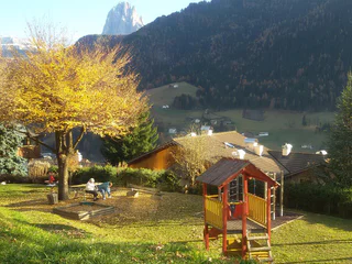
Ortisei/Urtijëi/St. Ulrich/Urtijëi, Urtijëi/Ortisei, Dolomites Region Val Gardena
| Pour vos vacances dans la région des Dolomites Val Gardena dans le Sud-Tyrol, sous le signe du bien-être et du divertissement, vous pouvez choisir parmi de nombreux hébergements qui répondent à vos souhaits. |
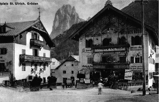
Ortisei/Urtijëi/St. Ulrich/Urtijëi, Urtijëi/Ortisei, Dolomites Region Val Gardena
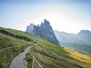
Sëlva/Selva di Val Gardena, Dolomites Region Val Gardena
easy
Difficulté
85 m
Gain d'altitude
0h:36 min
durée
1/2
Ortisei/Urtijëi/St. Ulrich/Urtijëi, Urtijëi/Ortisei, Dolomites Region Val Gardena
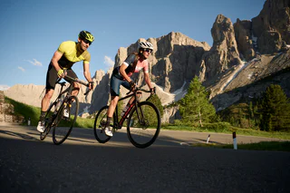
Sëlva/Selva di Val Gardena, Dolomites Region Val Gardena
medium
Difficulté
0 m
Gain d'altitude
0h:04 min
durée
Ortisei/Urtijëi/St. Ulrich/Urtijëi, Urtijëi/Ortisei, Dolomites Region Val Gardena
easy
Difficulté
110 m
Gain d'altitude
1h:01 min
durée
1/6
S.Cristina Gherdëina/St.Christina in Gröden/S.Cristina Gherdëina/S.Cristina Val Gardena, S.Crestina Gherdëina/Santa Cristina Val Gardana, Dolomites Region Val Gardena
medium
Difficulté
1202 m
Gain d'altitude
4h:01 min
durée
1/4
Selva/Sëlva/Wolkenstein/Sëlva, Urtijëi/Ortisei, Dolomites Region Val Gardena
medium
Difficulté
1101 m
Gain d'altitude
4h:28 min
durée
Selva/Sëlva/Wolkenstein/Sëlva, Sëlva/Selva di Val Gardena, Dolomites Region Val Gardena
Sëlva/Selva di Val Gardena, Dolomites Region Val Gardena
0 m
Gain d'altitude
0h:09 min
durée
Selva/Sëlva/Wolkenstein/Sëlva, Sëlva/Selva di Val Gardena, Dolomites Region Val Gardena

1/5
Ortisei/Urtijëi/St. Ulrich/Urtijëi, Urtijëi/Ortisei, Dolomites Region Val Gardena
Sëlva/Selva di Val Gardena, Dolomites Region Val Gardena
Sëlva/Selva di Val Gardena, Dolomites Region Val Gardena
Ortisei/Urtijëi/St. Ulrich/Urtijëi, Urtijëi/Ortisei, Dolomites Region Val Gardena
1/5
St. Ulrich/Urtijëi/Ortisei/Urtijëi, Urtijëi/Ortisei, Dolomites Region Val Gardena
difficult
Difficulté
1396 m
Gain d'altitude
4h:37 min
durée
1/3
Roncadizza/Runggaditsch - Ortisei/St.Ulrich, Urtijëi/Ortisei, Dolomites Region Val Gardena
S.Cristina Gherdëina/S.Cristina Val Gardena/S.Cristina Gherdëina/St.Christina in Gröden, Sëlva/Selva di Val Gardena, Dolomites Region Val Gardena
easy
Difficulté
0 m
Gain d'altitude
0h:10 min
durée
1/3
St. Ulrich/Urtijëi/Ortisei/Urtijëi, Urtijëi/Ortisei, Dolomites Region Val Gardena
medium
Difficulté
147 m
Gain d'altitude
1h:16 min
durée
Selva/Sëlva/Wolkenstein/Sëlva, Sëlva/Selva di Val Gardena, Dolomites Region Val Gardena
1/8
Sëlva/Selva di Val Gardena, Dolomites Region Val Gardena
difficult
Difficulté
870 m
Gain d'altitude
4h:46 min
durée
Selva/Sëlva/Wolkenstein/Sëlva, Sëlva/Selva di Val Gardena, Dolomites Region Val Gardena
easy
Difficulté
0 m
Gain d'altitude
0h:07 min
durée
1/2
Selva/Sëlva/Wolkenstein/Sëlva, Sëlva/Selva di Val Gardena, Dolomites Region Val Gardena
difficult
Difficulté
2901 m
Gain d'altitude
90.8 Km
distance
S.Cristina Gherdëina/S.Cristina Val Gardena/S.Cristina Gherdëina/St.Christina in Gröden, S.Crestina Gherdëina/Santa Cristina Val Gardana, Dolomites Region Val Gardena
1/4
Ortisei/Urtijëi/St. Ulrich/Urtijëi, Urtijëi/Ortisei, Dolomites Region Val Gardena
easy
Difficulté
0 m
Gain d'altitude
0h:15 min
durée
1/9
S.Cristina Gherdëina/S.Cristina Val Gardena/S.Cristina Gherdëina/St.Christina in Gröden, S.Crestina Gherdëina/Santa Cristina Val Gardana, Dolomites Region Val Gardena
Alpe di Siusi/Seiseralm, Kastelruth/Castelrotto, Dolomites Region Val Gardena

1/6
Ortisei/Urtijëi/St. Ulrich/Urtijëi, Urtijëi/Ortisei, Dolomites Region Val Gardena
1/4
Selva/Sëlva/Wolkenstein/Sëlva, S.Crestina Gherdëina/Santa Cristina Val Gardana, Dolomites Region Val Gardena
easy
Difficulté
263 m
Gain d'altitude
1h:30 min
durée
Selva/Sëlva/Wolkenstein/Sëlva, Sëlva/Selva di Val Gardena, Dolomites Region Val Gardena
1/14
Roncadizza/Runggaditsch - Ortisei/St.Ulrich, Urtijëi/Ortisei, Dolomites Region Val Gardena


