1/3
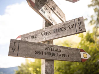
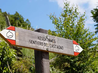
Apple Trail in Natz-Schabs /Naz-Sciaves
Naz/Natz, Natz-Schabs/Naz-Sciaves, Brixen/Bressanone and environs
easy
Difficulté
135 m
Gain d'altitude
2h:04 min
durée
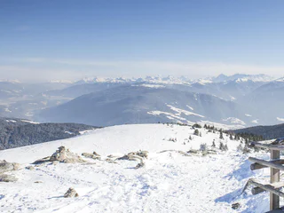
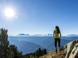
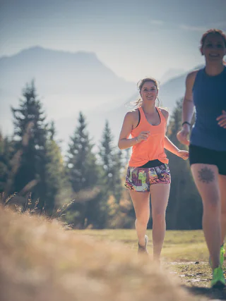
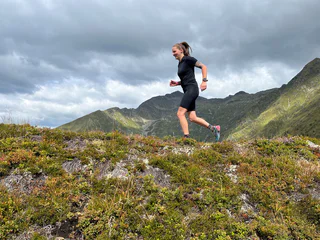
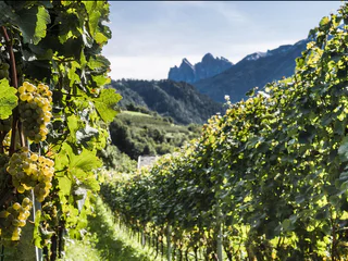
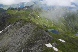
On peut être actif à toutes les altitudes dans la vallée de l'Isarco. Des sentiers pour les randonneurs et les cyclistes serpentent à travers la plaine de la vallée, passent devant des châteaux et des forteresses, traversent des vignobles et des vergers, montent vers des alpages ensoleillés jusqu'au royaume des Dolomites. Les 33 circuits répondent aux exigences élevées d'une expérience complète. Les terres cultivées par les agriculteurs, les prairies alpines en fleurs et les fiers sommets constituent le décor de ces 33 idées de randonnées dans la vallée d'Isarco. Ces circuits, sélectionnés par les stations touristiques respectives, traversent des régions méditerranéennes et alpines. Le point de départ et le point d'arrivée se trouvent au même endroit, le parcours et le temps de marche varient. Le long du chemin, des monuments d'art et de nature, des curiosités culturelles, des points de vue et des refuges rustiques invitent à faire une pause.
1/3
Naz/Natz, Natz-Schabs/Naz-Sciaves, Brixen/Bressanone and environs
easy
Difficulté
135 m
Gain d'altitude
2h:04 min
durée

Villandro/Villanders, Villanders/Villandro, Brixen/Bressanone and environs

1/2
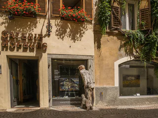
Bressanone città/Brixen Stadt, Brixen/Bressanone, Brixen/Bressanone and environs
Rasa/Raas, Natz-Schabs/Naz-Sciaves, Brixen/Bressanone and environs
1/5
Bressanone città/Brixen Stadt, Brixen/Bressanone, Brixen/Bressanone and environs
Fundres/Pfunders, Vintl/Vandoies, Brixen/Bressanone and environs
1/9
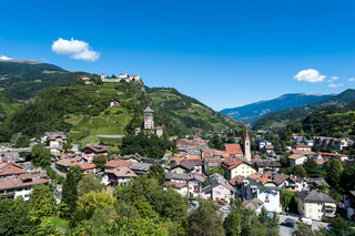
Chiusa/Klausen, Klausen/Chiusa, Brixen/Bressanone and environs
Vandoies di Sopra/Obervintl, Vintl/Vandoies, Brixen/Bressanone and environs
1/3
Lazfons/Latzfons, Klausen/Chiusa, Brixen/Bressanone and environs
1/3
Valles/Vals, Mühlbach/Rio di Pusteria, Brixen/Bressanone and environs
easy
Difficulté
147 m
Gain d'altitude
0h:46 min
durée
1/3
Caerna/Garn, Feldthurns/Velturno, Brixen/Bressanone and environs
medium
Difficulté
1032 m
Gain d'altitude
4h:07 min
durée
1/3
Terento/Terenten, Terenten/Terento, Brixen/Bressanone and environs
easy
Difficulté
190 m
Gain d'altitude
1h:25 min
durée
1/5
Fiumes/Viums, Natz-Schabs/Naz-Sciaves, Brixen/Bressanone and environs
easy
Difficulté
124 m
Gain d'altitude
1h:34 min
durée
1/3
Valles/Vals, Mühlbach/Rio di Pusteria, Brixen/Bressanone and environs
difficult
Difficulté
945 m
Gain d'altitude
3h:04 min
durée
1/2
Chiusa/Klausen, Klausen/Chiusa, Brixen/Bressanone and environs
medium
Difficulté
0 m
Gain d'altitude
1h:49 min
durée
Sciaves/Schabs, Natz-Schabs/Naz-Sciaves, Brixen/Bressanone and environs
easy
Difficulté
20 m
Gain d'altitude
2h:00 min
durée
Lazfons/Latzfons, Villanders/Villandro, Brixen/Bressanone and environs

1/3
Bressanone città/Brixen Stadt, Brixen/Bressanone, Brixen/Bressanone and environs
Bressanone città/Brixen Stadt, Brixen/Bressanone, Brixen/Bressanone and environs
1/6
Varna/Vahrn, Vahrn/Varna, Brixen/Bressanone and environs
Bressanone città/Brixen Stadt, Brixen/Bressanone, Brixen/Bressanone and environs
easy
Difficulté
438 m
Gain d'altitude
3h:28 min
durée
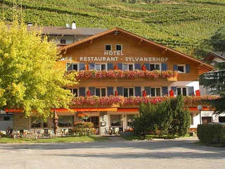
Maranza/Meransen, Mühlbach/Rio di Pusteria, Brixen/Bressanone and environs
1/3
Novacella/Neustift, Vahrn/Varna, Brixen/Bressanone and environs
1/2
Chiusa/Klausen, Villanders/Villandro, Brixen/Bressanone and environs
medium
Difficulté
486 m
Gain d'altitude
2h:06 min
durée
1/2
Lazfons/Latzfons, Klausen/Chiusa, Brixen/Bressanone and environs
1/11
Bressanone città/Brixen Stadt, Brixen/Bressanone, Brixen/Bressanone and environs
Terento/Terenten, Vintl/Vandoies, Brixen/Bressanone and environs
medium
Difficulté
320 m
Gain d'altitude
2h:00 min
durée
Villandro/Villanders, Villanders/Villandro, Brixen/Bressanone and environs
S.Benedetto/Nauders, Rodeneck/Rodengo, Brixen/Bressanone and environs
1/5
Vallarga/Weitental, Mühlbach/Rio di Pusteria, Brixen/Bressanone and environs
difficult
Difficulté
1166 m
Gain d'altitude
4h:00 min
durée


