
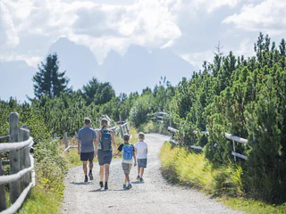
Plose Looping
Plose/Plose, Brixen/Bressanone, Brixen/Bressanone and environs
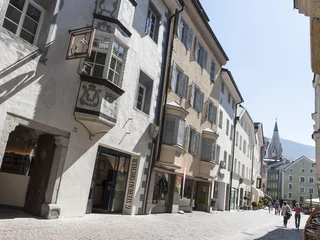
Brixen a jeho okolí nabízí celou řadu tras, od rodinných výletů až po náročné výstupy. Prozkoumejte kulturní města a vychutnejte si středomořský vliv. Brixen, Klausen/Chiusa a Sterzing/Vipiteno stojí za výlet. Září bohatou historií, krásnými památkami a úspěšnou kombinací zvyků a inovací Zažijte Törggelen, tradiční jihotyrolskou slavnost s vínem, jídlem a kaštany.
Plose/Plose, Brixen/Bressanone, Brixen/Bressanone and environs
Spelonca/Spiluck, Vahrn/Varna, Brixen/Bressanone and environs
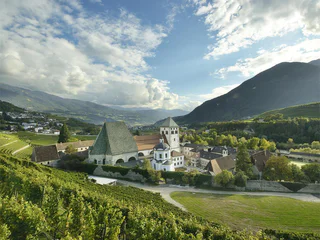
Colma/Kollmann, Barbian/Barbiano, Brixen/Bressanone and environs
medium
Obtížnost
640 m
Převýšení
4h:00 min
doba trvání
1/8
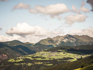
Monteponente/Pfeffersberg, Brixen/Bressanone, Brixen/Bressanone and environs
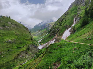
Vandoies di Sopra/Obervintl, Vintl/Vandoies, Brixen/Bressanone and environs
medium
Obtížnost
4762 m
Převýšení
3h:00 min
doba trvání
1/20
Plose/Plose, Brixen/Bressanone, Brixen/Bressanone and environs
Alpe di Villandro/Villanderer Alm, Villanders/Villandro, Brixen/Bressanone and environs
medium
Obtížnost
393 m
Převýšení
3h:15 min
doba trvání
1/7
Bressanone città/Brixen Stadt, Brixen/Bressanone, Brixen/Bressanone and environs

1/3
Bressanone città/Brixen Stadt, Brixen/Bressanone, Brixen/Bressanone and environs
1/8
Plose/Plose, Brixen/Bressanone, Brixen/Bressanone and environs
1/8
Bressanone città/Brixen Stadt, Brixen/Bressanone, Brixen/Bressanone and environs
1/2
Naz/Natz, Brixen/Bressanone, Brixen/Bressanone and environs
easy
Obtížnost
14 m
Převýšení
1h:45 min
doba trvání
Valles/Vals, Mühlbach/Rio di Pusteria, Brixen/Bressanone and environs
easy
Obtížnost
0 m
Převýšení
0h:03 min
doba trvání
Bressanone città/Brixen Stadt, Brixen/Bressanone, Brixen/Bressanone and environs

1/5
Vallarga/Weitental, Mühlbach/Rio di Pusteria, Brixen/Bressanone and environs
difficult
Obtížnost
1166 m
Převýšení
4h:00 min
doba trvání
Terento/Terenten, Terenten/Terento, Brixen/Bressanone and environs
1/2
Spinga/Spinges, Mühlbach/Rio di Pusteria, Brixen/Bressanone and environs
medium
Obtížnost
650 m
Převýšení
2h:07 min
doba trvání
Vill/Villa - Rodeneck/Rodengo, Rodeneck/Rodengo, Brixen/Bressanone and environs
Rio di Pusteria/Mühlbach, Mühlbach/Rio di Pusteria, Brixen/Bressanone and environs
1/5
Fundres/Pfunders, Vintl/Vandoies, Brixen/Bressanone and environs
difficult
Obtížnost
1491 m
Převýšení
5h:00 min
doba trvání
1/3
Villandro/Villanders, Villanders/Villandro, Brixen/Bressanone and environs
Bressanone città/Brixen Stadt, Brixen/Bressanone, Brixen/Bressanone and environs
easy
Obtížnost
291 m
Převýšení
1h:38 min
doba trvání
1/4
Valles/Vals, Mühlbach/Rio di Pusteria, Brixen/Bressanone and environs
difficult
Obtížnost
379 m
Převýšení
3h:12 min
doba trvání
1/6
Bressanone città/Brixen Stadt, Brixen/Bressanone, Brixen/Bressanone and environs
1/2
Tre Chiese/Dreikirchen, Barbian/Barbiano, Brixen/Bressanone and environs
1/4
Alpe di Villandro/Villanderer Alm, Villanders/Villandro, Brixen/Bressanone and environs
easy
Obtížnost
124 m
Převýšení
1h:53 min
doba trvání
Bressanone città/Brixen Stadt, Brixen/Bressanone, Brixen/Bressanone and environs
difficult
Obtížnost
2421 m
Převýšení
13h:37 min
doba trvání
Terento/Terenten, Terenten/Terento, Brixen/Bressanone and environs
Villandro/Villanders, Villanders/Villandro, Brixen/Bressanone and environs
1/2
Spinga/Spinges, Mühlbach/Rio di Pusteria, Brixen/Bressanone and environs
easy
Obtížnost
165 m
Převýšení
1h:34 min
doba trvání


