
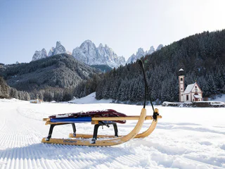
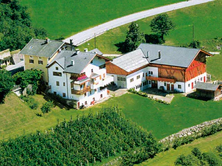
Rodelalm
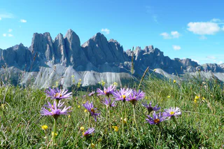
Koll/Colle, Villnöss/Funes, Dolomites Region Lüsen Villnöss
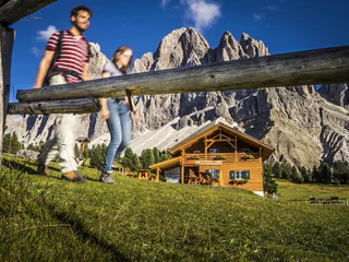
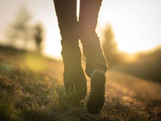
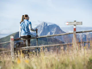
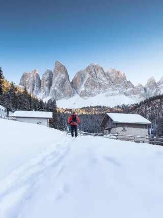
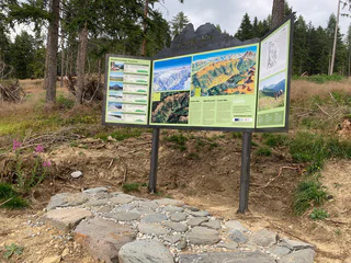
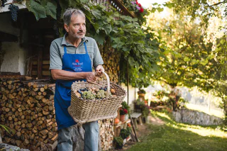
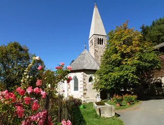
In allen Höhenlagen kann man im Eisacktal aktiv sein. Wege für Wanderer und Radfahrer schlängeln sich durch die Talebene, vorbei an Schlössern und Burgen, durch Weinberge und Obstwiesen, hinauf auf sonnige Almen bis in das Reich der Dolomiten. Die 33 Rundwege erfüllen die hohen Ansprüche an ein Rundum-Erlebnis. Von Bauern bearbeitetes Kulturland, blühende Almwiesen und stolze Gipfel bilden die Kulisse dieser 33 Wandertipps im Eisacktal . Diese von den jeweiligen Ferienorten ausgewählten Rundwege führen durch mediterrane Landstriche und alpine Regionen. Start und Endpunkt befinden sich an derselben Stelle, Wegverlauf und Gehzeit variieren. Entlang des Weges laden Kunst- und Naturdenkmäler, kulturelle Sehenswürdigkeiten, Aussichtsplätze und urige Hütten zum Innehalten.
Koll/Colle, Villnöss/Funes, Dolomites Region Lüsen Villnöss
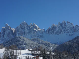
S. Maddalena/St. Magdalena - Funes/Villnöss, Villnöss/Funes, Dolomites Region Lüsen Villnöss
medium
Difficulté
744 m
Gain d'altitude
3h:13 min
durée
1/7
S. Maddalena/St. Magdalena - Funes/Villnöss, Villnöss/Funes, Dolomites Region Lüsen Villnöss
1/2
Luson/Lüsen, Lüsen/Luson, Dolomites Region Lüsen Villnöss
medium
Difficulté
340 m
Gain d'altitude
2h:15 min
durée
S. Maddalena/St. Magdalena - Funes/Villnöss, Villnöss/Funes, Dolomites Region Lüsen Villnöss
easy
Difficulté
321 m
Gain d'altitude
2h:01 min
durée
S. Maddalena/St. Magdalena - Funes/Villnöss, Villnöss/Funes, Dolomites Region Lüsen Villnöss
medium
Difficulté
400 m
Gain d'altitude
2h:13 min
durée
1/3
Tiso/Teis, Villnöss/Funes, Dolomites Region Lüsen Villnöss
1/2
Rodenecker Alm/Alpe di Rodengo, Lüsen/Luson, Dolomites Region Lüsen Villnöss
easy
Difficulté
0 m
Gain d'altitude
0h:04 min
durée
1/2
Alpe di Rodengo/Rodenecker Alm, Lüsen/Luson, Dolomites Region Lüsen Villnöss
medium
Difficulté
0 m
Gain d'altitude
5h:00 min
durée
1/2
Luson/Lüsen, Lüsen/Luson, Dolomites Region Lüsen Villnöss
medium
Difficulté
602 m
Gain d'altitude
3h:12 min
durée
1/2
Luson/Lüsen, Lüsen/Luson, Dolomites Region Lüsen Villnöss
easy
Difficulté
122 m
Gain d'altitude
0h:00 min
durée
1/2
Tiso/Teis, Villnöss/Funes, Dolomites Region Lüsen Villnöss
easy
Difficulté
84 m
Gain d'altitude
0h:31 min
durée
Tiso/Teis, Villnöss/Funes, Dolomites Region Lüsen Villnöss
1/2
S. Maddalena/St. Magdalena - Funes/Villnöss, Villnöss/Funes, Dolomites Region Lüsen Villnöss
S. Pietro/St. Peter - Funes/Villnöss, Villnöss/Funes, Dolomites Region Lüsen Villnöss
1/2
S. Maddalena/St. Magdalena - Funes/Villnöss, Villnöss/Funes, Dolomites Region Lüsen Villnöss
medium
Difficulté
0 m
Gain d'altitude
1h:10 min
durée
S.Valentino/St. Valentin - Funes/Villnöss, Villnöss/Funes, Dolomites Region Lüsen Villnöss
Tiso/Teis, Villnöss/Funes, Dolomites Region Lüsen Villnöss
1/2
Alpe di Rodengo/Rodenecker Alm, Lüsen/Luson, Dolomites Region Lüsen Villnöss
medium
Difficulté
142 m
Gain d'altitude
0h:00 min
durée
1/3
S. Maddalena/St. Magdalena - Funes/Villnöss, Villnöss/Funes, Dolomites Region Lüsen Villnöss
medium
Difficulté
278 m
Gain d'altitude
1h:40 min
durée
1/4
Tiso/Teis, Villnöss/Funes, Dolomites Region Lüsen Villnöss
1/3
Tiso/Teis, Villnöss/Funes, Dolomites Region Lüsen Villnöss
1/3
Luson/Lüsen, Lüsen/Luson, Dolomites Region Lüsen Villnöss
difficult
Difficulté
703 m
Gain d'altitude
4h:01 min
durée
1/3
Tiso/Teis, Villnöss/Funes, Dolomites Region Lüsen Villnöss
1/4
S. Maddalena/St. Magdalena - Funes/Villnöss, Villnöss/Funes, Dolomites Region Lüsen Villnöss
difficult
Difficulté
1307 m
Gain d'altitude
7h:30 min
durée
S. Maddalena/St. Magdalena - Funes/Villnöss, Villnöss/Funes, Dolomites Region Lüsen Villnöss
difficult
Difficulté
1652 m
Gain d'altitude
6h:10 min
durée
S. Pietro/St. Peter - Funes/Villnöss, Villnöss/Funes, Dolomites Region Lüsen Villnöss
1/2
S.Valentino/St. Valentin - Funes/Villnöss, Villnöss/Funes, Dolomites Region Lüsen Villnöss
1/4
S. Pietro/St. Peter - Funes/Villnöss, Villnöss/Funes, Dolomites Region Lüsen Villnöss
easy
Difficulté
322 m
Gain d'altitude
2h:01 min
durée
S. Pietro/St. Peter - Funes/Villnöss, Villnöss/Funes, Dolomites Region Lüsen Villnöss


