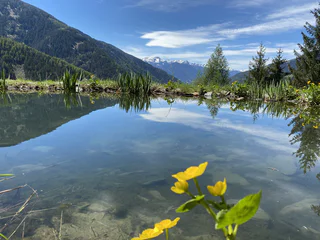
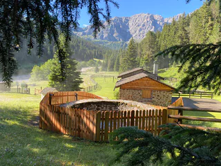
1/2
Panorama trip Lüsen
Luson/Lüsen, Lüsen/Luson, Dolomites Region Lüsen Villnöss
easy
Obtížnost
277 m
Převýšení
1h:36 min
doba trvání
Objevte kouzelný region Villnösstal/Val di Funes v Jižním Tyrolsku, který je známý svou nedotčenou přírodou a outdoorovými zážitky. Od nordic walkingu po lyžování - každý si zde najde něco pro sebe. Nenechte si ujít krásné hory Odle a památky, jako je kostel Santa Maddalena. Ideální poloha pro výlety do Val Gardeny, Seiser Alm a dalších míst.
1/2
Luson/Lüsen, Lüsen/Luson, Dolomites Region Lüsen Villnöss
easy
Obtížnost
277 m
Převýšení
1h:36 min
doba trvání

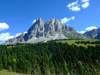
S. Pietro/St. Peter - Funes/Villnöss, Villnöss/Funes, Dolomites Region Lüsen Villnöss
1/3
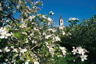
S. Maddalena/St. Magdalena - Funes/Villnöss, Villnöss/Funes, Dolomites Region Lüsen Villnöss
medium
Obtížnost
0 m
Převýšení
2h:28 min
doba trvání
S. Pietro/St. Peter - Funes/Villnöss, Villnöss/Funes, Dolomites Region Lüsen Villnöss
medium
Obtížnost
358 m
Převýšení
2h:08 min
doba trvání
1/2
S. Maddalena/St. Magdalena - Funes/Villnöss, Villnöss/Funes, Dolomites Region Lüsen Villnöss
medium
Obtížnost
1275 m
Převýšení
5h:31 min
doba trvání
1/2
S. Maddalena/St. Magdalena - Funes/Villnöss, Villnöss/Funes, Dolomites Region Lüsen Villnöss
easy
Obtížnost
0 m
Převýšení
0h:00 min
doba trvání
S. Pietro/St. Peter - Funes/Villnöss, Villnöss/Funes, Dolomites Region Lüsen Villnöss
1/3
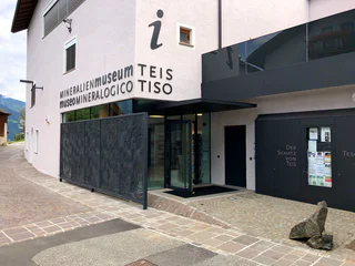
Tiso/Teis, Villnöss/Funes, Dolomites Region Lüsen Villnöss
S. Pietro/St. Peter - Funes/Villnöss, Villnöss/Funes, Dolomites Region Lüsen Villnöss
1/3
Tiso/Teis, Villnöss/Funes, Dolomites Region Lüsen Villnöss
1/7
Tiso/Teis, Villnöss/Funes, Dolomites Region Lüsen Villnöss
1/2
Tiso/Teis, Villnöss/Funes, Dolomites Region Lüsen Villnöss
1/2
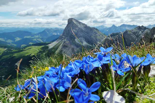
Plose/Plose, Lüsen/Luson, Dolomites Region Lüsen Villnöss
medium
Obtížnost
291 m
Převýšení
1h:04 min
doba trvání
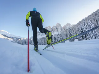
1/2
Plose/Plose, Lüsen/Luson, Dolomites Region Lüsen Villnöss
difficult
Obtížnost
468 m
Převýšení
1h:43 min
doba trvání
S. Maddalena/St. Magdalena - Funes/Villnöss, Villnöss/Funes, Dolomites Region Lüsen Villnöss
Lüsen/Luson, Dolomites Region Lüsen Villnöss
medium
Obtížnost
1951 m
Převýšení
24.6 Km
vzdálenost
1/2
S. Maddalena/St. Magdalena - Funes/Villnöss, Villnöss/Funes, Dolomites Region Lüsen Villnöss
S. Maddalena/St. Magdalena - Funes/Villnöss, Villnöss/Funes, Dolomites Region Lüsen Villnöss
medium
Obtížnost
921 m
Převýšení
3h:01 min
doba trvání
S. Maddalena/St. Magdalena - Funes/Villnöss, Villnöss/Funes, Dolomites Region Lüsen Villnöss
1/4
Tiso/Teis, Villnöss/Funes, Dolomites Region Lüsen Villnöss

1/2
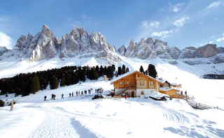
Alpe di Rodengo/Rodenecker Alm, Lüsen/Luson, Dolomites Region Lüsen Villnöss
medium
Obtížnost
0 m
Převýšení
5h:00 min
doba trvání
1/4
S. Maddalena/St. Magdalena - Funes/Villnöss, Villnöss/Funes, Dolomites Region Lüsen Villnöss
Tiso/Teis, Villnöss/Funes, Dolomites Region Lüsen Villnöss
S. Pietro/St. Peter - Funes/Villnöss, Villnöss/Funes, Dolomites Region Lüsen Villnöss
Tiso/Teis, Villnöss/Funes, Dolomites Region Lüsen Villnöss
easy
Obtížnost
448 m
Převýšení
2h:40 min
doba trvání
1/8
Colle/Koll, Villnöss/Funes, Dolomites Region Lüsen Villnöss
1/5
Longiarù/Campill, Lüsen/Luson, Dolomites Region Lüsen Villnöss
medium
Obtížnost
815 m
Převýšení
2h:47 min
doba trvání
St. Peter/S. Pietro - Villnöss/Funes, Villnöss/Funes, Dolomites Region Lüsen Villnöss
S. Maddalena/St. Magdalena - Funes/Villnöss, Villnöss/Funes, Dolomites Region Lüsen Villnöss
difficult
Obtížnost
608 m
Převýšení
3h:34 min
doba trvání
1/2
Piavenna/Plawenn, Villnöss/Funes, Dolomites Region Lüsen Villnöss


