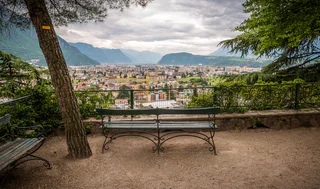
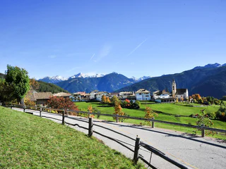
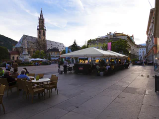
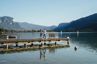
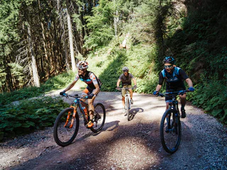
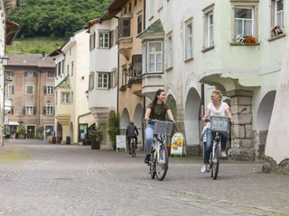
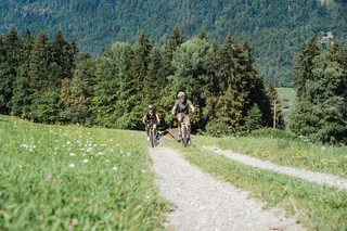
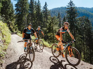
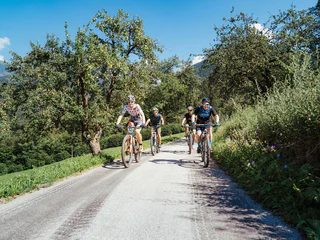
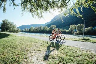
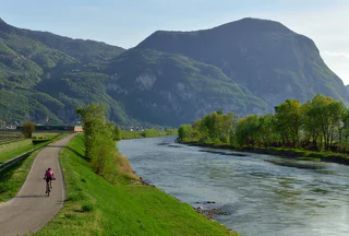
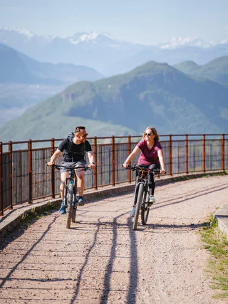
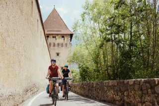
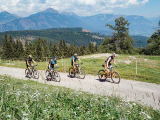
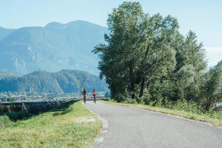
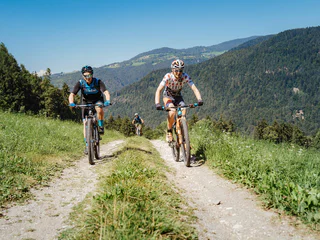
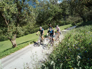
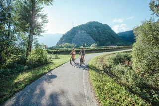
Jižní Tyrolsko je rájem pro cyklisty. Objevte rozmanité trasy vedoucí malebnými vinicemi, okouzlujícími vesničkami a horskými oblastmi ve vyšších nadmořských výškách. Ať už si chcete užít pohodovou jízdu nebo zdolat náročné úseky, zde najdete ideální trasu pro své cyklistické dobrodružství.
Anche questo single trail ha tanto da offrire. Parte sopra Spin e rappresenta un interessante raccordo per San Valentino e per la funivia della malga San Valentino; vi accompagnerà lungo il crinale sempre in direzione sud. L'imbocco si raggiunge alla fine della parte inferiore dello Spin Trail.
Start at the dam wall of the Reschensee at 1,500 m, cross it, and at Innerkaschon take the old Rojen road in the direction of Schöneben. After about 8 kilometres of pedaling uphill on the old asphalt road, reach the Schönebenhütte and take a break. After the short refreshment, take the asphalt road under the hut in the direction of Rojen and ride out of the valley to the car park of the Rescher Alm alpine hut near the "Kopfer" bridge. Turn left and ride slightly uphill to the Rescher Alm alpine hut, where you can have a second stop. As a reward for the effort enjoy a large variety of regional products and an enchanting view of Lake Reschen. Continue north to the Tendershof, a well-run tavern. The descent leads through the middle of a larch and spruce forest past Tendershof to the Vinschger cycle path before Reschen. From Reschen follow the cycle path orographically left to Graun to the historic church tower in the lake back to the starting point on the dam wall of Lake Reschen.
The Adige Trail can be reached just above the Resia and is named after the river in Italy, which springs right next start. He is also the continuation of the bunker trails and leads down to the village Resia and the lake lago di Resia. It is a lightweight, highly flow trail which makes you want more.
Il Gorf Trail inizia sopra Spin al termine della parte inferiore dello Spin Trail e questa tratta di sentiero rappresenta il collegamento verso il basso alla ciclabile lungolago. Da lì sulla pista ciclabile in direzione nord si arriva alla funivia Belpiano e a Resia.
Begin in Andreas Hofer Strasse near Lana tourism association and ride to Tribusplatz square. Here turn right into Treibgasse and left at the crossroads into Zollstrasse. Follow the signs for Bolzano (left). Cross the MEBO highway and the river Etsch and ride along the Bolzano-Merano cycle path towards Bolzano.
In Gargazon turn left and access the natural swimming pool via an underpass. Return to the starting point via the same route. Gargazzone natural swimming pool offers a natural water landscape and uses absolutely no chemical additives for cleaning the water. The secret of the natural, clean water is in its plant life.
Opening times natural bath Gargazon: middle of May to early September, daily from 10 a.m. to 7 p.m. Evening opening: Wednesday and Saturday until 7.30 p.m. ( of 11. June to 09. August)
Sights along the route: Lana-Postal electric locomotive
On the Haideralm Trail the trails of the 3-Country region shows there full power and technical level. This trail is the most difficult trail. The trail passes directly under the cable car from the mountain station to the place San Valentio/St. Valentin. With the necessary bike-driving skills and technical knowledge the Haideralm Trail is a real big hit for all Enduro-fans.
This route is suitable for a leisurely excursion, for families, and for mountain bike or e-bike tours for warm-up. The Resia lake can be cycled in both directions. Almost exclusively on asphalt, start along the cycle and gravel path from the famous church tower in Graun northwards to Reschen - past the sailing boats waiting for wind. Don't cycle straight forward to the Austrian state border. Instead, follow the cycle path in Reschen towards the western lakeside, past the Schöneben valley station, and calmly tackle the incline along the lake. The route is leisurely - until the southern lakeside with the dam wall and there is a fantastic view over the Malser Haide and King Ortler (3,905 m). At the dam, turn north and enjoy the panorama with the lake and the approaching mountains back to Graun. If the wind is strong, kiters and sailors can be spotted on Lake Reschen. There are cozy stops along the lake at the Sciuri at the Schöneben valley station, at the taverns Greinhof and Giernhof, at the new kitestation or at the businesses in Reschen and Graun.
Nestled between the Endkopf "Jaggl" (2,627 m) and Pleisköpfl (2,425 m) lies the destination, the Grauner Alm alpine pasture, at 2,173 m. Start the tour in Graun at 1,500 m. For a quick warm up, follow the road into the Langtauferer valley. After 250 m, turn right over the bridge and pedal up through the shady Arluiwald forest on a mainly pleasant incline on the alpine path to the Grauner Alm alpine pasture. There is a possibility to park your mountain bike at the mountain pasture and continue on foot via hiking trail no. 10 to the summit of the Endkopf (2,652 m). Duration of hike: approx. 2.5 hours (ascent and descent). On the hiking path to the peak, it's possible to spot some rare edelweiss flowers and marmots. Lying in the grass on the slope, enjoy the sensational panorama and head back down to the valley via the alpine path to stop by the village for a good meal.
Sulla parte inferiore del trail Belpiano, all'ultimo incrocio con la pista da sci, il facile Giern Trail porta in direzione di San Valentino e Giern. Il Giern Trail è il collegamento con il lago di Resia e termina al maso Giernhof. Da lì si può pedalare sulla pista ciclabile per San Valentino.
The easiest trail in the Kronplatz family: Launched in mid-2015, it winds down the eastern face of the mountain from the middle station Olang 1+2 lift over countless bends all the way down to Casola-Gassl. Although it’s chock-full of easy jumps and low-banked curves, its ever-changing route layout won’t distract you from appreciating the stunning panoramic views – a perfect place to whip up an appetite for freeriding!
Con il Plattweg Trail avete davanti a voi un single trail indimenticabile della regione enduro 3-paesi: vi rapisce nel solitario mondo delle montagne altoatesine, offre profonde vedute del lago di Resia e vi porta allo stesso tempo in direzione nord. Alla Schneider Kreuzung si immette nella parte inferiore dello Spin Trail e poi si può scegliere tra il Grein Trail (ritorno alla malga San Valentino) o il Gorf Trail (proseguendo per Belpiano).
The second trail of the Haider Alm, the Haider Flow Trail, is a nice trail from the Haider Alm down to San Valentino/St. Valentin. Most of the time you ride on the ski slope, but there are also parts through woods - so this trail is a diverse trail for anyone.
The classic of the Val d'Ega, the Latemar Ronda, offers breathtaking panoramic views of the Dolomite mountains and is a dream tour for all those who want to get very close to the Latemar by mountain bike.
Going clockwise, the Latemar massif can be conquered also by trained hobby mountain bikers and bike-loving families on a full-day tour in 6 hours without any major climbs, but with two more challenging and steep descents. Begin this panoramic tour from the delightful villages of Welschnofen | Nova Levante, Karersee | Carezza or Obereggen.
THE LIFTS TO THE LATEMAR RONDA ARE OPEN FROM MID-JUNE UNTIL MID-SEPTEMBER!
From St. Valentin over the dam wall of lake Resia, the tour takes us westwards through the hamlet of Innerkaschon up to the old road towards Schöneben (above the old Reschensee road). The climb is approx. 8 km and 650 m in altitude, first on asphalt and then on gravel, mainly through forest, to the Haideralm mountain restaurant with its beautiful panoramic terrace overlooking the surrounding mountains and the two lakes. The descent leads back 350 m along the ascent route before turning on the right towards Zerzer valley. Cross the ski slope to hiking trail no. 7, which leads to the Bruggeralm alpine hut, where you can enjoy some excellent dumplings and alpine cheese in the summer months. After the bridge behind the alpine hut, turn left and follow signpost no. 8, past the St. Martin chapel to the Faulen See lake and continue down the paths to the Vinschger cycle path. Turn left and cycle comfortably along the Haidersee lake back to St. Valentin.
Note: The name "Goas" comes from the Vinschgau dialect and means goat. When farmers in this region increasingly practised "Goashaltung" in agriculture, this mountain was the grazing area for these animals.
The Alta Badia valley, the green valley at the heart of the Dolomites and a UNESCO World Heritage Site, has been a popular destination for leisure cyclists for years. At first it was racing bike enthusiasts who loved the mountain passes, but nowadays the Dolomites region in South Tyrol is also a magnet for mountain bikers.