1/3
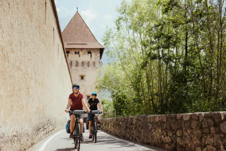
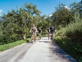
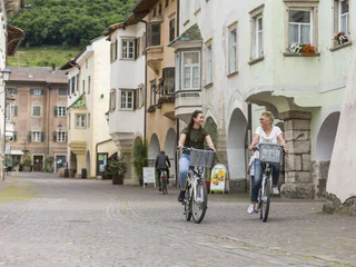
From medieval charm to Mediterranean flair by bike - from Glurns to Neumarkt
Glurns/Glorenza, Neumarkt/Egna, Alto Adige Wine Road
difficult
Obtížnost
190 m
Převýšení
105.8 Km
vzdálenost
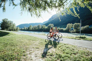
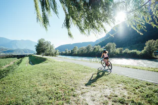
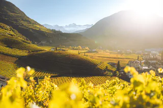
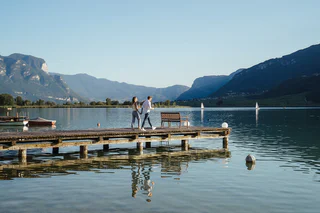
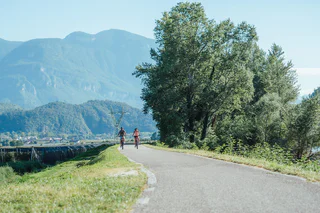
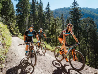
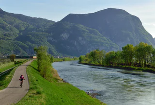
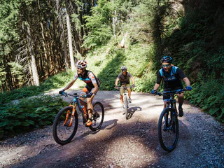
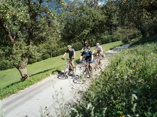
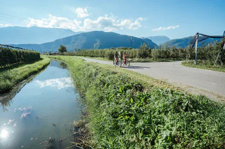
Jižní Tyrolsko je rájem pro cyklisty. Objevte rozmanité trasy vedoucí malebnými vinicemi, okouzlujícími vesničkami a horskými oblastmi ve vyšších nadmořských výškách. Ať už si chcete užít pohodovou jízdu nebo zdolat náročné úseky, zde najdete ideální trasu pro své cyklistické dobrodružství.
1/3
Glurns/Glorenza, Neumarkt/Egna, Alto Adige Wine Road
difficult
Obtížnost
190 m
Převýšení
105.8 Km
vzdálenost
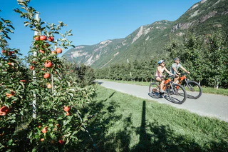
1/3
Auer/Ora, Alto Adige Wine Road
medium
Obtížnost
269 m
Převýšení
39.2 Km
vzdálenost
1/3
Ora/Auer, Auer/Ora, Alto Adige Wine Road
easy
Obtížnost
0 m
Převýšení
0.0 m
vzdálenost
1/5
Anterivo/Altrei, Altrei/Anterivo
easy
Obtížnost
157 m
Převýšení
11.5 Km
vzdálenost

Auer/Ora, Alto Adige Wine Road
medium
Obtížnost
209 m
Převýšení
17.9 Km
vzdálenost
1/4
Mazzon/Mazon, Neumarkt/Egna, Alto Adige Wine Road
easy
Obtížnost
56 m
Převýšení
20.3 Km
vzdálenost
1/6
Pochi/Buchholz, Salorno/Salurn, Alto Adige Wine Road
easy
Obtížnost
1288 m
Převýšení
76.1 Km
vzdálenost
1/4
Cauria/Gfrill, Salorno/Salurn, Alto Adige Wine Road
medium
Obtížnost
1741 m
Převýšení
121.4 Km
vzdálenost
1/2
Bolzano Centro/Bozen Zentrum, Bolzano/Bozen, Alto Adige Wine Road
easy
Obtížnost
252 m
Převýšení
46.0 Km
vzdálenost
1/4
Ora/Auer, Auer/Ora, Alto Adige Wine Road
easy
Obtížnost
202 m
Převýšení
17.1 Km
vzdálenost
Margreid a.d.W./Magrè s.S.d.V., Margreid an der Weinstraße/Magrè sulla Strada del Vino, Bolzano/Bozen and environs
medium
Obtížnost
172 m
Převýšení
41.6 Km
vzdálenost
Mazon/Mazzon, Neumarkt/Egna, Bolzano/Bozen and environs
difficult
Obtížnost
67 m
Převýšení
105.8 Km
vzdálenost
Kurtatsch/Cortaccia s.S.d.V., Kurtatsch an der Weinstraße/Cortaccia sulla Strada del Vino, Alto Adige Wine Road
medium
Obtížnost
1527 m
Převýšení
26.2 Km
vzdálenost
Cortaccia s.S.d.V./Kurtatsch, Kurtatsch an der Weinstraße/Cortaccia sulla Strada del Vino, Alto Adige Wine Road
easy
Obtížnost
545 m
Převýšení
46.6 Km
vzdálenost
1/2
Ora/Auer, Auer/Ora, Alto Adige Wine Road
medium
Obtížnost
1033 m
Převýšení
92 Km
vzdálenost
Cortaccia s.S.d.V./Kurtatsch, Kurtatsch an der Weinstraße/Cortaccia sulla Strada del Vino, Alto Adige Wine Road
easy
Obtížnost
545 m
Převýšení
46.6 Km
vzdálenost
1/3
San Lugano/San Lugano, Truden/Trodena
medium
Obtížnost
759 m
Převýšení
23.6 Km
vzdálenost
Ora/Auer, Auer/Ora, Alto Adige Wine Road
difficult
Obtížnost
2973 m
Převýšení
154.8 Km
vzdálenost
1/3
Auer/Ora, Alto Adige Wine Road
difficult
Obtížnost
1250 m
Převýšení
55.7 Km
vzdálenost
Kohlern/Colle, Bolzano/Bozen, Alto Adige Wine Road
medium
Obtížnost
952 m
Převýšení
35.1 Km
vzdálenost
Barleit-Lavardi/Barleit-Lavardi, Kaltern an der Weinstraße/Caldaro sulla Strada del Vino, Alto Adige Wine Road
medium
Obtížnost
334 m
Převýšení
9.8 Km
vzdálenost
Cortaccia s.S.d.V./Kurtatsch, Kurtatsch an der Weinstraße/Cortaccia sulla Strada del Vino, Alto Adige Wine Road
easy
Obtížnost
174 m
Převýšení
28.9 Km
vzdálenost
Cortaccia s.S.d.V./Kurtatsch, Kurtatsch an der Weinstraße/Cortaccia sulla Strada del Vino, Alto Adige Wine Road
easy
Obtížnost
473 m
Převýšení
40.0 Km
vzdálenost
1/7
Trodena/Truden, Truden/Trodena
difficult
Obtížnost
928 m
Převýšení
24.2 Km
vzdálenost
1/4
Alto Adige Wine Road
difficult
Obtížnost
0 m
Převýšení
0.0 m
vzdálenost
1/3
Cortaccia s.S.d.V./Kurtatsch, Kurtatsch an der Weinstraße/Cortaccia sulla Strada del Vino, Alto Adige Wine Road
easy
Obtížnost
436 m
Převýšení
62.7 Km
vzdálenost
1/4
San Lugano/San Lugano, Truden/Trodena
medium
Obtížnost
768 m
Převýšení
17.7 Km
vzdálenost
1/5
Ora/Auer, Auer/Ora, Alto Adige Wine Road
easy
Obtížnost
273 m
Převýšení
25.3 Km
vzdálenost
Cortaccia s.S.d.V./Kurtatsch, Kurtatsch an der Weinstraße/Cortaccia sulla Strada del Vino, Alto Adige Wine Road
easy
Obtížnost
805 m
Převýšení
73.9 Km
vzdálenost
1/2
Ora/Auer, Auer/Ora, Alto Adige Wine Road
medium
Obtížnost
278 m
Převýšení
24.8 Km
vzdálenost


