Přeskočit na obsah

přidáno k oblíbeným

odebráno z oblíbených

Jejda! Došlo k problému, zkuste to prosím znovu

Vytváří se váš účet

Váš účet byl úspěšně vytvořen a nyní jste přihlášeni

Jste úspěšně přihlášeni!

Váš účet byl úspěšně vytvořen, ale nepodařilo se nám vás automaticky přihlásit

Jste odhlášeni

Filtr
Vybrané filtry
    Úroveň obtížnosti
    Doba trvání
    Vzdálenost v km

    Objevte krásy Vinschgau

    Vinschgau vás okouzlí svou krásou a širokými možnostmi pro zimní sporty a rekreaci.
    Výsledky
    Hiking
    Test Name Eng
    Vinschgau/Val Venosta
    Test Allgemeine Beschreibung en
    Obtížnost: vysoká
    0 m nadmořská výška
    0h:00 min doba trvání
    Themed Hikes
    Natur-Mythenweg path
    Kastelbell-Tschars/Castelbello-Ciardes, Vinschgau/Val Venosta

    The sun, in the dialect "Sunn", is the all-determining force on the Vinschger Sonnenberg. It heats up the rocks and bathes the landscape in its golden light. Wonderful starting points alternate with curious, exciting and unexpected insights into the secrets of a sensitive balance of natural forces.

    Obtížnost: střední
    431 m nadmořská výška
    2h:30 min doba trvání
    Running & Fitness
    Mareinwaal Loop
    Latsch/Laces, Vinschgau/Val Venosta

    Medium-long, moderately difficult round between forest and apple orchards, between valley and Nörderberg, between ascents and flat passages.

    Obtížnost: střední
    309 m nadmořská výška
    2h:13 min doba trvání
    Themed Hikes
    Circular path Malga di Tarres-Variante C
    Latsch/Laces, Vinschgau/Val Venosta

    Exciting family hike at Laces‘ Monte Tramontana. After the chairlift ride you can discover the Malga di Tarres family circular route characterized by meadows, forests, rustic trees and mystic mythical characters.

    You can choose from three different variants to discover the Malga di Tarres circular route. Variant A (easy) starts at the mountain station of the chairlift and leads through the forest and over wooden footbridges until above the Malga di Tarres mountain hut where you can sit on a Hollywood swing and enjoy the view of the valley.

    Variant B starts at the same starting point and takes you through the forest to a small idyllic riverbed. It's as if you walked through a fairyland in an almost untouched environment. From there follow the signs across steep meadows towards Malga di Tarres.

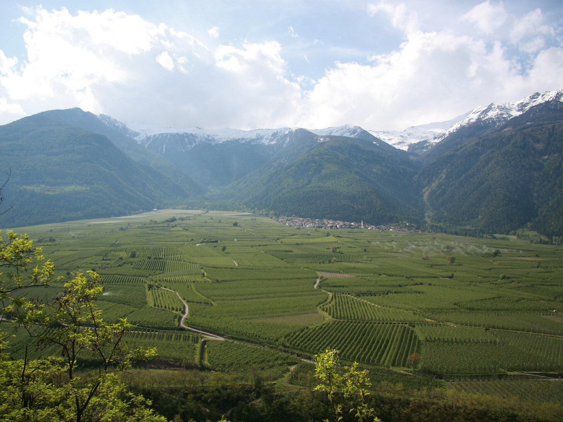
    Variant C is the most demanding one and always starts at the same starting point. After the riverbed you climb the so-called “Zirmruan“. You are already above the timberline and the surrounding stone giants show you how small you are. Once at the top, you have an invaluable view of the holiday area and of Val Venosta. A path through a mystical forest takes you down to the starting point with refreshment places with typical specialities.
    Obtížnost: vysoká
    363 m nadmořská výška
    1h:37 min doba trvání
    Running & Fitness
    VertikalK Up
    Stilfs/Stelvio, Vinschgau/Val Venosta
    Crunchyverticalmountainrunfromthecentretothe hut Gampenhütte.
    Obtížnost: střední
    1084 m nadmořská výška
    3h:16 min doba trvání
    Snowshoe Hikes
    Burgusio - San Valentino alla Muta
    Mals/Malles, Vinschgau/Val Venosta
    Hiking tour to the lake Haidersee along the Adige River
    Go from the market place in Burgeis to the Gasthaus Gerda inn, straight on along the Adige River to S. Valentin Lake. Start of the hike around the lake at landing (No. 1). After the circuit 2 trails lead back to Burgeis: 1: the same way back, along the Adige River (marked as a bike path); or 2: at the end, follow trail No. 5A to the Faulen See Lake and use trail No. 4 to the mountain lake. From here take trail No. 3 back to the village of Burgeis.
    Obtížnost: střední
    245 m nadmořská výška
    3h:30 min doba trvání
    Themed Hikes
    Circular path Malga di Tarres-Variante A
    Latsch/Laces, Vinschgau/Val Venosta

    Exciting family hike at Laces‘ Monte Tramontana. After the chairlift ride you can discover the Malga di Tarres family circular route characterized by meadows, forests, rustic trees and mystic mythical characters.

    You can choose from three different variants to discover the Malga di Tarres circular route. Variant A (easy) starts at the mountain station of the chairlift and leads through the forest and over wooden footbridges until above the Malga di Tarres mountain hut where you can sit on a Hollywood swing and enjoy the view of the valley.
    Obtížnost: nízká
    53 m nadmořská výška
    0h:24 min doba trvání
    Running & Fitness
    Jägersteig-Turn
    Latsch/Laces, Vinschgau/Val Venosta

    Demanding, with almost 8km a rather long loop through the forests south of Latsch.

    Obtížnost: střední
    484 m nadmořská výška
    2h:31 min doba trvání
    Hiking
    Cima Gioveretto & Monte Cevedale
    Martell/Martello, Vinschgau/Val Venosta

    Alpine tour with impressive views of Ortler and Gran Zebru and overnight-stay possibility at Rifugio Martello or Rifugio Nino Corsi.

    Obtížnost: vysoká
    1873 m nadmořská výška
    8h:01 min doba trvání
    Themed Hikes
    Sun path
    Kastelbell-Tschars/Castelbello-Ciardes, Vinschgau/Val Venosta

    The sun, in the dialect "Sunn", is the all-determining force on the Vinschger Sonnenberg. It heats up the rocks and bathes the landscape in its golden light. Wonderful starting points alternate with curious, exciting and unexpected insights into the secrets of a sensitive balance of natural forces.

    Obtížnost: střední
    300 m nadmořská výška
    6h:00 min doba trvání
    Running & Fitness
    Rosim Trail
    Stilfs/Stelvio, Vinschgau/Val Venosta

    Panoramic and partly very quiet trail to the Rosimböden and the Zay valley.

    Obtížnost: střední
    633 m nadmořská výška
    3h:15 min doba trvání
    Running & Fitness
    Goldrainer Panoramic-Run
    Latsch/Laces, Vinschgau/Val Venosta

    A scenic highlight among the running tracks along the Goldrainer Panorama Trail.

    Obtížnost: střední
    473 m nadmořská výška
    2h:15 min doba trvání
    Long-Distance Hiking Paths
    Long distance hike 1st stage: Guarda - Chamonna Tuoi CAS
    Vinschgau/Val Venosta
    The long-distance hike starts in Guarda, the home of "Schellen-Ursli", and leads through the enchanting village of Guarda, which is worth a visit in itself.
    After arriving in Guarda and a tour of Schellen-Ursli's home village, the hike begins in the direction of Val Tuoi. Above the course of the Clozza stream, the hike leads to Alp Suot. Above the tree line, the hike continues into the valley to the foot of the mighty Piz Buin with the Chamonna Tuoi CAS as the destination. (2250 m above sea level).
    Obtížnost: střední
    617 m nadmořská výška
    2h:30 min doba trvání
    Running & Fitness
    From Laces to San Martino in Monte
    Latsch/Laces, Vinschgau/Val Venosta

    Deny the same stage like the runners of the oldest still taking place mountain run San Martino in Monte which yearly in October takes place.

    The mountain run to San Martino is a real classic, with regular competitions since 1950, also one of the oldest ones of the whole nightmare space. The wonderful distance, the demanding increase, the perfect one infrastructures - a lot speaks for this mountain run.
    The competition distance starts directly on the main square of pasting and leads up to the top terminal of the cable railway. On narrow mountaineering and most different subsoil you procees in your tempo to the wonderful mountain hamlet of San Martino in Monte.

    Obtížnost: vysoká
    1128 m nadmořská výška
    3h:23 min doba trvání
    Themed Hikes
    Alta via Meranese - Ortles stage 3
    Latsch/Laces, Vinschgau/Val Venosta

    The day starts with a descent from Malga Zirmtal (2114 m). Follow the sign for Marzoner Alm/Malga Marzon. The steep path has been partially rebuilt and is in good condition. After a descent with an altitude difference of 300 meters you reach a forest road with signposts. Take the path down to Malga Marzon. Shortly descend on the forest road before you take the so-called Almenweg on the right (signs for Freiberger Mahd and Almenweg). The rather flat path takes you through the light forest until a signposted junction. Turn left (signs for Latschiniger Alm and Kofelraster Seen) and take the partially steep path through the larch forest to Latschiniger Alm/Malga di Lacinigo (1936 m) where the ascent to the Covolo Lakes (Kofelraster Seen) begins. Follow path no.3 with the red and white marking and many bends through the forest before you reach a clear area. Then the path soon becomes steeper. Hike through the mountain basin until the junction near the mountain crest. On the left, you can see the variant (see description below) leading up here from Malga Obermarzon. Continue upwards towards the Covolo Lakes (signs for Kofelraster Seen). As soon as you reach the first of the Covolo Lakes (2407 m), you have to be careful. There is only an old, weathered wooden sign with faded letters (Tarscher Alm/Malga di Tarres). Climb the steep path no.15 and shortly descend from the crest before the next climb. Then you reach the Gran Ladro wind gap (2612 m). Descend on the long, well-marked path to Malga di Tarres (1935 m).

    Obtížnost: vysoká
    3253 m nadmořská výška
    9h:43 min doba trvání
    Hiking
    San Martino - Egg- Forra
    Latsch/Laces, Vinschgau/Val Venosta

    The San Martino - Egg - Forra trail is also recommended for less experienced hikers.

    Obtížnost: střední
    339 m nadmořská výška
    3h:10 min doba trvání
    Long-Distance Hiking Paths
    360° Alta Venosta: San Valentino alla Muta - Planol
    Mals/Malles, Vinschgau/Val Venosta

    Idyllic mountain villages with a unique charm is what the second stage of the circular hiking trail 360° Upper Vinschgau Valley has to offer.

    Obtížnost: nízká
    512 m nadmořská výška
    4h:00 min doba trvání
    Long-Distance Hiking Paths
    360° Alta Val Venosta: Slingia/Schlinig - Prämajur (Valley station Watles)
    Mals/Malles, Vinschgau/Val Venosta

    Along alpine meadows to the waterfall below the alpine hut Sesvenna leads the first part of the ninth stage of the circular hiking trail 360° Upper Vinschgau Valley. It continues on the high mountain trail to the mountain restaurant Plantapatsch and along the “Almenweg” path to Prämajur.

    Obtížnost: střední
    627 m nadmořská výška
    5h:30 min doba trvání
    Themed Hikes
    Uina Gorge to Sur-En
    Vinschgau/Val Venosta

    On the Smugglers paths - fascinating hike along the Schlinigtal valley high mountain trail to Uina gorge, a unique trail from 1908 - 1910 hewn in rock about 900 m long.

    Obtížnost: střední
    339 m nadmořská výška
    6h:30 min doba trvání
    Waalwege
    Rautwaal irrigation channel path
    Latsch/Laces, Vinschgau/Val Venosta
    Idyllic irrigation channel path to the cultural treasures, with a unique panorama.
    Obtížnost: nízká
    122 m nadmořská výška
    1h:22 min doba trvání
    Waalwege
    "Neuwaal-Rautwaal- Mareinwaal" irrigation channel path
    Latsch/Laces, Vinschgau/Val Venosta

    A loop trail with plenty to enjoy: farmland, orchards, woods, rest areas and 
    mysterious Waaler rock paintings paired with breathtaking views over the ruins of 
    Obermontani and Untermontani castles.

    Refreshment stop:
    Landhotel Latscherhof
    Bierkeller Latsch
    Hotel Krone in Morter
    Kostbar in Morter
    Stroblhof in Morter

    Water course:
    Water runs partly underground

    Obtížnost: nízká
    292 m nadmořská výška
    2h:47 min doba trvání
    Running & Fitness
    Easy Panorama Trail
    Stilfs/Stelvio, Vinschgau/Val Venosta

    A short itinerary to acclimatise and discover the mountain village of Sulden, situated at 1,900 m above sea level.

    Obtížnost: nízká
    194 m nadmořská výška
    1h:30 min doba trvání
    Long-Distance Hiking Paths
    360° Alta Venosta: Prämajur - San Valentino alla Muta
    Mals/Malles, Vinschgau/Val Venosta

    The first stage of the circular hiking trail 360° Upper Vinschgau Valley leads to the marvelous scenery of the Upper Vinschgau Valley with refreshments at Brugger Alm alpine pasture.

    Obtížnost: nízká
    380 m nadmořská výška
    4h:30 min doba trvání
    Hiking
    Mountain hut hike at Malga di Marzon
    Kastelbell-Tschars/Castelbello-Ciardes, Vinschgau/Val Venosta

    The Marzon Alm Pasture is ideal for families.
    The familiy Gerstgrasser offers you some tipical products.
    You can walk also with the babybuggy.

    Obtížnost: nízká
    132 m nadmořská výška
    0h:30 min doba trvání
    Snowshoe Hikes
    Around the Stallwieshof
    Martell/Martello, Vinschgau/Val Venosta

    The tour starts at the Hotel Waldheim in Val Martello and goes over the bridge of the Plima. Continue along the path no.5 through the wood untill the "Löcherhof", from there on the old road at the free slope to the meadows of "Hochegghof" and a moderate rise brings you to the "Stallwieshof" (1,926m). From there you go on at the footpath no.8 to the log cabins of the Malga Schluder/Schluderalm. Following the path no.34 up to the forest and then down into the valley. At the end of the tour, cross again the bridge and return to the starting point. A wonderful winter tour with great views!

    Obtížnost: střední
    404 m nadmořská výška
    3h:00 min doba trvání
    Snowshoe Hikes
    Peder-Stier-Lyfi Mountain Hut Tour
    Martell/Martello, Vinschgau/Val Venosta

    Panoramic tour through the snow-covered landscape along small streams with the possibility to stop at the Lyfi Mountain Hut.

    Obtížnost: nízká
    324 m nadmořská výška
    1h:58 min doba trvání