1/5
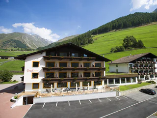
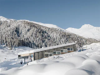
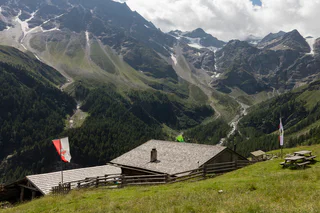
Berghotel Tyrol
Madonna/Unser Frau, Schnals/Senales, Vinschgau/Val Venosta
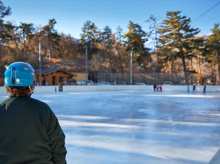
| Vinschgau vás okouzlí svou krásou a širokými možnostmi pro zimní sporty a rekreaci. |
1/5
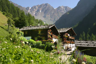
Madonna/Unser Frau, Schnals/Senales, Vinschgau/Val Venosta
1/5
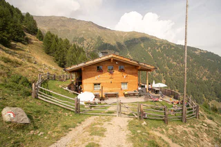
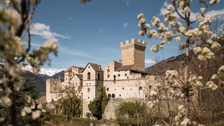
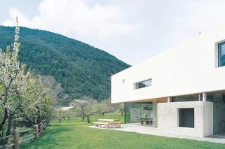
Tarces/Tartsch, Mals/Malles, Vinschgau/Val Venosta
1/9
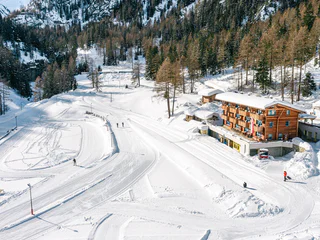
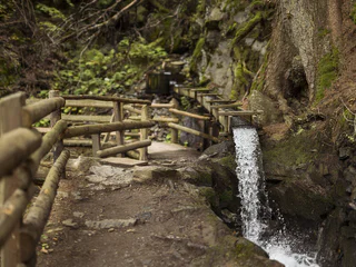
Castelbello/Kastelbell, Kastelbell-Tschars/Castelbello-Ciardes, Vinschgau/Val Venosta
medium
Obtížnost
507 m
Převýšení
1h:30 min
doba trvání

Altavalle/Hintermartell, Martell/Martello, Vinschgau/Val Venosta
medium
Obtížnost
0 m
Převýšení
2h:30 min
doba trvání
1/11
Unser Frau/Madonna, Schnals/Senales, Vinschgau/Val Venosta
Trafoi/Trafoi, Stilfs/Stelvio, Vinschgau/Val Venosta
1/3
Slingia/Schlinig, Mals/Malles, Vinschgau/Val Venosta
medium
Obtížnost
110 m
Převýšení
0h:00 min
doba trvání
Lasa/Laas, Laas/Lasa, Vinschgau/Val Venosta
Vallelunga/Langtaufers, Graun im Vinschgau/Curon Venosta, Vinschgau/Val Venosta
1/8
Sluderno/Schluderns, Schluderns/Sluderno, Vinschgau/Val Venosta
Silandro/Schlanders, Schlanders/Silandro, Vinschgau/Val Venosta
Corzes/Kortsch, Schlanders/Silandro, Vinschgau/Val Venosta
S. Martino al Monte/St. Martin - Laces/Latsch, Latsch/Laces, Vinschgau/Val Venosta
medium
Obtížnost
708 m
Převýšení
3h:32 min
doba trvání
Trafoi/Trafoi, Stilfs/Stelvio, Vinschgau/Val Venosta
easy
Obtížnost
0 m
Převýšení
0h:00 min
doba trvání
1/3
Altavalle/Hintermartell, Martell/Martello, Vinschgau/Val Venosta
1/4
Vernago/Vernagt, Schnals/Senales, Vinschgau/Val Venosta
difficult
Obtížnost
1232 m
Převýšení
4h:40 min
doba trvání
Piavenna/Plawenn, Graun im Vinschgau/Curon Venosta, Vinschgau/Val Venosta
medium
Obtížnost
1010 m
Převýšení
5h:42 min
doba trvání
Piavenna/Plawenn, Graun im Vinschgau/Curon Venosta, Vinschgau/Val Venosta
medium
Obtížnost
404 m
Převýšení
2.2 Km
vzdálenost
Burgeis/Burgusio, Mals/Malles, Vinschgau/Val Venosta
easy
Obtížnost
146 m
Převýšení
0h:45 min
doba trvání
Silandro/Schlanders, Schlanders/Silandro, Vinschgau/Val Venosta

1/3
Slingia/Schlinig, Mals/Malles, Vinschgau/Val Venosta
easy
Obtížnost
30 m
Převýšení
0h:00 min
doba trvání
Monte di Tramontana/Nördersberg, Schlanders/Silandro, Vinschgau/Val Venosta
1/9
Oris/Eyrs, Laas/Lasa, Vinschgau/Val Venosta
medium
Obtížnost
880 m
Převýšení
4h:01 min
doba trvání
1/3
Monte S. Caterina/Katharinaberg, Schnals/Senales, Vinschgau/Val Venosta
1/2
Laudes/Laatsch, Mals/Malles, Vinschgau/Val Venosta
Sulden/Solda, Stilfs/Stelvio, Vinschgau/Val Venosta
Certosa/Karthaus, Schnals/Senales, Vinschgau/Val Venosta
Graun/Curon, Graun im Vinschgau/Curon Venosta, Vinschgau/Val Venosta
1/2
Sluderno/Schluderns, Schluderns/Sluderno, Vinschgau/Val Venosta
easy
Obtížnost
290 m
Převýšení
3h:00 min
doba trvání
1/4
Montesole/Sonnenberg - Parcines/Partschins, Graun im Vinschgau/Curon Venosta, Vinschgau/Val Venosta
difficult
Obtížnost
1432 m
Převýšení
79.1 Km
vzdálenost


